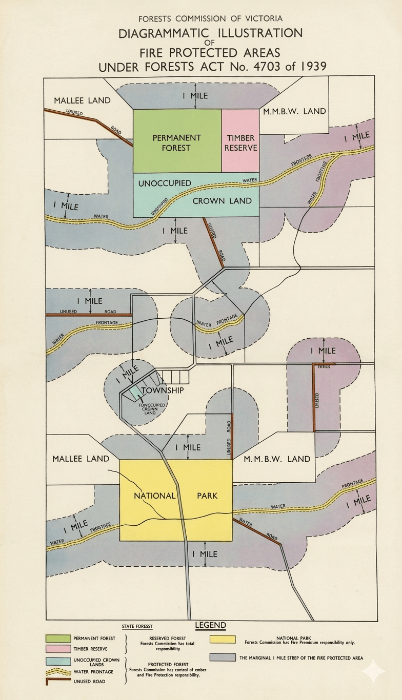
One lasting consequence of the 1939 Stretton Royal Commission was a revision of the Forest Act in 1939 which handed the Forests Commission the additional responsibility for bushfire protection on all public land including State forests, National Parks and unoccupied Crown Lands, plus a buffer extending one mile beyond their margins onto private land. (A.K.A. – The Marginal Mile).
The land was known as the Fire Protected Area (FPA) and the Forests Commission’s fire protection responsibilities leapt overnight from 6 to nearly 16 million acres, or to nearly one third of the State.
The rural and urban brigades of, what was to become, the Country Fire Authority (CFA) in 1945, took responsibility for all the remaining private land, or “Country Area”, of Victoria, but it excluded the Melbourne metropolitan region, where the Metropolitan Fire Brigade (MFB) took the lead.
The Bush Fire Brigades Act (1939) provided that:
The captain of any bushfire brigade… with or without consent… may enter upon any [private] land and abate or remove any fire hazards.
Similarly, forest officers were given this power in the Fire Protected Area in the revised Forest Act.
The MMBW was deemed a “public authority” under the CFA Act and took responsibility for fire protection in Melbourne’s water catchments. This arrangement changed with the creation of the National Park and fire protection was then managed by agreement between Parks Victoria, DEECA and Melbourne Water.
The SEC had a similar arrangement for the Kiewa Valley which was “vested”. The Latrobe Valley was deemed private land, and the SEC maintained their own equipment as an industry brigade, which fell under the CFA legislation.
The FPA was revised in the review of the 1958 and much of the marginal mile, particularly with fragmented public land, has now been excised.
When the Forests Act and Country Fire Authority Act were reviewed in 1958 and clearly enshrined the role of the two agencies and the Chief Fire Officers into complementary legislation.
The CFA took responsibility for fire suppression on “Country Victoria” leaving the Forests Commission to focus on the public land estate such as State forest and National Parks, which amounted for the remaining one third of the State.
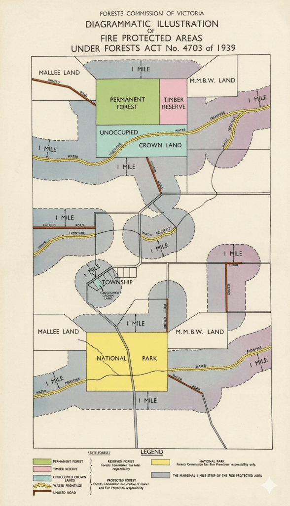
After 1939 bushfires the Fire Protected Area (FPA) leapt from 6 to 16 million acres, or to nearly one third of the State. This diagram was used to assist in identifying areas within the marginal mile of the FPA. Source: John Nicholson. (enhanced)
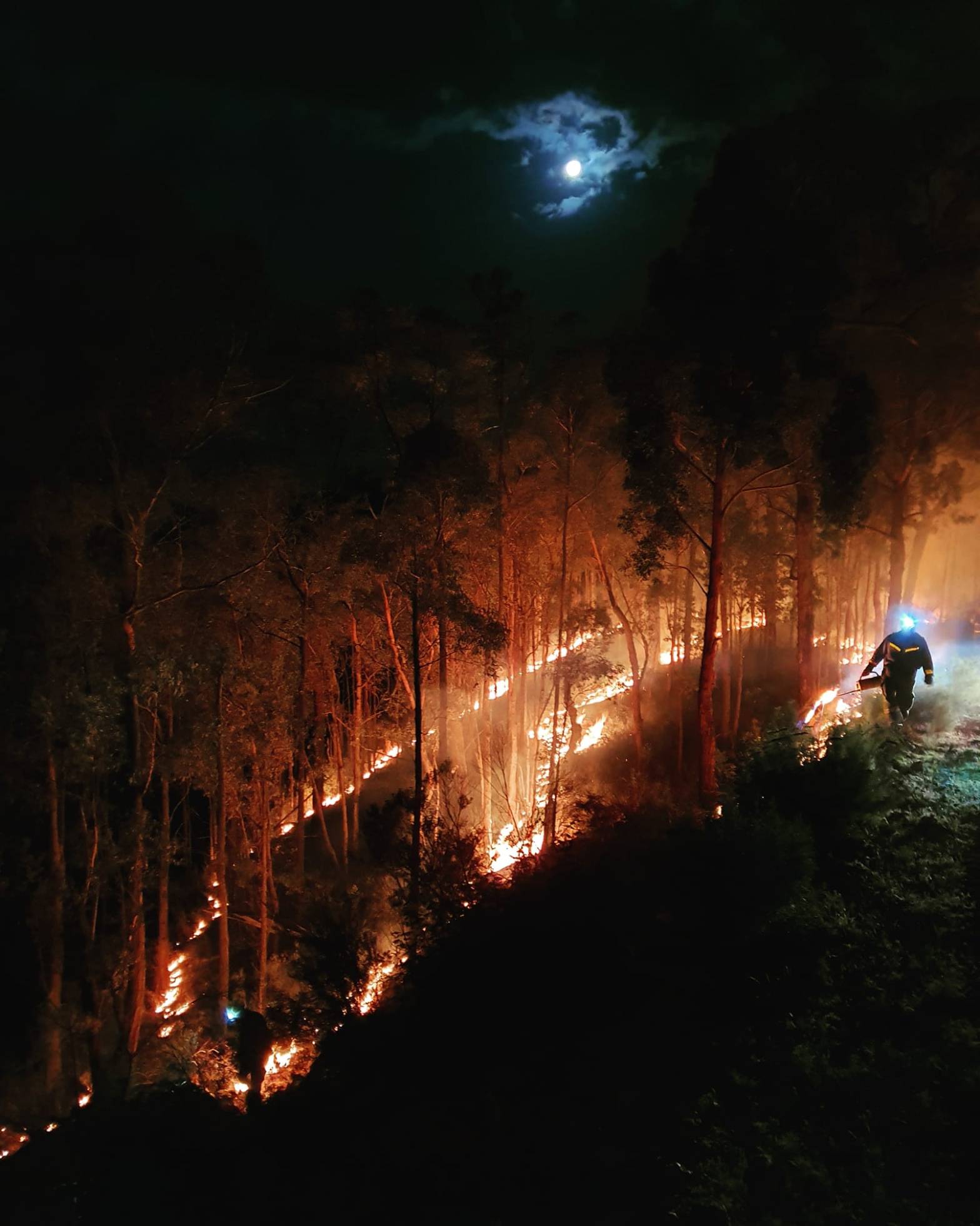
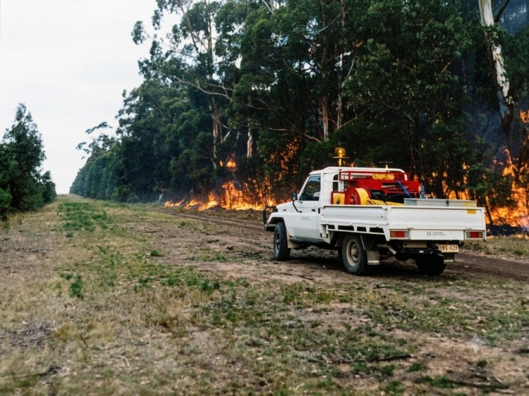
Backburning to build or thicken a control line from a strategic fuel break, road, ridgeline or 4WD track is a common and effective dry firefighting technique, particularly in remote and rugged country.
But indirect attack using backburning increases overall fire size and therefore fire perimeter. It also introduces more fire into the landscape, often under unfavourable fire weather conditions.
Backburning is often done in conjunction with aerial ignition and burning out the remaining fuels.
However, backburning ahead of a fast-moving fire front is often a last resort strategy, one that requires great skill and courage, as well as a generous dollop of good fortune to execute successfully, which presents a serious dilemma for all forest firefighters.
Backburning operations can be a spectacular success at stopping the run of bushfire, but many a backburn has either got away or split the main fire to create a troublesome second fire front.
It also should be noted that there is a huge difference between Fuel Reduction Burning(FRB) which is done in the cooler months, under prescribed weather and fuel conditions and within a predefined boundary, compared to a backburn constructed as a control line (often under difficult fire weather conditions and with limited time to plan and prepare), to stop the passage of a running bushfire.
A recent example of pre-dawn backburning during the 2020 Gippsland fires. Note the three parallel lines of ignition which aim to give “depth” to the edge and draw the fire back away from the control line. Photo: Wayne Morris.
Victorian foresters were initially trained in European traditions and believed fire had no place in the forest.
Like many early settlers, colonial foresters only saw bushfire as a threat, particularly to young regrowth, and sought to eliminate it altogether.
A fire exclusion policy, though well-intentioned, shaped forest management for decades with mixed results. Early Forests Commission annual reports are full of references to the lengths of fire breaks built and maintained.
Firebreak work was a big priority during the unemployment (susso) programs in the 1930s. But they were laborious and costly to build and maintain with only simple hand tools available
By the late 1930s, a network of firebreaks had been built to protect the forests across the State, but their effectiveness was severely challenged during the devastating 1939 bushfires.
It was soon realised that firebreaks weren’t enough on their own, which led to a shift in the 1960s to Fuel Reduction Burning (FRB), particularly when aircraft and aerial ignition became available.
It’s true that most fire breaks, or more correctly fuel breaks, are generally ineffective at stopping the run of fast-moving and high intensity bushfires (FFDI > 50), particularly if there is long distance spotting ahead of the main front.
However, these severe bushfire weather conditions don’t occur as often as many might believe. It’s just when the media seems to take an interest. For example –
Over a six-month fire season in Gippsland (180 days) there are, on average, only 3 or 4 days where the fire danger is “Very High” (FFDI > 24) and even fewer spike days of “Extreme” bushfire danger (FFDI >50). And then there are the cooler nights.
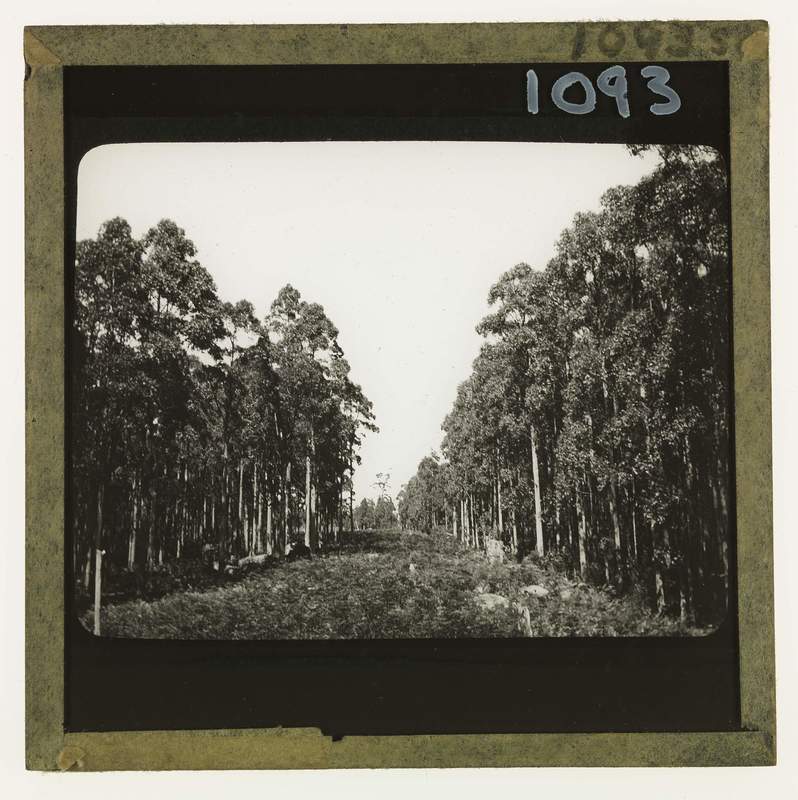
Strategic roadside fuel breaks, along with areas that have recently been fuel reduced by burning, have the effect of breaking up the extensive areas of uniform forest fuels on public land into manageable blocks.
Together, fuel reduced areas and strategic breaks have consistently proven very effective at providing access and safety zones for first attack crews and creating anchor points for control lines and large-scale backburning to contain the fire.
In most cases, first attack is successful and bushfires are quickly contained without fuss or fanfare. But these impressive efforts by fire crews go mainly unnoticed by the community and unreported by mainstream media. For example –
In 2023-24, a total of 1,179 fires occurred on Victoria’s State forests and National parks and 92% were kept to less than 5 ha in size, and a whopping 96% were contained by 8.00 am on the day following detection.
Hundreds of kilometres of new control and fallback lines were hurriedly built and widened along ridge tops, roads and old 4WD tracks during the 2002-03 alpine bushfires. Many were rehabilitated only to be reopened and lengthened in the subsequent 2006-07 bushfires. This was both costly and futile. A permanent, well-designed, and well-maintained network was clearly needed.
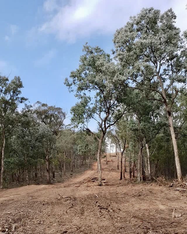
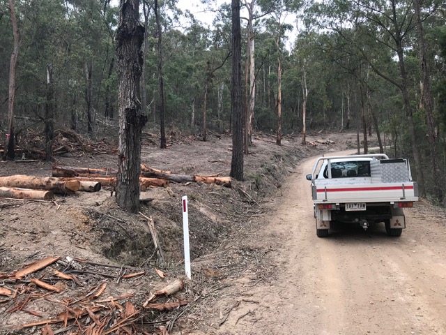
Building a permanent network of strategic fuel breaks (20 m – 40 m wide) on State forests and National Parks in remote locations, along with asset protection breaks (40 m wide) near settlements, was one of the key outcomes of the 2009 Black Saturday Bushfires Royal Commission.
The presence of large and hazardous trees on the boundaries, particularly eucalypts with fibrous or ribbon bark, can compromise the effectiveness and safety of the breaks. They are even more effective if the forest behind the edge of the cleared break is thinned (50 m – 100 m) and the understory fuel reduced by burning or mulching. (See: Understanding Fuel).
Strategic fuel breaks are contentious but much of the debate is often lopsided or misreported with strident critics quick to point out examples where they have failed.
However, based on decades of experience in Gippsland as a senior firefighter, strategic fuel breaks and forest roads have repeatedly proven very useful at keeping remote bushfires small and contained on public land.
Some media commentators have not helped either, by creating an unrealistic and simplistic expectation that, together with fuel reduction burning, the breaks are some kind of “magic bullet” that can prevent and stop the run of serious bushfires and guarantee the protection of life and private property… which they are not…
Furthermore, I do not accept the claim, made by some detractors, that remote strategic fuel breaks and landscape fuel reduction burning offer little or no fire protection benefit, or that widened roads act as wind tunnels.
For example, a notable feature of Victorian summers are the strong cold weather fronts and dry thunderstorms that roll across the eastern mountains from the southwest during the late afternoon, particularly after a hot windy day, sometimes bringing thousands of lightning strikes. (See: Bushfire Flume).
Following the passage of the storms it was not unusual that by the evening, or early the next day, as reconnaissance detection flights resumed and fire towers went back up, to get that familiar sinking feeling as a steadily increasing number of bushfires popped up on the incident battle board, often at some very remote and inaccessible places.
When confronted with these widely scattered, but still relatively small bushfires, one of my first requests as a Level 3 Fire Planning Officer or Controller – after the situation reports and the weather forecasts – was for the latest fuel reduction burning and strategic road maps to identify initial priorities, control lines and fallback options.
Importantly, unless they were quickly attacked and contained during the mild and stable weather in the days after the thunderstorm, these small lightning strikes had the capacity to overwhelm firefighting resources as they grew, and even joined up, to become an unstoppable bushfire complex. (e.g. 2002-03, 2006-07, 2013, 2019-20).
Once the fuse was lit, virtually no amount of heroic suppression effort by on-ground crews or aerial firebombers could overcome the deadly combination of extreme weather, rugged terrain and heavy accumulation of fuels when these campaign bushfires escalated to the landscape scale. (See: Gippsland Zig Zag).
Helicopters capitalise on the three main advantages of aircraft… speed, access and observation…
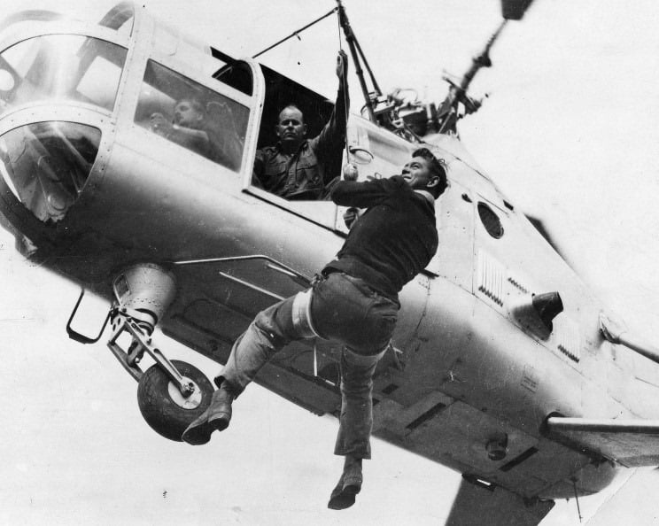
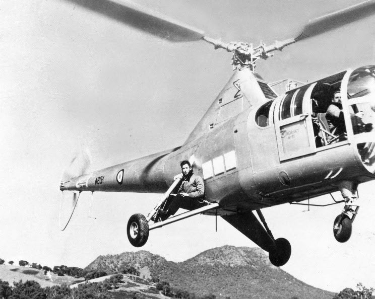
The RAAF’s first helicopter, a Sikorsky S-51 Dragonfly (A80-1), was test flown at Laverton Air Base on 9 October 1947.
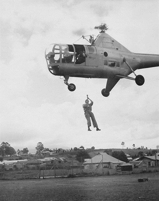
In May 1949, in an Australian first, the Forests Commission winched firefighters from the hovering Dragonfly.
The Sikorsky proved very versatile and was later used for reconnaissance and mapping missions as well as deploying fire crews and their equipment into remote locations.
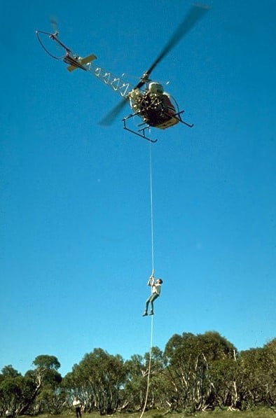
Based on these successful RAAF trials, as well as experience in the 1965 Gippsland bushfires, the Commission contracted its own Bell 47G in late 1965, which was also an Australian first for any forest agency.
Development of rappelling techniques at Snowy Plains and Tallangatta followed, which led to operations based at Heyfield with a two-man crew to quickly attack small fires in remote locations.
The Heyfield rappel crew was another Australian first and remained in place for the following two fire seasons but lapsed after concerns from the Civil Aviation Safety Authority (CASA) about the stability of the small and underpowered Bell 47G.
However, the Forests Commission continued to expand its use of light helicopters throughout the 1960s and 1970s for transport, sling-loads, reconnaissance, mapping, aerial seeding, spraying, Forward-Looking-Infra-Red (FLIR) cameras and developing aerial incendiary techniques.
A notable feature of the January 1978 fire season was the very important part played by larger military helicopters. Three RAAF Iroquois were used to move crews and supplies across the Victorian alps. This was probably the first-time military helicopters had been used to support Australian firefighters on such a large scale.
It was a game-changer…
The National Safety Council of Australia (NSCA), which was based near Sale in Gippsland, expanded its aerial operations significantly during the 1982-83 bushfire season.
In 1982, after nearly 18 years absence, rappelling operations recommenced using larger and more powerful NSCA Bell 212 and Bell 412 helicopters.
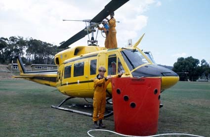
A NSCA Bell 212 with a 1700 litre water bucket was first used at the Seaton fire in November 1982. If a water source was nearby, the bucket proved very effective at supporting ground crews at knocking down spot fires and supressing flames.
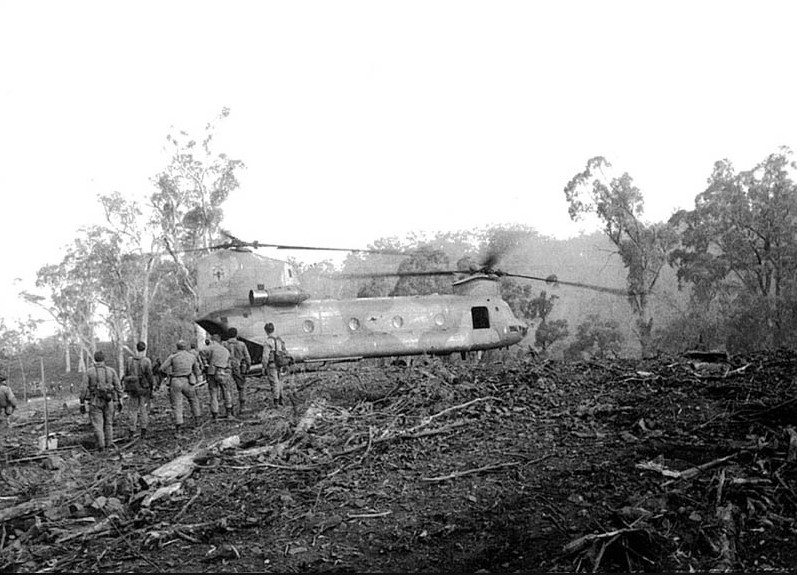
Also, during the Ash Wednesday bushfires in 1983, a 30-passenger RAAF Chinook helicopter deployed firefighters, relief crews and fuel for bulldozers in difficult terrain at Nug Nug near Mount Buffalo.
The NSCA later conducted its first firebombing operations in Victoria using Canadian designed helicopter bellytanks in 1984-85.
Valuable lessons about using aircraft, particularly at the 1985 bushfires at Mt Buffalo, led the Department to initiate national training programs and accreditations for aircraft officers, observers, incendiary operators, hot refuelling crews, retardant mixers as well as specialist Air Attack Supervisors (AAS).
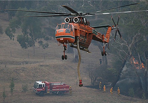
The Erickson Sky Crane first came to Victoria in 1997-98 and could lift nine tonnes of water.
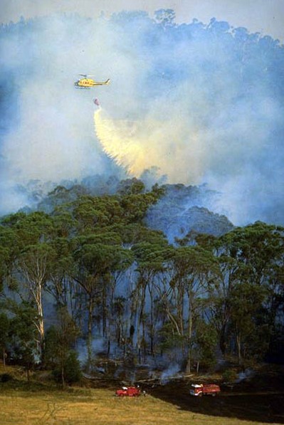
Modern firefighting operations are generally conducted with a mixture of both fixed and rotary wing helicopters. But helicopters have a major advantage over fixed wing aircraft of being able to hover over the fire and accurately drop water, foam or retardant. They can pick up water from shallow dams or rivers using snorkels to fill their belly tanks or dipping a collapsible bucket suspended on a line. Helicopters can also be used for reconnaissance, air attack, infrared mapping, dropping supplies and delivering crews.
Depending on forest type, fuel load, understory thickness and slope, a large Type 1 helicopter like a Sky Crane can construct, suppress and hold about 500m of control line per hour. A mid-size Type 2 Helicopter like a Bell 412 with a bucket or belly tank might only achieve 200 m.
For comparison, the sustained rate to construct and hold fire control lines by hand crews is between 5 and 20 m per person per hour.
The operating costs of medium helicopters are much higher than fixed-wing aircraft carrying similar loads but their flexibility, accuracy and ability to pick up retardant close to the fire can make them more cost effective in many situations.
They are particularly effective in tight mountainous terrain and providing close support to knock down flames for ground crews working near the fire edge. But there is no substitute for “boots-on-the-ground”.
But the greater use of heavy-lift helicopters forced major changes to fuel and retardant handling. Medium helicopters like the Bell 412 require about 600 litres of fuel per hour, or three standard 200 litre drums, whereas heavy-lift helicopters like the Erickson Air Crane were fitted with massive 4,900 litre fuel tanks and guzzled a staggering 2,000 litres per hour.
Helicopters have continued to evolve and are now an integral part of bushfire suppression.
Winching trials with RAAF Sikorsky S-51 Dragonfly in 1949. Photo: State Library of Victoria.
The Forests Commission pioneered Australia’s use of aircraft for firefighting and crew transport. This photo was taken at Erica in 1949. Source: State Library of Victoria.
Forests Commission crew transport and emergency evacuation trials using a RAAF Sikorsky S-51 Dragonfly near Eildon Weir in May 1949. This particular aircraft, serial A80-1, was the very first helicopter to arrive in Australia in 1947. Photo: State Library of Victoria.
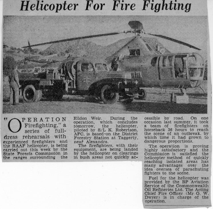
A newspaper report from Mansfield in north-east Victoria. May 1949. Source: FCRPA
Rappel trial in 1965 at the Snowy Range with a Bell 47G. Ian Betts, Heyfield Field Staff, dangling on the rope. Source: FCRPA Collection
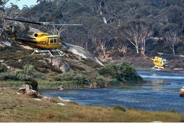
The summer of 1984-85 in northeast Victoria had the largest single aerial firefighting operation in Australia up to that time. Up to 20 helicopters and 16 fixed-wing aircraft including Navy Wessex and RAAF Bell UH-1 Iroquois. Photo – NSCA Bell 205 – Buckland Valley. Source: Bryan Rees.
NSCA Bell 205s filling fitted with Canadian belly tanks at Lake Catani on the Buffalo Plateau. February 1985. Photo: Bryan Rees
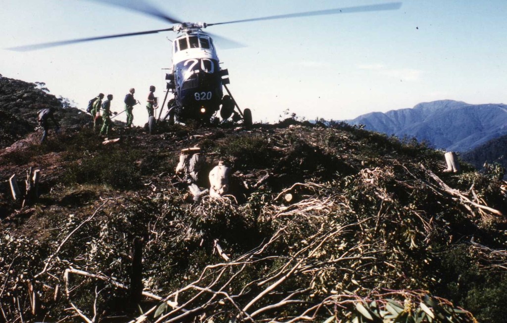
Loading crews into a Navy Wessex at Mt. Murray in January 1985. Mt. Feathertop is in the background. These fires were the largest single aerial firefighting operation up to that time and valuable lessons were learned. Source: Peter McHugh.
NSCA Bell 212 with a 1700 litre water bucket was first used at the Seaton fire in November 1982. Provided a water source was nearby it was very effective at supporting ground crews. Photo: National Archives.
Chinook at Nug Nug, 1983. Source: FCRPA
The Erickson Sky Crane could lift nine tonnes of water but consumed nearly 2,000 litres of fuel per hour. It proved very effective at providing close support to ground crews to knock down flames. But there was no substitute for “boots-on-the-ground”. Elvis first came to Victoria in 1997-98.
The first trials using aircraft to attack bushfires in Australia were conducted in Victoria in 1937-38 when the Forests Commission carried out tests dropping brine solution (bitterns) in cartons.
The US Forest Service began trials around the same time and the two organisations collaborated closely over the subsequent decades.
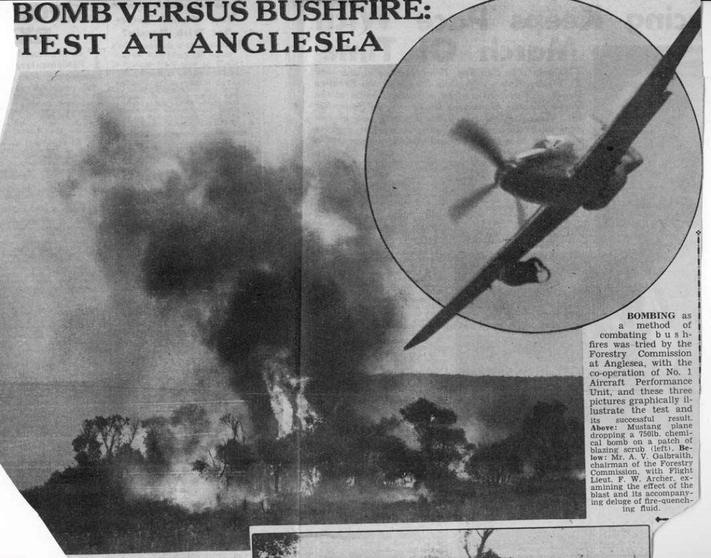
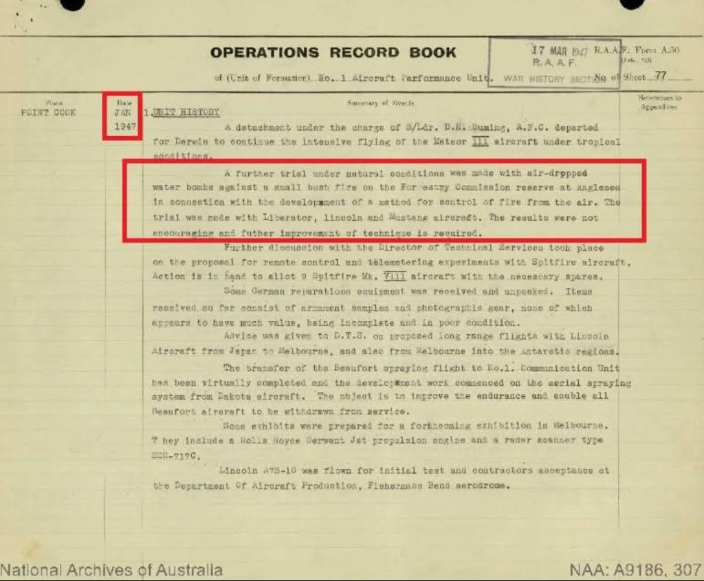
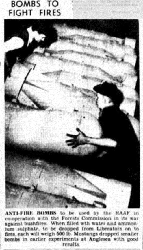
Further trials were conducted after the War in November 1946 by the Commission at Anglesea to compare the performance of RAAF Mustang P51 fighters, Consolidated B-24 Liberators and Avro Lincoln Bombers dropping ammonium sulphate compounds in 500 lb bombs from about 100 feet, which were designed to burst on impact. Several containers were tested on small fires for their accuracy, falling and bursting characteristics. The results were encouraging but inconclusive.
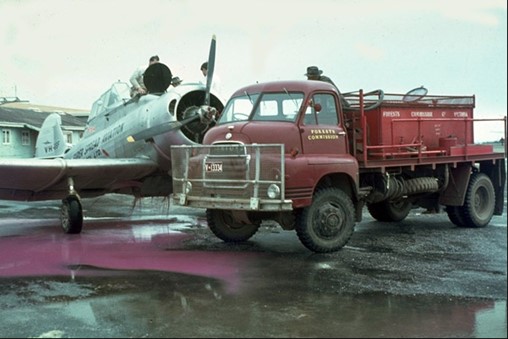
After a lull, FCV fire researcher, Athol Hodgson, resumed testing of retardants in 1963 at Ballarat, dropping water-thickened with bentonite clay from a Ceres CA-28 aircraft.
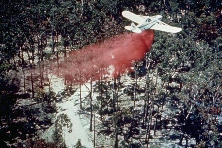
The 1963 trial was followed in 1965 using a Piper Pawnee to drop the new chemical retardant, Phoscheck, provided by Monsanto.
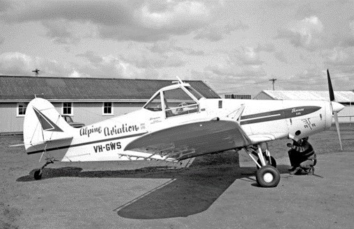
All this experimental work culminated with two Piper Pawnees from Benambra, flown by Ben Buckley and Bob Lansbury, making Australia’s first operational drop of fire-retardant on a small lightning-strike on 6 February 1967.
The 15 loads were able to contain the remote fire to less than one hectare.
But this was the first real firebombing job and marked the beginning of modern aerial firefighting operations in Australia.
It was also what has become the classic application of firebombing. The “proof of concept” at Benambra encouraged many more innovations with new and more powerful aircraft.
The effectiveness of aerial firebombing is complex and depends on many factors including: aircraft turn-around time, distance from fire, aircraft type (fixed wing vs rotary), aircraft performance, load size, terrain, drop characteristics, drop door system, ambient weather conditions, wind, availability of ground support, fire intensity, fire size, fuel type, pilot skill and suppressant used.
Firebombing improves the chances of successful first attack on a bushfire up to 50% when the Fire Danger FFDI ranges from moderate to high (<24). However, the chances of success fall rapidly as the Fire Danger FFDI rises, fuel loads increase and delays in reaching the fire extend.
For example, the probability of success drops to less than 20% if the FFDI is severe (>50) and the delay is more than 30 minutes. These figures are significantly affected by the presence or absence of ground crews.
Aircraft dropping retardant can be very effective at slowing the rate of spread of fire, which in remote locations, gives more time for the arrival of ground crews. In a few cases firebombing has been sufficient to extinguish small fires such as single trees or very small spots.
Limitations of firebombing are often determined by:
the rate at which aircraft can deliver retardant, water or foam on the fire.
penetration of retardant through the overstory canopy and the amount that reaches and coats the ground fuels.
a threshold fire intensity, above which, a fire will spot across or burn through a control line.
firebombing is not generally effective against high intensity or fast-moving bushfires.
aerial firebombing fails on its own as a containment strategy if the fire behaviour includes medium or long distant spotting.
The upper limit of fire intensity that can be successfully attacked from the air is estimated to be about 2,000 kW/m in eucalypt forest fuel. This roughly equates to the limits which can be handled by either ground crews alone, or ground crews supported by fire tankers, graders, bulldozers, etc.
Severe bushfires, such as on Black Saturday, generated intensities more than 100,000 kW/m, whereas low intensity prescribed burns are usually less than 500 kW/m. For comparison, a large household radiator emits about 1 kW.
Depending on turnaround times, forest type, fuel hazard and terrain, a small single engine firebomber might construct and hold about 100 m of control line per hour.
By comparison, the sustained rate to construct and hold fire control lines by hand crews is between 5 and 20 m per person per hour depending on forest type, fuel load, understory thickness, slope and terrain.
Unlike foam or water, a retardant like Phoscheck is laid ahead of the fire edge and coats the fuel. As the fire burns into the retardant line a chemical reaction occurs that effectively slows the fire. The main advantage of retardant is that it remains effective for some time after it has been dropped.
Water is efficient at extinguishing fire, and usually has the advantage of being available at little cost, but when dropped from an aircraft it has big disadvantages because it breaks up in the air-stream and a significant proportion erodes into mist and either evaporates before it hits the target or falls in concentrations too light to be effective against a fire, so its extinguishing properties do not last very long.
However, firebombing with foam or water can be very effective at extinguishing grass fires in open farmland, protecting houses by knocking down flames or working in conjunction with ground crews.
While firebombing aircraft play an important role, there is no substitute for “boots-on-the-ground”, particularly in heavy forest fuels.
The technology and application of aerial firebombing using larger and larger aircraft has become an integral part of modern bushfire suppression.
Forests Commission firebombing tests at Anglesea with a RAAF P51 Mustang. Note the bomb “hung-up” under the right wing. November 9, 1946. Source Melbourne Sun Newspaper.
500 lb bomb casings were filled with water and ammonium sulphate and dropped by RAAF aircraft during firebombing trials at Anglesea – Melbourne Herald Newspaper, December 1946.
Firebombing trials at Ballarat dropping water thickened with bentonite clay from a CRC Ceres CA-28 aircraft – 1962. Photo: Athol Hodgson.
Source: FCV Annual Report 1965/66.
One of the Piper Pawnees that flew Australia’s first operational firebombing mission from Benambra on 6 February 1967. Photo NAFC.
Dropping Phoschek retardant was dangerous work for the pilots flying these small but powerful agricultural aircraft through the hills and valleys in the mountains in order to get close to the fire edge. They also had thick smoke and dead trees that stuck up through the canopy to contend with. It took nerves of steel and if they got into trouble, they needed to dump the load and pull-on full throttle to climb out steeply. FCRPA Collection
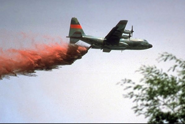
During the summer of 1981-82, the Forests Commission borrowed a Modular Airborne Firefighting System (MAFFS) from the United States Forest Service for evaluation under operational conditions. Photo: RAAF C130 Hercules at Mount Hickey -.8 Feb 1982. FCRPA
Fast and aggressive First Attack… has always been the mantra drummed into trainee forest firefighters.
The primary aim is to keep bushfires small, and less than 5 ha in size within the first 24-hour period following detection. This gives the best chance of quick control.
But the main problem for firefighters on the ground isn’t fire area… it’s fire perimeter… a conundrum rapidly compounded by spot fires.
A small 5 ha fire can be nearly 1 km around its perimeter. That’s a long way to build a control line by hand. And believe me… it’s hard slog…
And with big fires, the perimeter to be extinguished can stretch for hundreds of kilometres through thick bush, in rough terrain and remote from any access tracks.
Firefighting is a challenge of balancing available resources in both space and time. Sometimes a bit of agile mental arithmetic is required to judge the expected fire behaviour, rates of spread and where the fire edge might be, against the time and resources available to build and hold control line.
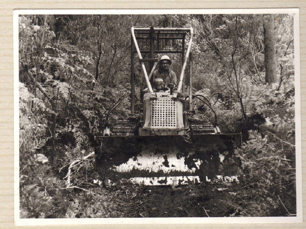
About 18 heavy bulldozers were purchased in the late 1940s in response to the Stretton Royal Commission recommendations.
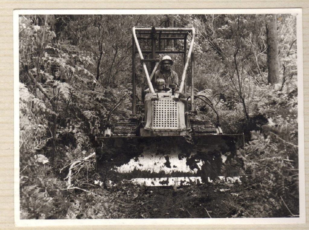
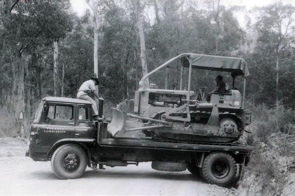
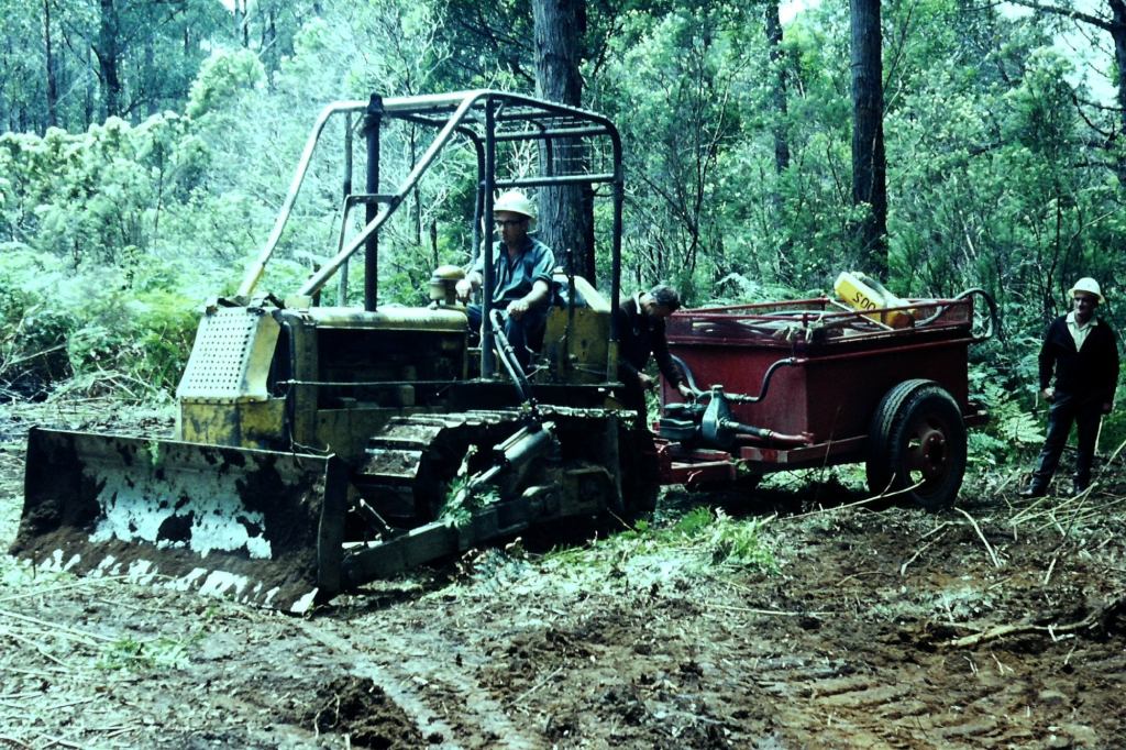
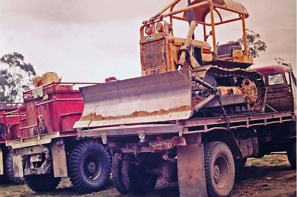
As technology improved, the Commission began putting smaller D4 size First Attack Dozers (FAD) on the back of tip trucks, and later small trailers, to transport machines more rapidly to the fire edge.
A small D4 bulldozer in the hands of a skilled operator could construct about 350 m/hr of control line in moderate fuels provided there wasn’t too much side slope, while a bigger D6 could double that figure.
Depending on forest type, fuel load, understory thickness and slope, the sustained rate to construct and hold fire control lines by hand crews is between 5 and 20 m per person per hour.
“Fires always look worse at night, and fires always look worse from a distance” – Alan McArthur, c 1961.
Firstly, it is important to understand that bushfire perimeter, rather than bushfire area, is the main control problem for forest firefighters on the ground. A conundrum rapidly compounded by spot fires.
In extreme cases, the perimeter to be extinguished can stretch for hundreds of kilometres through thick bush, in rough terrain and remote from any access tracks.
The principles of effective forest fire suppression have not changed over the decades. It requires –
Early detection combined with rapid and determined first attack to keep fires small.
The flames must be suppressed.
The perimeter must be surrounded by a bare-earth trail or non-combustible edge like a road or river, to ensure that smouldering fuels are physically separated from unburnt ones.
Smouldering material in the burnt area, within a certain distance of the fire edge (> 50m), and including large logs, trees alight in hollows and roots that can burn underground must be extinguished. This often requires tree-felling, digging and breaking open large material (aka – blacking out).
The fireline must be patrolled and blacked out until it is certain that it won’t relight.
Dry firefighting involves building a mineral earth trail down to bare dirt. In addition to building new hand trails, an existing road, strategic fuel break or 4WD track can be a suitable control line.
It is often the only option where there is limited access to reliable and plentiful water supplies, which characterised the prolonged campaign bushfires in remote and mountainous locations in the middle of summer.
A strong fuel moisture differential (e.g. river, heathland or swamp) is sometimes suitable as a control line but needs careful and ongoing monitoring.
Areas that have recently been burnt, with lower fuel levels, generally have milder fire behaviour and can offer safer access for crews and act as anchor points for control lines or back burning.
These operational techniques have proven effective firefighting in heavier forest fuels which, unlike grass, tend to retain heat and smoulder.
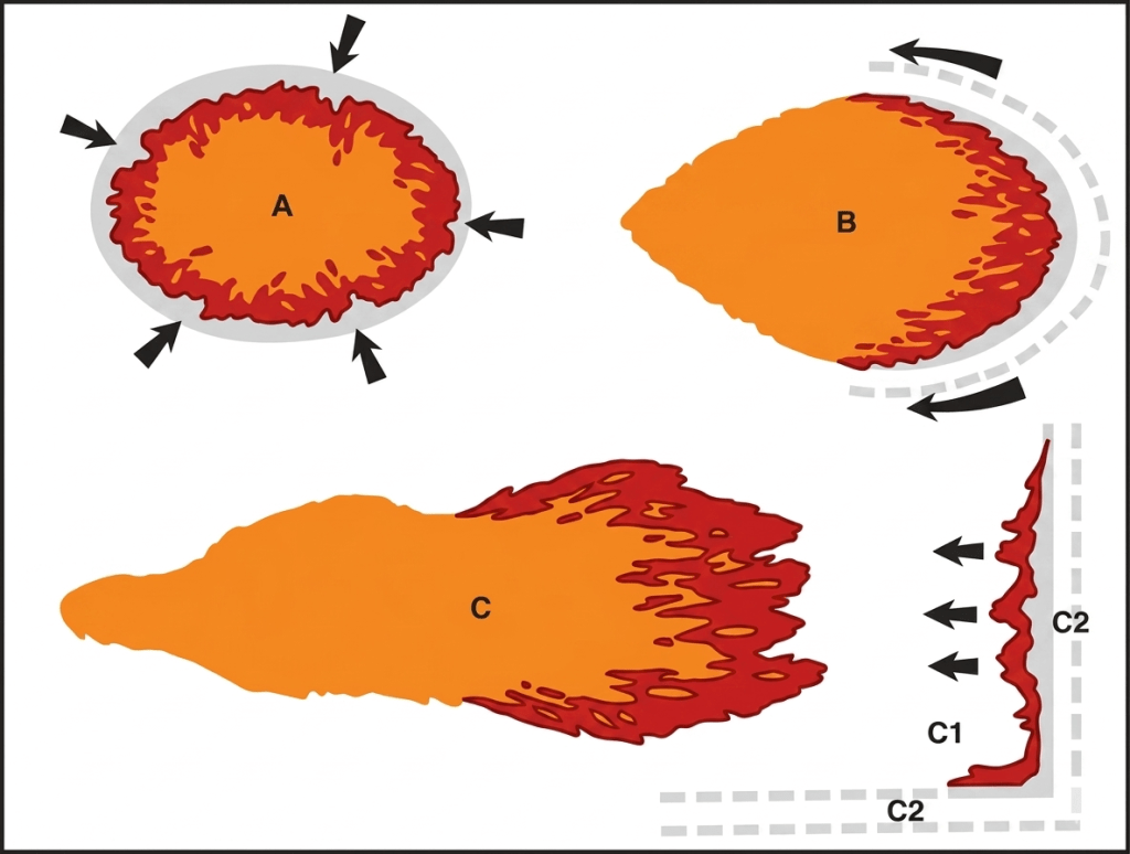
Direct attack is the normal tactic in the early phases of a bushfire when it’s still small. It requires getting a crew close to the edge, either on the flanks or at the head of the fire as quickly as possible, and building a break with hand tools like rakehoes, axes and chainsaws… or with small First Attack Dozers (FADs).
It is possible to control a small bushfire using direct attack provided the flame height is less than about a metre or so, the bushfire is accessible on foot or vehicle, the scrub isn’t too thick, and the weather remains stable.
For hand crews on foot, making sure there is a nearby safety zone that is clear, or has already been burnt, if the fire builds unexpectedly. This is often known as “keeping-one-foot-in-the-black”. Maintaining good communication and vigilant lookouts is an essential safety strategy.
Aircraft are very effective, particularly in the early stages. Sometimes a load of retardant dropped from a small firebomber or helicopter can suppress the flames and buy enough time for ground crews to reach it, particularly if the bushfire is remote or a single tree that has been hit by lightning.
By contrast, indirect attack usually involves building a fallback control line along roads or ridges, often well away from the active fire edge , and backburning.
Indirect attack is often done in conjunction with aerial ignition to burn out the remaining fuels, but it also rapidly increases fire complexity, size and perimeter.
And while aircraft and firebombers can make a big difference, particularly in the early stages, absolutely nothing beats “boots on the ground” for blackout and patrol.
The Forests Commission, (now DEECA/FFMVic), honed these firefighting skills over many decades of hard-won experience.
And falling trees and branches remain the greatest risk to the safety of firefighters on the ground.
A) Direct attack B) Parallel or Flanking attack C) Indirect attack with backburning C1 & C2. From Luke & McArthur.
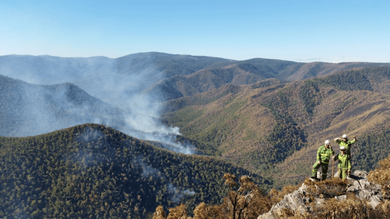
Large areas of State forest and National Parks in Gippsland and north-east Victoria are rugged and remote, so direct attack is difficult. Photo: DEECA.
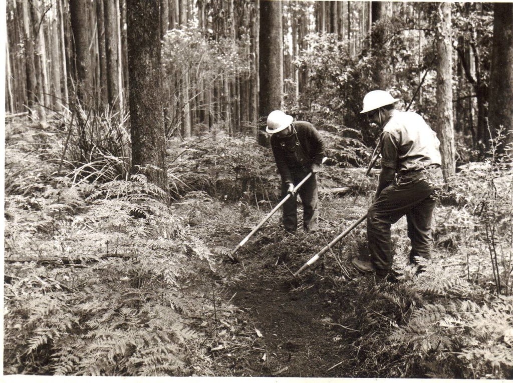
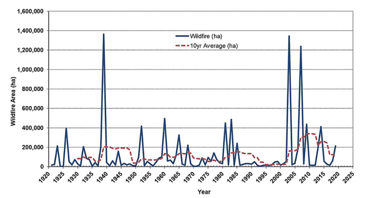
The first reference to the humble rakehoe was in the 1955-56 FCV Annual Report. Photo: Lyall Christenson, FCRPA Collection.Bushfires in Victoria since 1920. The solid line is the annual total area burnt by bushfire and the dashed line is the rolling 10-year average. Source: Morgan, Tolhurst et al. https://www.tandfonline.com/doi/full/10.1080/00049158.2020.1739883
The landscape features that distinguish Gippsland, and which strongly influence the weather, and therefore the bushfire behaviour are:
the remote, sometimes inaccessible, heavily forested mountains with winter snow-capped alpine peaks which rise up steeply from the hinterland and foothills.
major river valleys like the Macalister, Tambo, Buchan, Mitchell, Snowy and Cann Rivers which are generally orientated north-south and tend to funnel the prevailing weather patterns.
the Great Dividing Range and the strong north winds that tumble over the ridges which often brings bushfires from the north-east of the state.
the blocking effect of the Strzelecki Ranges which influences rainfall patterns.
rivers and valleys which empty out onto the flat fertile plains, the wetlands and the inland Gippsland Lakes.
the exposed southern coastline of Bass Strait from Wilsons Promontory to Point Hicks.
Far east Gippsland is one of the few places in mainland Australia where the forests extend unbroken from the mountains to the sea.
Eastern Victoria, and Gippsland in particular, sits directly within the Australian bushfire flume.
The thick forested landscape is subject to repeating weather cycles over the long summer months, with hot northerly winds, followed by strong south westerly changes and dry lightning storms, which can ignite many small fires in the mountains.
The heavy forest fuels are hard to fully extinguish without rain and can smoulder for weeks.
Inevitably, the whole drying cycle repeats itself and within a few days after the cool change, the strong north-west winds are back again to push any existing or new fires out of the bush.
Each time making a strong run with the north-west wind and then sweeping back into the bush with the cool south-west change.
Where it waits…
The end result of these repeating weather cycles interacting with the landscape and the eastern coastal forests is what I have termed the “Gippsland Zig-Zag”.
In combination with prolonged drought where natural fire barriers like creeks and tree fern gullies have dried out, these pesky campaign bushfires can burn for months.
The Zig-Zag becomes the typical and infuriating pattern as bushfires move with the wind, both up-and-down, and in-and-out of the forest, while their overall footprint steadily creeps across the Gippsland landscape from west to east.
Another distinguishing feature of the campaign bushfires and the Zig-Zag is the stress it causes to neighbouring communities. The endless sleepless nights waiting and wondering when, and even if, the fire will come out of the forest. Occasionally emotions bubble over and tempers fray.
Major Zig-Zag bushfires in Gippsland include 1965, Cann River in 1982-83 which burnt for several months, while more recent campaigns include the Caledonia River in 1998, the Alpine fires in 2002-03, 2005-06, 2006-07, Aberfeldy/Seaton in 2013, the Snowy River Complex in 2014 and Black Summer 2019-20.
Note- The term Gippsland Zig Zag can be traced back to the campaign fires in 2003. It was the year that the fires burnt through the Omeo base camp on the footy field and the outskirts of Swifts Creek itself. I was leading the planning team at Swifts Creek and we had some Americans with us for the first time. Ben Rankin was the incident Controller. I recall one of the Americans who had recently arrived, made the remark about the zig zag shape of the fire and it sorta stuck. I even renamed the fire in the Incident Action Plan (as it was known back then) for the next shift but the Region and Head Office didn’t see the funny side. But everyone in the bush knew exactly what I was talking about.
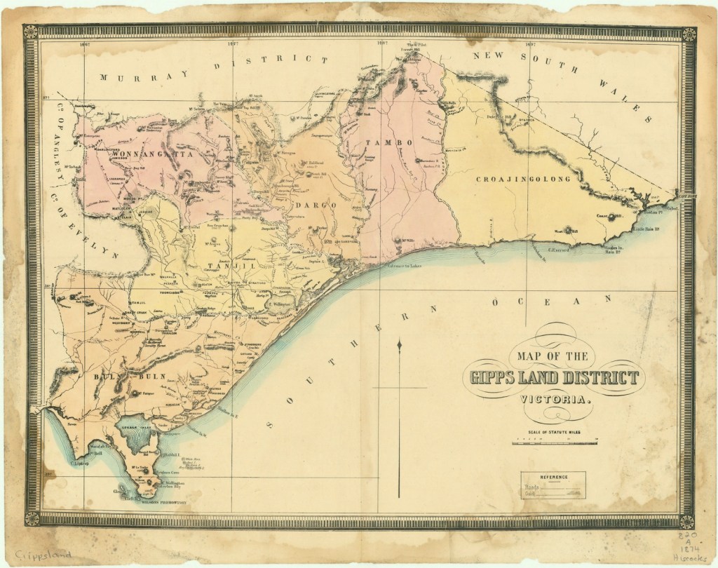
The boundaries of Gippsland can sometimes be diffuse, depending on who you talk to, but it’s generally agreed to be south of the Great Dividing Range to Bass Strait (including Wilsons Promontory) and extending eastwards from near Pakenham to the NSW border. Map of the Gipps Land district, Victoria – 1874. Source: SLV https://handle.slv.vic.gov.au/10381/87732
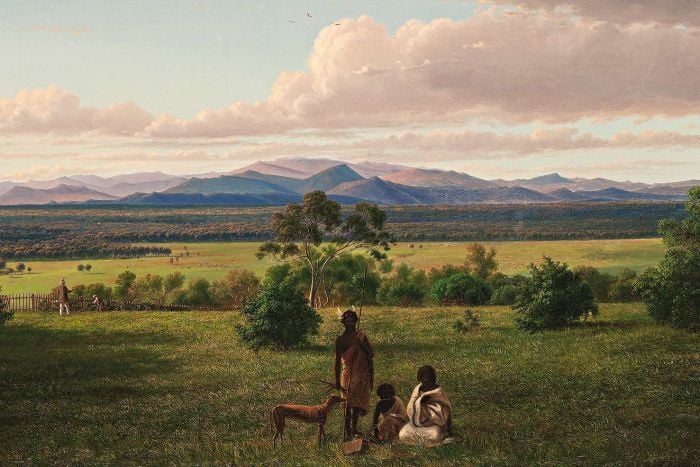
Painting by Eugene von Guérard of Mr John King’s Station near Rosedale in 1861. Mt. Wellington and Ben Cruachan, which are prominent peaks north of Valencia Creek and Briagolong, can be seen.
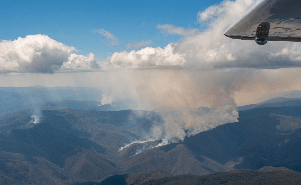
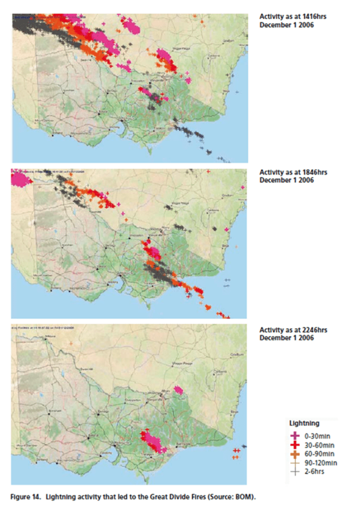
Multiple lighting strikes across the mountains north of Licola 2006/07. These fires often overwhelm firefighting capacity and quickly join up to become a large complex. (sharpened image).
Lighting progression 2006
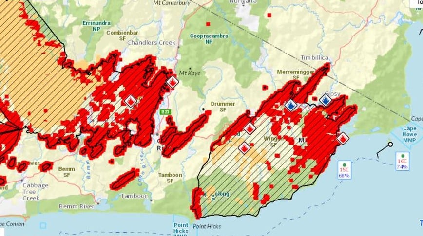
A recent example of the Gippsland Zig-Zag from 1 January 2020. The wind barb near Cape Howe is the clue.
Internationally, southern Australia and particularly the State of Victoria, New South Wales, South Australia and the island State of Tasmania, is commonly regarded as one of the three most landscapes on Earth prone to damaging bushfires. The other two are southern California and the Mediterranean coast.
Victorians live entirely within what the international renown fire historian, Stephen Pyne, calls “the bushfire flume.” It is the most distinctive bushfire region of Australia and one of the most dangerous in the world.
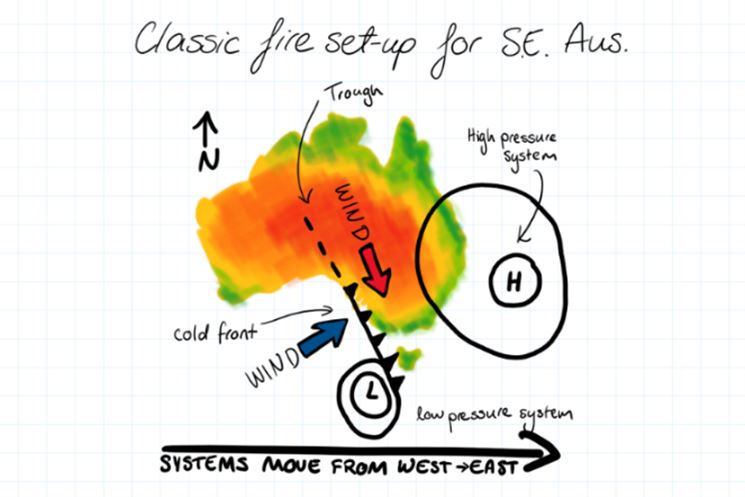
When a high-pressure system stalls in the Tasman Sea, hot northerly winds flow relentlessly down from central Australia across the densely vegetated south-east of the continent.
This fiery “flume” brews a deadly chemistry of air and fuel.
The mountain topography of steep slopes, ridges and valleys channels the hot air, temperatures climb to searing extremes, and humidity evaporates, such that the air crackles.
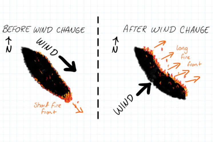
Fires starting under the influence of the strong north-westerly wind move quickly in a long straight line.
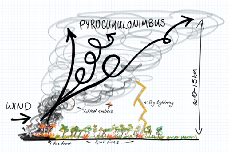
An unstable atmosphere with boiling pyrocumulonimbus cloud can also increase lightning and spot fires as burning leaves and bark get lifted up and carried through the air to start more fires downwind.
Typically, dry lightning storms without significant or any rainfall will roll across the landscape from the south-west with a strong cool change. The pattern of these storms begins before Christmas and continues well into autumn.
Depending on fuel dryness, the lightning storms often start numerous small fires on ridgetops as they strike dead trees. These trees ignite and bushfire spreads slowly for a while under the cooler conditions.
It is not uncommon for a single summer lightning storm to start as many as 50 to 100 small fires across the remote forests and mountains of eastern Victoria.
With a strong cool change, sometimes there is rain, but more often in summer and autumn, it is only a light sprinkle. Certainly not enough to extinguish any new blazes or wet the ground fuels.
After the south-west change has passed, the weather is typically benign for a few days with the development of a strong inversion layer and light winds. So new fires that have been started by lightning often smoulder undetected.
Combined with low clouds in the valleys these conditions make detection of any new fires from aircraft or firetowers difficult.
But there is also a chance to do some good suppression works before it gets hot and windy again.
When the winds swing around with a cool south-west change the entire eastern flank becomes the bushfire head and often breaks into smaller fingers of bushfire. Source: ABC
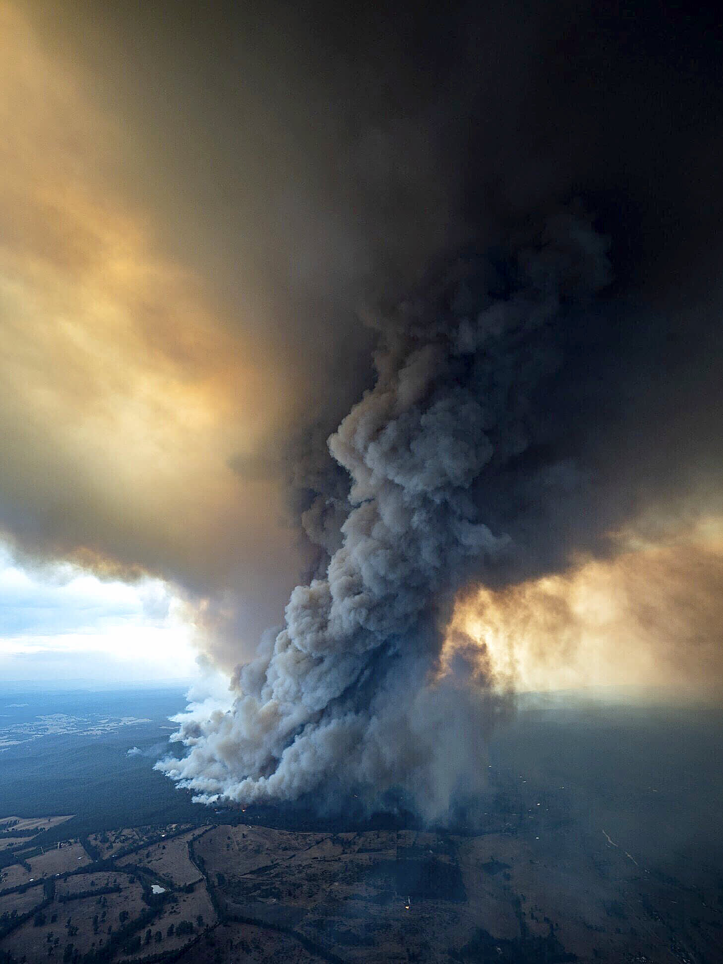
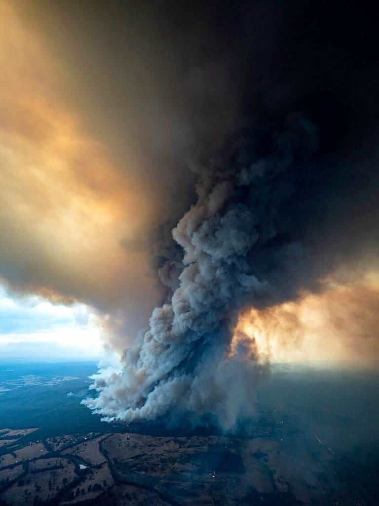
Fire storm with pyrocumulonimbus cloud. Photo: DELWP 2019.
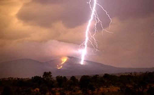
Bushfires on State forest and National Parks are often started by lightning. Usually with a south-westerly change after a hot day. Photo: ABC
Fire behaviour is usually described in terms of fire intensity (heat output – kw/m), flame heights, rates of spread and spotting distance.
It is influenced by a complex interaction of many factors including forest type, fuel quantity and arrangement, fuel dryness, temperature, atmospheric stability, wind speed and direction, Relative Humidity (RH), topography, aspect and even slope.
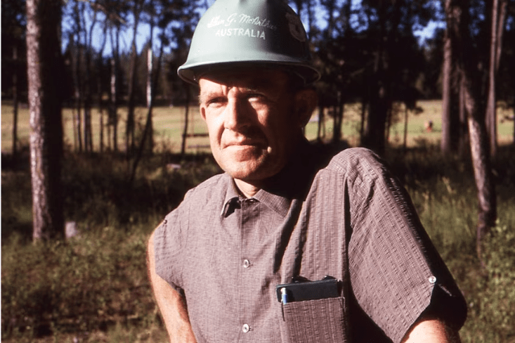
The Forest Fire Danger Index (FFDI) was originally developed by the legendary pioneer of Australian bushfire science, Alan Grant McArthur, during the 1950s and ‘60s.
Alan studied forest science at the University of Sydney in 1945, and later the Australian Forestry School in Canberra.
In 1953, Alan transferred to the Commonwealth Forestry and Timber Bureau in Canberra as a fire researcher. Five years later he was appointed Principal Research Officer in the newly created Division of Forest Research within the Commonwealth Scientific and Industrial Research Organization (CSIRO).
Alan was a very hands-on forester and fire researcher. To gather data, he deliberately lit over 450 experimental fires between 1956 and 1961 under a range of low to moderate weather conditions in the Kowen Forest and Bulls Head Creek area around Canberra. There were other test fires near Traralgon and the Wombat Forest near Daylesford. The experimental data was reinforced from studies of a few well-documented bushfires.
For obvious reasons, he couldn’t light test fires under extreme weather conditions, so his subsequent fire danger equations needed to be extrapolated.
Much of his raw field data was collected by students from the Australian Forestry School and later the Australian National University where he lectured. Alan used his fit and hardy crew, armed with time-stamped rocks, to mark the progress of the test fires and collect the data as well as map fire progression for his meter, a hugely useful improvement in fire prediction at the time.
Alan made thousands of detailed observations of things like wind speed, RH, temperature, cloud cover, rainfall, fuel moisture content, flame height, fire intensity, spotting distance, rate of spread and fuel quantity. He also made subjective assessments of fire suppression difficulty.
Alan published his landmark paper, “Controlled burning in eucalypt forests” in 1962. Leaflet No. 80, as it was known, proved a turning point for forest and fire managers across Australia.
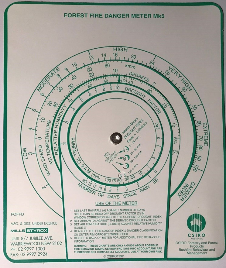
More importantly, Alan was a very practical forester and wanted his work to be useful to people in the field, so after several iterations he came up with the now familiar circular slide rule called the Forest Fire Danger Index meter (FFDI). The Mk 4 version first appeared in operational use in 1967.
There is also a grasslands fire danger meter.
The FFDI meter uses measurements of dryness, based on rainfall and evaporation together with the Keetch-Bryram Drought Index to calculate a Drought Factor (DF) ranging from 1 to 10.
The Drought Factor is then combined with wind speed, temperature and relative humidity to calculate a FFDI in a range from 0 to 100.
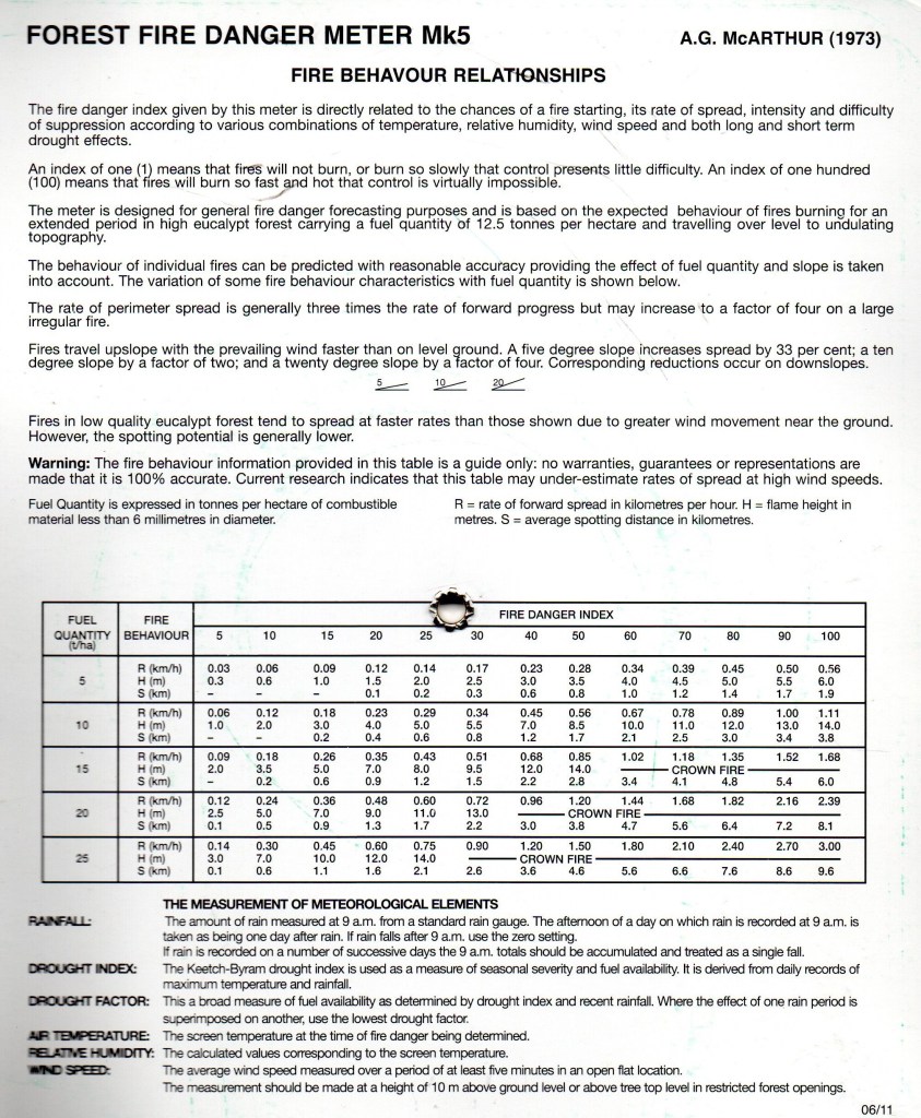
By assessing fuel load (tonnes/ha) and slope, the fire behaviour characteristics such as Rate of Spread (ROS), flame heights and spotting distance can be estimated under a range of fire danger indices.
The rate of perimeter growth is generally three to four times the rate of forward spread. But long-distance spotting can increase these figures.
Fires travel uphill and with the prevailing wing much faster than on flat ground. A five-degree slope increases the spread by 33% and 25 degrees by as much as a factor of four. These rates reduce by the corresponding amount going downslope.
The McArthur FFDI meter was designed for a fuel load of 12.5 tonnes per hectare. Increasing fuel increases fire intensity, rates of spread, perimeter growth and flame heights.
Most successful firefighting, and indeed fuel reduction burning, occurs when the FFDI is in the “Moderate” range between 5-12. The FFDI rises to “High” between 12-24 and “Very High” between 24 and 50. A day with an index exceeding 50 is considered “Extreme”.
Alan used the weather and fuel conditions of the 1939 Black Friday fires as his example to set the upper limits of FFDI at 100.
However, the FFDI went “off the scale” on both Ash Wednesday in 1983 and Black Saturday in 2009. Under these extreme or catastrophic bushfire conditions, the weather rather than fuel load or arrangement, becomes the dominant factor influencing fire behaviour.
But for anyone who has been involved in bushfires they will know that the FFDI has its shortcomings.
The original system was only designed for use in forests and grasslands. But Australia has lots of different types of vegetation such as Mallee heath, woodlands and open savanna, and the FFDI system does not forecast those well.
The FFDI meter does not consider all the conditions which have an impact upon fire behaviour such as wind changes and atmospheric stability.
The meter tends to overestimate fire danger and rates of spread on cloudy days with stable atmosphere and also in the early morning.
Due to the time lag in moisture uptake by fine fuels the meter tends to underestimate fire danger in the late afternoon and early evening
The meter begins to break down at the extreme end of the scale and small changes to temperature, humidity and wind speed can have a huge influence on the fire danger index.
But no matter what the limitations of the FFDI meter, Alan’s scientific legacy is unquestionably huge and has served forest firefighters very well over the decades. New research will undoubtedly refine and develop even better models.
McArthur, A. G. (1962). Controlled burning in eucalypt forests. Leaflet No. 80.
Alan McArthur. Source CSIROLighting a test fire near Canberra. Source CSIRO
There was a noticeable increase in burning across Australian forests after Alan MacArthur’s research work with the CSIRO and his publication of Leaflet No 80 in 1962. The McArthur Forest Fire Danger Meter (FFDM) first appeared in operational use in 1967 as the Mk 4. Photo: Jack Gillespie.
Forest Fire Danger Meter (Mk5). Photo: Peter McHugh
Bushfire behaviour is influenced by many factors including forest type, fuel quantity, fuel arrangement, fuel dryness, drought index, temperature, Relative Humidity (RH), topography, atmospheric stability, aspect and even slope.
Wind has a dominant effect on the Rate of Spread (ROS), and also bushfire size, shape and direction.
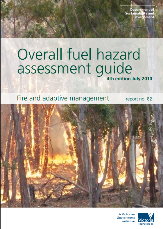
Measuring Fuel Hazard.
Fuel quantity (tonnes/ha) affects fire intensity (heat output – kilowatts/metre), the Rate of Spread, flame height and spotting distance.
Put simply – more fuel produces more heat output and greater fire intensity, which directly affects fire suppression difficulty.
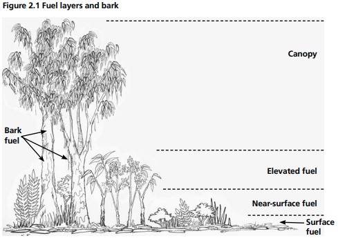
But fuel arrangement is just as important as fuel quantity to the overall fuel hazard rating. Fibrous and ribbon bark, wiregrass and suspended leaves, together with elevated and near-surface scrub fuels, act as ladders which can lead flames into the tree canopy.
Overall fuel hazard can be significantly reduced by rearranging the elevated fuels by mulching or mowing, even though the total fuel quantity initially remains the same.
Perhaps the best simple illustration is to imagine unsuccessfully trying to ignite a thick phone book with a match but then tearing out all the pages and scrunching them up into a pile and then setting it alight. There is no change in overall fuel quantity but the difference in the arrangement significantly affects the resulting fire behaviour.
Fuel size is an important factor in “flammability” too. Fine fuels include dead plant material, such as leaves, grass, bark and twigs less than 6mm thick, and live plant material thinner than 3mm thick. Typically, they burn quickly at the fire edge and contribute the most to the rate of spread and flame height.
Bark quantity and type have a dominant influence on the overall fuel hazard and therefore fire behaviour. Burning can significantly reduce the long-term back hazard.
Under extreme conditions, fibrous bark like messmate (Eucalyptus obliqua) can produce massive spotting 100-500 m, while ribbon bark from manna gum (E. viminalis) in combination with unstable atmospheric conditions can start spot fires 10-20 km ahead of the fire front.
The leaves on standing trees will not, on their own, support a fire, and fires will not occur in tree crowns unless there is an intense fire burning on the ground beneath.
Available Fuel vs Total Fuel.
The quantity of fuel available to burn (compared to total fuel quantity) depends largely on moisture content. When moisture content exceeds 20-25% not much will burn, whereas 9-17% is the optimal range for safe fuel reduction burning, but if the moisture content drops below 9%, virtually everything will ignite, and fire behaviour can become extreme.
But here is the important bit, fine fuels like leaves and bark act like a sponge and can absorb moisture from the air when the Relative Humidity (RH) is high, and temperature is cool. Conversely, they can also dry out very quickly.
This means that fuel availability can increase rapidly from nearly zero after high RH, rain, dew, drizzle or fog, to many tonnes per hectare as fuel dries out. This can happen quickly over a few hours on hot and windy days. Rapidly drying fuel is the main reason that bushfires escalate during the late afternoon.
Under the normal drying cycle, the fuel dries from the top of the litter bed and the near surface fuel. Under mild conditions, and in spring, the lower litter layer next to the soil often remains too wet to burn.
Heavy forest fuels like big logs on the ground, or dead standing trees (stags), take much longer to dry out and are more affected by prolonged drought and underlying soil dryness. They have a long residual burning time and don’t extinguish quickly or easily like grass. This adds considerably to the complexity and length of the firefighting effort in forests. Campaign bushfires lasting weeks, or even months, are not uncommon in heavy forest fuels.
Finally, the explosive flammability of eucalyptus oil is well known to Australian forest firefighters. The aromatic oil has an energy content similar to petrol, with about 43MJ/kg once its vaporised, but it has a much higher flashpoint like diesel. Fireballs of explosive gas are thankfully uncommon but exhibit erratic behaviour and are very frightening.
Fuel Accumulation.
The rate of fuel accumulation from leaf and bark fall in forests varies between 4 to 10 tonnes/ha/year. The rate of decomposition also depends on forest type, soils, seasonal rainfall and climate.
Contrary to popular belief, forest fuels do not accumulate indefinitely. An equilibrium, or steady state, is eventually reached where the accumulation rate matches the rate of decomposition.
For dry foothill forests commonly found across Victoria, fuel quantities typically range from 15-40 tonnes/ha after 20-25 years. In wet forests like mountain ash it is typically higher.
Wombat – Fire Effects Study Areas (FESA).
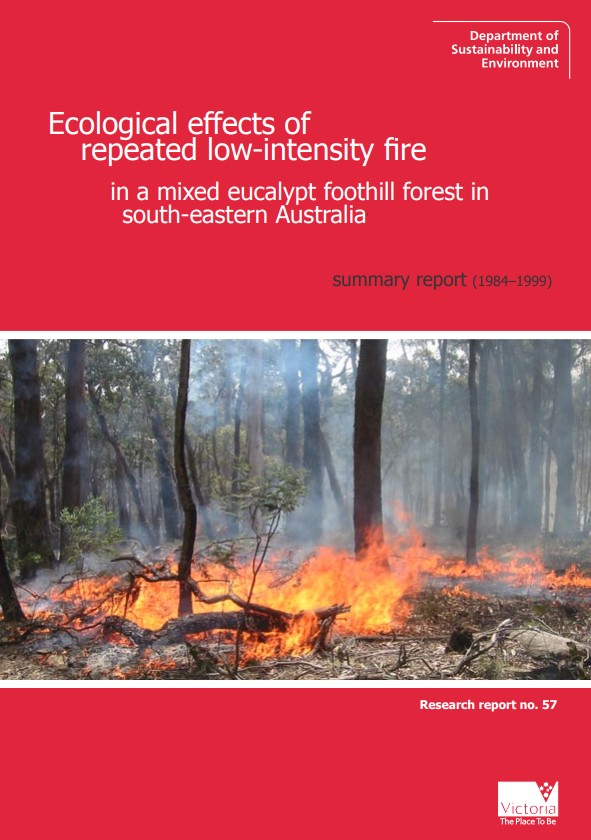
One of the most authoritative and comprehensive long-term research projects in Victoria began in 1984 in the Wombat State forest. The research was led by the late Dr Kevin Tolhust and assessed the ecological impacts of repeated, low-intensity prescribed fire. Short and long-term rotation burning in spring was compared to autumn ignition. Some control plots were not burnt.
The structure and type of near surface and elevated fuels in the understory evolved over time. The long-term patterns of fire frequency, intensity, and season play a role in understory and fuel redevelopment (aka – Fire Regime).
The study found that surface fine fuels had an average steady state level of 16 tonnes/ha, but seasonal variations ranged from 9 to 26 t/ha.
Surface fine fuels reaccumulated to within 90% of the long-unburnt state within four years of either spring or autumn burning at the fire low intensities studied. The impact of prescribed burning on surface fuels is therefore relatively short-lived.
The rate of accumulation of surface fine fuels was not significantly affected by the season of burn or the burn frequency.
The study found that while the surface fine fuel complex may reaccumulate very quickly, the overall fuel hazard levels were likely to continue to slowly increase for 20 years or more due to slower of regrowth of bark and accumulation of elevated fuels.
Over the 14-year period, no plant species were either lost or gained as a result of up to four successive spring fires or three successive autumn fires. However, short-rotation spring burning can favour Austral Bracken (Pteridium esculentum), herbs, geophytes and Poa (Poa sieberiana), and disadvantage Forest Wire-grass.
There were also subtle changes in the forest understorey in the absence of fire. These changes were only small on a year-to-year basis, but amount to significant changes over a period of a decade or more.
When severe bushfire removes or damages the tree crowns and lets the sunshine reach the ground it can lead to a pulse of understory scrub regrowth, particularly in some foothill forests.
In addition to examining fuel dynamics, the Wombat study also investigated the ecological effects of repeated fire on vegetation, tree growth, invertebrates, mammals, birds, bats, reptiles, along with changes to soil nutrition and organic matter.
But the monitoring of these important FESA plots finished in 1999, and it would be wonderful to see them reinstated to put some more science into the debate.
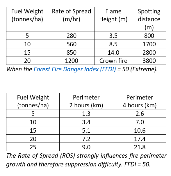
The Rate of Spread (ROS) strongly influences fire perimeter growth and therefore suppression difficulty. FFDI = 50.
Flammable bark and highly aeriated ladder fuels with a strong vertical arrangement can have a greater impact on fire behaviour than overall fuel quantity (tonnes/ha). Source: Bushfires CRC.
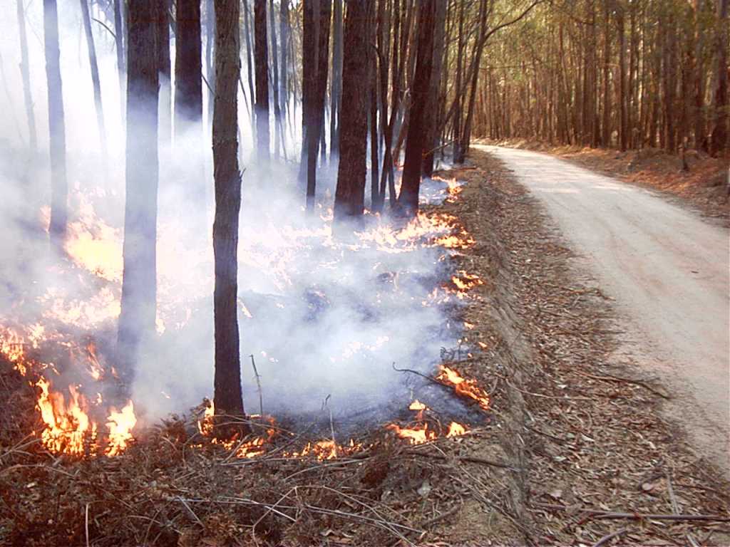
Low flame heights with no elevated (ladder) fuel. Moisture content around 15%. Photo: Lee Gleeson – Cobaw 2003.
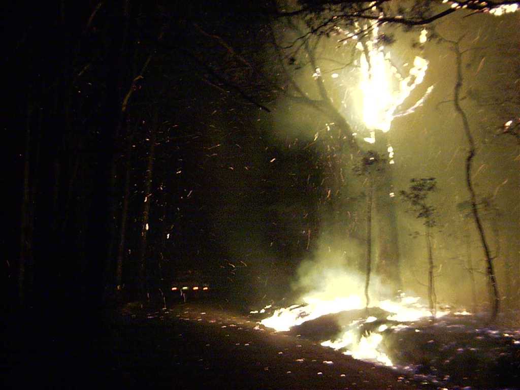
Elevated fuel and fibrous barks from messmates (E. obliqua) tend to cause massive, short distance spotting. Photo: Lee Gleeson – Cobaw 2003.
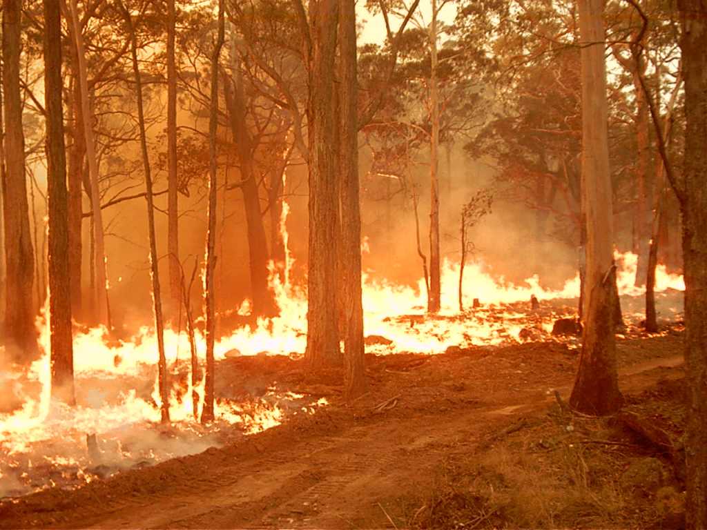
Flames beginning to climb up the unburnt messmate trunks as the fuel begins to dry out in the late afternoon and into the early evening. Fuel availability on the same site can rapidly increase from zero to many tonnes per hectare in the space of a few hours as moisture contents falls. Photo: Lee Gleeson – Cobaw 2003.
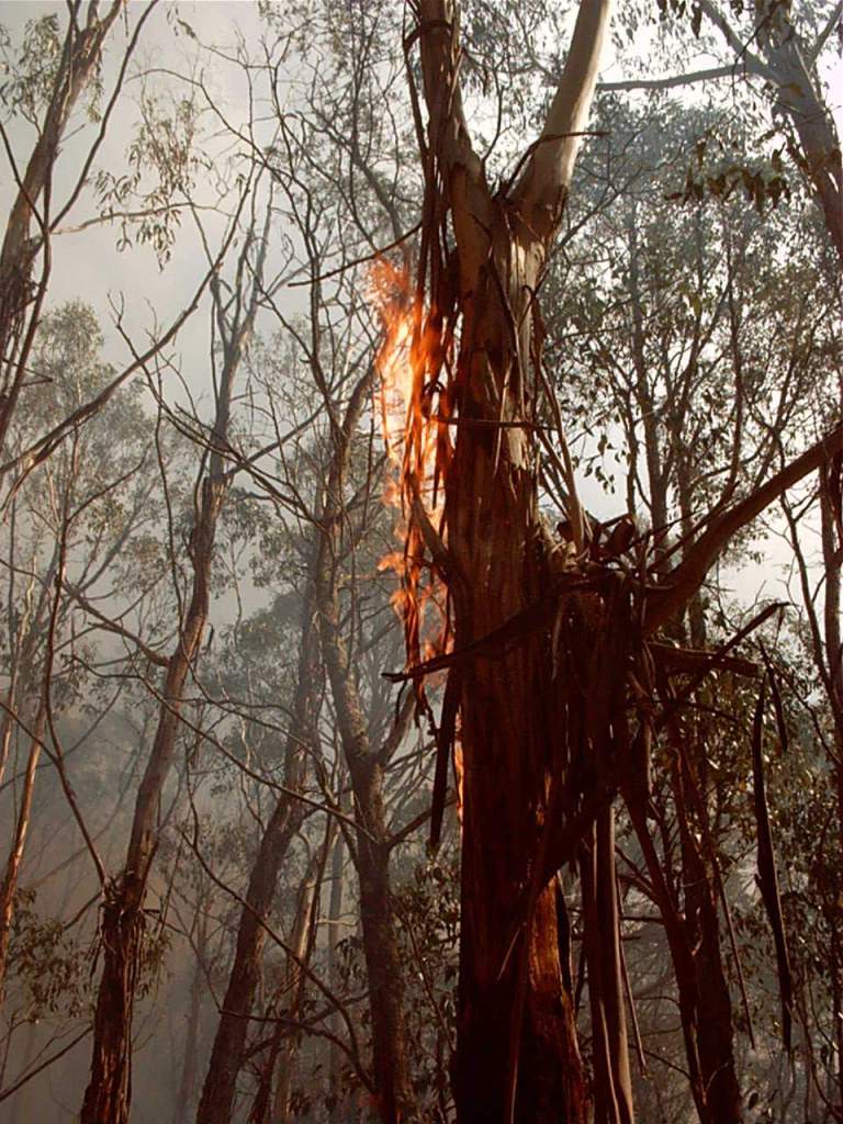
The ribbon bark from manna gum (E. viminalis) can ignite high in the trees, and under extreme conditions, may travel many kilometres to start new fires. Photo: Lee Gleeson – Cobaw 2003.
Over the next week or so I will present some material about basic fire management based on my personal knowledge and 40 years’ experience as a Victorian forest manager, senior firefighter and incident controller. The topics covered include –
Understanding fuel dynamics
Fire hazard
Fire danger indices
Bushfire Suppression
Fuel Reduction Burning (FRB)
Effectiveness of fire/fuel breaks
Mosaic burning
Changing climate
Some bushfire terminology.
There is a large body of scientific literature, technical reports and training manuals which capture the accumulated wisdom of experienced firefighters.
There are also many facts and fallacies, myths and misunderstandings, truths, half-truths, strongly held opinions, ideological beliefs, blatant lies and occasional outright BS surrounding this complex topic.
I acknowledge the science is incomplete and there is always more to learn and understand, but there also are many alternate and, sometimes dangerous, beliefs that commonly circulate, particularly on social media.
In my years of bushfire experience, nothing is ever as simple and one dimensional as it appears, but it seems everyone is an expert on bushfires…
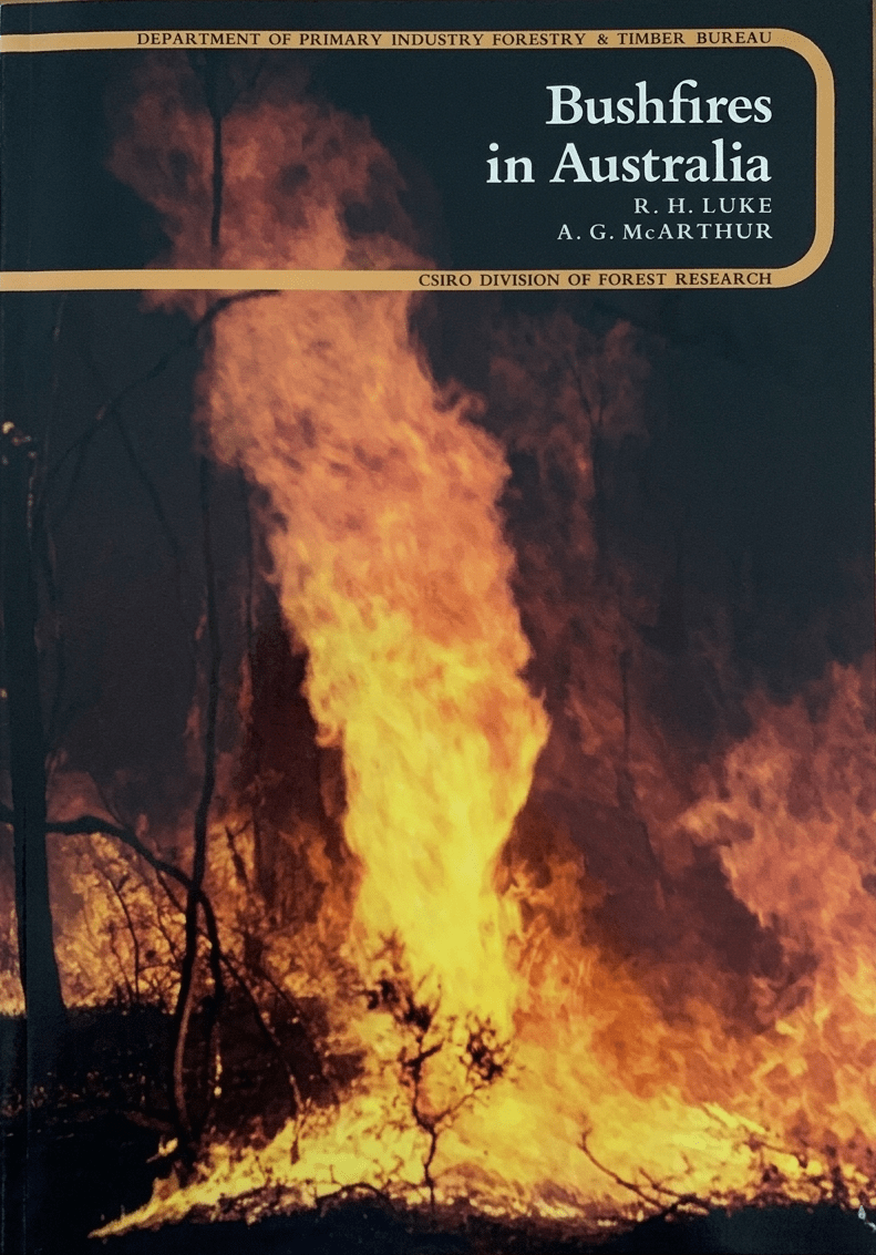
My well-worn copy of bushfires in Australia by Luke and McArthur from 1978. Compulsory reading for ever firefighter.
There is often confusion about the many terms used in firefighting. They often vary between States but are outlined in the AFAC glossary. Here are just a few.
Fuel Reduction Burning. The planned application of fire to reduce hazardous fuel quantities, undertaken under prescribed environmental and fuel conditions within defined boundaries. (AKA Planned burning, controlled burning, prescribed burning, hazard reduction burning, patch burning, mosaic burning and cultural burning). Often confused with backburning.
Backburn. A fire started intentionally along the inner edge of a fireline during indirect attack operations to consume fuel in the path of a bushfire. Also used a last resort control strategy and very high risk which requires great skill, courage and an element of good fortune.
Burning Out. A fire set to consume islands of unburnt fuel inside the fire perimeter and between the fire edge and fireline.
Backing Fire. The part of a fire which is burning back against the wind or down slope, where the flame height and rate of spread are reduced.
Blacking Out. The process of extinguishing or removing burning material along or near the fire control line, felling stags, trenching logs to prevent rolling and the like, to make the fire safe.
Breakaway. The points at which a fire, after it has been contained, escapes into unburnt areas across a fireline or fire edge.
Bushfire An unplanned fire. A generic term which includes grass fires, forest fires and scrub fires both with and without a suppression objective. (preferred over “wildfire” which is more an American term)
Direct Attack. A method of fire attack where wet or dry firefighting techniques are used. It involves suppression action right on the fire edge which then becomes the fireline.
Dry Firefighting. The suppression of a fire without the use of water. This is normally achieved by removing the fuel with hand tools, burning or machinery.
Edge Burning. Perimeter burning of an area in mild conditions prior to large scale prescribed burning. This practice is used to strengthen buffers and to reduce mop-up operations.
Fall back control line. Any fire control line which is at a distance from the fire perimeter and is the second control line at which the fire perimeter may be stopped should it cross the first fire control line. Also known as ‘fallback line’.
Forest Fire Danger Index (FFDI). A relative number denoting the potential rates of spread, or suppression difficulty for specific combinations of temperature, relative humidity, drought effects and wind speed. Developed by Alan McArthur from the CSIRO in the 1960s.
Fireline. A natural barrier like a ridge or stream, or a constructed barrier like a road or track, or treated or burnt fire edge, used in fire suppression and prescribed burning to limit the spread of fire. (AKA Control line, hand trail, dozer line, dead edge, tie in point))
Fire Intensity. The rate of energy release per unit length of fire front usually expressed in kilowatts per metre (Kw/m). A function of available fuel quantity, Rate of Spread (ROS) and weather conditions like temperature, Relative Humidity (RH) and wind.
Fire Regime – described as the long-term cycles and patterns of fire intensity, fire frequency, spatial arrangement (patchiness) and season the year when burning occurs.
Fuel. Any material such as grass, leaf litter and live vegetation which can be ignited and sustains a fire. Fuel is usually measured in tonnes per hectare. Related Terms: available fuel, coarse fuel, dead fuel, elevated dead fuel, fine fuel, surface fuels, and total fine fuel.
Fuel Arrangement. The spatial arrangement of fuel. Flammable bark and highly aeriated ladder fuels with a strong vertical arrangement can have a greater impact on fire behaviour than overall fuel quantity (tonnes /ha).
Indirect Attack A method of suppression in which the control line is located some distance away from the fire’s active edge. Generally done in the case of a fast spreading or high-intensity fire and to utilize natural or constructed firebreaks or fuel breaks and favourable breaks in the topography. The intervening fuel is usually backburnt; but occasionally the main fire is allowed to burn to the line, depending on conditions.
Keetch-Byram Drought Index (KBDI). A numerical value reflecting the dryness of soils, deep forest litter, logs and living vegetation, and expressed as a scale from 0 – 200 where the number represents the amounts of rainfall (mm) to return the soil to saturation.
Over many decades the Forests Commission used and developed a wide range of incendiary devices for its burning operations.
These pyrotechnics included “strike anywhere” wax vestas, safety fusees, burning tyres dragged behind vehicles, humble drip torches, incendiary shotguns and mortars, flame throwers of various designs, blow torches, jellied petrol blivets wired up to electrical circuits and heavy-duty detonation chord to create firelines, and even gelignite to blow up dangerous trees.
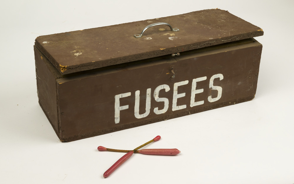
One of the most common incendiaries in the 1960s and ‘70s were Delayed Action Incendiary Devices (DAIDs) which were a long double ended match with a short length safety fuse in between. These were mostly dropped from helicopters.
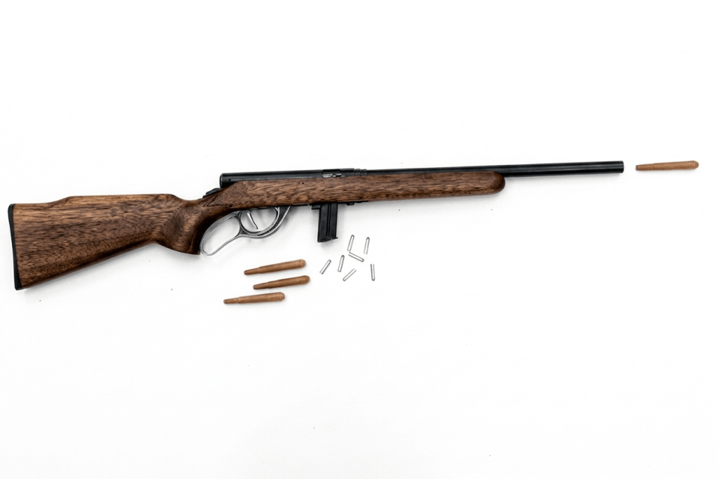
Another common technique used to ignite small spot fires was the Gun Operated Flamer (GOF). This was a modified DAID which was fired using blank ammunition from a modified .22 rifle fitted with a larger shotgun barrel.
But they were all bloody dangerous.
The most tragic accident occurred on 19 April 1978 when a helicopter crashed at Wandiligong near Bright during fuel reduction burning operations, killing two FCV officers, Peter Collier and Stan Gillett, along with their pilot, John Byrnes.
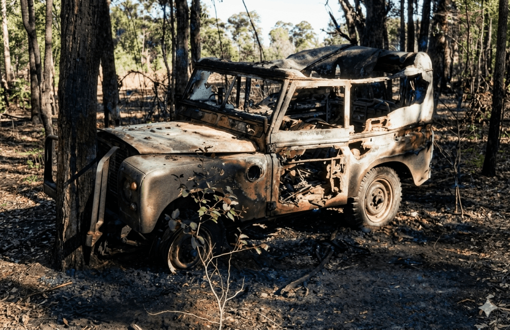
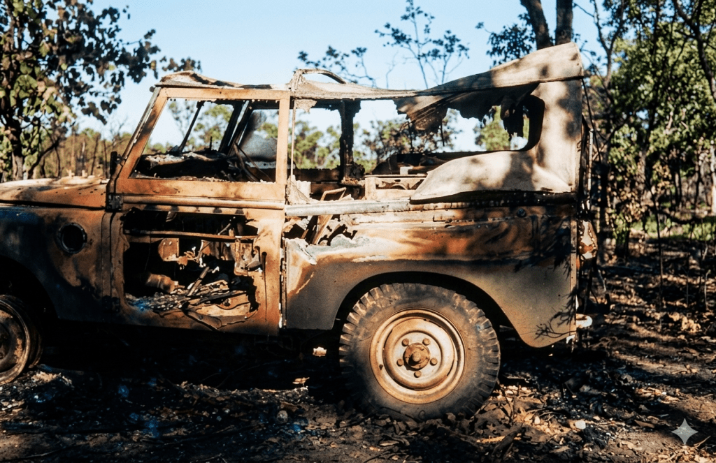
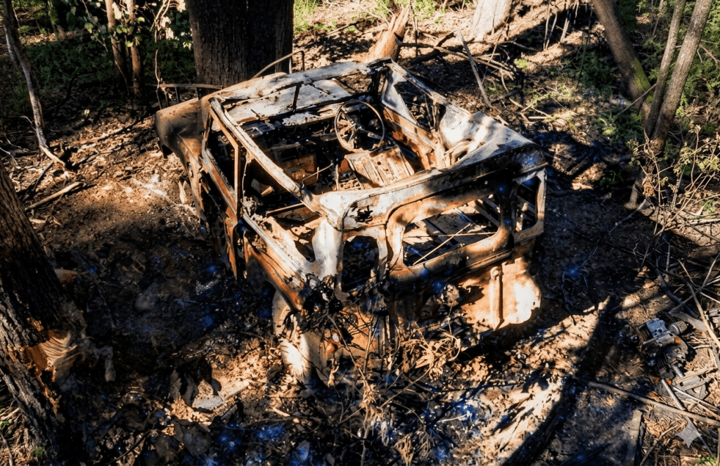
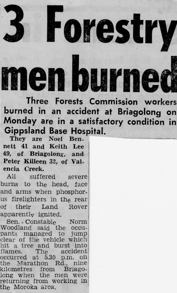
But only a few months earlier on 3 October 1977, there was another significant accident when a box of GOFs exploded in flames in the back of a short-wheel-base Land Rover carrying three staff from Briagolong in Gippsland.
Noel Bennett, Peter Killeen and Keith Lee were returning after a day in the bush along the Marathon Road when the GOFs, which were stored in a safety box in the back, caught fire and their vehicle crashed into a tree. All three escaped but with serious burns and spent some time in Sale hospital recovering. Noel’s small dog also managed to escape, but without injury.
It’s reported that a box of GOFs was later tested on a shake table at the Altona workshops where they indeed caught fire.
These two incidents, plus many other minor ones, led to the Commission banning these types of incendiaries and developing safer techniques like the aerial ping-pong ball machines which are still in use today.
Gun Operated Flamer (GOF) was a modified .22 rifle fitted with a larger shotgun barrel that used blank ammunition to fire incendiaries. Source: FCRPA Collection.Source: Noel Bennett. (restored image)Source: Noel Bennett. (restored image)Source: Noel Bennett. (restored image)
Gippsland Times October 1977. Source: Noel Bennett.
Bryant and May at Richmond worked with the Forests Commission to develop a Delayed Action Incendiary Device. DAIDs. They had an overall length of 180 mm, striker end length – 10 mm. Ignition end length – 80 mm, then a layer of high melting point wax (to prevent accidental ignition when rubbing together in transit). Both ends coated with a modified match head compound with safety fuse exposed length between coated match ends. There was a 17-second delay from when the small end was struck to an intense flaming of the large end, which lasted for 40 seconds. DAIDs were dangerous so were stored in a safety box. FCRPA Collection
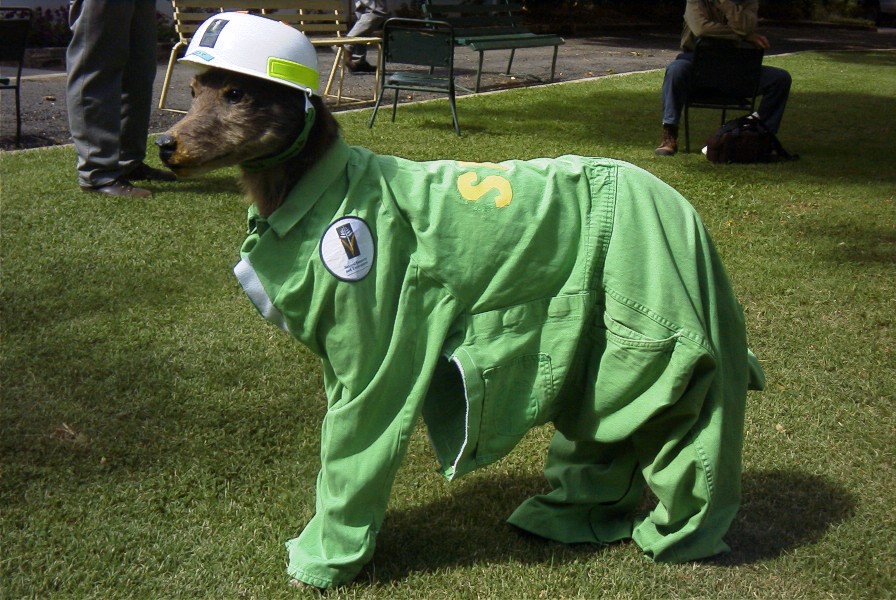
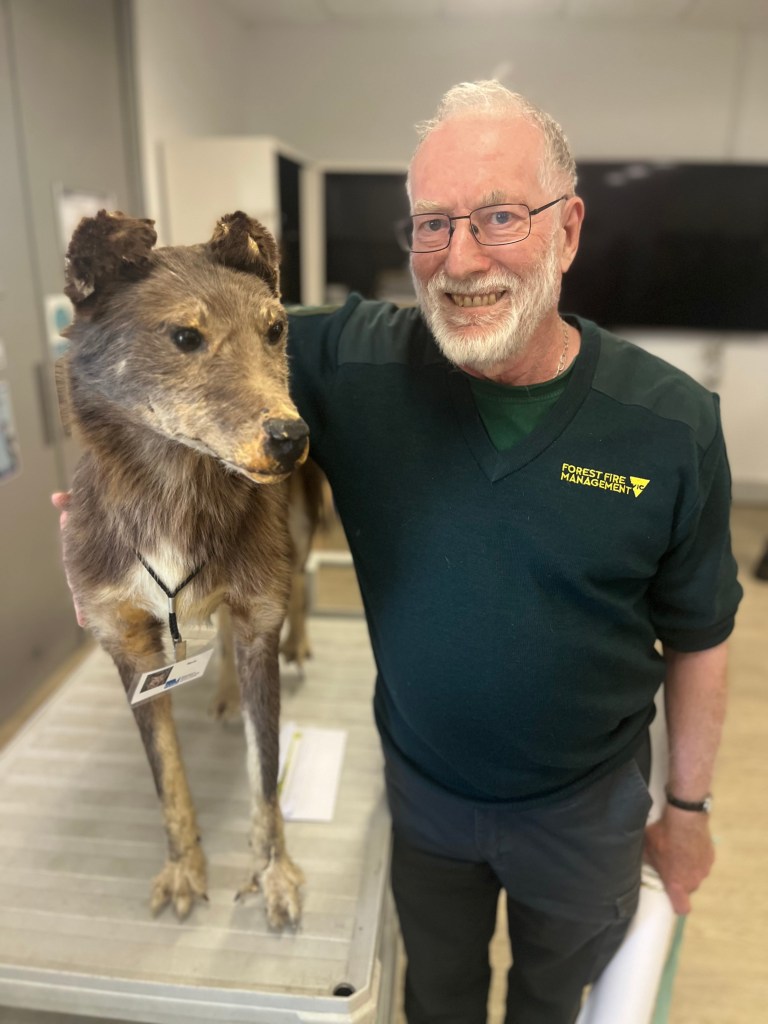
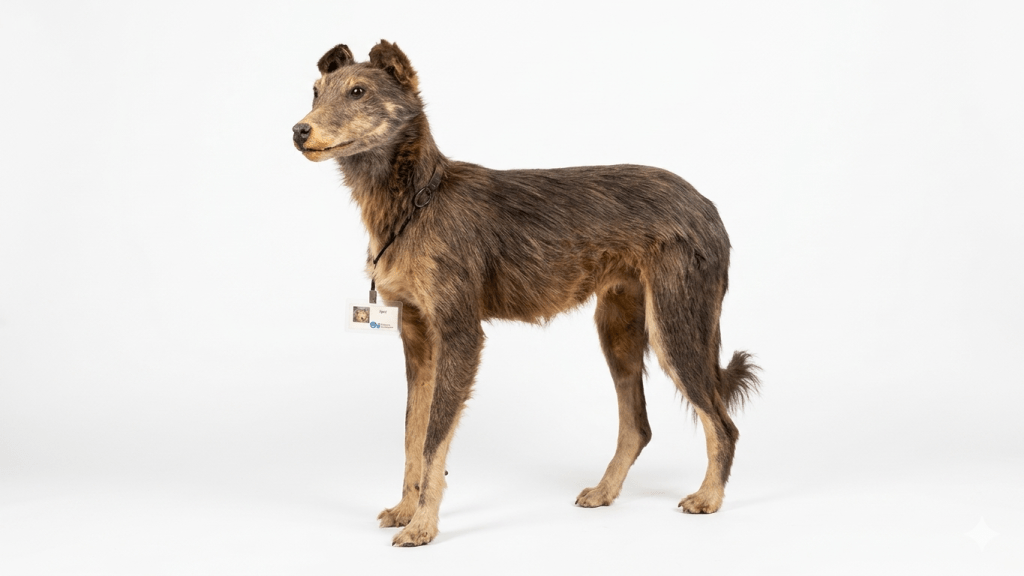
Spot and Ted Stabb became friends in the late 1980s during the days of the Department of Conservation, Forests and Lands (CFL).
Rob Chalwell (ex-Bright Forests Commission) told Ted that Spot had been looking very sad and lonely in the front window of the Lands Department Office at Bright for some years.
Ted then rescued Spot and gave him a new lease on life with a focus on State forests, recreation, bushfires, planned burns, office openings, statewide videoconferences and similar gala events (invited or not).
Spot enjoyed many adventures and travels with Ted over the next 35 years or so, and became very popular and well known, particularly in northeastern Victoria.
But not everyone liked or appreciated Spot, and one Departmental Secretary, who has long since been forgotten, even referred to him as “That Dog”. But the locals ignored the rudeness and Spot stayed.
And outside work, Spot was also known to be active in his local community. He even had a social and political conscience and was occasionally seen trying to influence the way we vote.
On Friday 13th November 2025, Ted finally, and somewhat reluctantly, retired from the Department after a very long and distinguished career as a forester.
And while Spot would have liked to go home with Ted – which he did during Covid lockdown and for the duration of the Wodonga office refurbishments – Ted has a fairly small house and backyard, and Spot is a big dog that needs space to run.
Besides, Spot was not under any pressure to leave the department like other oldies, because he is not paid a salary, doesn’t need a computer or desk space and has no large credit of unused sick leave.
Pleasingly, Aaron Kennedy, the Deputy Chief Fire Officer for Hume Region, promised to give Spot a bit of a spruce up and find an appropriate place for him in the Benalla Office, rather than the dusty museum at Altona. He has also assured Ted that Spot will never end up in the dumpster or standing in a lonely window again.
But the staff objected to Spot’s transfer to Benalla, so he stayed in Wodonga. Allegedly for his own protection he has been placed in a Perspex display case at the front of the office, where he keeps a watchful eye on staff and visitors.
Spot and Ted… both Victorian forestry and bushfire legends…
This is Spot. Spot can run. Spot can jump. Spot is brave…
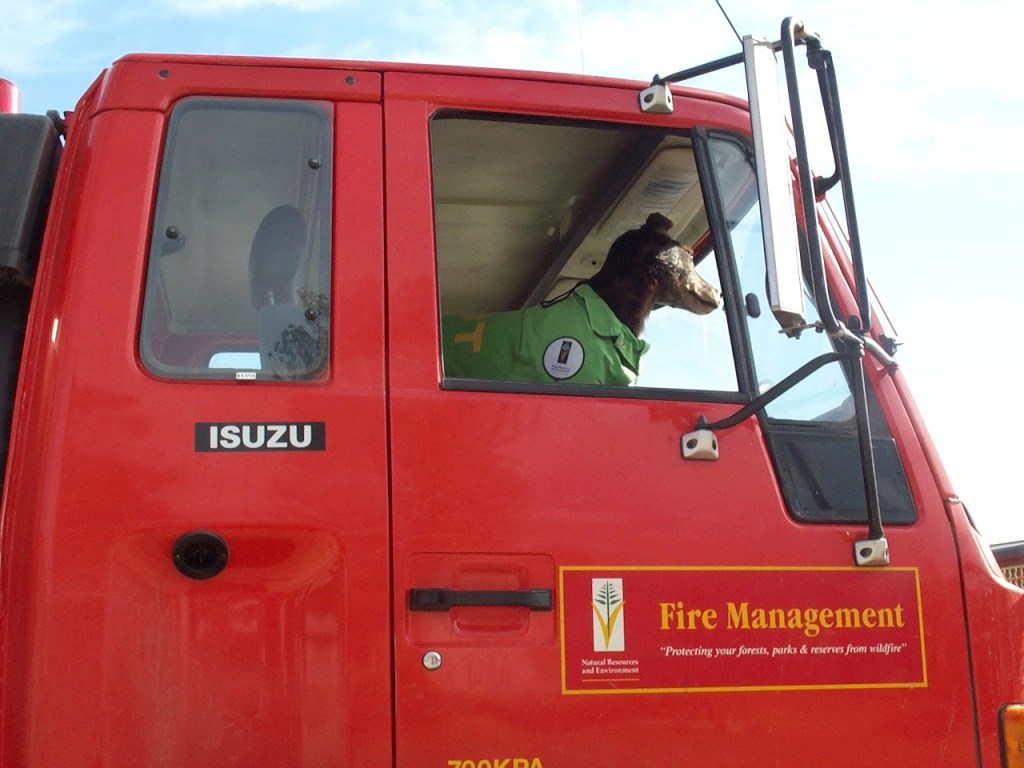
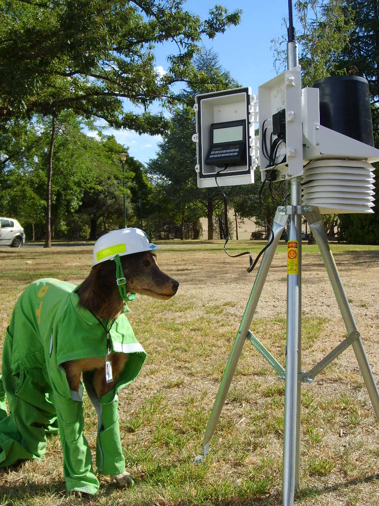
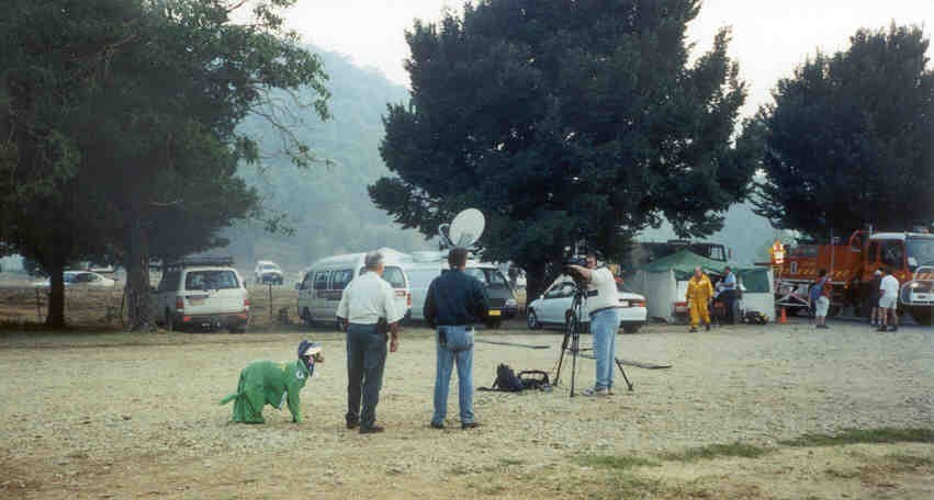
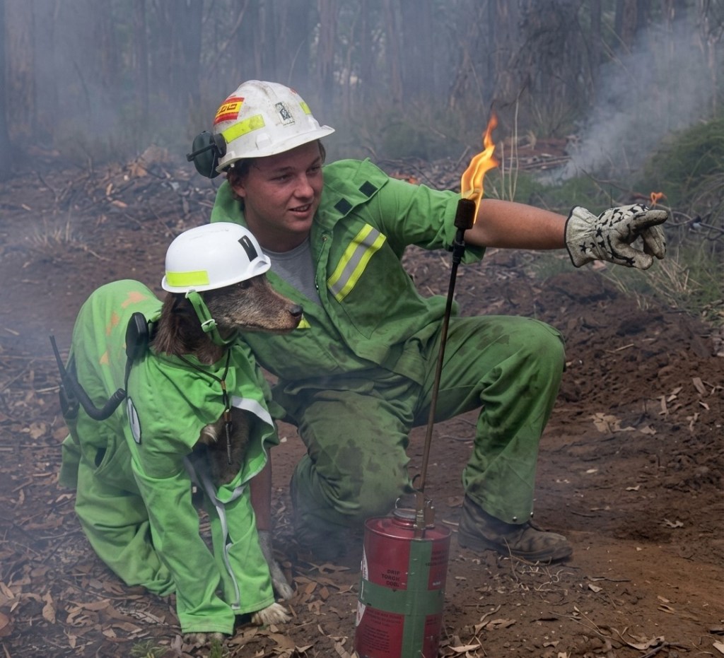
Spot’s driving skills were in big demand throughout the fires. Evidence provided to the Federal Bushfire Inquiry indicated that while there were numerous people at the Incident Control Centre, there were at times only two men and a dog on the fire line due to stretched resources.Checking the portable weather stationSpot giving a media interview at Ovens
Chris Arnold had adventures with Spot too. But he had trouble on the drip torch due to his lack of opposable thumbs.
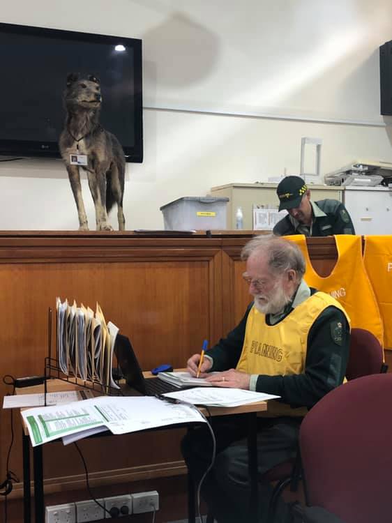
Keeping watch at the ICC
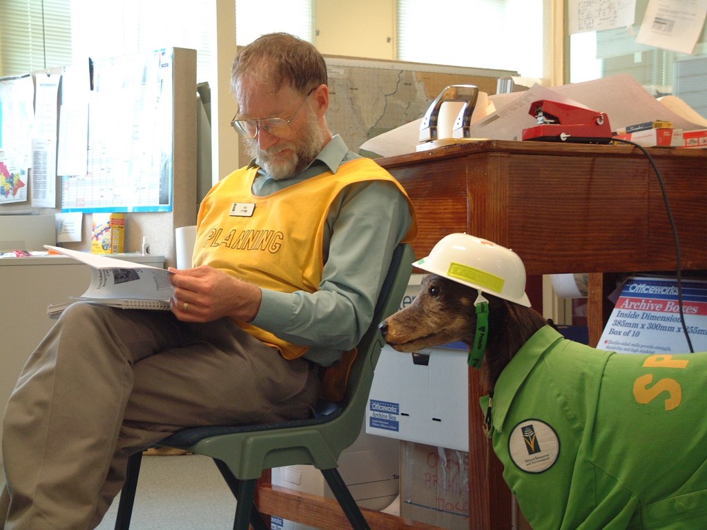
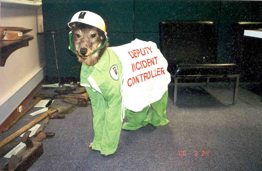
Here is Spot at the Ovens Incident Control Centre, mentoring the Planning Officer. The Federal Bushfire Inquiry heard evidence from landholders that the Chief Fire Officer of DSE was actually a dog in green overalls, but even the Honourable Members from Canberra thought that this particular piece of evidence must be an exaggerationTaking the lead. Spot helped save Eastern Victoria during the Alpine fires in January/February 2003.Spot’s tailor-made bushfire overalls.Vote 1 Spot.Ted sadly parts with Spot. 13 November 2025Enhanced image
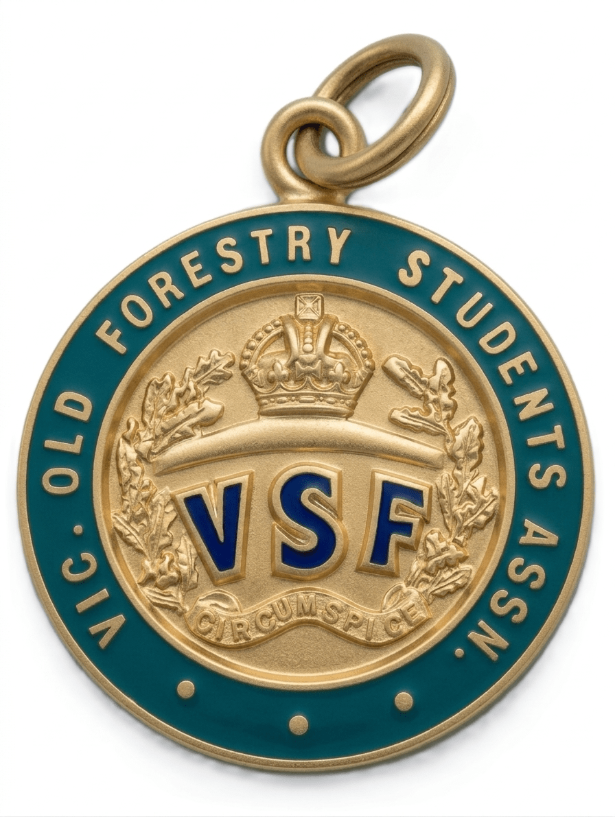
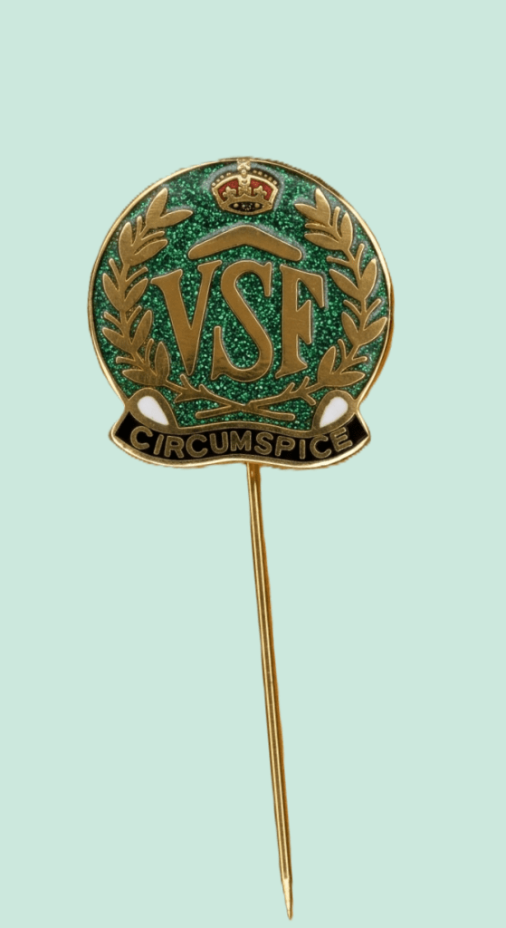
The colours and emblem for the Victorian School of Forestry (VSF) were designed in 1916 when Charlie Carter became the Principal. The school opened only a few years earlier in 1910 and he remained as Principal until 1926.
The design was a joint effort with the students.
The motto “CIRCUMSPICE”, which is Latin for “look around you”, was suggested by Mr Carter who believed that foresters should always be observant.
The plant in the design is acacia mollissima (black wattle) the bark of which was used extensively as a source of tannin used in the leather industry at the time.
The boomerang beneath the crown was incorporated as another Australian element.
Lapel Pin date unknown.
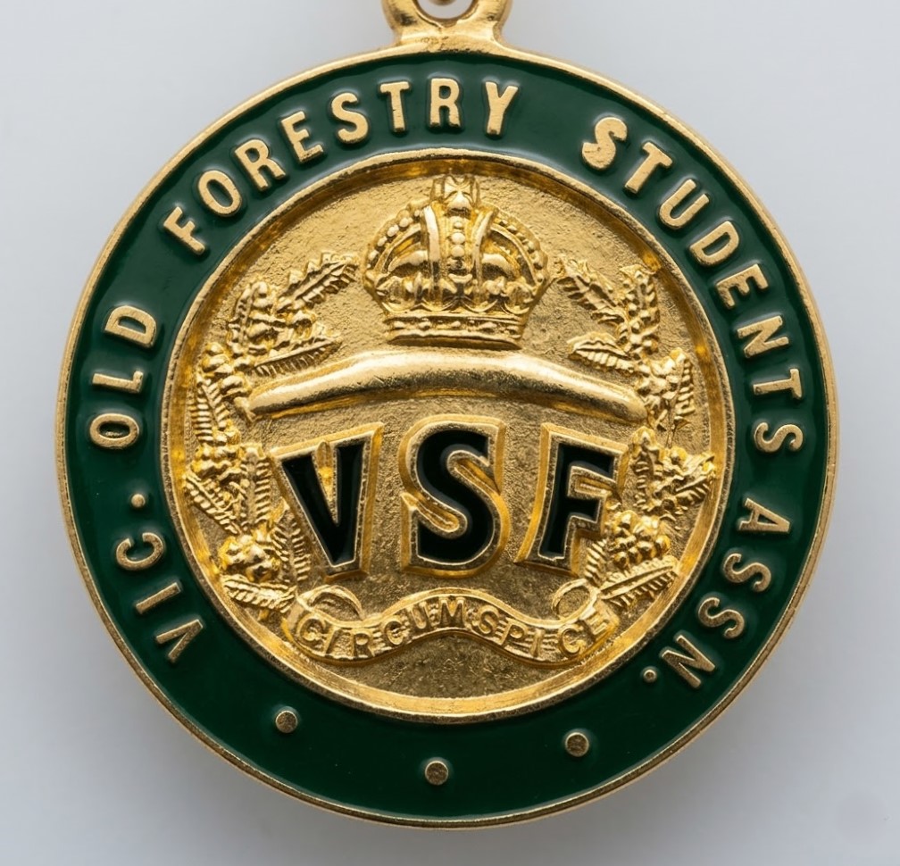
The graduates of the School formed the Victorian Old Forestry Students Association and produced an annual magazine Sylvanite, from 1920.
The Association aimed to preserve the school spirit, personal contacts and close friendships. The magazine was a means of not only maintaining contact between the foresters after graduation but also serving as a technical journal.
But the Association and the magazine seem to have fizzled out by 1930s, which helps to date this medallion.
In 1934, the first issue of The Victorian Forester was published. This was replaced in 1953 with the Victorian State Foresters Association Newsletter which continued until demise of the Forests Commission in the mid-1980s. Both publications aimed share information about technical, social and other matters to all forestry staff.
The Forests Commission Retired Personnel Association (FCRPA) was formed in 1979 and continues to this day with over 150 members.
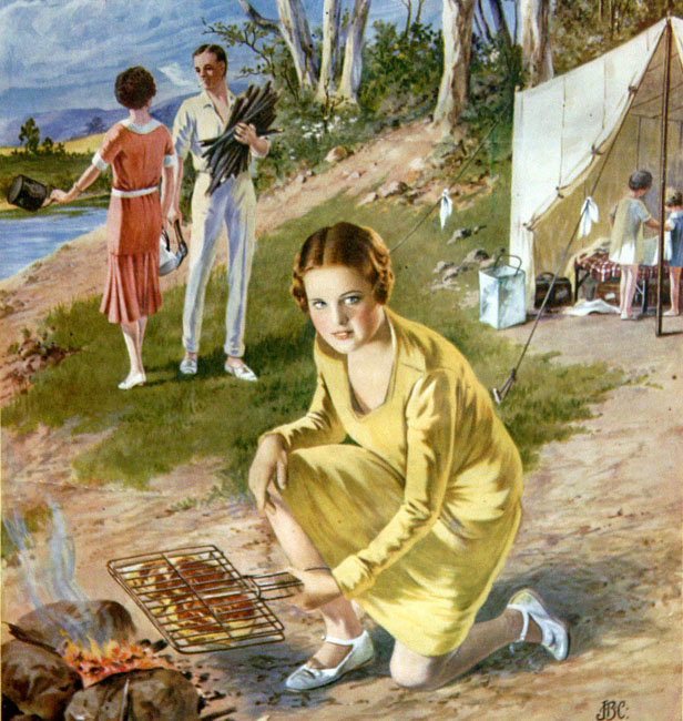
Picture this… a leisurely Sunday drive in the Wolseley 24/80 from a modest weatherboard home on a quarter acre block in Melbourne’s eastern suburbs, along Ferntree Gully Road up to the nearby Dandenong Ranges, to spend a lazy afternoon in the bush, and let noisy kids run riot with sticks, with Dad bent over a smoky fire pit pretending to be MasterChef, clacking metal BBQ tongs to sizzle a snag or incinerate a chop, while enjoying a cold frothy straight from the Esky, while Mum buttered the Tip Top, or made a yummy salad, and perhaps sipped a chilled glass of Ben Ean, or maybe drank a mug of hot black tea made in a billy, then sitting in the sunshine on a wobbly deck chair or picnic rug to juggle a plastic plate on your lap, or devour a burnt banger smothered in Rosella tomato sauce wrapped in soggy white bread. The leftovers (if there were any) got packed in the Tupperware for weekday school lunches. These were the memorable family rituals of the 1960s and ‘70s.
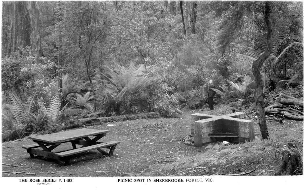
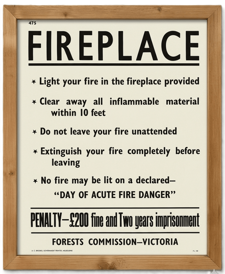
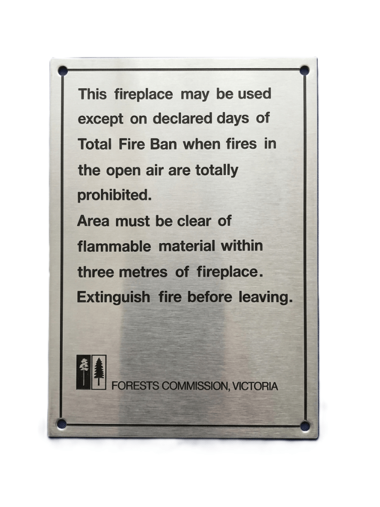
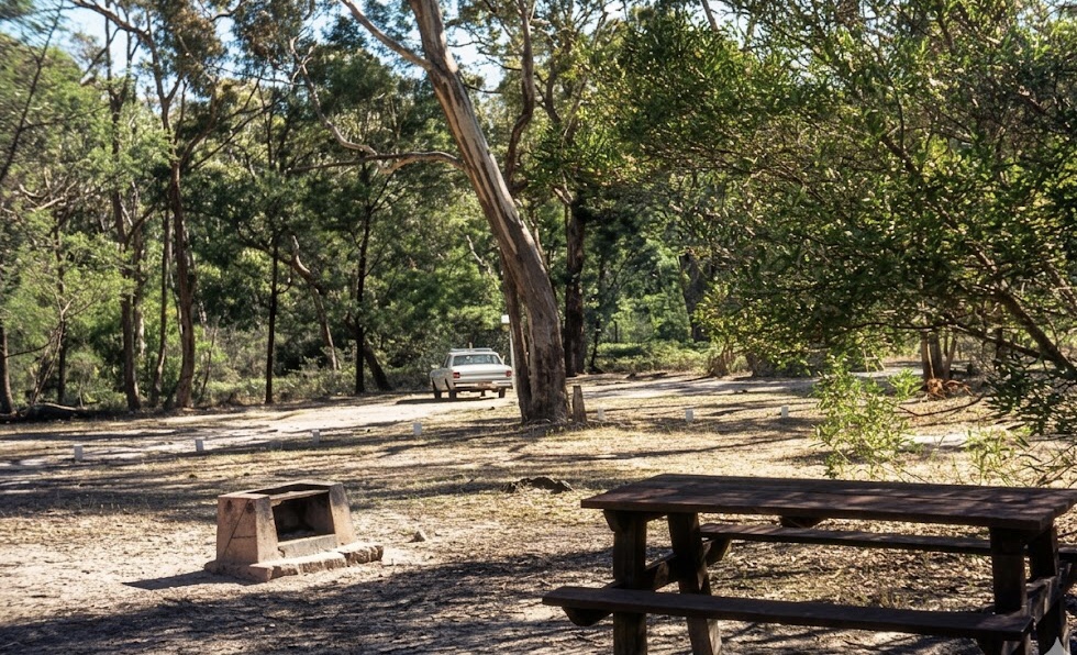
The Forests Commission, National Parks Service, Country Roads Board (CRB) and even the Board of Works (MMBW) provided woodfired BBQs at nearly all their picnic sites and campgrounds. And in some cases, they even supplied firewood and hot water at the more popular places.
Local Councils and Lions Clubs tended to provide more substantial public BBQ shelters, often with gas or electric hotplates.
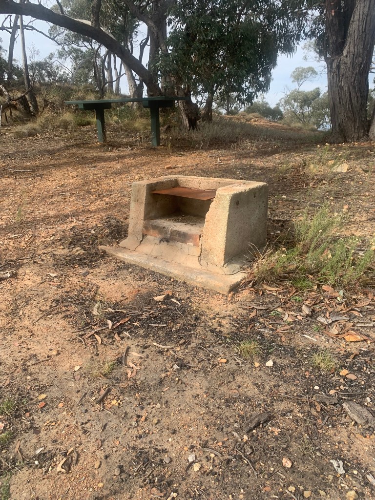
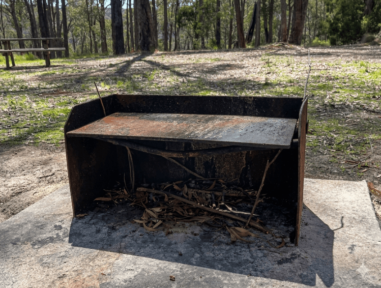
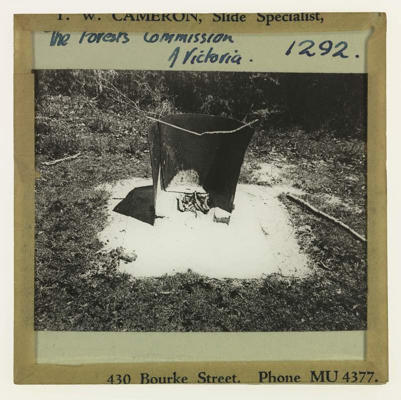
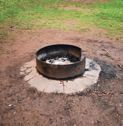
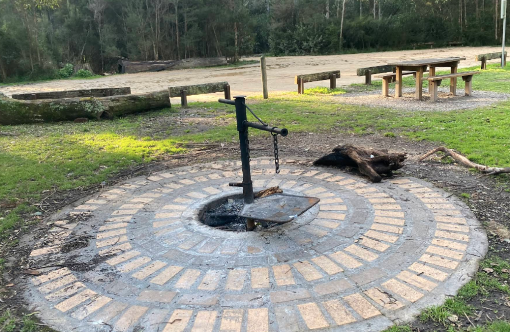
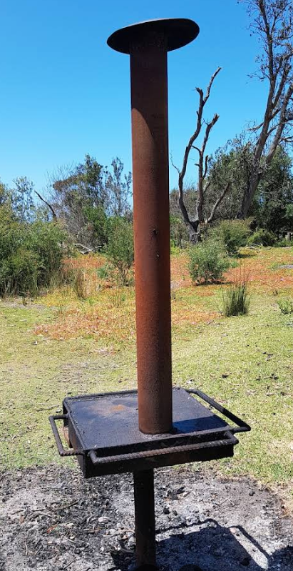
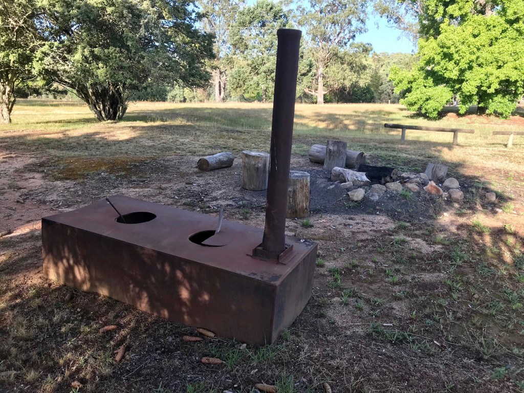
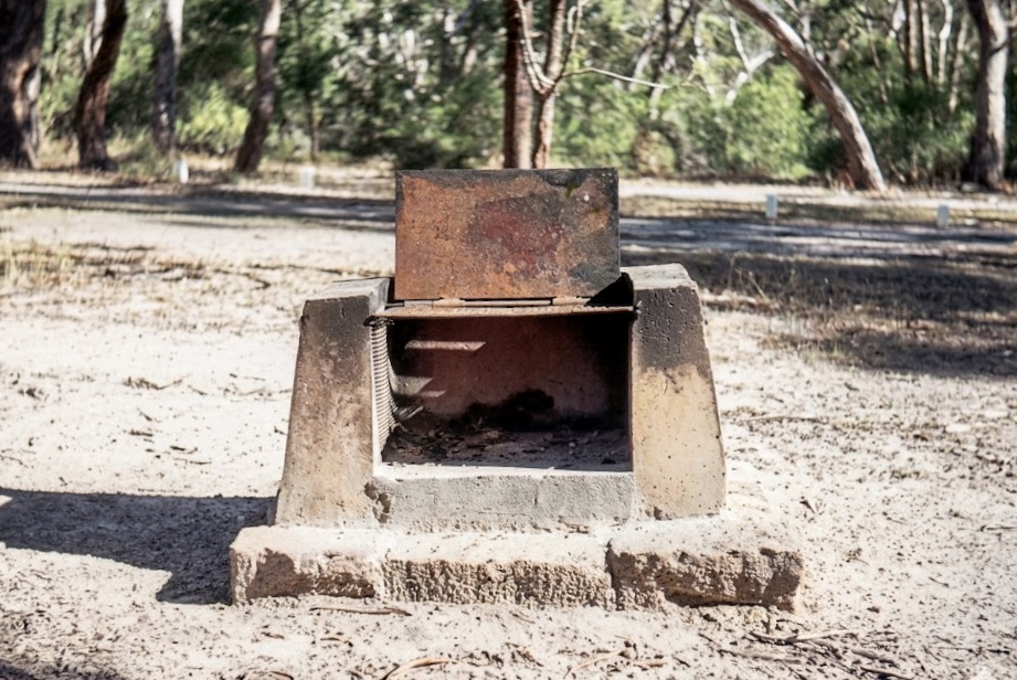
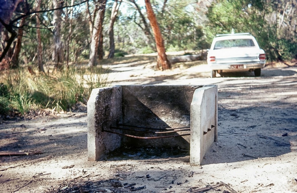
The Forests Commission had a wide variety of wood BBQ designs ranging from small fire pits to large brick and concrete erections.
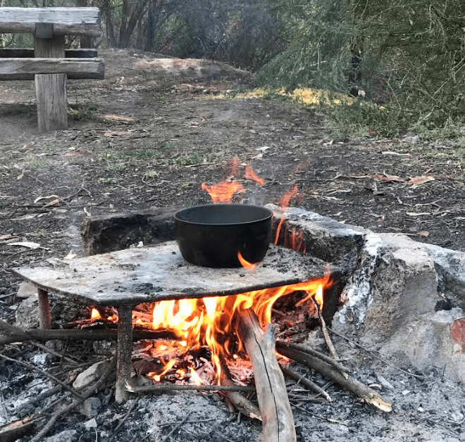
Or in some cases, there was just a simple circle of river rocks with a hotplate that could be pushed aside so it could also be used as a roaring campfire in the evening to keep warm and toast marshmallows.
Innovation was encouraged and designing a bush BBQ that was attractive, functional and vandal proof was always a worthy challenge.
There was fierce competition, and sometimes outright rivalry, between forest districts over the best BBQ and fire pit design.
The steel components were often fabricated in district workshops, and they were installed and maintained in the bush by local FCV crews. These projects also provided important off fire season and wet weather work.
The Commission produced a Recreation Facility Manual in about 1983 which captured and standardised BBQ designs.
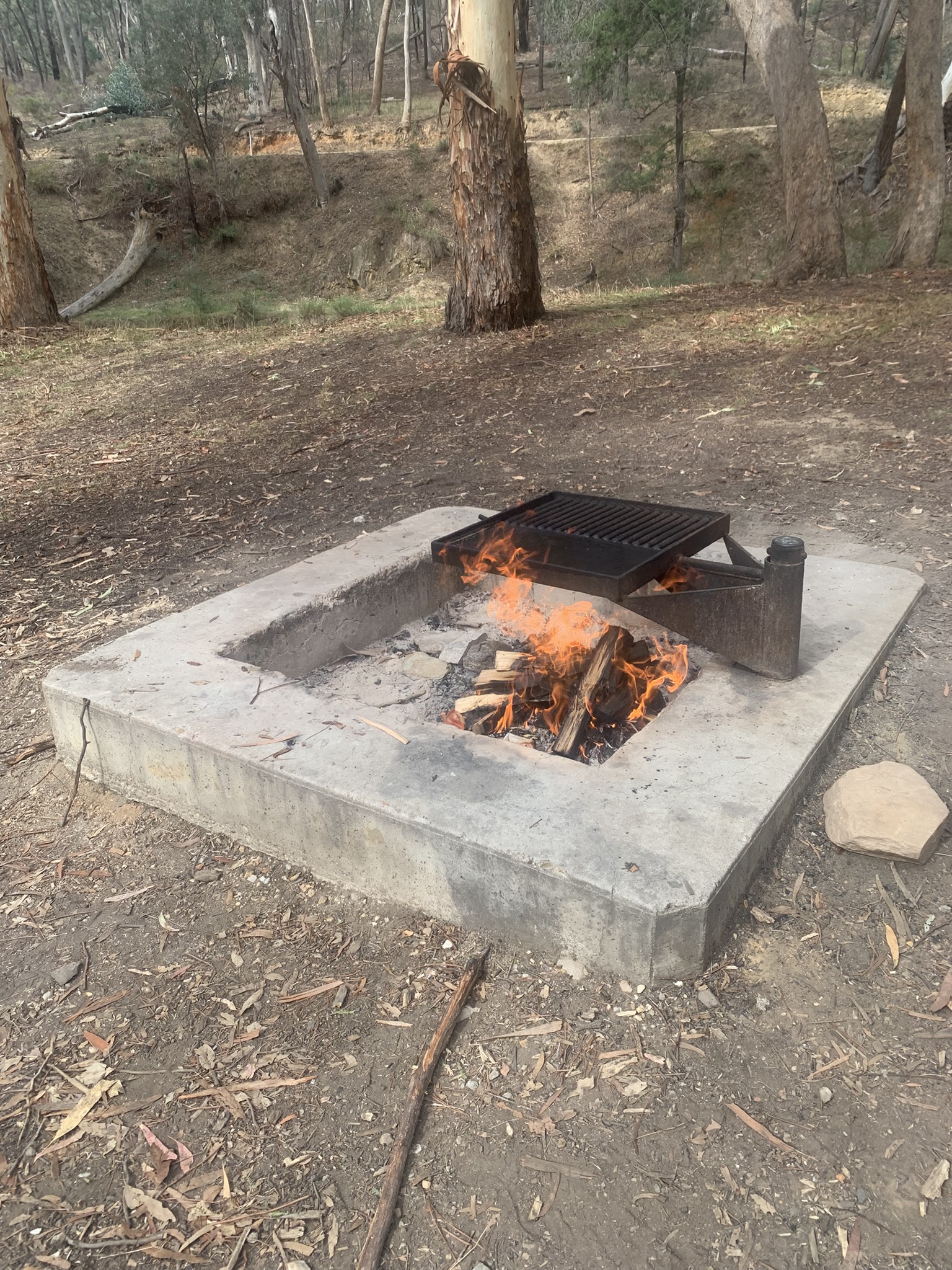
But portable fire pits are now very common, and it seems to me that many of the traditional BBQs have been removed and not replaced over the last few years, so I have started to collect a few photos.
I welcome your photos and stories of forest BBQ and picnic grounds.
Waterfalls Picnic Area. Pyrenees near Avoca. Peter McHugh 2026Pyrenees near Avoca. Peter McHugh 2026TrenthamFireplace of steel plate in concrete base at Nowa Nowa. 1948.
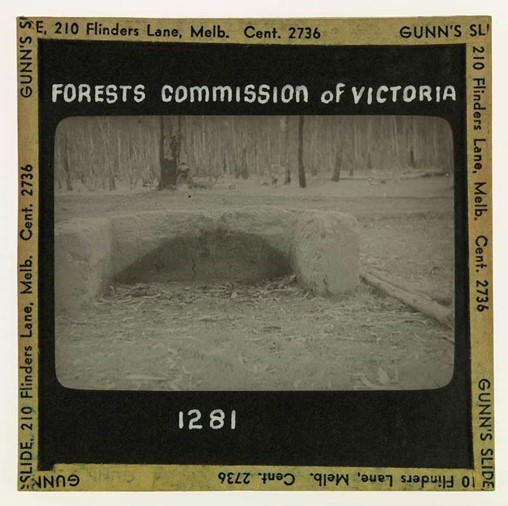
Fireplace constructed of mud at Gunbower Island. Photo Alf Lawrence. 1948
Toorongo Falls
Log Crossing – Colquhoun
McKinnon Point
Twig BBQ – Loch Sport
The best of both worlds – an Aldershot oven for cooking and a fire pit with cut stumps to keep warm. Shelley Camp (before it was destroyed in the 2026 bushfires) Photo: Peter McHugh.
Photo: Jack Gillespie. FCRPA CollectionPhoto: Jack Gillespie. FCRPA Collection
Photo: Jack Gillespie. FCRPA Collection
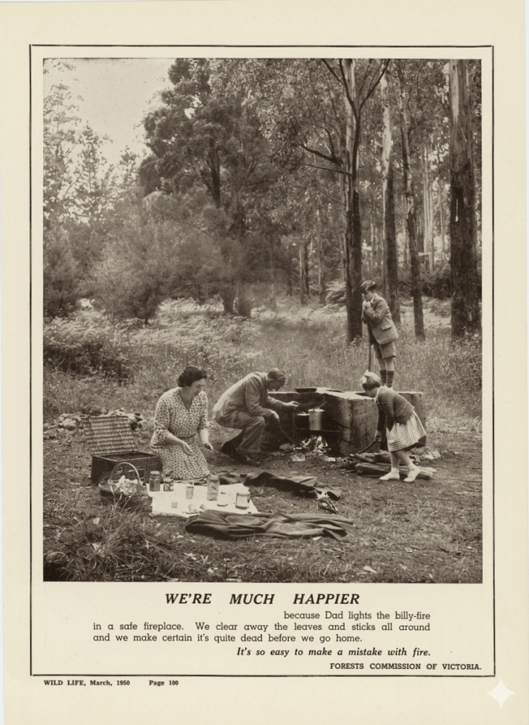
Wild Life Magazine – March 1950 (note the Kookaburra on the rug waiting for a sausage).
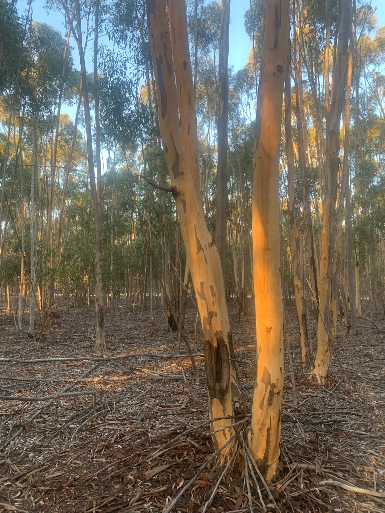
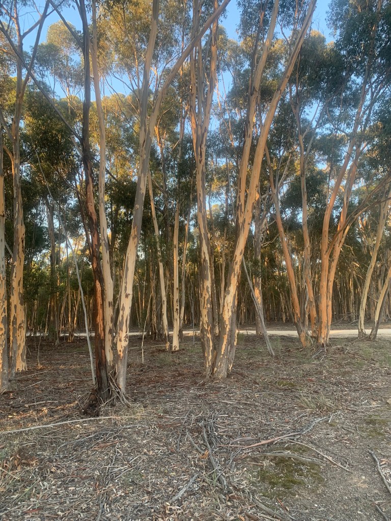
Sugar Gum (Eucalyptus cladocalyx) originates in South Australia in three distinct populations: the Flinders Ranges, Eyre Peninsula and Kangaroo Island.
Sugar Gum is also widely planted across the drier western district of Victora as a windbreak or shelterbelt and for durable farming timber as well as magnificent firewood.
Sawn timber harvested from sugar gum has little defect and is prized for its durability. It is particularly suited to situations requiring high strength where appearance is also important, such as flooring and joinery. Its durability also makes it a valuable timber for exterior applications such as cladding, decking, outdoor furniture and pickets.
The Forests Commission recognised value of sugar gum from its earliest days.
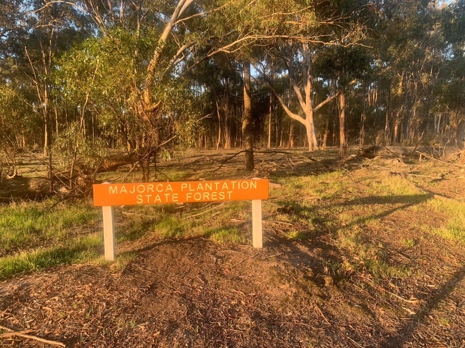
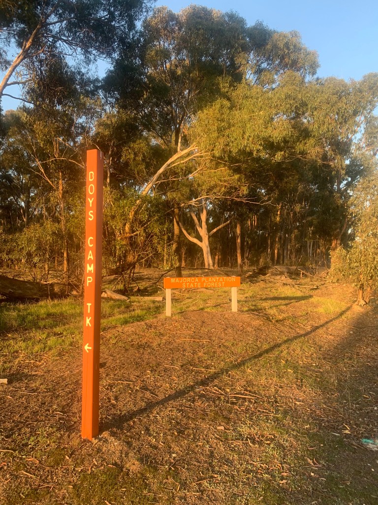
A plantation near Majorca (south of Maryborough) was established in about 1887 to supply mining timbers when it was thought there would be a shortage due to the slow regrowth of local native timbers after being cleared.
But the mines closed before the plantation fully developed and then became a valuable resource of durable fencing timber and firewood.
The current stand is thick regrowth coppice from previous harvesting that would respond well to thinning.








 Victoria’s Forests & Bushfire Heritage