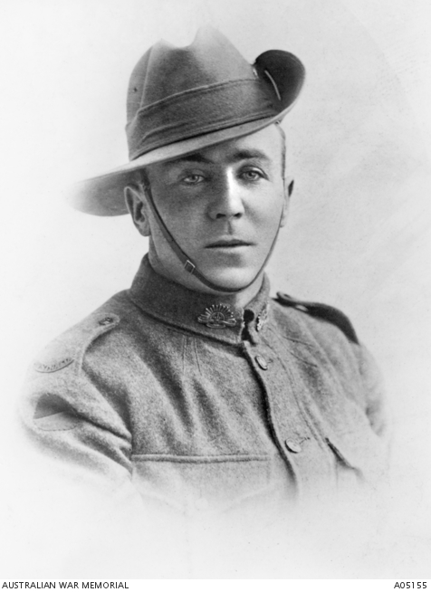
Stan McDougall, soldier and forester, was born in Recherche in Tasmania on 23 July 1889 and became a blacksmith.
Illness prevented him from enlisting in the AIF until 31 August 1915 when he was posted to the 12th Reinforcements of the 15th Battalion.
In Egypt, on 3 March 1916, he was drafted into the 47th Battalion and embarked for France in June. The Battalion fought at the famous battles at Pozières in August 1917 and later at Messines and Broodseinde.
Stan was promoted to Sergeant in January 1918.
At Dernancourt on 28 March, he saw the enemy knock out a Lewis gun position. McDougall then attacked two German machine-gun teams, killing their crews by firing back with the Lewis gun. He then attacked a second wave of Germans, burning his hands on the hot barrel casing of his gun. When a German officer aimed his pistol at some Australians, McDougall killed him with rifle and bayonet. Twenty-two Germans were killed and 30 were captured, largely because of McDougall’s actions.
For his actions at Dernancourt Stan was awarded the Victoria Cross.
Eight days later, at the same place, McDougall won the Military Medal, taking over the platoon when his commander was killed.
After the war McDougall became an officer with the Tasmanian Forestry Department, and later, as inspector-in-charge of forests in north-east Tasmania.
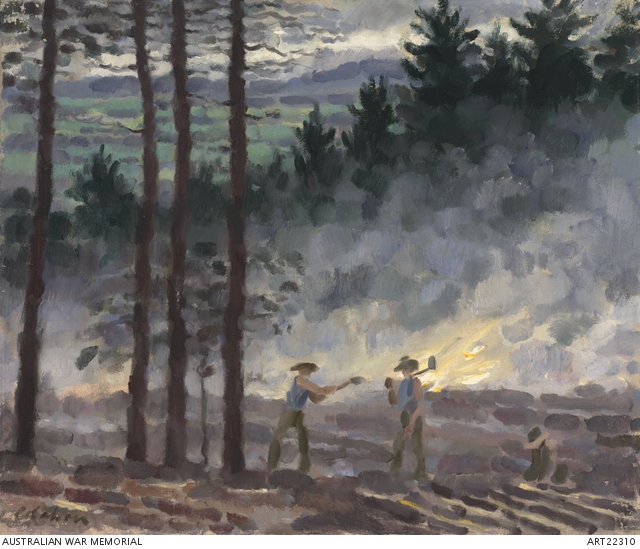
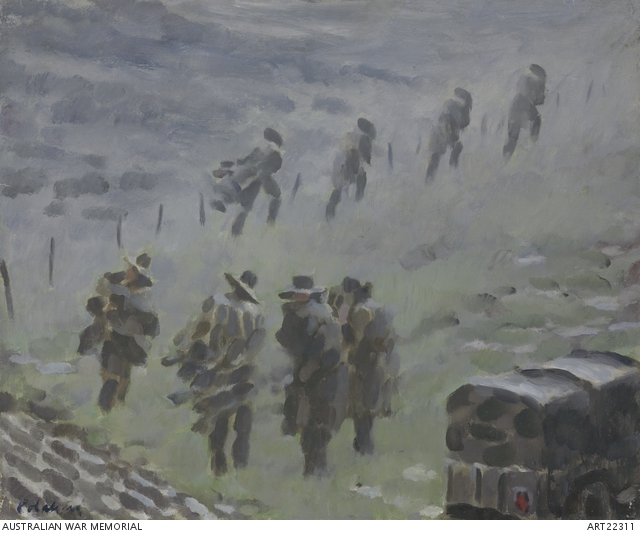
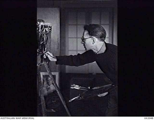
The Australian War Memorial (AWM) holds over 90 artworks of Colin Colahan.
Colahan was born in Victoria in 1897 and gave up medical studies to attend the National Gallery School in 1917. He moved to Europe in 1935 and never returned to Australia.
In London in August 1942, he was appointed as an official Australian war artist and remained in the role until October 1945
The AWM collection includes at least 15 featuring the forestry units working in Scotland.
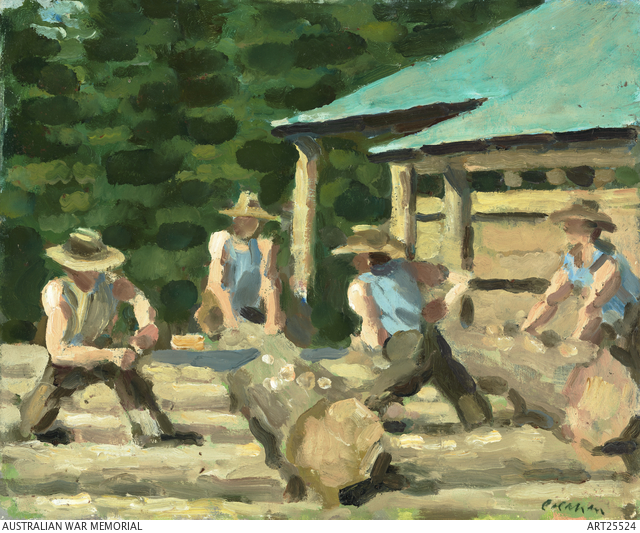
Burning off in Scotland.
Rain and bloody misery.
Australian Foresters, Scotland.
Scotch Sunday, church parade of 2nd Coy of Foresters.
Bush Mill in Scotland.
Scottish Idyll.
Martha and Mary.
Skids on the Highlands.
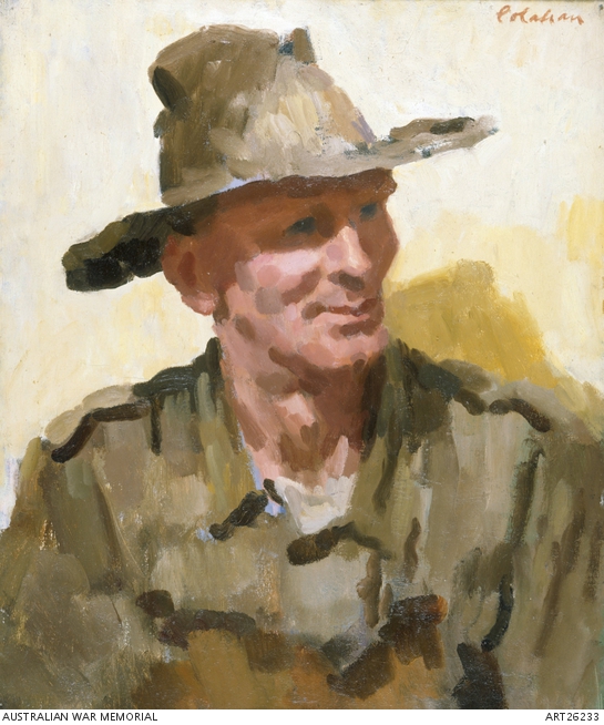
The portraits are of unit members from the 1st and 2nd companies of the Australian forestry units:
Lieutenant Austin Rule (2nd Coy).
Sapper Jack Garrig (2nd Coy). *
Sapper Jack White (2nd Coy).
Sapper Francis Deering (2nd Coy).
Lieutenant Edmond Russell (2nd Coy).
The Covenanter (Sapper Alan MacDonald, 1st Coy).
Maintenance (Corporal Henry (Blue) Rogers, (1st Coy). *
The 1st Company were mostly from NSW, Queensland and South Australia while 2nd Company included many Forests Commission Victoria staff, local sawmillers and experienced bushmen from Victoria, WA and Tasmania including veterans of the First World War.
* Not available online
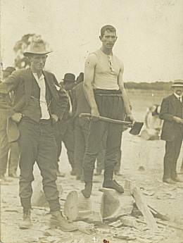
Sapper Francis Thomas DeeringSapper Jack WhiteRain and Bloody MiseryAustralian Foresters, ScotlandBurning Off in ScotlandScotch Sunday, church parade of 2nd Coy of Foresters.Bush Mill in ScotlandLieutenant Austin Rule (2nd Coy).Lieutenant Edmond Russell (2nd Coy).The Covenanter (Sapper Alan MacDonald, 1st CoyMarha and MaryScottish IdyllOn the skidsFor me, his most famous painting is “Ballet of wind and rain” of some RAAF airmen in Holland painted in 1945
Soon after the outbreak of World War Two, the British Government requested experienced forestry soldiers from Australia, New Zealand and Canada to be deployed in France as part of the British Expeditionary Force.
But the French Government had stipulated that they must be commanded by trained foresters so that the wasteful cutting and forest destruction experienced in World War 1 was not repeated.
The Australian Government readily agreed and two forestry companies were quickly raised as part of the Royal Australian Engineers (RAE).
The first Forestry Company (2/1) was based in Sydney with men from NSW, Queensland and South Australia, led by Captain Cyril Richard Cole, a professional forester from the Australian Capital Territory.
The second Forestry Company (2/2) included many Forests Commission staff, local sawmillers and experienced bushmen from Victoria and Tasmania including veterans of the First World War. They were led by Captain Andrew Leonard (Ben) Benallack, a graduate from the Victorian School of Forestry in 1922.
Both Forestry Companies sailed from Fremantle on the Stratheden in late May 1940 and landed in England not long after the evacuation of Dunkirk. They were immediately positioned to guard against the threat of German invasion while the Battle of Britain was in full fury overhead.
Whereas the Canadians came self-contained and brought logging equipment and sawmill machinery with them, the Australian and New Zealand companies had to be equipped in Britain which was in short supply and was not what they were used to. Until crawler-tractors were available, converted agricultural tractors had to serve for logging operations. There were no chainsaws, just axes and crosscut saws.
Later moving to Scotland they worked tirelessly to produce railway sleepers, sawn scantling and pit props for coal mines. And although their work was without the glamour associated with combat troops, they performed an invaluable task by cutting millions of super feet of spruce, poplar, larch, oak and fir which was used in the production of Mosquito bombers, Horsa gliders, patrol boats and other wartime needs.
The winter of 1940-41 was particularly cold and hard on the men. Many had not seen snow before. Another shock was the quaint British custom of cutting trees flush at ground level rather than leaving a stump which meant sometimes kneeling in the snow.
The foresters were recalled to Australia at the insistence of Prime Minister John Curtin in late 1943 because of the War in the Pacific. New Zealand and Canadian Forestry Companies stayed in the UK and were later deployed to Europe after the D-Day invasion of Normandy on 6 June 1944.
Returning via America the LumberJacks were given the unique honour of marching in a ticker-tape parade with fixed bayonets down Broadway in New York on 1 October 1943, said to be the only occasion that armed foreign troops had marched through an American city since Independence. Legend has it that they sang “Waltzing Matilda”.
However, the need for sawn timber was largely being met by civilian sawmills and State forest agencies so after reequipping and some refresher training in jungle warfare at Kapooka the 2/2 Forestry Company was deployed to Lae in Papua New Guinea in May 1944.
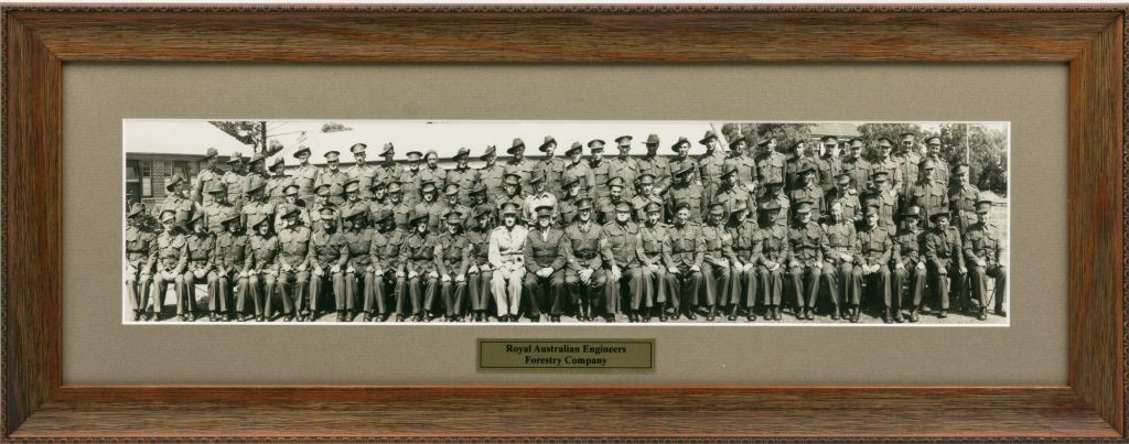
This photograph was probably taken in Australia before embarkation to the UK or before deployment to PNG in May 1944.
The RAE Woodpeckers’ Association, a social organisation for members of the post-war Army Reserve unit, the 91 Forestry Squadron, has generously purchased the photo from an Adelaide based antiquarian bookseller and it will now find its way into the forestry museum at Beechworth.
Dedicated to commemorating their predecessors, the Woodpeckers have carried the banner of the WWII forestry units in Melbourne’s Anzac parade since 1977.
The photograph has a generic caption with no annotations on the backing, but it appears to be 1 Forestry Company, commanded by Major Jack Thomas, who became a prominent South Australian forester after the war.
Today is special for Australians, young and old, for many different reasons.
The custom across the British Empire of observing a minute’s silence on Remembrance Day is largely due to Australian soldier and journalist Edward George Honey.
A small unassuming plaque can be found near the Shrine of Remembrance in Birdwood Ave. Edward never returned to Australia and died in England in 1922. I particularly like the gum trees on his plaque as a reminder of home.
So proudly wear a poppy, and take a minute’s silence at 11 am, to remember all the Australian men and women who served our country in military conflicts.
Very little is recorded about Australian forestry efforts during WW1.
Huge quantities of timber were needed on the Western Front and by 1918 the British were exploiting about 44,500 hectares in a dozen locations north of the river Seine.
But it’s reported that relations between the Allies over forestry issues were not always cordial and that French authorities were unhappy with the extent of the forest harvesting and wastage.
Large sawmills were operated in France by British Royal Engineer units as well as by the Canadian Forestry Corps.
But some small scale mills were operated from time to time by the AIF engineer field companies who tended to move around with their Divisions.
It’s thought that while in a rear area in June 1917 some Western Australian sappers from 6 Field Company operated a sawmill at Blangy-Tronville and also supplied logs to another sawmill at Glisy by floating them down the Somme River to avoid damage to the roads.
Timber was felled locally and the sawmill was operated entirely by Australians which turned out over 1 million super feet (2,360 m3) per month.
The labour was chiefly from 200-300 German prisoners, working under Australian supervision but men from the British army were also attached.
The Australians also undertook forestry patrols to prevent wasteful and unauthorised felling of trees in the various woods in the area.
In the early stages of the conflict timber for engineering and construction was generally imported. So to save on shipping space and to reduce waste, the Australians established an ANZAC Workshop in late 1916 at Meaulte near Albert in northern France to meet the timber needs for the Somme winter.
The workshop was run by skilled officers and men detached from the engineers, pioneers, infantry and other branches from all the Australian Divisions.
The Australian workshop manufactured pre-fab huts, duckboards and revetting panels for fortifications and even turned the sawdust into coal briquettes.
Later in June 1917, the ANZACs left the Somme for the Ypres offensive and the sawmill complex was handed over to a British unit.
Two proposals to form a more permanent Australian Forestry Unit did not materialise and by July 1917 all the men returned to their original units.
By the end of the Great War in November 1918 the extensive felling carried out by all armies and the damage caused by field artillery had decimated the forests of northern France.
A steam powered sawmill near the Somme battlefields established by 2nd Pioneer Battalion (mostly Victorians). France 1918. Source: AWM.This timber mill erected by 6th Field Company of the Australian Engineers (mostly Western Australians) near Bonnay on the Somme was used to cut timber for the war effort. Note the steam engine under the metal roof which has been camouflaged with twigs. Source: AWM.
Norman was born in 1893 at Jerek and entered the Victorian School of Forestry (VSF) but did not graduate.
Norman signed up in Bendigo in March 1916 with the 38 battalion (#750). He joined with his brother Alexander Cosmo McDonald (#751). They both embarked from Melbourne on board HMAT A54 Runic on 20 June 1916.
Norman rose the rank of sergeant and was wounded in France in 1917, and again in 1918. He returned to Australia 31 March 1919.
His brother Alexander was killed in October 1917 at Passchendaele
Norman returned to farming after the war. He died in July 1973 at Culgoa.
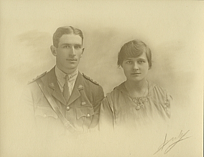
Formal group portrait of 751 Pte Alexander Cosmo McDonald (far right) and 750 Pte Norman Alan McDonald (far left) with two unidentified soldiers. Pte Alexander and Pte Norman McDonald were brothers from Jeruk, Victoria. They enlisted together at Bendigo on 11 March 1916 and embarked from Melbourne on 20 June, aboard HMAT Runic (A54). Both brothers sustained gunshot wounds to the arms and legs whilst taking part in a raiding party on the Western Front on 28 May 1917. They were invalided to England in June and rejoined their unit in France at the end of September. Norman was admitted to hospital on 12 October. The next day Alexander was killed in action at Passchendaele. Norman rejoined the unit one week later. He rose to the rank of Sergeant and returned to Australia aboard HT Khyber on 22 May 1919.
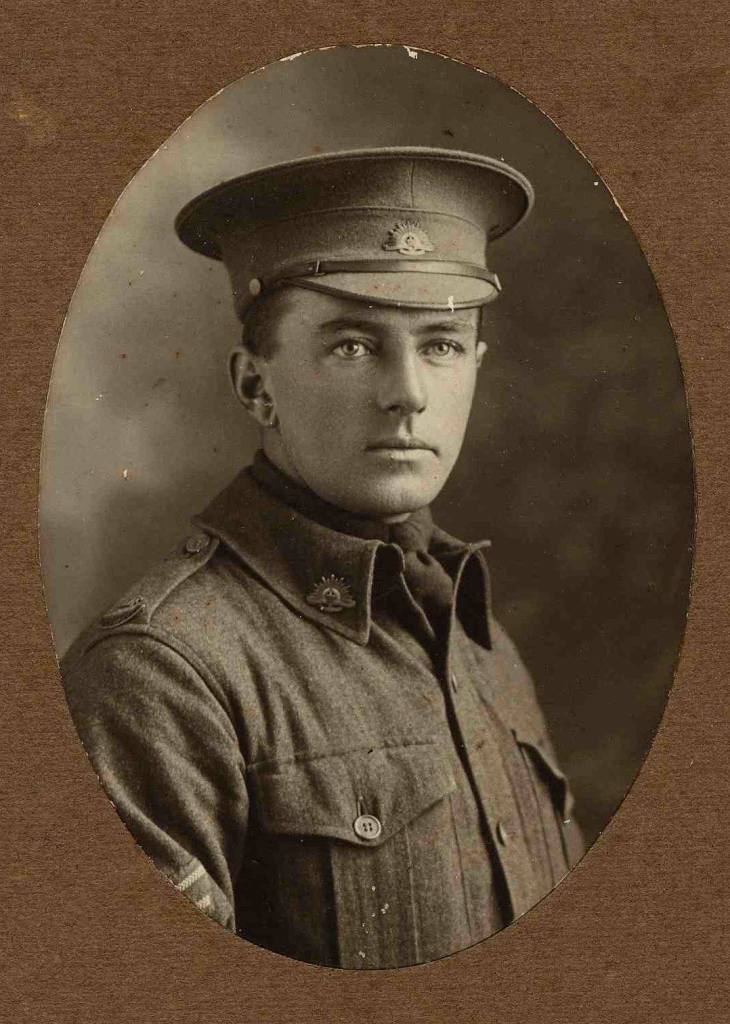
Reg Lindsay was one of the first foresters to graduate from the Victorian School of Forestry at Creswick in 1912.
He was also a member of the famous Creswick artist family and brother of Norman Lindsay, the author of The Magic Pudding.
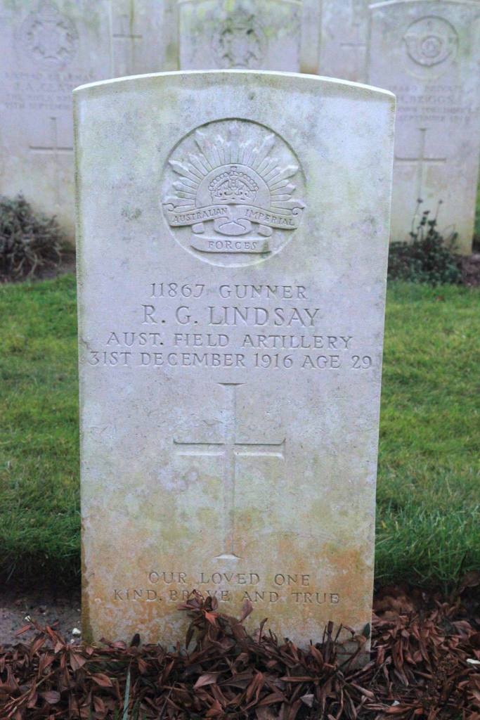
Sadly, Reg was killed instantly in France with four other soldiers while queuing for rations on 31 December 1916 when they were hit by a shell landing directly on them, although it’s often more colourfully reported that he was shot “when dashing out of his dugout to rescue a bottle of rum” on New Year’s Eve.
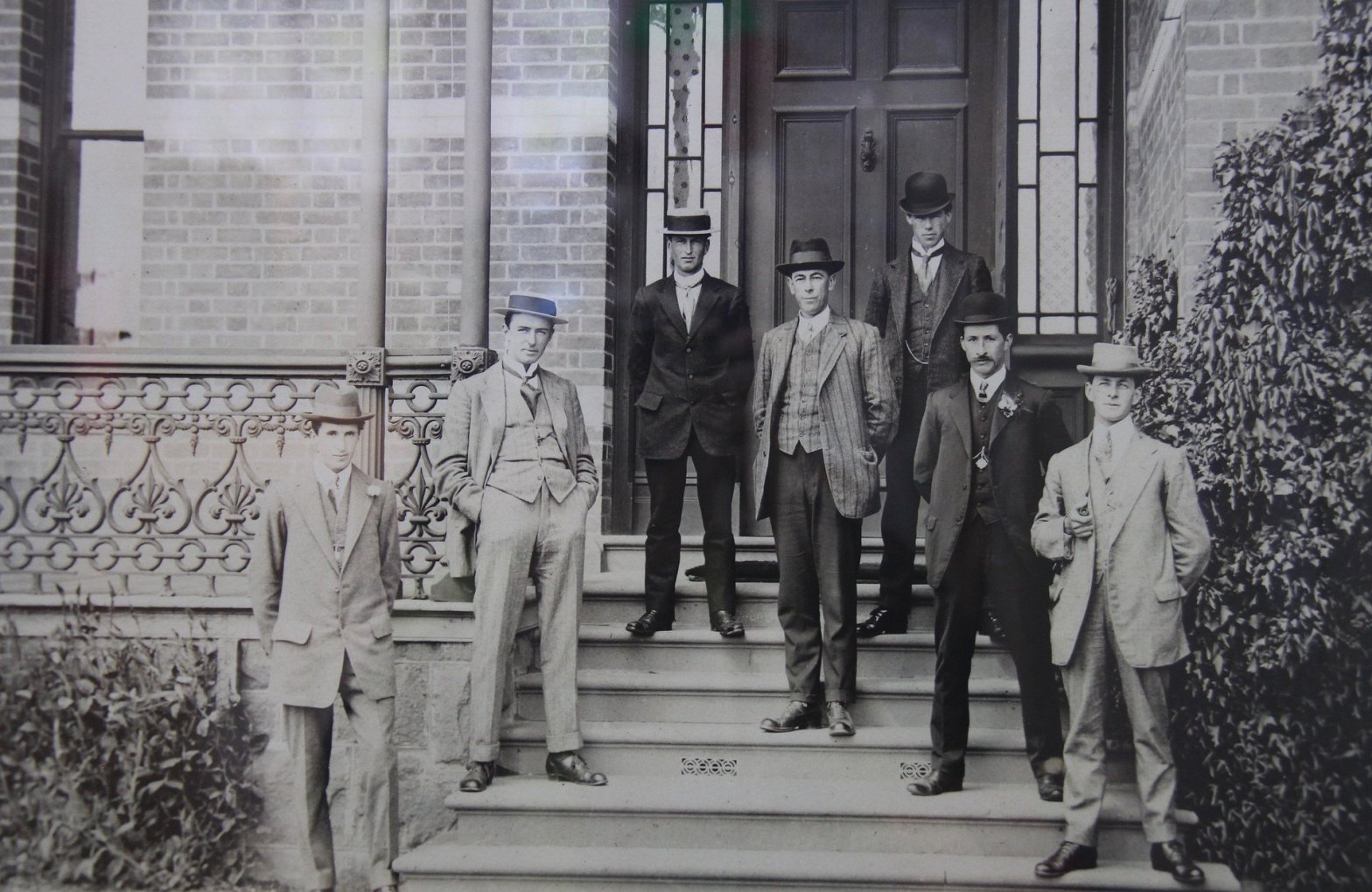
That’s Reg… on the steps of Tremearne House, second from the left, with the snappy boater hat and hands shoved in his pockets. Apparently, he was a bit of a lady’s man.
He was 29…
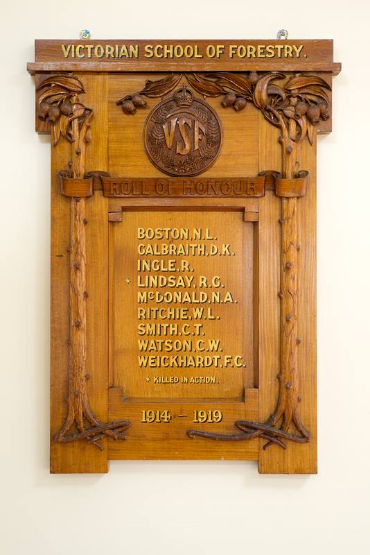
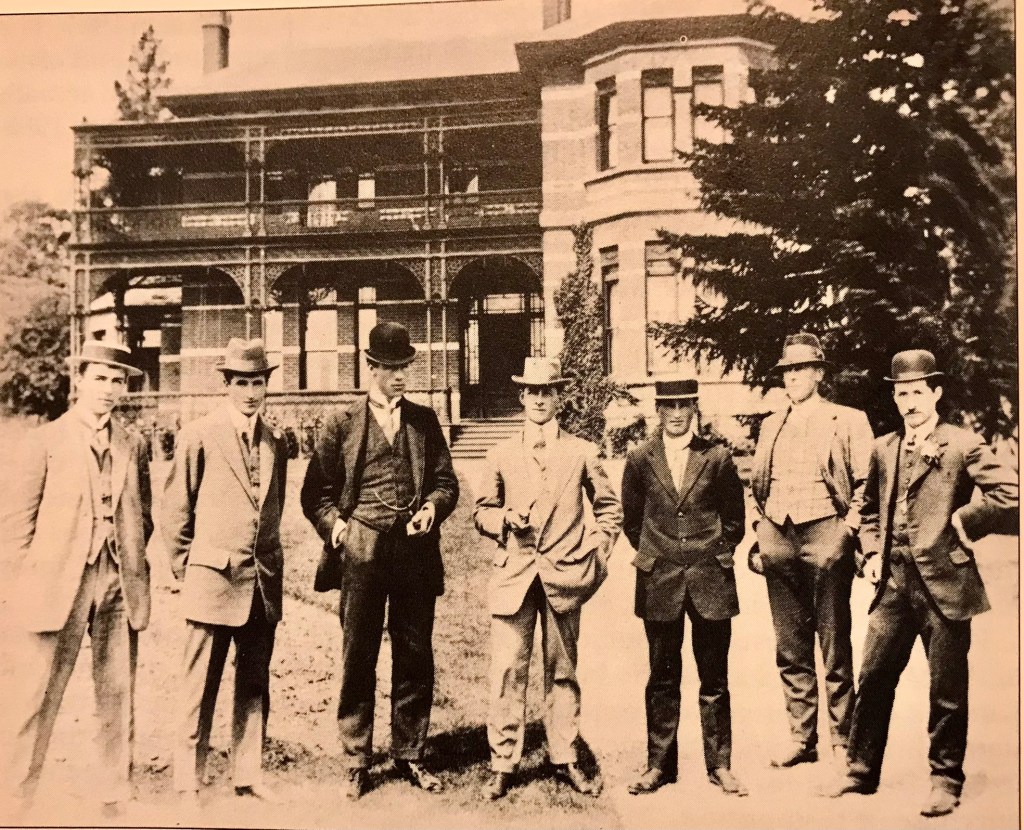
Reginald Graham Lindsay – KIA 31 December 1916. Photograph from the collection of Robert C. Littlewood.Source: AncestryThe Victorian School of Forestry (VSF) honour board. Source: University of Melbourne.FCV Honour Board at the Beechworth museum. Photo: Peter McHughGuards Cemetery Lesbeufs, France. (Plot VI, Row Q, Grave No. 9). Photo: Robert C. Littlewood 2016In 1910, six students began classes at the Victorian School of Forestry. Pictured on the steps of Tremearne House in 1912 are the graduates. From left to right: Walter Henry Horn, Reginald Graham Lindsay, Henry O. Felstead (Nursery superintendent), Norman L. Boston (Nursery staff), J. Sampson, A. Ken (Nursery staff), Arthur H. Warren. Source: University of Melbourne.
Norman Boston was one of the first to attend the Victorian School of Forestry at Creswick in 1912 as nursery staff.
He was born in Daylesford and enlisted in the 59 Battalion AIF (#2578) in 1916, at a relatively senior age of 38 and 7 months.
He embarked on the Shropshire in September 1916 and served in France.
Norman returned to Australia in July 1919.
In 1928 he was listed in Victorian public service records as “staff foreman to assistant forester plantations” based at Macedon.
I believe Norman died in 1936.
Norman Boston (second from the left) with first intake of students in 1912
In 1910, six students began classes at the Victorian School of Forestry. Pictured on the steps of Tremearne House in 1912 are the graduates. From left to right: Walter Henry Horn, Reginald Graham Lindsay, Henry O. Felstead (Nursery superintendent), Norman L. Boston (Nursery staff), J. Sampson, A. Ken (Nursery staff), Arthur H. Warren. Source: University of Melbourne
Frederick Anderson was born on 15th July 1893 in Buangor, which is between Ballarat and Stawell.
He enlisted for military service with the 14th battalion on 14th September 1914 and remained until 10th May 1919. He was one of the first to join up and his service number was 545.
His occupation before enlistment was as a foreman in State Forests Department.
He landed at Gallipoli where he was wounded. He was gassed and wounded again by shrapnel in France. He was awarded the Military Medal in 1916 for entering German trenches and going back repeatedly under machine gun fire to rescue the wounded. He rose the rank of Captain in 1918.
He married Margaret Hayton in England in 1918.
After the war, Fred and Margaret ran the Glenthompson Post Office in western Victoria for 32 years.
Fred then reenlisted in the second world war in 1940 as a Captain (V1298) in the 15th Battalion of the Volunteer Defence Corps.
He returned to Glenthompson and Fred died on 7 May 1965.
Frederick Anderson – Source: AncestryFrederick Anderson – Source: AncestryFrederick Anderson – Source: AncestryFrederick Anderson – Source: Ancestry FCV Honour Board at the Beechworth museum. Photo: Peter McHughHe married Margaret Hayton in England in 1918
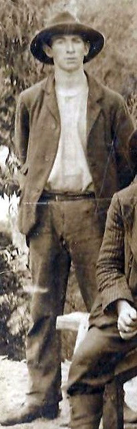
Reg was born at Beechworth in 1899 and entered the forestry school at Creswick in 1915. It’s reported that he, along with many others, struggled with his subjects and was required to sit supplementary exams.
At the time, nearly half of the intake failed. The Board blamed students and the staff for the poor results.
By 1916 things were improving but the Board still considered Reginald Ingle “did not show sufficient evidence of capacity to justify his further continuance as a trainee at the forest school”.
Despite his VSF results, the records show Reginald was a graduate in 1917.
Around the same time there were changes to the teaching staff and the appointment of Charles Carter as the Principal.
Reginald joined the 46 Battalion (#3404) of the AIF in February 1917 and sailed to England in May. Oddly, he listed his occupation as orchardist, maybe because forestry was a protected profession.
Reg was wounded in France in September 1917 by a gunshot wound to his right hand and ended his war in hospital in England. He returned to Australia in March 1919.
Reginald resumed with the Forests Commission in 1919 and went onto a long and successful career with placements at Macedon, Port Campbell, Ovens, Yarram, Tarnagulla and then at Neerim South in 1927.
In 1929 he was appointed as the assistant forester at Chiltern, and by July, he was promoted as the District Forester at Yarrawonga.
In 1938 Reginald moved to Maryborough as the District Forester with his final career posting at Bendigo in 1952. Reginald Ingle retired from the Commission during the 1959/60 financial year, and I believe he may have died in Maryborough in 1971
Reginald Ingle in 1928 at forestry refresher course at VSF
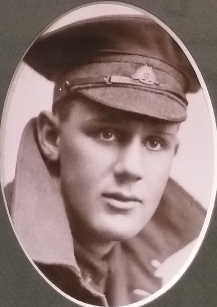
Frederick Conrad Weickhardt was born in Clunes in February 1899.
Con as he was known to his family, was one of nine candidates to pass the entrance exam into Victorian School of Forestry (VSF) at Creswick in April 1913.
Like another of his fellow students who went off to the war, David Kennedy Galbraith, Frederick is not listed as having graduated from the school, but his name is on the VSF honour board.
Frederick was aged just 18 years and 4 months when he enlisted in Melbourne (#2278) on 15 June 1917.
He joined as an electrical air mechanic in the Australian Flying Corps (AFC). His parents owned the Clunes bakery and wrote a letter giving their blessing for him to join provided he could use his skills and follow his training.
He embarked overseas on 30 October and arrived in Devonport in England on 27 December 1917.
Frederick was admitted to hospital at Aylesbury with pleurisy on 27 February 1918. After a month in hospital and some further time in the AFC Depot, he was posted to the 6th Training Squadron at Leighterton in the Cotswolds on 16 May 1918, the home of the “Flying Kangaroos” where he served until the end of the war.
He returned to the AFC Depot at Wendover on 9 December 1918, where he remained for three months, before he was granted special leave to work as an electrical fitter for the firm of Edmundson’s Electrical Co. in Westminster in London from 20 March to 3 September 1919.
Frederick embarked for Australia on 22 September 1919 and arrived back in Melbourne on 12 November, where he was formally discharged from the AIF on 8 February 1920.
And just like David Kennedy Galbraith, Frederick’s name doesn’t appear on the State Forest Department honour board held at Beechworth.
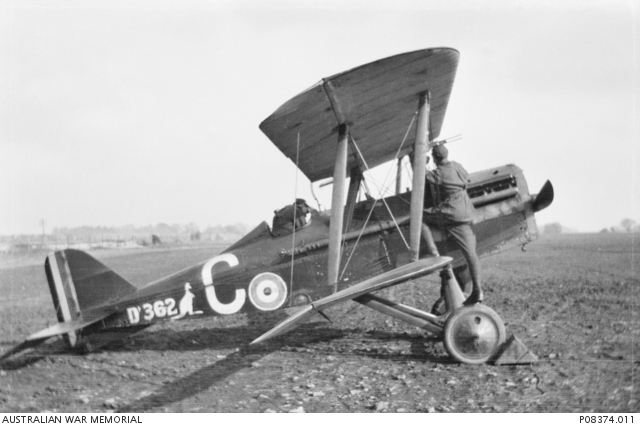
Aircraft Mechanics on a Rolls Royce engine at AFC depot 1918AFC No. 6 (Training) Squadron aircraft including S.E.5a scouts. Note the Flying Kanagaroo on the side
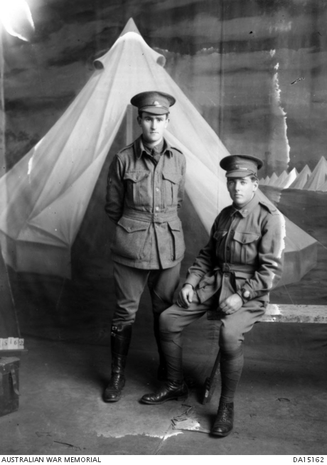
Charles was born in Majorca near Maryborough in 1895 and entered the Victorian School of Forestry (VSF) in 1913 as one of the first student intakes.
He was also a member of the Creswick 71st company militia.
Charles graduated in 1915, and in February 1916, he enlisted in the 59th Battalion (#1769) aged 20. Charles listed his occupation as a student, rather than a forester, when he signed up.
Promoted to the rank of Sergeant and then wounded in France, Charles, returned home in February 1919 and resumed his career with the Forests Commission.
Charles then had postings at Heathcote and Barmah (1927), Assistant Forester at Belgrave (1929), Forester at Macedon (1930), District Forester at Nowa Nowa (1934–1938), Yarrawonga (1938) and Cohuna at Gunbower (1939).
In 1942 Charles re-enlisted (V362896) in the “Home Guard” as a signaller with his old battalion based at Bendigo and rose to the rank of Captain.
After the war, Charles resumed full time employment with the Forest Commission. He was posted as Divisional Forester at Wangaratta in 1949, before retiring in 1960.
He died in 1976.
769 Private Pte Charles William Watson.Studio portrait of 1769 Private Pte Charles William Watson (standing) and 1765 Pte Robert Hancock, 59th BattalionVSF honour BoardFCV Honour Board at BeechworthPhotograph taken in the Chemistry Lab at the VSF in 1915 : Students from the graduating classes of 1915 and 1917 – (l to r) FG Gerraty, D Walker (Ballarat School of Mines – Lecturer), C Smith, A Small, T Hart (Principal), Charles Watson, R Ingle, P Sims, W Trainor, W Zimmer, M Campbell, G McEwan
James joined the 29th Battalion on 12 July 1915 at a relatively senior age of 44 and embarked from Melbourne aboard HMAT Ascanius on 10 November 1915.
A native of Stawell, he lived at Brimpaen and worked as a forest officer in the Wartook and Murra Murra state forests on the western side of the Grampians at the time of enlistment. I think the Murra Murra bush may now be known as the Black Range or Burranj Range.
Prior to 1910 he had been a farm roustabout and boundary rider in Victoria, NSW and WA.
James returned from England to Australia on 8 April 1917.
He resumed duty as a forest officer with the Forests Commission at Brimpaen before retiring in 1934 and moving to Hay in NSW to live with his sister.
He never married but was well known around the district for his welcoming hospitality.
James travelled extensively in his retirement including a visit to China. He was planning another trip to Queensland but died in Horsham hospital of pneumonia on 7 May 1944. He is buried at Brimpaen and flags on the Horsham town hall were lowered to half mast in his honour.
He is sometimes listed as “James Leas Shaw” due to an incorrect interpretation on his enlistment papers.
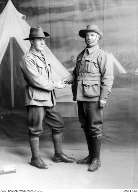
Left to right: 2296 Private (Pte) Donald William McTavish, 4th Reinforcements, 22nd Battalion, of Horsham, Vic; and 1246 Private (Pte) James Leas Shaw, D Company, 29th Battalion, of Horsham, Vic, aged 44. Pte McTavish enlisted on 24 July 1915 and embarked from Melbourne aboard HMAT Hororata on 27 September 1915. He was killed in action on 27 July 1916 at Pozieres, France.
Studio portrait of nine soldiers. Identified, centre, back row, is 1246 Private (Pte) James Leas Shaw, D Company, 29th Battalion, of Horsham, Vic, aged 44.
FCV Honour Board at the Beechworth museum. Photo: Peter McHugh
David Kennedy Tener Galbraith was born in Bendigo in October 1896.
He was living in Heathcote when he was one of nine candidates to pass the entrance exam into Victorian School of Forestry (VSF) at Creswick in April 1913.
David is not listed as having graduated from the school, but his name is on the VSF honour board.
Forestry mustn’t have been his calling because David is then listed in the McIvor Times newspaper as transferring from the Bendigo Branch of the Bank of Australasia to Charlton in December 1914.
David joined the AIF on 4 December 1915 when he was 19 and left Australia a few months later on the 20 May 1916.
He puts his occupation as a bank clerk on his enlistment papers rather than a forester.
He served as a gunner (#22932) with the 1st Australian Field Artillery Brigade in both France and Belgium and was gassed.
He returned in June 1919 and lived in Melbourne.
And just like Frederick Weichardt, David’s name doesn’t appear on the State Forest Department honour board held at Beechworth.
However, there are a number newspaper reports in 1934 of a David Kennedy Galbraith, aged 37, a bank clerk from Numurkah, married with two children, and a war veteran, pleading guilty to fraud of £36/2. This was a lot of money during the depression when average weekly wages were about £5 per week. David was sentenced to 18 months imprisonment with hard labour.
David Kennedy Galbraith died in Heidelberg in 1974.
William Ritchie was a from a forestry family. His father, James Stewart Ritchie, trained as a crown land bailiff in the 1890s at Creswick under the now famous John la Gerche.
William was born at Glen Park near Ballarat in 1895 and was one of the first students to enter the Victorian School of Forestry (VSF) at Creswick when it opened in 1910 but lasted for only one year.
In 1912 he was a trainee forester at the nearby forest nursery established by la Gerche but still attended night lectures in Tremearne House at the Forestry School in order to graduate in 1914.
In 1913 he went tree planting at French Island and later in 1915 to the State nursery at Macedon.
But on 25 September 1916, aged 20, William enlisted Royal Australian Naval Bridging Team and sailed off to the war. He switched to the AIF as a Sapper with the 1st Army Troops Company of the Royal Australian Engineers in March 1917, while in Egypt.
His military records indicate he mostly served in England.
On returning to Australia in May 1919 William resumed with the Forests Commission and took the job at the newly established Moonlight Flat Plantation near Harcourt.
By 1926 he was promoted to OiC at Bright to oversee the massive Ovens plantation project where he supervised the planting of millions of pine trees on the steep hills and river flats denuded during the earlier gold mining.
During WW2, because of severe staff shortages, William was the District Forester for both Bright and Ovens Plantations.
In 1950 William was appointed as the District Forester for Creswick, which included the nursery where he started, and by 1955 rose to Assistant Superintendent of Plantations for the FCV based in Head Office.
William Ritchie retired in 1960, aged 65, and died in 1989.
Oddly, William is listed on the VSF honour role as W. L. Ritchie while on FCV honour roll he is listed as W. S. Ritchie, but on his enlistment papers he has no second initial at all… I can offer no rational explanation…
And to add more branches to the family tree, William’s son is well-known FCV forester Russ Ritchie who graduated from VSF in 1944 and retired as Divisional Forester at Wangaratta in 1984.
Furthermore, there is Trevor Ritchie (son of Russ) who graduated from the Forestry School at Creswick in 1967, and then Ted Stabb (nephew of Russ), who graduated in 1971 and remarkably is still working as a forester for DELWP.
Robert Kerr was born in 1885 as the eldest son of Robert Kerr (senior), the assistant head teacher at the Prince of Wales State School in Northcote.
Kerr later gained both First and Second Certificates from the Teacher Training College and was appointed junior teacher at Victoria Park in Collingwood, later becoming assistant at Armadale.
In 1908, he resigned as a teacher and joined as a public servant with the State Forests Department, the predecessor of the Forests Commission Victoria (FCV). It’s not sure what his job was, but he was living in North Melbourne at the time.
Robert Kerr then enlisted in the 57th Battalion on the 23 August 1916.
Kerr was also a qualified pianist and gymnasium teacher, and had spent five years with the 1st Battalion, Victorian Scottish Regiment before enlisting.
Robert embarked from Melbourne aboard HMAT Nestor (A71) on 2 October 1916 as 2760 Private R J L Kerr.
He transferred to the Officers’ Cadet Battalion at Oxford in April 1917 and was promoted to 2nd Lieutenant on 1 August 1917. He went to France to join his unit on the 19August.
His military records show he was promoted to the rank of Lieutenant on 23 April 1918 and killed on the same day by a bomb dropped from an enemy aircraft. He was on the line with the Battalion at Aubigny near Villers-Bretonneux in France.
Lieutenant Robert John Leslie Kerr is buried in the Daours Communal Cemetery Extension in France.
He was 33.
Robert’s younger brother, Benjamin (1888) embarked as a Lieutenant in 1915, was wounded at Gallipoli and repatriated back to Australia. He re-enlisted in 1917 and returned with rank of Captain.
FCV Honour Board at the Beechworth museum. Photo: Peter McHugh
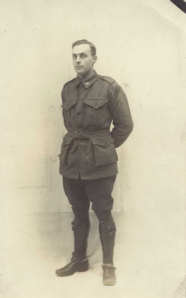
Reginald was born on 12 February 1900 at Heathcote.
He joined the Forests Commission when he was 16 and transferred to Ferntree Gully.
On 25 April 1917, when he was only 17 and 3 months, he enlisted with the 23 Battalion of the AIF (# 6866A) by forging his father’s signature because he was still underage.
While serving in France his true age was discovered when he wrote home about his 18th birthday. He was subsequently moved away from the front to a working party.
After returning from the war in 1919 Reginald resumed with the FCV, again at Ferntree Gully, but later shifted to a job with Victorian Railways.
Reg married Marion Harris in 1922 and returned to Heathcote to work in the timber industry.
Reg then reenlisted in WW2 and worked in the stores branch at Royal Park.
Reg sadly died at Heidelberg hospital on 29 January 1943 after a scuffle in West Brunswick while serving with the army. Another soldier was committed to trial for manslaughter.
Reginald Dennis Hall is buried at Springvale.
Reginald Hall (right). Source: AncestrySource: Kerri BarrettSource: Kerri BarrettSource: AncestryDavid Galbraith and Reginald Hall are listed at Heathcote PS.
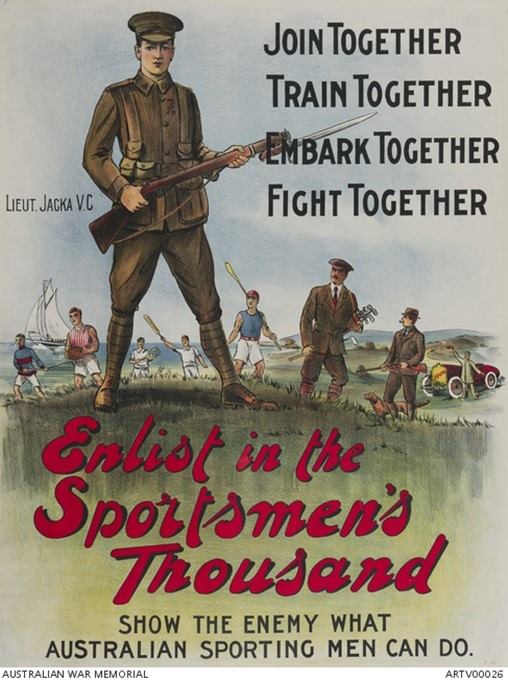
Perhaps Australia’s finest fighting soldier, Albert Jacka has the honour of being the first Australian to be awarded the Victoria Cross during WW1, the highest decoration for gallantry in the face of the enemy.
Albert Jacka is also one of twenty employees displayed on the Forests Department’s Roll of Honour that hangs at the Beechworth Forestry museum.
Albert was working at Heathcote when the war broke out and his career over the preceding three years had been along the southern side of the Murray River at Wedderburn, Cohuna, Koondrook, and Lake Charm. His work included fencing, fire break clearing and tree planting.
Jacka landed at Gallipoli on 25 April 1915 and received his Victoria Cross less than a month later amid frenzied fighting when the Turks launched a counter assault against a section of an Australian trench at Courtney’s Post.
Following his outstanding act of bravery at Gallipoli, Jacka instantly became a national hero and recruitment poster boy for the Sportsmen’s 1000.
He later served on the Western Front where he was promoted, seriously wounded and decorated again with a Military Cross and Bar. Many prominent historians claim he should have received three Victoria Crosses.
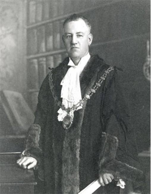
On returning home, Jacka turned down the offer to return to the Forests Department and established an electrical business which was largely underwritten by the infamous Melbourne figure John Wren.
He was later elected Mayor of St Kilda and fought hard for the unemployed during the Great Depression. He died in 1932 and has been honoured at a special council service ever since.
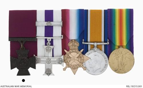
The 14th Battalion regimental colours are laid up in St Kilda Town Hall while his Victoria Cross is displayed at the Australian War Memorial in Canberra.
Albert Jacka in 1914 when he was 21. This postcard was taken when he was working for the Forests Department at Heathcote.The Forest Department Honour Roll hangs at the Beechworth Forestry museum and includes Albert Jacka VC.