Athol Hodgson made a significant and lasting contribution to Victorian forestry and bushfire management over his long and distinguished career.
Born in Wagga Wagga on 20 March 1930 into a large family of seven siblings, Athol spent his early years on the family dairy farm at Nariel near Corryong in northeastern Victoria. He often recalled helping to protect the property from the 1939 bushfires, and these events stuck in his mind and possibly helped shape his career.
Schooling at Nariel and then later boarding at Bendigo High School to obtain his Leaving Certificate, Athol’s family made major commitments and sacrifices to further his education.
At the beginning of 1948, Athol secured a coveted scholarship to enter the Victorian School of Forestry (VSF) at Creswick. This was during a growth period in the school’s history which saw a rapid rise in the intake from about 5 to 15 students per year. But because he only had his Leaving Certificate, Athol was required to study some additional subjects by correspondence towards his matriculation.
It was during his first year at Creswick that Athol met his future wife, Joy Dowler.
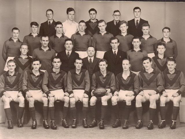
In addition to academic subjects and practical field work, Athol ran the school’s forest office administering the school bush, issuing harvesting licences and supervising contractors. Athol also proved to be a pretty handy footballer while at the school.
He worked his summer vacation in the Fire Protection Branch and got to meet the Forests Commission’s movers and shakers of the time including Alf Lawrence, Finton Gerraty, Arch Shillinglaw, Karl Ferguson, Herb Galbraith, Mervyn Bill, Charlie Ewart and Frank Treyvaud.
Athol graduated with a Diploma of Forestry at the end of 1950 as second in his class of twelve.
Like so many others before him, Athol’s first posting with the Forests Commission Victoria (FCV) was to the Assessment Branch (1951-52), where he undertook resource inventories across parts of eastern Victoria. He also made topographic and contour maps of the remote forests using stereoscopic aerial photographs taken by the RAAF during the war.
His first assessment job was to Heyfield where he camped with a small team in the mountains beyond Connors Plain at Mt Skene. A bulldozer was assigned to them to build new tracks, while horses were used to travel to more remote camps. This was followed by a second tour, also near Heyfield, camping at Murderers Hill before moving onto Cann River.
The days were long and hard in the bush, but his weekends were spent travelling to Creswick to see Joy whenever he could get away.
It was all pioneering work. The stakes were high, and it was critical for the Forests Commission to collect accurate timber volume figures because future decisions about new sawmill locations were to have long-term social and economic ramifications.
Athol was then posted to the Bruthen Forest District in East Gippsland (1952-54) working for Jim Westcott. It was while here that he befriended the famous bushman and fireguard Bill Ah Chow, who lived in the mountains east of Swifts Creek in the Moscow Villa hut.
Athol first lived next to the Bruthen office in a Spartan singleman’s quarters before he and Joy were married at Creswick on 4 April 1953. Athol needed special permission to take leave during the summer and after a short honeymoon to Mallacoota, the couple moved into a small cottage in the main street of the town in what later became the Bruthen Bakery.
On 25 August 1954, a RAAF Dakota took off on a routine flight from Canberra bound for East Sale, but it crashed at Cowombat Flat in the headwaters of the Murray River. A rescue mission was immediately mounted, and Athol maintained radio contact with the RAAF aircraft and ground search parties. The wreckage was later assembled into a makeshift hut by cattleman and FCV staff.
Athol began studies at the University of Melbourne in 1955 towards a Degree in Forestry. Being newly married, Athol claims he didn’t get too involved in the usual university student shenanigans.
Following his graduation from Uni, Athol returned to East Gippsland with a field posting to the Nowa Nowa Forest District (1956-58) working for Gerry Griffin. It was a busy place at the time with many sawmills and sleeper cutters in the bush. There were normal district roading and fire protection works learning from experienced forest overseers.
In late 1958, Athol somewhat reluctantly returned to his alma marter at the Forestry School as a lecturer to final year students – a role he said he would have preferred not to have been given. He was transferred because one of the main VSF lecturers, Alan Eddy, had secured a scholarship to study at Berkely University in America. Athol’s subjects included silviculture, forest products, forest mensuration, wood technology, forest economics, statistics and soils science.
When Alan Eddy returned from America, William (Billo) Litster, who was sometimes described as a dour Scotsman, was still the acting Principal. The school was going through a complex staff shuffle and there were some unsettling internal politics amongst the staff. Athol worked briefly at the nearby Daylesford District but still lived at Creswick.
Meanwhile, the Commission continued to invest heavily in the campus facilities and a new accommodation building, AVG House, named after a previous FCV Chairman, A. V. Galbraith, was constructed to replace the older and dilapidated student buildings.
Athol lectured at the Forestry School for a further period of five years but remained unhappy and was on constant lookout to find a more fulfilling role elsewhere.
He applied for numerous jobs and finally in 1962 was appointed as the FCV’s Fire Research Officer, after the incumbent Val Cleary was promoted. The Forests Commission was making a significant investment in practical scientific research at the time.
Athol then moved from Creswick to the Fire Protection Branch in Head Office and remained in this important role until 1971. He and Joy purchased a home in the southeastern suburbs of Melbourne for their growing family.
Because of his close involvement in the Stretton Royal Commission and his subsequent role as Chief Fire Officer after the 1939 bushfires, the Chairman of the Forests Commission, Alf Lawrence, was very supportive and closely followed Athol’s research progress.
Athol was a very hands-on type of fire researcher and during this time he became a driving force behind many significant innovations in the way the Forests Commission managed its bushfire responsibilities. His work included.
- Setting aside 1,000 acres of State forest at Mollongghip near Daylesford to conduct experimental fires, similar to those done by Alan McArthur from the CSIRO at the Kowen Forest and Bulls Head Creek near Canberra.
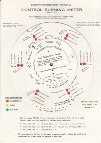
- Building on Alan McArthur’s work, Athol undertook some of the first definitive studies into fire behaviour, and together with Rus Ritchie used the results to develop an operational planned burning meter which was better suited to Victorian forests.
- Conducting early studies into the effect of bushfires on flora and fauna.
- Developing prescriptions for high intensity slash burns in pine plantations, and for the regeneration of native forests after logging.
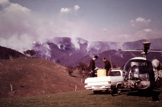
- Development of the operational use of helicopters and fixed wing aircraft for firefighting, aerial ignition and firebombing.
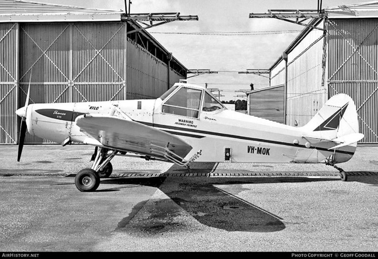
This work came to fruition on 6 February 1967, when two Piper Pawnees from Benambra near Omeo, flown by aviation legends Ben Buckley and Bob Lansbury, made Australia’s first operational drop of fire retardant on a small lightning-strike.
Meanwhile, Athol resisted the strong push from some US fire aviation companies to engage large fire bombers, and consistently advocated for smaller and more agile agricultural aircraft. - In 1968, Athol directed the use of Delayed Action Incendiary Devices (DAIDs) to aerially ignite a large 20,000 ha backburn in northeast Victoria, in what is believed to be a world first.
- He was briefly seconded to the Commonwealth Department of Supply’s “Project Euroka” in Queensland which was commissioned by the Army. It was a study of mass fire behaviour during an era of fears of nuclear attack. Testing of dugout design was included in the experiments.
- Experimenting with cloud seeding to increase rainfall across Victoria’s forests and water catchments.
- Establishment of Mobile Support Crews (AKA – The Hotshots), which like their American counterparts, were based on the temporary employment of fit, young university students as mobile, highly trained, well equipped and well-led firefighters to give additional surge capacity to the FCV when needed.
In 1964, during his period as FCV fire researcher, Athol was offered a place with the legendary Alan McArthur at the Forest Research Institute in Canberra. Not wanting him to leave, the Commission responded quickly with a counter-offer which included a big pay rise and promotion to an A Class Officer, the equivalent of an Assistant Divisional Forester. Athol was only 34 and chose to stay.
But Athol felt the need to study further if he was to advance in his research career and made several applications overseas.
In 1965, Athol was awarded one of Australia’s inaugural Winston Churchill Fellowships to study fire management in North America and Canada. Alvyn Turnbull and David McKittrick kept the fire research program running while he was away for a year during 1966-67.
He took his family overseas with him where his study focused primarily on the use of fire to create and sustain habitat for wildlife on privately owned forests. He also found time to study remote sensing of forest fires, lightning detection, weather modification, mass fire behaviour and prescribed burning. Athol also graduated from the US Forest Service’s National Advanced Fire Behaviour School at Marana in Arizona.
Athol returned from America even more confident that Victoria was heading in the right direction with regard to fuel reduction burning on State forests.
He published many articles in scientific journals, produced operational guidelines and presented papers at Australian and overseas conferences. But even in his own words, Athol’s main role was “spreading the gospel” about bushfires and controlled burning to anyone who would listen.
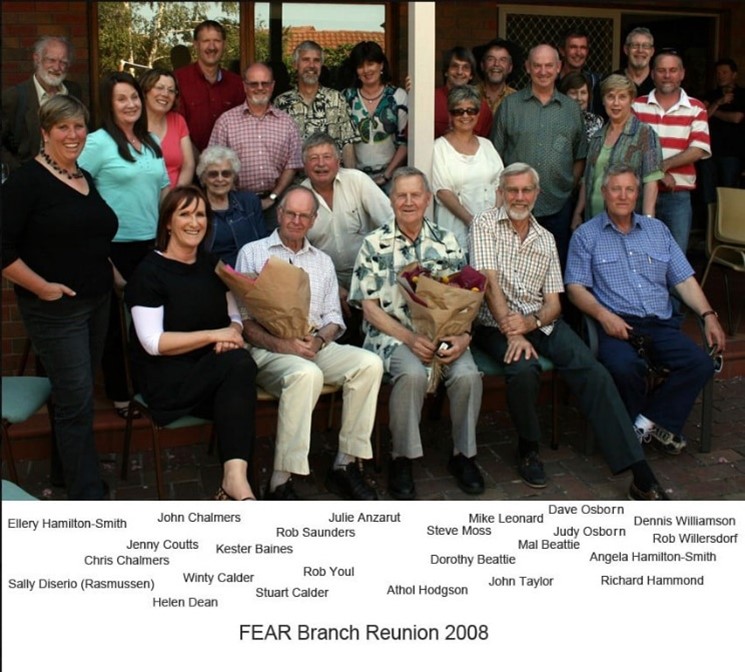
In 1971, he was appointed the manager of the newly formed Recreation Branch for the Forests Commission. By 1972, the Branch’s responsibilities had been considerably broadened and it became known as the Forest Environment and Recreation Branch (FEAR). This development signalled the Commission’s increasing awareness of environmental issues that were emerging, particularly at that time in the United States, and the fact that Victoria’s forests were slowly but increasingly being used by the community for recreation pursuits. This new direction did not necessarily have whole-hearted support throughout the organisation. The role also included oversight of some special FCV Reserves such as the Mt Buller ski resort.
In 1977, Athol was seconded to the State Electricity Commission Victoria (SECV) to assist with the study of the potential for overhead conductors on power lines to start bushfires. The results later assisted the Board of Inquiry into the “Occurrence of Bush and Grass Fires in Victoria”.
After FEAR Branch, Athol was promoted in 1977 to the Chief of the Division of Forest Management, a senior position he held until 1983.
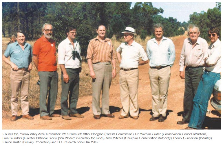
His representation of the Forests Commission on the Land Conservation Council (LCC) led to many significant land use decisions and creation of new National and State Parks. He led the environmental assessment into wood chipping in East Gippsland and a proposed new ski resort on Mt Stirling.
Often during this period, Athol acted as FCV Commissioner while Dr. Ron Grose was assigned to the Head of the Public Service Board working directly for the Premier, Dick Hamer.
Athol was finally appointed a Commissioner in his own right in May 1983 when the Chairman Alan Threader retired. The other senior members of the FCV included Gerry Griffin and Ron Grose, who was elevated to Chairman.
But his promotion as a Commissioner was immediately after the catastrophic 1983 Ash Wednesday bushfires and at a time when the FCV was making way for the Department of Conservation, Forests and Lands (CFL) under a new Labor Government with Premier, John Cain, and Minister for Forests, Rod Mackenzie.
Conservation, Forests and Lands was the result of an amalgamation of the Forests Commission, Crown Lands and Survey Department, National Parks Service, Soil Conservation Authority and Fisheries and Wildlife Service into a single mega Department.
The formation of CFL was announced in State Parliament on 5 May 1983 and came into effect a few months later on 1 September with a short Act of Parliament. This was followed by a long and disruptive period of transition while the Forests Commission continued to exist as a legal entity.
The appointment of an outsider, British academic, Professor Tony Eddison, as the new Director-General of CFL took many by surprise.
The restructure led to an extended period of uncertainty for Athol, as he held out hope of being appointed as the Chairman of the newly formed Alpine Resorts Commission (ARC). After about 8 months in limbo, Athol was directly contacted by the Minister and asked to return to CFL as its Chief Fire Officer, replacing Stan Duncan who had elected to retire.
Meanwhile, Gerry Griffin was appointed the Regional Director of CFL while the ex-FCV Chairman Ron Grose reluctantly moved to another government role in April 1985.
Many more senior staff of the Forests Commission chose to leave or retire, which left big gaps in skills and corporate knowledge.
Moreover, some staff from the other agencies that made up CFL often had very different cultures from those of the Forests Commission. Some staff strongly resisted changes which included restrictions on their summer leave. And some were unhappy and what they saw as “conscription” into bushfire roles within CFL.
The first major test for CFL as a firefighting agency was during the summer of 1984-85 when lightning started 111 fires in the mountains of northeast Victoria. Over 3000 firefighters on the ground, including 500 volunteers from the CFA, 449 armed services personnel, 120 sawmill workers, 50 State Electricity Commission staff, 75 bulldozers, 400 fire trucks, 20 helicopters and 16 fixed wing aircraft were deployed. Remarkably, the fires were controlled within 14 days without the help of rain.
Athol was first to admit that the bushfires had a positive effect by bonding the staff into the new department and cementing them into an effective fire fighting force.
His experiences during the 1984/85 alpine fires prompted Athol to taking a high-level delegation of Australian bushfire controllers on a study tour to the USA and Canada.
The eventual adoption of the Australasian Interagency Incident Management System (AIIMS) was a direct result of this tour. Athol had previously supported Kevin Monk, also from the Fire Protection Branch, to undertake a preliminary study of the AIIMS idea on trip to North America in early 1984 on a Churchill Fellowship.
In his role as the Chief Fire Officer, Athol was appointed as a Member to the Boards of the Country Fire Authority (CFA), and the State Disaster Council. He was also a Board Member of the National Safety Council of Australia (NSCA).
Athol retired from the Victorian Public Service in July 1987 but continued to lead a busy life as the Assistant General Manager of the NSCA (AKA – The Thunderbirds) where he was responsible for the organisations’ fire services and aircraft being offered to forest and fire agencies across Asia, Australia, Spain, North America and Canada.
However, the NSCA later collapsed in mysterious and spectacular fashion under the leadership of its charismatic Chairman John Friedrich in 1989. Athol and his family became embroiled in a lengthy and difficult supreme court case where creditors were seeking to recover lost funds in the subsequent liquidation action.
Other notable roles were as a fire consultant and expert witness to the Victorian, Tasmanian, NSW and Western Australian governments.
Athol was also a founding member of the Stretton Group, which was established in December 2003 following the disastrous southeast Australian alpine bushfires in 2002-03.
His ongoing frustration at what he saw as poor firefighting efforts led him to becoming one of the founders and President of Forest Fire Victoria together with Rod Incoll, Barrie Dexter, David Packham and other like-minded bushfire experts.
The group became strident and authoritative critics of the 2003 alpine firefighting efforts and the subsequent Bruce Esplin report. They highlighted failings of successive governments to focus adequate attention and funding to maintain fuel reduction burning programs in forests to protect life and property.
The group wrote substantial submissions about other major bushfires including the 2009 Black Saturday Royal Commission. They were undoubtedly an uncomfortable thorn in the State Government’s side.
In June 2012, Athol was deservedly made a Member of the Order of Australia (AM) in the Queen’s birthday honours “for service to forestry science, particularly the development of land management and bushfire risk reduction strategies, to emergency service organisations, and to the community of rural Victoria”.
Those who worked with Athol would unquestionably acknowledge his intellect and bushfire credentials, but also note him as a “good boss”. He was direct, tough, innovative, certainly not afraid to take a risk and very supportive of his staff.
Athol’s energy right up to the time of his death on 5 August 2018 was considerable. His legacy is clear and remains significant. His wife Joy passed away four years later in 2022.
Oral History:
https://soundcloud.com/user-99949261/sets/athol-hodgson/s-F0oDJ
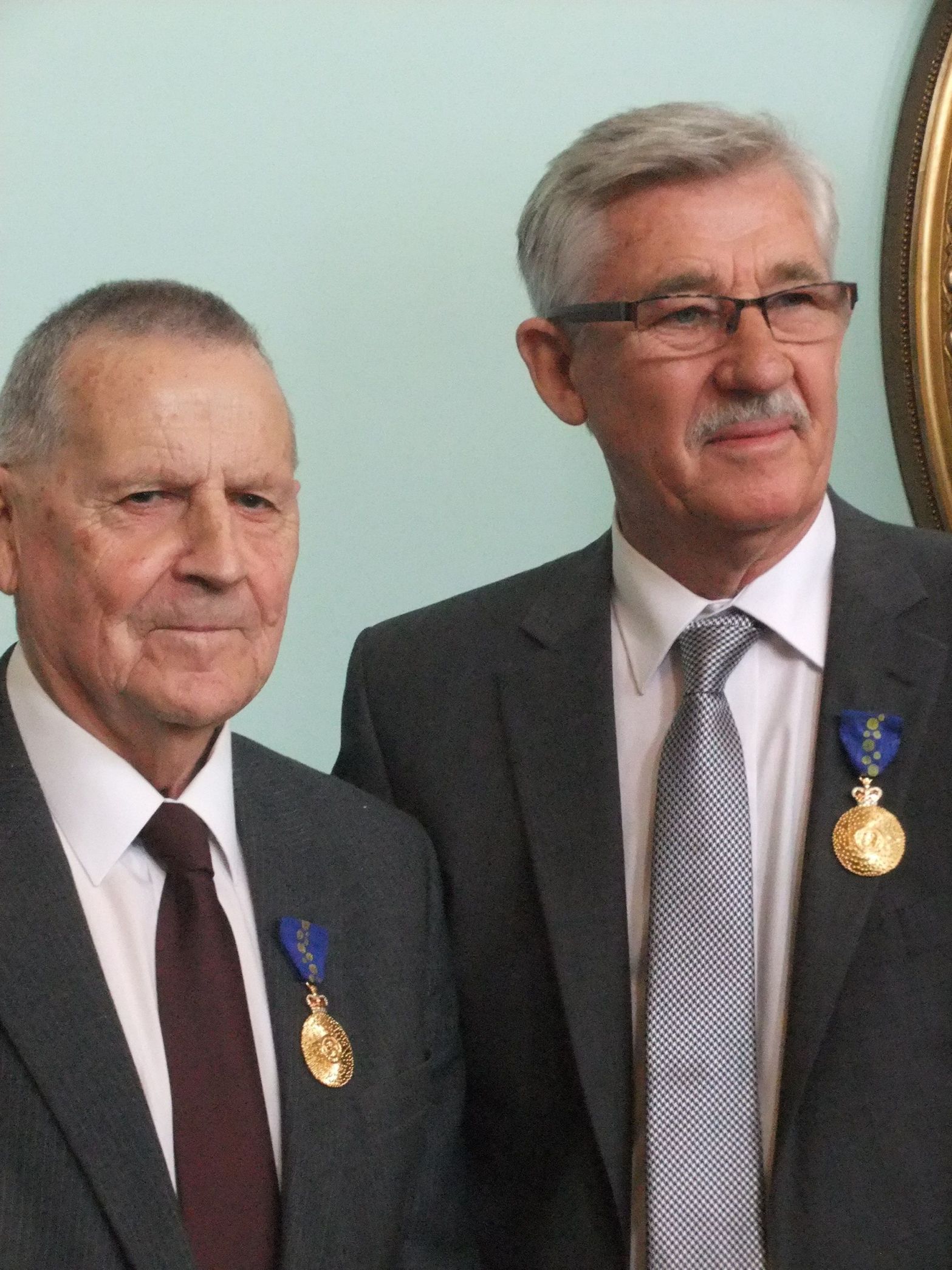
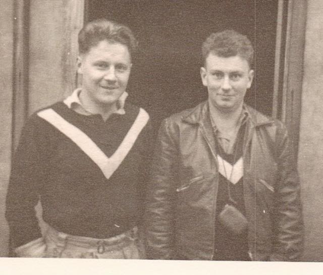
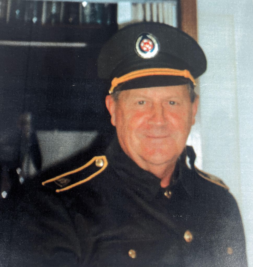
Main image: taken with Barry Marsden in 2012 at Government House on receiving AM.
Thanks to Athol’s family for providing support and insights to write this tribute.


Oral History: