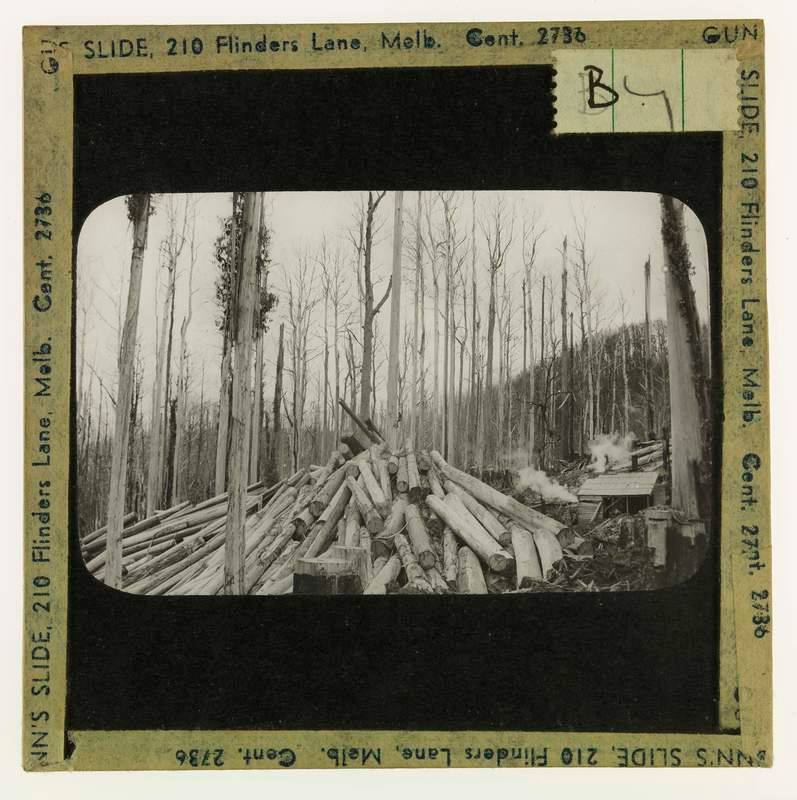
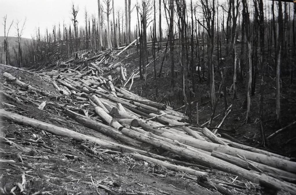
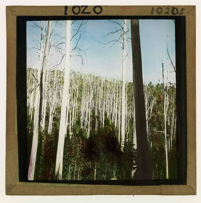
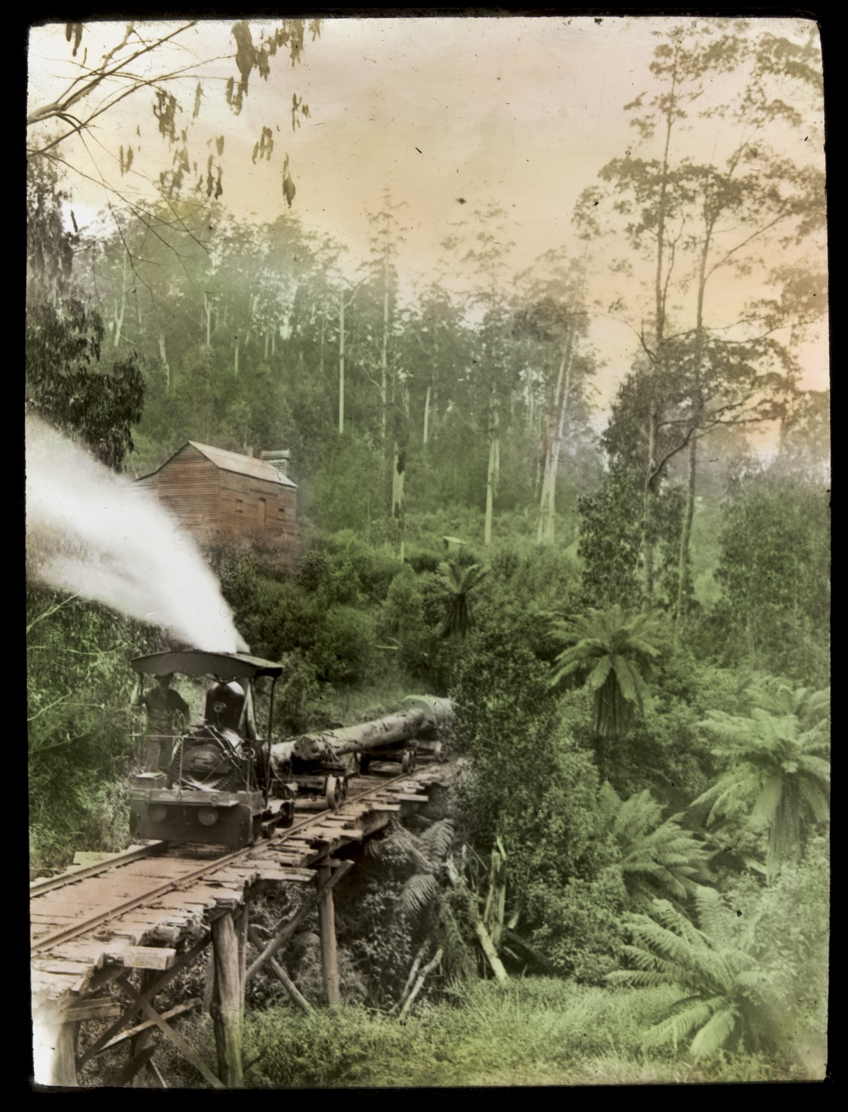
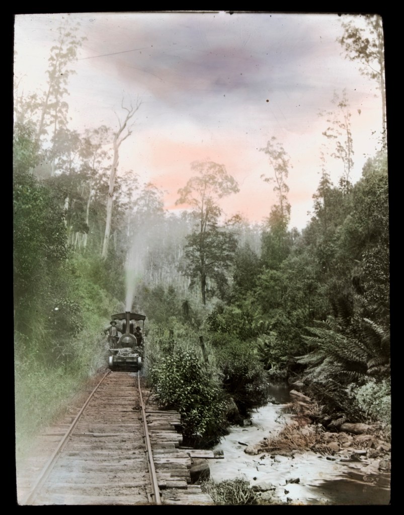
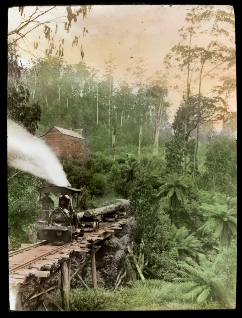
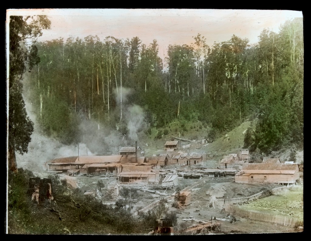
The firestorm tore trees from the ground and scattered them like matchsticks across the landscape.
The devastation of the 1939 bushfires was unprecedented. Several towns were entirely obliterated leaving 71 people dead including four FCV staff, 69 sawmills were lost and over 3700 buildings destroyed.
Nearly two million hectares of Victoria’s State forests were burned. The intense bushfire killed vast swathes of mountain ash, alpine ash and shining gum, some for the second time since 1926 and 1932.
Salvage of the fire-killed trees became an urgent and overriding task for the Forests Commission. It was estimated that over 6 million cubic metres needed to be harvested, and quickly, before the dead trees split and the valuable timber deteriorated.
New roads and bridges were hastily constructed, sawmills and timber tramways rebuilt. A massive job made more difficult by labour shortages caused by the War and a bleak winter of 1939.
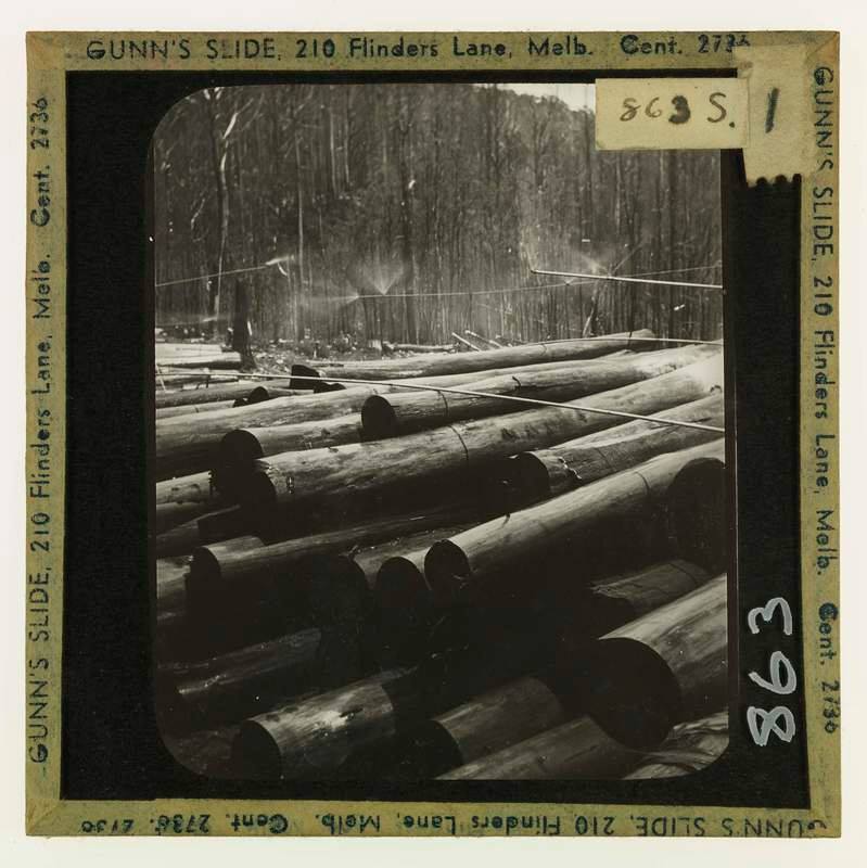
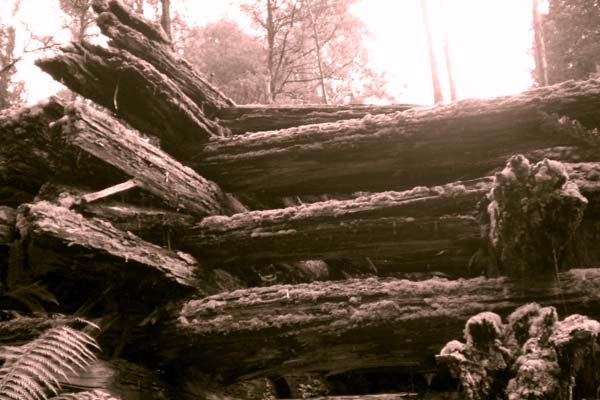
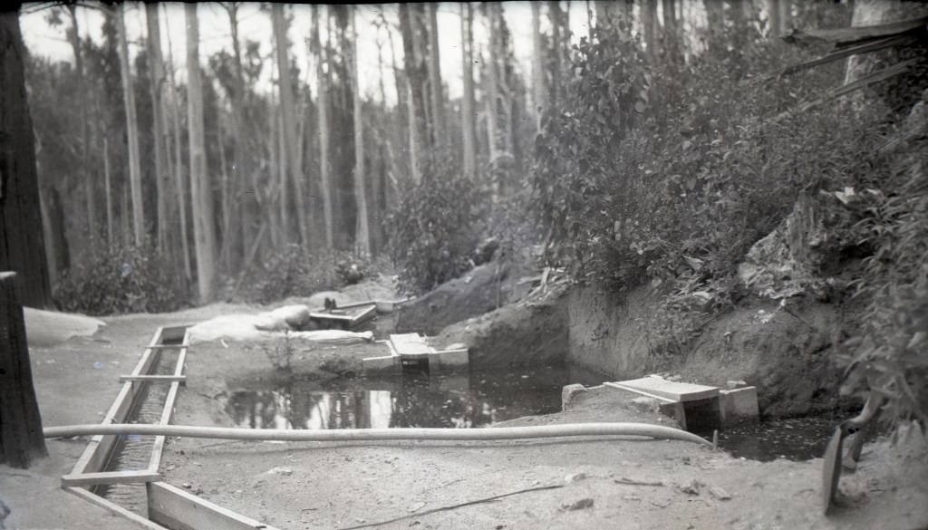
There was so much timber that many of the logs were stockpiled into huge dumps along creek beds and covered with soil and tree ferns or wetted down with sprinklers to stop them from cracking. Some logs were recovered as many as fifteen years later.
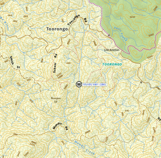
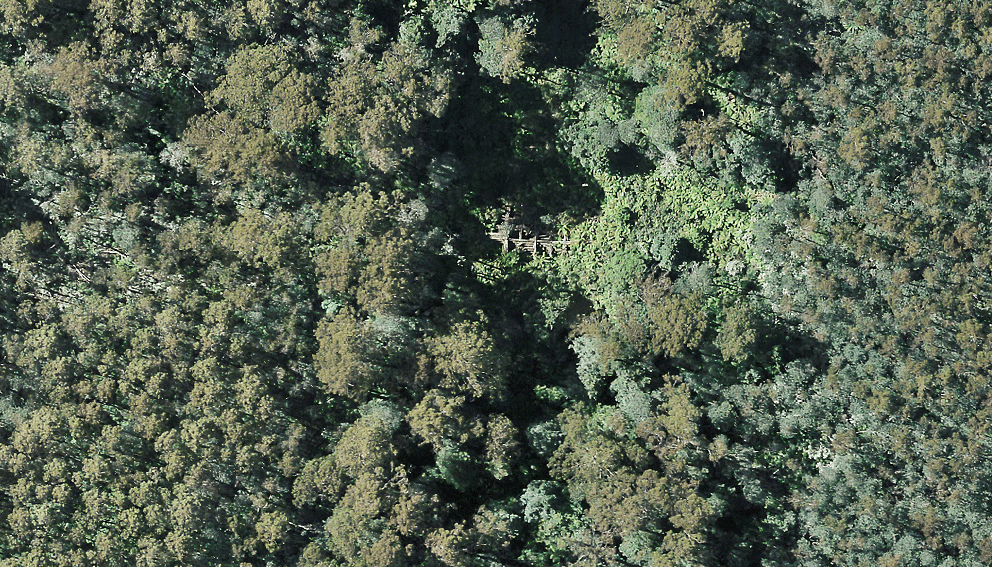
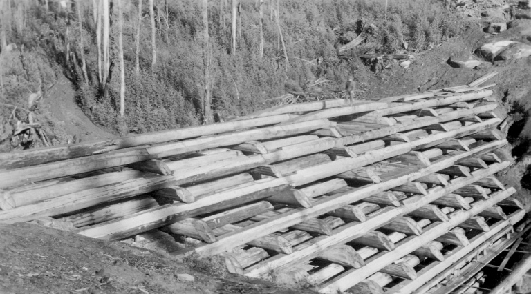
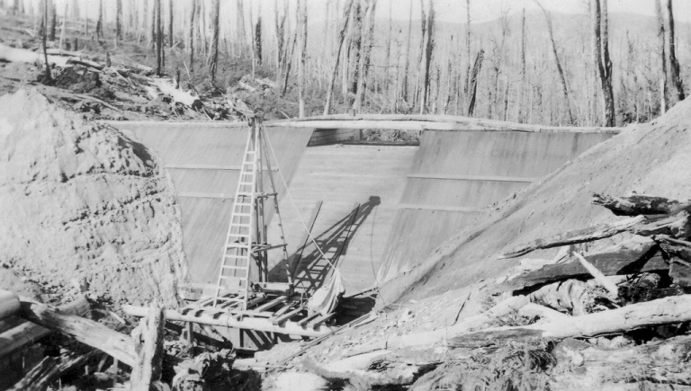
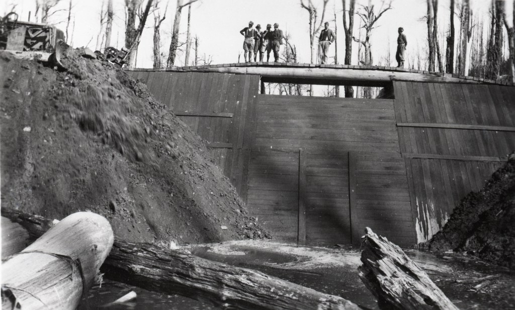
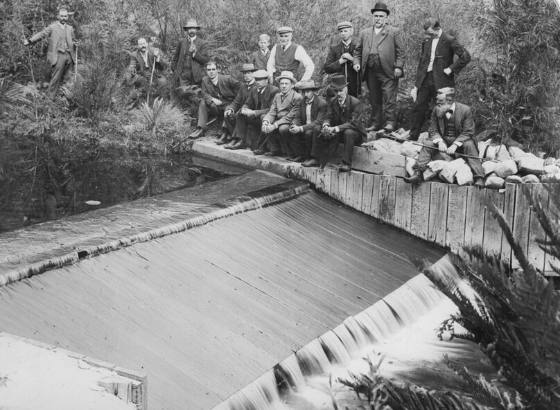
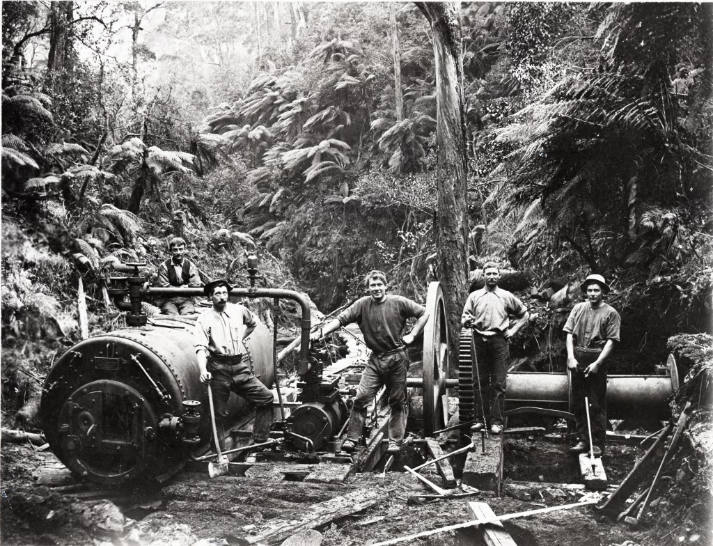
Mundic Wier was hurriedly built in 1941 of logs and earth on the Toorongo Plateau north of Noojee by Forests Commission engineer, Phillip Avery. The dam was a massive crib-log construction, with the upstream side faced with heavy planking. However, not long after its completion, a violent storm on the Toorongo Plateau filled Mundic Creek to overflowing; the planking failed and the dam burst. It was not repaired and, consequently, the dump remained only partially submerged.
Mundic Weir on the Toorongo Plateau – 1941. Information from Owen Salkin.
The remnants of Mundic Weir are still visible on the Toorongo Plateau. Information from Owen Salkin.Photograph taken in 1941 by W Flentje (Source: N Flentje) : Mundic Creek Dam under constructionPhotograph taken in 1941 by W Flentje (Source: N Flentje) : Mundic Creek Dam under constructionPhotograph taken by David Malady in June 2011 : Remains of the wall of Mundic Dam built for 1939 salvage, Toorongo PlateauPhotograph taken in 1941 (Source: FCRPA) : Mundic Creek Dam under construction on the Toorongo PlateauPhotograph taken in 1942 (Source: FCRPA) : Water take off for log dump sprays – West TanjilPhotograph taken by David Malady in June 2011 : Remains of the wall of Mundic Dam built for 1939 salvage, Toorongo PlateauPhotograph taken in 1941 (Source: FCRPA) : Mundic Dam under construction on the Toorongo Plateau
In the post war period, the State Government put a strong emphasis on buying British 4WD vehicles such as Series 1 Land Rovers.
They were light weight but pretty primitive and very prone to breakdown.
The files in the Public Record Office are thick with warranty claims by the Forests Commission about the reliability of Land Rover gearboxes and drive trains.
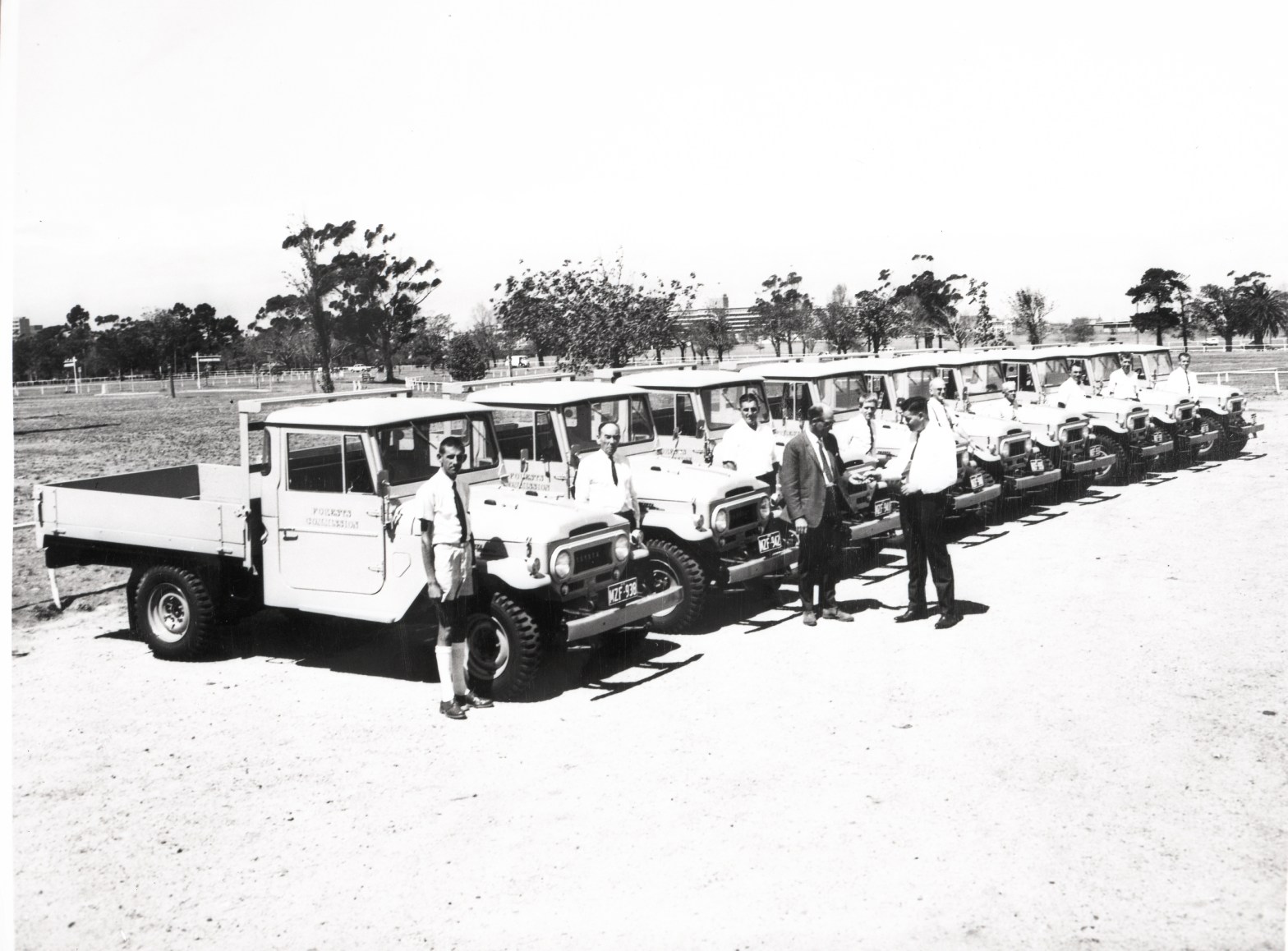
Meanwhile in the early 1950s, the Korean War created a big demand for light military vehicles, and the United States government tasked the Toyota Company to manufacture what later became the Land Cruiser.
In 1958, Sir Leslie Thiess imported Toyota Land Cruisers into Australia for the Snowy Mountains Scheme which proved they were robust and reliable.
But at the time, there was some outright community hostility towards vehicles made in Japan.
The Forests Commission took the matter direct to the Premier Sir Henry Bolte and State Cabinet to have the purchasing policy overturned.
The Victorian Government Motor Transport Committee (VGMTC) finally acknowledged the mechanical failure of Land Rovers was contributing to higher overall maintenance costs and lower resale values of the Forests Commission’s fleet. This problem was made worse by a chronic shortage, and long delays, in dealers sourcing replacement parts from England. In some cases, differentials from surplus WW2 Austins were being substituted.
Sir Henry grudgingly gave his permission in the mid-1960s for the FCV and other agencies to make a quiet switch to purchasing Japanese Toyotas.
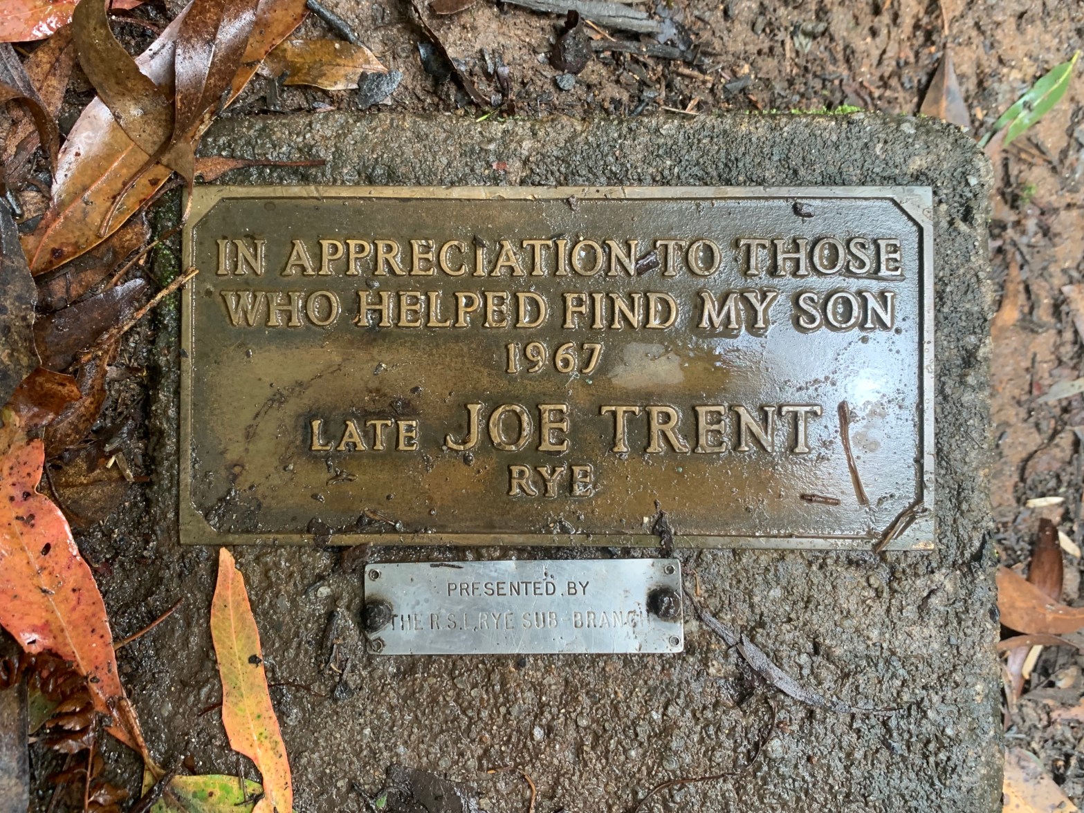
This small brass plaque to the late Joe Trent can be found at the base of Toorongo Falls near Noojee.
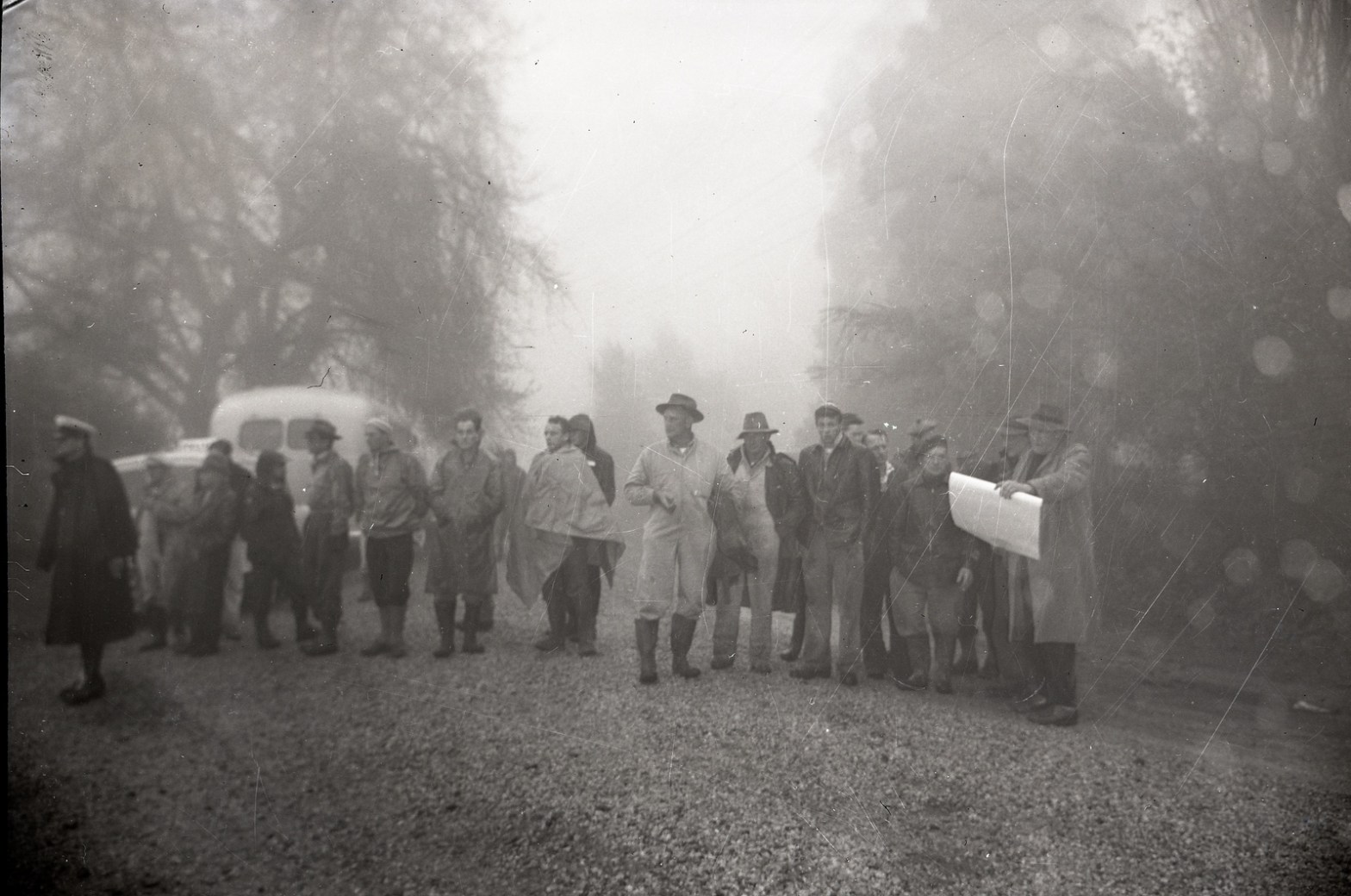
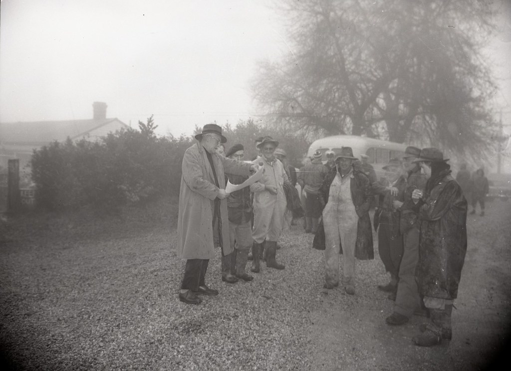
It was Joe’s son Gregory who had been lost in the bush for 27 hours on July 16 and 17, during the middle of winter in 1967.
Joseph Charles Trent died of a heart attack two weeks later on 30 July 1967. It’s said the strain of the search contributed to his death. He was 54 and is buried at Rye.
His wife Rita and the family erected this plaque, which is a bit misleading because it gives the false impression that it was Joe that died in the bush.
Joe had been a truck and tractor driver and served in the Citizens Military Forces (CMF) during World War Two – which explains the smaller plaque from the Rye sub-branch of the RSL.
During 1966-67 the Forests Commission supported the Police in 35 search and rescue operations.
Another major search was mounted at Toorongo Falls for Kostya (Costa) Mezentseff, aged 5, who ran away during a family picnic on 27 August 1972. The search was scaled down by Police after five days, but local FCV staff and other groups such as the Scouts and St John Ambulance persisted until early September. But sadly, Kostya was never found.
A Victorian Search and Rescue committee was established in 1954 after the earlier successful rescue of a young couple, Kirk McLeod and Jennifer Laycock, at Mt Donna Buang near Warburton.
The committee was led by the Police, and included the Federation of Victorian Bushwalking Clubs, the Board of Works, the Forests Commission, the Country Fire Authority, the State Electricity Commission and the National Safety Council.
The history of organised search and rescue efforts can be traced back to when the Melbourne Walking and Touring Club banded together with other groups into the Federation of Victorian Bushwalking Clubs in 1934. And while their chief Interest was enjoying the bush, in 1949 a dozen walkers joined in the search for a man missing at Wilsons Promontory.
The Federation then formed a Search and Rescue Section to assist Police looking for people lost in remote or difficult terrain. In the early 1990s the name changed to Bushwalkers Search and Rescue.
The Forests Commission mainly took a supporting role to the Police by providing staff with local knowledge of bush tracks as well as provision of 4WD vehicles and drivers. The Commission’s field offices and radio system always played a key role.
The 1954-55 annual report describes the Commission’s role in the dramatic search and rescue of two men at Mt Baw Baw. One of the members of initial search party, 19-year-old David Hally, became lost himself and was rescued after 6 days in the snow, but the body of 21-year-old skier Mihram Haig was never found.
“The Commission’s radio equipment and organisation under the direction of the radio engineer were used effectively over a period of ten days in an intensive search for two persons missing in the Baw Baw mountains during the winter. Field communications were based on VL3AZ, Tanjil Bren, and fourteen stations were in operation.”
The Police formed a specialist Search and Rescue Squad not long after in 1957 while the State Emergency Service (SES) was formed in 1975.
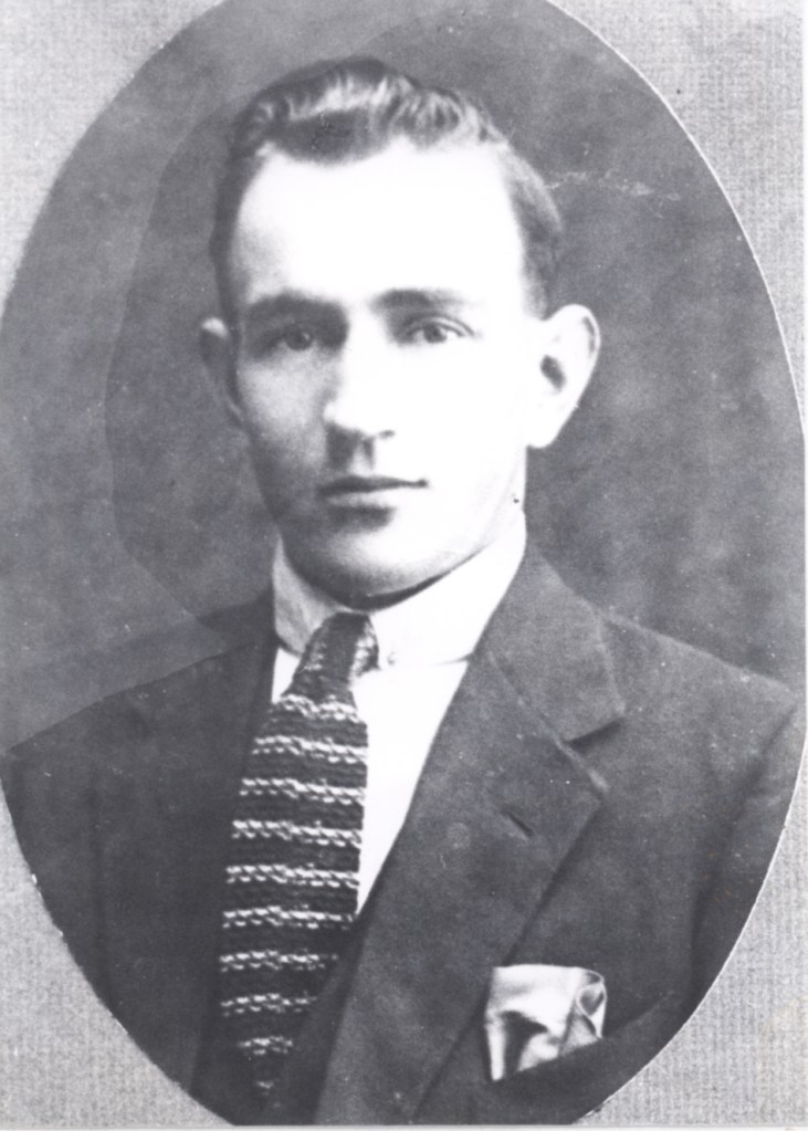
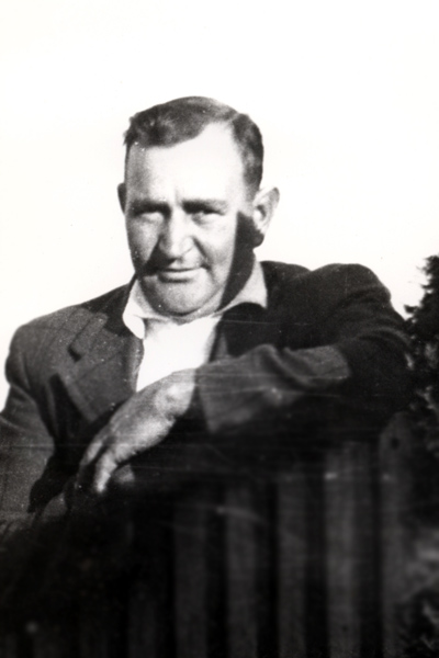
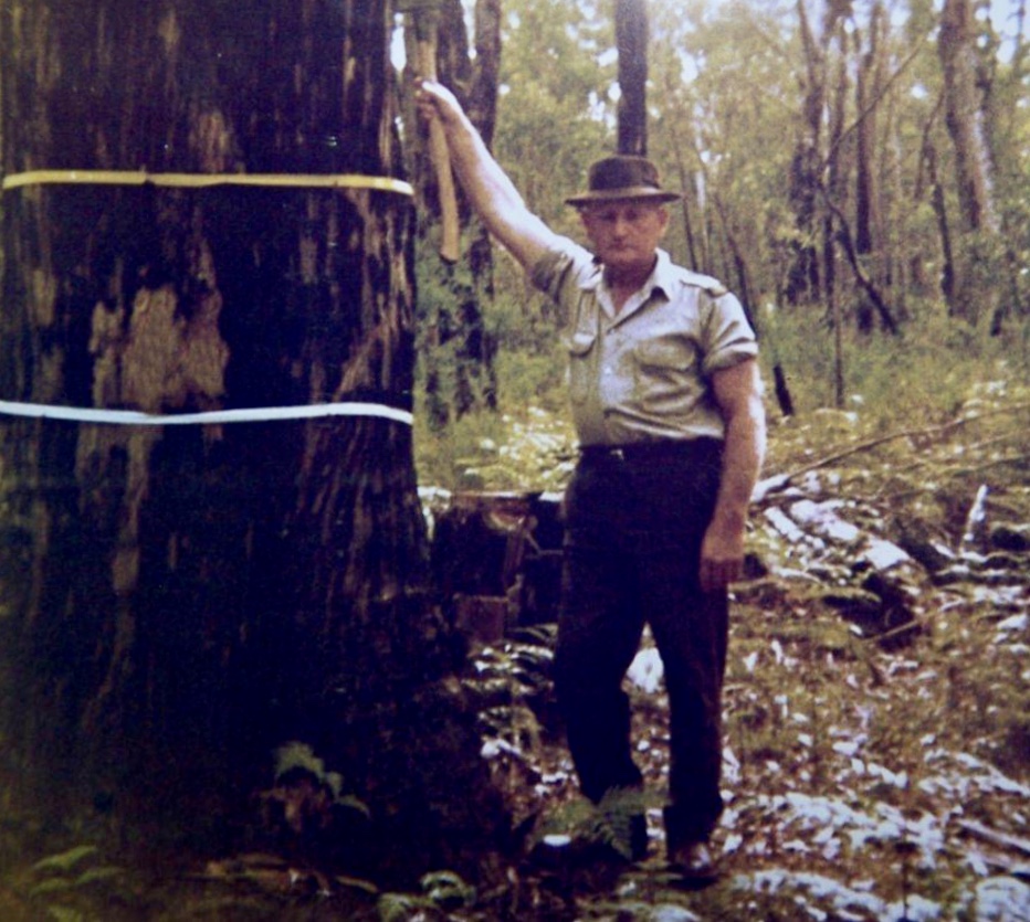
Harold Aldridge (AKA Stringy) worked for the Forests Commission Victoria (FCV) at Heywood in far south western Victoria, firstly as a labourer in 1930, and later from the early 1960s as a forest foreman and overseer.
Stringy also served as a driver in the CMF during the war years.
During the 1950s and ‘60s forest overseers were undisputed kings of their domain with overall operational control of the bush.
The men working at Heywood included Stringy Aldridge at Narrawong, Central Cobboboonee, Dunmore and Tyrendarra, while Tim Hodgetts was at Gorae, and Alec Murphy looked after Greenwald and Dartmoor. Bob Riley was responsible for Digby and Hotspur while Stanley Oswald (Dick) Aldridge had charge of Drumborg, Annya and Myamyn.
Dick Aldridge, a returned RAAF serviceman, was Stringy’s younger brother and joined the Forests Commission at Heywood in 1940. He also rose to become Forest Overseer and retired in 1976.
In addition to firefighting, road maintenance and other operational works, one of the main tasks of a forest overseer was marking trees to be felled in the bush before they were snigged out and loaded onto trucks to be delivered to local sawmills.
The silvicultural operation tended to be selective harvesting and thinning of the larger trees, rather than clear felling.
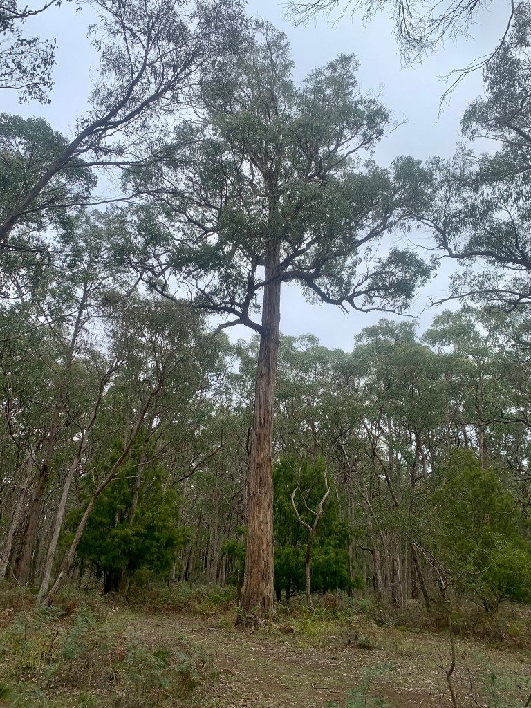
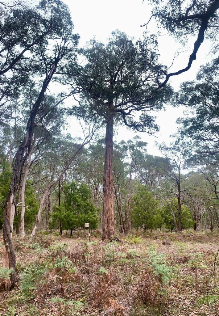
Stringy Aldridge is noted for protecting a large messmate (E. obliqua) in the Cobboboonee State forest, just west of Heywood,
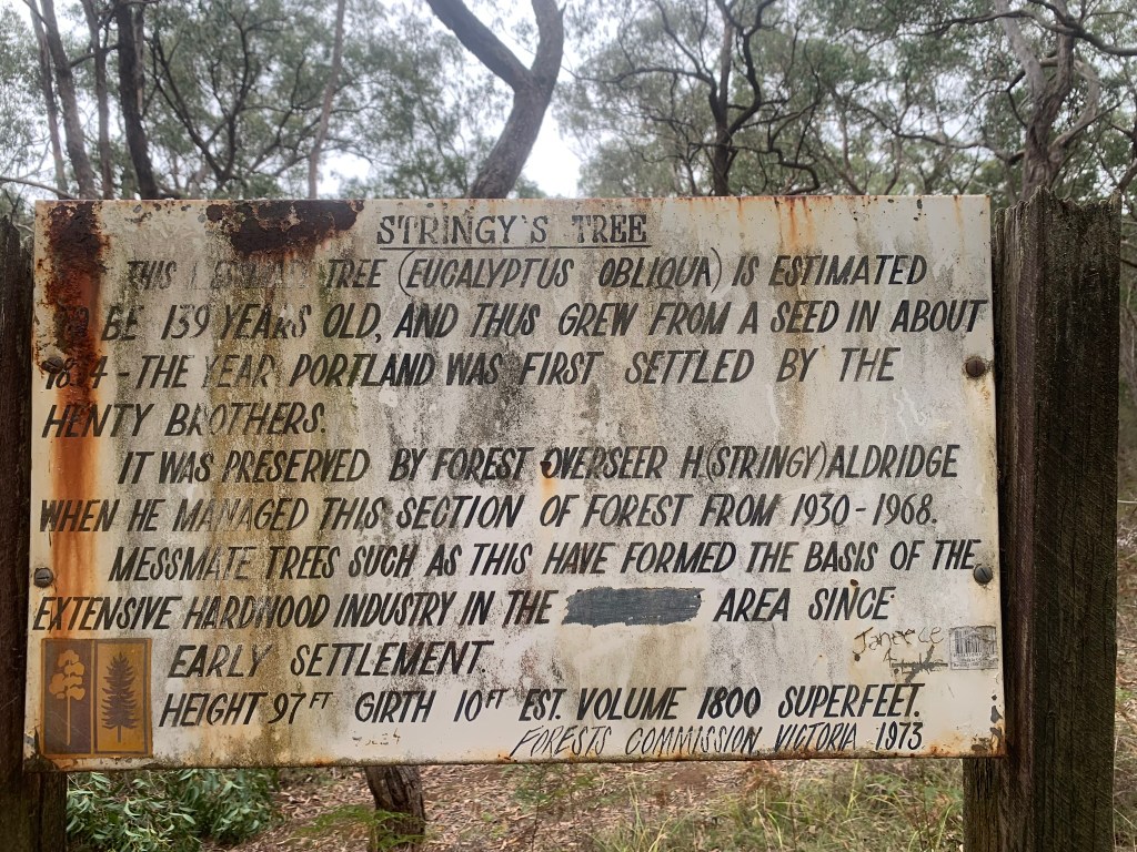
The tree is said to have germinated as a seedling in 1834 when the Henty Brothers first settled at Portland, making it about 190 years old.
Rumour also has it that an occasional bag of fertilizer was spread under the tree. The crown and stem certainly look very healthy.
Stringy Aldridge died suddenly at his home in Heywood on 29 December 1968, aged 64, and he is buried at the Portland South Cemetery.
Later, in 1973, local Forest Commission staff from Heywood erected a large interpretive sign at the tree in Stringy’s honour. The sign is looking a bit tired and worn now, although surprisingly, there are no bullet holes in it, and it would be nice to see it refurbished.
In June 2024, I personally remeasured the height of Stringy’s Tree with my trusty tape and clinometer at 31.25 m (102.5 feet). This represents an increase of 1.7 m (5.5 feet) over the last 51 years since 1973.
The weathered sign also states that the tree was 10 feet in circumference in 1973. This equals a girth of 305 cm, or a Diameter Breast Height Over Bark (DBHOB) of 97 cm.
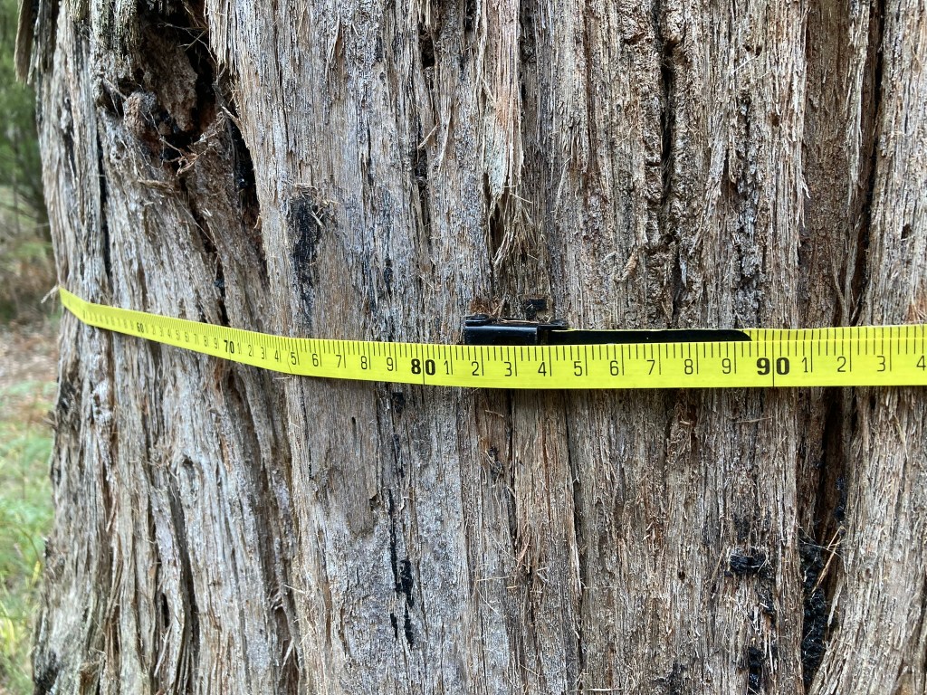
In 2004, I also remeasured the circumference of Stringy’s Tree at 381 cm, which equals a DBHOB of 121 cm.
The increase in DBHOB of 24 cm (121 – 97) since 1973 equates to a growth rate of 0.47 cm/year. (which seems very low for a messmate on good soils).
If we assume an average diameter increment of 0.47 cm per year over its life, and then working backwards, Stringy’s Tree might be 257 years old (121 cm ÷ 0.47), rather than the 190 as claimed on the sign board.
I accept there are lots of assumptions and flaws with this method, and without cutting it down and counting the rings, or taking core samples, it’s impossible to tell. And maybe it doesn’t really matter because Stringy’s Tree is still a magnificent specimen.
Ref: Garry Kerr. (1995) A History of the Timber Industry in Victoria’s Far Southwest.
Photo: In the Heywood bush. Harold “Stringy” Aldridge, Alf Telford and Harry Perkins. Photo: Vern McCallum Collection
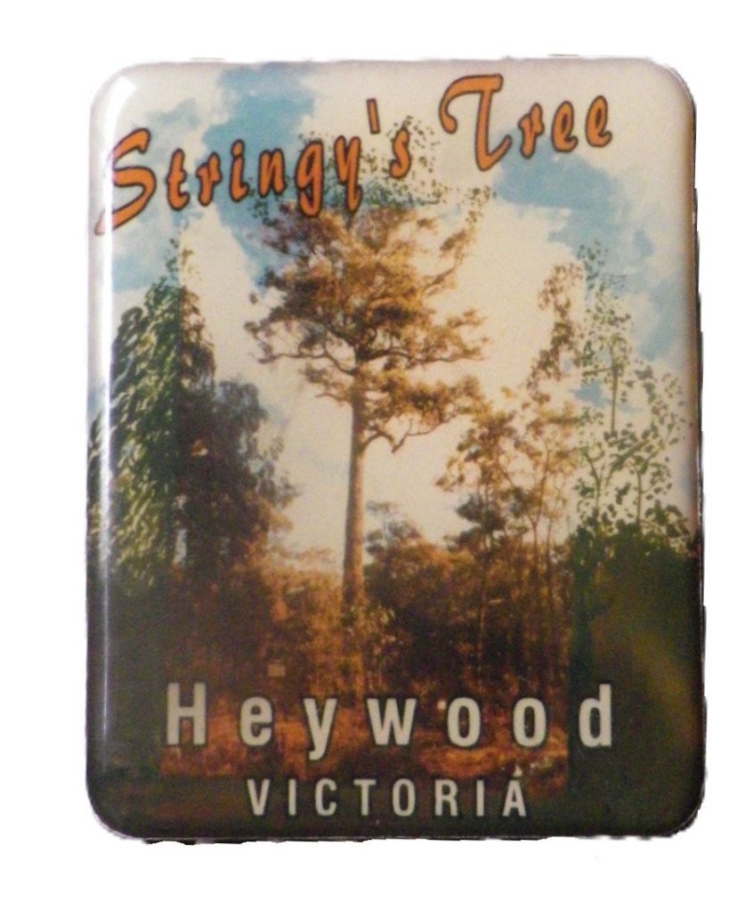
Now 102.5 feet tall with a healthy crown. Photo: Peter McHugh 2024Now 102.5 feet tall with a healthy crown. Photo: Peter McHugh 2024Harold (stringy) Aldridge age 23. Photo: Vern McCallum CollectionPhotograph probably taken in the 1960s (Source: G Kerr) : Harold (Stringy) AldridgeThis sign was erected in 1973 after Stringy’s death and is looking a bit tired and worn. Photo: Peter McHugh 2024Stringy’s Tree even had a fridge magnet.Stringy’s younger brother, Stanley Oswald (Dick) Aldridge, was also a FCV overseer. Seen here In the Annya Forest, late 1960s- early 1970s. He retired in 1976. Source: G Kerr https://www.victoriasforestryheritage.org.au/showcase/what-was-it-like/689-fcv-overseer-dick-aldridge.htmlA circumference of 381 cm or DBHOB of 120.8 cm is only a modest increase of 24 cm over the last 51 years. Photo: Peter McHugh 2024
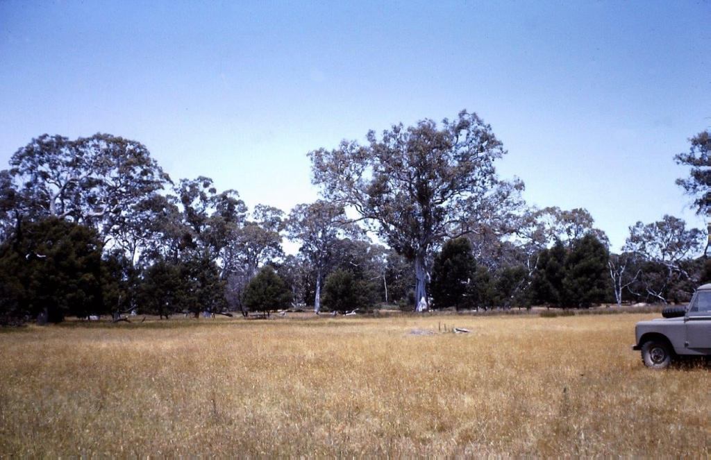
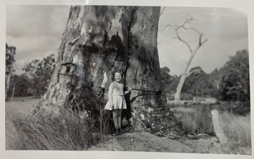
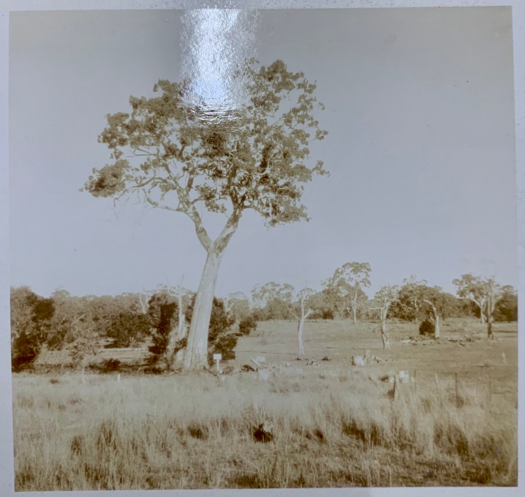
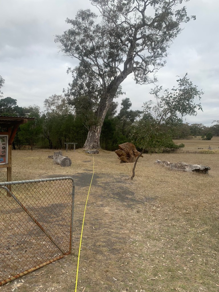
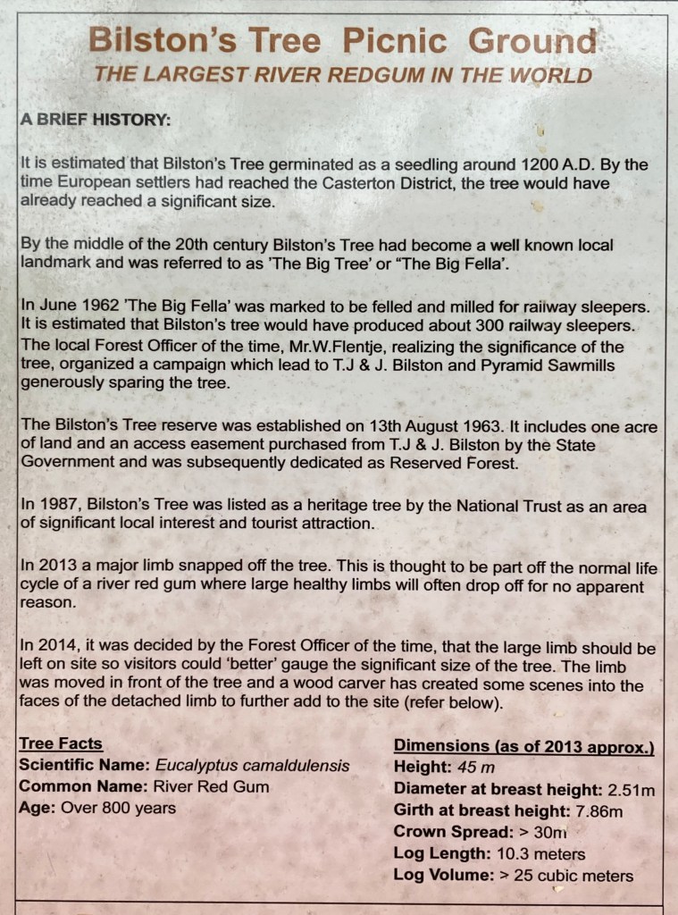
The magnificent Bilston Tree near Brimboal in far western Victoria was a big part of the local consciousness in the late 1950s.
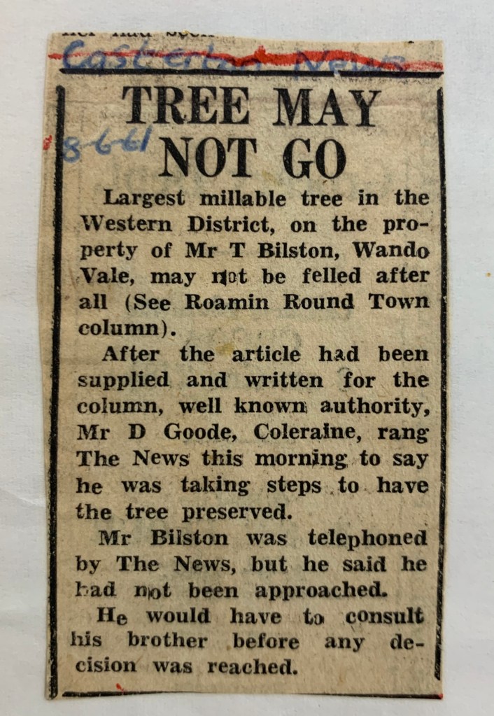
The massive river red gum (Eucalyptus camaldulensis) was scheduled to felled for railway sleepers on 12 June 1961 but was saved by local community action led by Bill Flentje, the District Forester at Casterton.
Subsequent negotiations between the Forests Commission Victoria (FCV) with the landowners, Mr Thomas Henry Bilston and his brother Mr John Wheeler Bilston, as well as Mr Lance Thyear from Pyramid Sawmills, led to the acquisition of the tree by the FCV on 6 March 1962 for the sum of 70 pounds as compensation for the loss of timber.
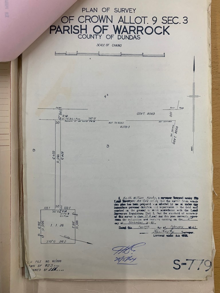
Significantly, the Bilston brothers also donated a small patch of land (1 acre, 1 rood, 26 perches) surrounding the tree, including a half-chain-wide right of carriageway.
The brothers had always wanted to see the tree preserved as a tribute to their grandfather who had been one of the district’s earliest pioneers. Thomas Bilston (Snr) had driven stock into the area in 1839, shortly after Major Mitchell’s historic expedition in 1836, and the Henty Brothers had established Portland’s first permanent settlement in 1834.
In the late 1950s, they had offered to gift the tree to the National Parks Authority (NPA) and contacted Dewar Wilson Goode from Coleraine, a prominent local pastoralist, conservationist and board member of the NPA, but he was not in a position to accept the generous proposal.
All the standing timber on three paddocks of the Bilston’s property was subsequently sold for a cash amount to Pyramid Sawmills at Casterton but the owner, Lance Thyer, could readily see the significance of the big tree to the local community and was instrumental in having it saved.
Lance wrote to the Minister for Forests, Mr Alexander John Fraser, in August 1961 to advise that he had willingly forfeited 10,000 super feet of timber that would have been cut from the Bilston Tree but, instead, had harvested an equivalent volume of unallocated timber from another paddock owned by the Bilstons.
A total of 70 pounds (which was roughly the equivalent of four times the basic weekly wage) was offered to the Bilstons by the State Government as compensation to offset the loss of revenue from the additional timber made available to Pyramid sawmills.
The donated land around the tree was then transferred to the Crown on 16 August 1963, with legal fees of 4 pounds and 4 shillings met by the FCV. The land was subsequently declared Reserved Forest on 28 May 1964.
At the time of purchase, the tree was thought to be about 400 years old – not 800 as is now more commonly claimed.
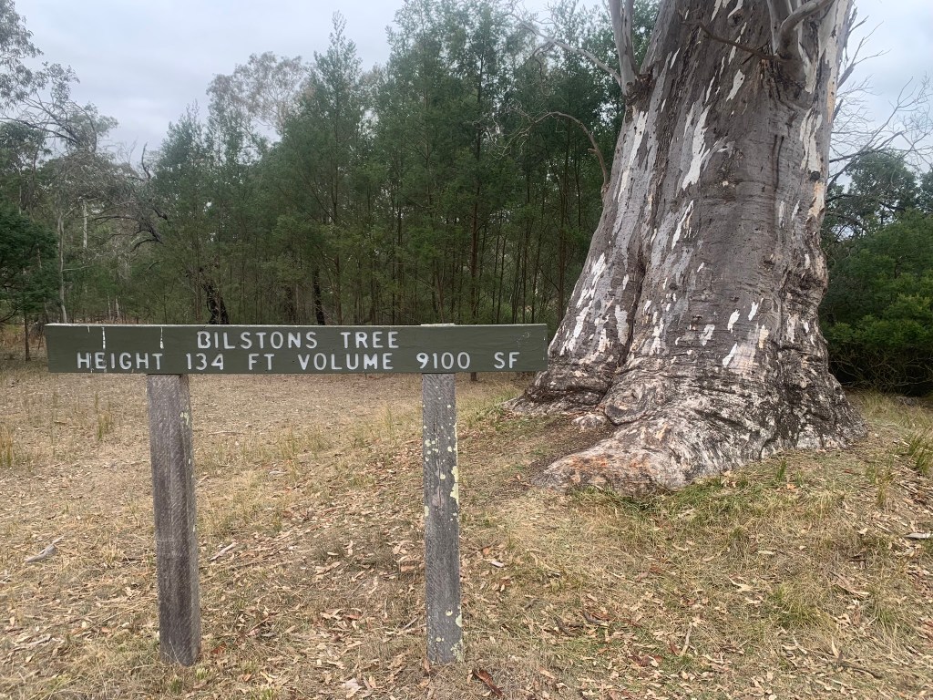
In 1961, the tree circumference was 23 feet and 10 inches (measured at breast height). The total tree height was 134 feet with a log length of 34 feet giving an under bark volume of 910 cubic feet (as measured by Bill Flentje).
The massive specimen was once known as the “Big Fella”, but now more commonly as the Bilston Tree after the original landowners, is listed on both the National Trust and Victorian Heritage Registers.
A sign on the Casterton-Chetwynd Road makes the bold claim that the Bilston Tree is the world’s largest river red gum. Tourism websites and Google repeat the assertion.
But how do you best measure a river red gum ??? – is it height, girth, diameter, crown size, crown spread or log volume ???
The national register of big of trees, compiled by well-known botanist Dean Nicolle, uses a points-based system combining height, girth and crown spread to identify Australia’s largest river red gums.
The Bilston Tree, with 443 points, makes it onto the list, as does the well-known tree at Guildford near Castlemaine (562 points), but the biggest river red gum in Victoria is the “Morwell Tree” in the Grampians which accumulated a massive 700 points.
The Bilston Tree is not exceptionally tall either. A gun-barrel straight river red gum in the Barmah state forest named “Codes Pile”, after the Chairman of the Forests Commission, William James Code, was measured at 46.6 m. The Bilston Tree is also not of great girth, being only 812 cm measured at breast height (1.3 m) above the ground.
There are certainly lots of river red gums with more bulk (or biomass) but the unique thing about the Bilston Tree is its clear unbranched trunk, with very little taper, up some 40 feet (12 m).
Estimates in 1961 suggested that 910 cubic feet or 25.7 m3 of timber could be sawn from the tree, which is enough for over 300 railway sleepers. This probably makes the Bilston Tree the largest “merchantable” river red gum.
The local Forest Overseer, Peter Musgrove, reported in 1987 “you might find a taller river red, or one with a bigger girth, but there is none with such bulk as this”.
River red gums are a bit like people. They shoot up in height in their early years. But, also a bit like people, river red gums then slowly thicken around the middle as they age, and mature trees can come in all different shapes and sizes.
Competition from other trees, soils, droughts, floods, and the rhythm of the seasons all have an impact on growth rates, with wet years encouraging increasing tree dimensions.
Tree size, together with its dominance and spacing in the landscape, bushfire, pests and diseases are also factors in tree growth.
River red gums often regenerate as a dense thicket of seedlings after flood, or wet conditions, and it can take years for a dominant stem to emerge. The mature tree can then suppress regeneration and growth of nearby seedlings by leaching tannins from their leaves, which is known as an allelopathic effect.
The Bilston Tree is commonly claimed to have germinated in 1200 AD making it now 824 years old. This is more than double the estimate made in 1963 when the tree was purchased. The first suggestion of such a remarkable increase in antiquity seems to have been made in a newspaper article (thought to be from 1971), but it’s unclear where the enhanced statistic came from.
But estimating the growth rate and age of trees, particularly old river red gums, which often have a large hollow in the centre, and are sitting out exposed in a paddock, can be a notoriously fraught process, so even the initial 400-year-old claim must be an educated guess at best.
Roger Edwards, a Forest Officer at Cavendish, measured the growth of river red gums in the nearby Woohlpooer State Forest over a 25-year period from 1977 to 2002. The trees probably originated as natural regeneration after grazing ceased in 1913 and the block was acquired by the Forests Commission. The trees were thought to be between 75-110 years old at the completion of his trial. Four of his one-hectare plots had been thinned. Roger found diameter growth rates were highly variable and ranged from nearly zero to 0.6 cm per year, but with an average of 0.26 cm per year. And unsurprisingly, he found that larger, well-spaced trees grew faster than smaller and more crowded ones.
Whereas, I have measured the diameter growth of young, well-spaced, 23-year-old river red gums, near a creek at 2.3 cm/year. Trees planted on farms, with access to ground water, well-spaced and initially well-fertilised also show high growth rates.
So, in June 2024, I decided to practice a bit of field forestry and measure the Bilston Tree for myself with a trusty tape and clinometer, and then compare its size to other records.
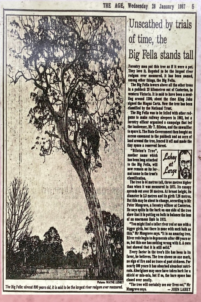
But if you look at the attached table I have compiled, there are some odd contradictions and discrepancies for the tree’s dimensions, particularly for 1961, 1971, 1987 and 2013. It’s also hard to know what techniques may have been used to measure the tree in the past, or if a standard breast height of 1.3m for diameter was adopted.
The figures shown on the sign for the 1971 dimensions are incorrect. They should be for 1961 not 1971. The correct 1961 figures came from measurements by Bill Flentje. (eg – the tree was 23 feet 10 inches girth and 134 feet in height)
For the purposes of this exercise, I have considered the 1961, 1998, 2011 and 2024 measurements to be the most reliable.
If you look at the increase in diameter using the measurements from 1961 to 2024, the Bilston Tree grew a total of 27 cm over the 63-year period. This equates to an annual diameter increment of 0.42 cm/year. That’s the equivalent of a single annual growth ring (or end grain) being less than 2 mm wide which, as any wood turner will tell you, seems reasonable for red gum timber .
However, the 26-year period from 1998 to 2024 equates to an increase in diameter of 13 cm, or 0.50 cm/year.
And it’s a very similar story for the more recent 9-year period from 2011 to 2024 which equates to 0.55 cm/year.
So, if we assume an average diameter increment of 0.5 cm per year over its life, and then working backwards, the Bilston Tree might now be more modest 516 years old. (258 cm ÷ 0.5).
However, if we use a lower growth estimate of 0.26 cm/year, based on those trees measured by Roger Edwards at Woohlpooer, it could be nearly 1000 years old (which seems very high).
I accept there are lots of assumptions and flaws with this method, but without cutting it down and counting the rings, or taking core samples, it’s impossible to be 100% certain.
The crown is thinning and showing signs of senescence while there is some epicormic growth from the lower trunk. Unlike many other old river red gums, there is no major swelling at the base or large burls. Large branches fell in 1973 and again in 2013 which may partly explain its shrinking stature over the decades.
I understand a core test showed in 1987 that the trunk was solid. The large branch which broke from the tree in 2013 has been carved by local artists.
The carpark, walking track, interpretive signs and surroundings all looked well-loved and carefully maintained. Although, some of the information on the interpretive sign about the Bilston Tree is contradictory and would benefit from a review. The magnificent carvings on the fallen branches had been freshly coated with preservative. Full credit must go to the local DEECA staff and the adjoining landowner for taking care of this arboreal treasure.
The Bilston Tree may not be the world’s largest or oldest river red gum as is often claimed in the tourist brochures. And maybe it doesn’t really matter because it’s still big, still old, still magnificent and still well worth the visit.
Forests Commission Files – 73/1299 & 61/888. “Reprieve for a giant red gum at Wattleglen, Parish of Warrock, Brimboal [Bilston’s Tree], Casterton Forest District”. Held at Public Record Office Victoria (PROV).
Main Photo: Bilston Tree – Feb 1964. Photo: Gregor Wallace.
Note: The 1971 records shown on the sign near the tree are incorrect. They actually relate to 1961 as measured by Bill Flentje (eg in 1961 the tree was 23 feet 10 inches girth and 134 feet in height). The figures in the original 1961 FCV file note were “estimates” and so are also incorrect.
Photograph taken in 1961 (Source: W Flentje) : The Bilston Tree
Photograph taken in 1994 (Source: W Flentje) : Bill Flentje at the Bilston Tree
Lyne Waters, granddaughter of Thomas Bilston at the tree in 1959. Source: FCV File 73/1299 & 61/888 – PROVBilston Tree – 1959. Note it has three large branches. One broke off in 1973 and another in 2013. Source: Source: FCV File 73/1299 & 61/888 – PROVAfter a large branch broke off in 1973. Source: FCV File 73/1299 & 61/888 – PROVA small picnic table and 4 stools was carved by local staff from the large branch that fell in 1973. Source: FCV file
Source: FCV File 73/1299 & 61/888 – PROV
From Google.Circumference (girth) of 812cm equals a diameter at breast height (1.3 m) of 258 cm. Photo: Peter McHugh 2024.Measuring tree height with a tape 40m from the base of the tree. (Clinometer readings – 36 degrees up plus 3 degrees down) – Tan 39 degrees x 40 = 32.4 m.Carvings in a branch that fell in 2013. Photo: Peter McHughCarvings in a branch that fell in 2013. Photo: Peter McHughThe sign at the base of the tree.The site is well maintained and the interpretive signs informative. Photo: Peter McHughhttps://www.nationalregisterofbigtrees.com.au/editorfiles/file/largest_river_redgums_feb_2022.pdfSource: FCV File 73/1299 & 61/888 – PROVA newspaper article (undated but thought to be from 1971) on the information board gives a girth at 23 feet 10 inches and height of 134 feet. It also dates the tree from 1200 AD.This January 1987 story by Age journalist John Lahey contains a number of inconsistencies about the tree’s size and age.This sign at the tree also perpetuates some errors.Information Board. Some of the information on the interpretive sign about the dimensions of the Bilston Tree is contradictory. Photo: Peter McHugh
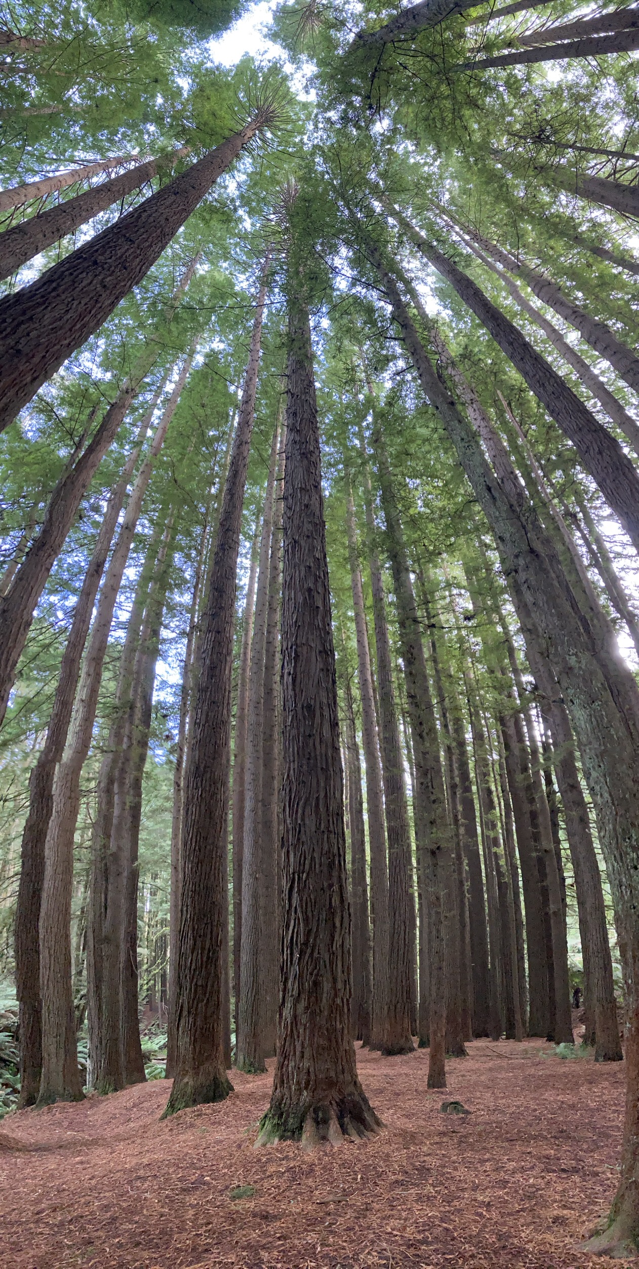
There are three distinct species of redwoods commonly planted in Victoria.
Dawn redwood(Metasequoia glyptostroboides). Thought to have been extinct for millions of years, the Dawn redwood was rediscovered in 1944 by a forester in the Sichuan-Hubei region of China.
Giant sequoia(Sequoiadendron giganteum) which grow into the most massive trees on Earth. The General Sherman Tree in Sequoia National Park is probably the best well-known. They reach an average height of 50–85 m with trunk diameters ranging from 6–8 m. They are found in groves on the western slopes of the Sierra Nevada mountain range of California.
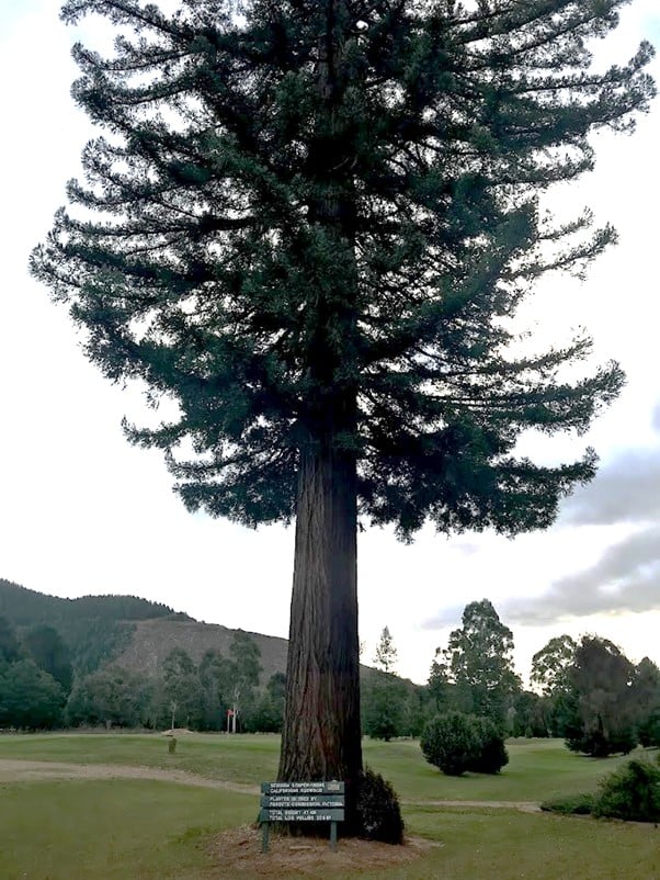
Coast redwood(Sequoia sempervirens), also known as Californian redwood, can live up to 2000 years or more. They are the tallest trees on Earth, and the current tallest is the Hyperion, measuring 115.61 m (379.3 ft). By comparison, the tallest measured mountain ash (E. regnans) is named Centurion and stands 100.5 metres tall (330 feet) in Tasmania.
And while all three species of redwood are breathtaking to behold, the Coast redwoods are something special.
There are some significant individual specimens in both private and public gardens in Victoria. One of the most notable is outside the Bright Golf Clubhouse which was planted by the Forest Commission in 1923 when the site was a softwood nursery. And there are at least three large street trees around the township of Beechworth.
There were a few old Coast redwoods near the Forestry School at Creswick, but they were damaged or destroyed in the 1977 bushfires which swept the bush.
However, two small stands of Coast redwoods have become incredibly popular destinations over the last few decades.
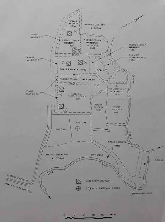
Probably, the most well know was planted by the Melbourne & Metropolitan Board of Works (MMBW) in 1930. The site is about 8km east of Warburton on Cement Creek Road and has several species of softwoods including Coast redwoods.
It was established as a research plot to examine interception of rainfall by tree canopies and for comparison with native mountain ash forest in the Coranderrk area. There are over 1476 trees ranging in height from 20 metres to the tallest being 55 metres on an even 3.3 m grid spacing. The stand has not self-thinned like the one in the Otways and is not as tall.
It is believed that the seed came from England and the seedlings were raised at the Forests Commission nursery at Creswick.
The East Warburton stand can become packed with visitors on weekends, somewhat destroying the serene and eerie ambiance of the tall trees.
The second, and my personal favourite, is the experimental stand of Coast redwoods planted by the Forest Commission in 1936 in the Aire Valley in the Otways. I understand there were five other stands of Coast redwoods, but they are now gone.
The initial plot of 461 trees has thinned down to 220 stems since planting in 1936. Some have died, some have been struck by lightning, some have been removed or cut down, and others have fallen down. The planting rows, where trees were originally spaced at of 3.3 metres, are still visible.
The initial growth of the seedlings was disappointingly slow, but they are now about 60 metres tall (2004).
The Forests Commission built a camp next to the Aire Valley Redwoods in March 1948 which consisted of a cookhouse and mess, shower block, toilets, woodshed and eighteen small two-man Stanley Huts. It was used to house post-war immigrants and refugees who came from Lithuania, Latvia, Estonia, Poland, Czechoslovakia and Yugoslavia. The “Balts”, as they were known, had come to replant the degraded and abandoned farmland in the Otway Ranges which had been progressively purchased by the Commission for softwood plantations.
I’m also aware of two other smaller, and less accessible stands of Coast redwoods. One known as the Magic Forest in the Stanley plantation near Beechworth, and the other is hidden in the bush between Toolangi and Narbethong.
It’s hard to know exactly what has triggered the incredible popularity of Coast redwood plantations in the last few years. Maybe it’s a quest by pouting influencers for that perfect selfie or Instagram photo. Or perhaps, it’s the latest trend of shinrin yoku, which is the ancient Japanese relaxation ritual of forest bathing.
Ever wondered about Chains, Links, Yards, Furlongs, Miles, Acres, Roods and Perches?
Before metrication was introduced into Australia during the 1970s, distance on parish plans was shown in chains and links while area was in acres, roods and perches.
Gunter’s chain was used for measuring distance in surveying. It was designed and introduced in 1620 by English clergyman and mathematician Edmund Gunter (1581–1626).
Gunter developed the measuring chain of 100 links. The chain and the link became statutory measures in England and subsequently the British Empire.
This 66-foot-long brass Gunter’s Chain is from the forestry museum at Beechworth.
It is divided into 100 links (each 7.92 inches long) and marked off into groups of 10 by shaped tags which simplify intermediate measurement.
The chain was a precision part of a surveyor’s and foresters’ equipment. It required frequent calibration yet needed to be sturdy enough to be dragged through rough terrain for years. It has brass hand grips at each end of chain.
It is heavy but flexible enough to be dragged through the bush on surveying transects. (Hence the common forestry term – chainman).
The January 1939 bushfires swept across almost five million acres, killed 71 people, destroyed 69 bush sawmills and almost entirely obliterated several towns. The small and remote township of Omeo lost the hospital, four shops, the main hotel and 27 houses.
Workmen from Omeo went to fight the fire at Cobungra Station, but they were trapped when the wind caused fresh outbreaks. Along with refugees from the station, including several children, they plunged into the Victoria River, and remained there until rescued.
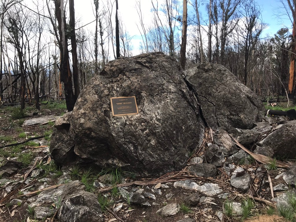
Amongst those killed in the bushfires was James Ernest (Ernie) Richards, aged 31, a stockman from Cobungra who perished along with his horse and cattle dog.
The story goes that Ernie was out droving and tried to return to Cobungra to rescue his wife and young infant, but was caught in the flames. His wife and child had been taken into Omeo earlier by the doctor for safety.
Ernie’s body was recovered and buried at Omeo Cemetery, but the remote site in the bush was lost in time as the scrub regrew and people moved on with their lives.
The story I was told from a reliable source, but haven’t been able to independently verify, is that about 20 years ago someone from the Richards family (possibly Ernie’s son) was trying to locate the site and set out with the assistance of either forest management or parks staff from Swifts Creek and some knowledgeable folks from the Omeo Historical Society.
With the aid of a modern metal detector the searchers found a metal buckle from a horse saddle and figured they had discovered the right spot.
A metal plaque was later placed on a nearby rock by the side of the Alpine Way between Cobungra and Mt Hotham.
My photos were taken in October 2020, not long after bushfires had once again swept the area.
The first “road” to be built in Victoria by European settlers was on Phillip Island, more than two centuries ago.
The “project manager” was the Commander of HM Brig Lady Nelson – John Murray – who was surveying the Bass Strait area in 1801 on behalf of Victoria’s first road authority – the Government of New South Wales.
The New South Wales Government continued to oversee the development of Australia’s south-eastern corner until 1851, when Victoria was proclaimed a Colony in its own right.
But by 1851, Victoria’s roads were in a parlous state and the new government tackled the issue as a matter of priority. It was spurred by the huge increase in traffic fuelled by the gold rush, and in 1853 an Act for making and improving roads in the Colony of Victoria was passed.
A Central Road Board, as well as several District Road Boards, were established, the former responsible for main roads and the latter for local roads.
The State Government financed the main roads and contributed half the cost of local roads, while maintenance was partially funded through tolls.
The Central Road Board was a great success, but nonetheless was abolished in 1857 and its responsibilities transferred to a new Board of Land and Works. These were days when rail travel was in the ascendancy, taking up much of central government’s time and money.
The responsibility for building and maintaining roads was increasingly devolved to local municipalities. And here, local interests often prevailed over the greater good, leading to patchwork development of the Colony’s road system.
But roads were to undergo a resurgence, not surprisingly, driven by the ever-increasing popularity of the motor car at the turn of the century (the first motor vehicle in Melbourne appeared in 1897).
The earlier period of 1851 – 1857 had shown the value of central direction on road management and, in 1913, the Country Roads Board (CRB) was established – the heir of the Central Road Board and a parent of the current VicRoads.
Civil engineer William Calder was appointed the first Chairman of the Board, and he took an important role in guiding the development of the Great Ocean Road until his death in 1928. Calder, after whom the Calder Highway is named, often inspected roads on horseback.
The new Board began by conducting a two-year investigation of Victoria’s roads (which it found to be “anything but satisfactory”, according to its first annual report).
The Board, in its first year, also approved contracts for works amounting to 94,876 pounds.
Interestingly, the first annual report also commented on matters such as the false economy of cheap construction, poor maintenance methods, the need to set road standards, conservation and aesthetics.
With its first investigations completed, the CRB hoped to begin major construction work. However, this was set back by the start of the First World War in 1914.
From 1918 to 1943, the CRB’s brief expanded to include many other classes of road. The most significant was State Highways, which were developed and maintained by the CRB to relieve municipalities of providing for long distance “through traffic”.
Meanwhile, after the 1939 bushfires, the Forests Commission was busy building over 50,000 km of forest roads and tracks. The two organisations always had a close working relationship because of the need to transport logs from the forest to sawmills in nearby towns, and then move sawn produce to markets.
The CRB obviously worked to different engineering standards, but the two organisations shared knowledge and sometimes equipment. CRB crews and their machines were always handy at bushfires.
VicRoads was formed in 1989.
The Roads Act (2004) help to delineated road ownership between VicRoads, municipalities, and the Department.
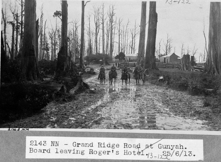
Photo: Members of the newly formed Country Roads Board on their inspection of roads in the Strzeleckis – 25 June 1913. CRB Collection, Public Record Office, Victoria. VPRS 17684/P0003/108, 13_00122_A
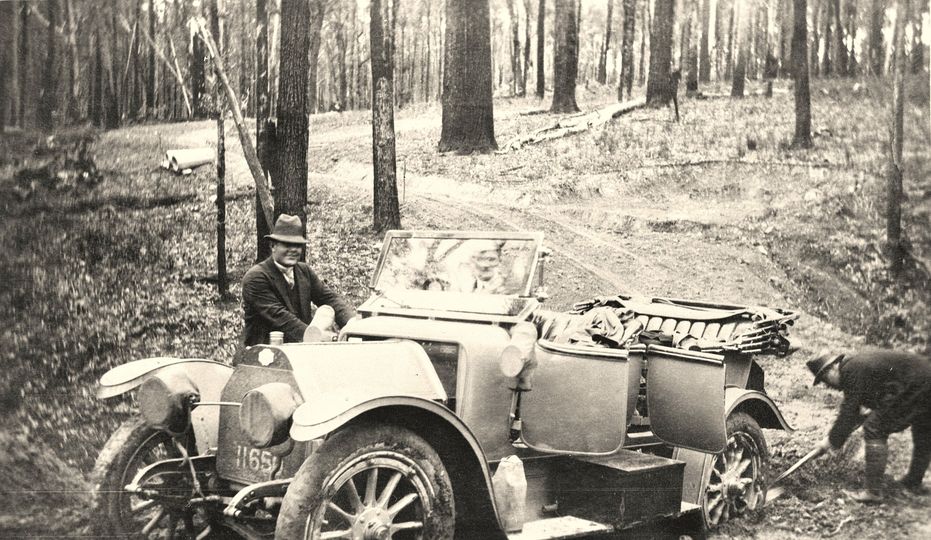
A Country Roads Board car bogged on the Princes Highway between Hospital Creek and Orbost, 25 October 1913. From the PROV Collection: VPRS 17684/P0003/137, 13_00168Using a “Spanish windlass” recover a bogged Country Roads Board car on the Princes Highway between Hospital Creek and Orbost, 25 October 1913. From the PROV Collection: VPRS 17684/P0003/140, 13_00169_AA Country Roads Board car in difficulties on a newly-formed, re-routed section of the Nowa Nowa-Buchan-Gelantipy Road, 21 October 1913. Part of the PROV Collection. VPRS 17684/P0003/121, 13_00144_B
Even before the gold rush of the 1850s, timber splitters invaded Victoria’s eastern forests including the Dandenong Ranges which were close to the city.
Mr. J. W. Beilby established a sawmill at Ferntree Gully in about 1850 and a small township sprang up around it. He later claimed that his was the first sawmill established in Victoria.
However, the credit for Melbourne’s pioneer sawmill can be attributed to Alison and Knight which started up in 1841.
The early explorers noted magnificent trees growing in the wet gullies of the mountains. The records are mostly unreliable and often exaggerated but one tree in the Dandenong Ranges was measured in 1859 by the Surveyor-General Clement Hodgkinson at 300 feet tall.
Mr George Washington Robinson, an early pioneer and later shire engineer who lived at Narre Warren between 1854 and 1862, is said to have measured several mountain ash at 340 feet or better.
However, indiscriminate and unregulated cutting by splitters and timber getters was continuing to have a major impact on the forests across the state.
The first legislative power to reserve timbered areas of the Colony was an amendment of the Lands Act in 1862 which enabled the Governor-in-Council to proclaim areas for the “preservation and growth of timber” A total of 116,000 acres were reserved under this provision.
In 1867 the State Government instructed John Hardy to survey a Timber Reserve in the nearby Dandenong Ranges. Hardy initially identified some 32,940 acres, but on 1 April 1867 a reduced 26,500 acres of the “Dandenong and Woori Yalloak State Forest” was officially declared.
A “Board of Lands and Works” was authorised to issue licences to cut timber inside the new reserves. The first recorded Crown Land Bailiff to be appointed to enforce the new regulations in the Dandenongs was George Charles Dickson in 1868.
But by 1878 the demand for land near Melbourne resulted in 10,000 acres the Timber Reserve sliced off and being made available for selection and private sale.
The clearing of land and felling of large trees for the new settlements easily supplied Melbourne’s timber demand so harvesting ceased in the government Timber Reserve for a time.
Later during Melbourne’s economic depression of the 1890s a further 10,000 acres of the Timber Reserve was made available by the Minister for Lands, John McIntyre for families to purchase and settle. The eastern Strzelecki Ranges in Gippsland was opened up at the same time.
The boundaries of the original Timber Reserve continued to be slowly whittled away until the Forests Commission finally took control of the State Forest in 1907 and the alienation of public land virtually stopped.
By the 1930s, most of the 26,500 acres of original the Timber Reserve had vanished. All that remained were some stream reserves, the Olinda Forest comprising 3326 acres and the Monbulk Forest (which included Sherbrooke) with a further 2050 acres. A parcel of 556 acres of the Timber Reserve had been set aside in 1882 as the Ferntree Gully National Park.
James O’Donohue was the first forester in the Dandenong Ranges from about 1915 and a small plot of pine trees was planted by him in Sherbrooke Forest which became a popular picnic ground.
Timber harvesting was regulated under licence including Sherbrooke Forest. There were tramlines in both Hardy and Monbulk gullies drawing logs to the trestle bridge near Belgrave and there was also a sawmill on Coles Ridge.
The public land area increased in June 1950 by another 689 acres with the purchase of the Doongalla estate at the Basin.
Following the 1962 bushfires the State Government embarked on a long-term land buyback program which saw the area of State forest increase, most notably on the fire prone western face of the Ranges.
There were other acquisitions including the historic Nicholas gardens.
In 1957, the Forests Commission set aside Sherbrooke Forest Park as the first of many parks and reserves including Lerderderg Gorge, You Yangs, Mt Cole, Grampians and Mt Baw Baw.
The Dandenong Ranges National Park was proclaimed in 1987 which consolidated all the public land under one tenure.
Source: Helen Coulsen (1959). The story of the Dandenongs.
Cubs, Scouts, Brownies and Guides all provide great outdoor adventure and leadership opportunities for young people.
Major-General Robert Baden-Powell started the movement in 1907 at a time when explorers were reaching the north and south poles, the Wright brothers were taking off at Kitty Hawk, and the first Model T Fords were rolling off the production line.
Scouts soon went global and by the end of 1908 eleven Scout Troops had formed in Victoria and the organisation continued to grow and thrive over the subsequent decades. Membership declined during the 1980s but from 2007 Scouts Victoria experienced a strong resurgence.
Lots of Forests Commission staff had either been scouts in their youth or volunteered as scout leaders later on. The relationship between the Commission and the scouts and guides was always strong.
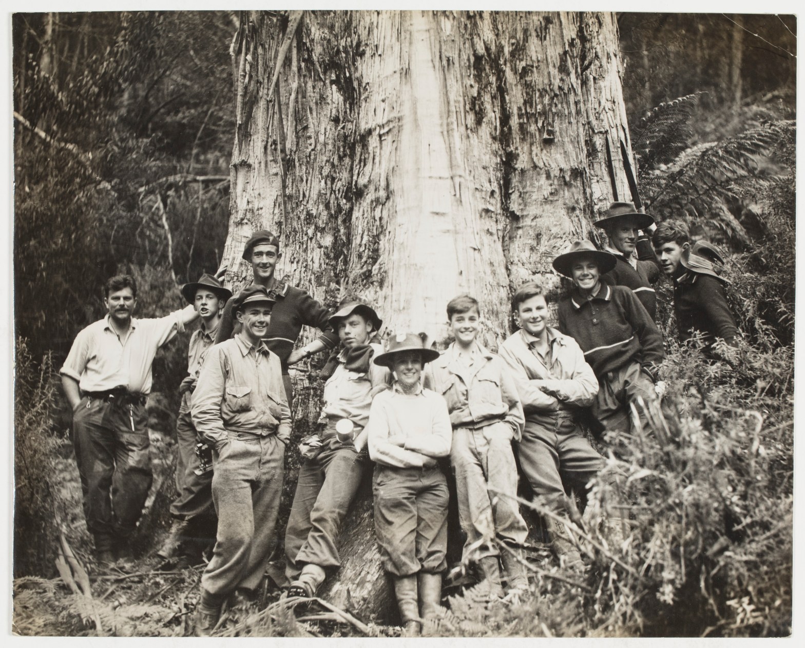
State forests near major scout camps like Gilwell Park at Gembrook and guide camps at Britannia Creek were always popular for overnight hikes and building elaborate contraptions made of wood, rope and canvas. Long bush poles and firewood were always in demand and the Commission was happy to oblige where it could.
Both scouts and guides always had a strong commitment to helping in their local communities. As an example, in 1971 the 1st Upwey Scout Group built a wooden fire lookout tower. The boys watched for smoke during the summer months and used instruments along with a sightline to the Emerald Water Tower and other mapped landmarks to plot the bushfire locations and report them to the local CFA Brigade.
The Chairman of the Forests Commission, Alf Lawrence, somehow found times in his busy schedule to occupy various leadership positions with the Victorian Boy Scouts, including Deputy Chief Commissioner in 1968. On Queens Birthday 1969, Alf was honoured with a civil Order of the British Empire (OBE) for his outstanding services to forestry and scouting.
I’m also pretty sure that being a Queen’s Scout had some influence on many applicants being offered a place in the Victorian School of Forestry.
Milk comes from cartons and water comes out of a tap… doesn’t it? I wonder how many people stop to think about where their water comes from?
The MMBW catchments supply Melbourne, but State forests have always been an important source of clean water for rural communities. One of the more innovative and unusual water supply schemes was at Stawell in western Victoria.
The discovery of gold in 1853 saw Stawell’s population rapidly expand which required a reliable water supply.
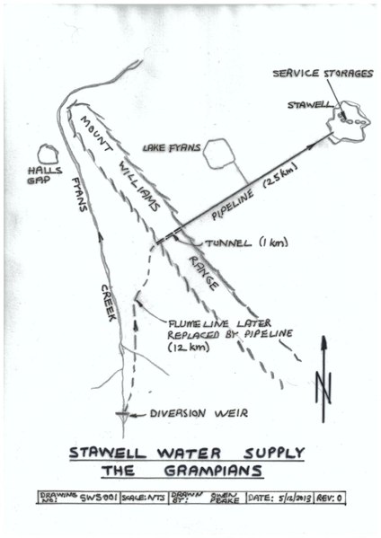
John D’Alton was the Borough engineer as well as the town valuer, surveyor and designer of several buildings, including the Stawell town hall. He devised a gravity scheme to bring water from Fyans Creek in the Grampians via a tunnel hewn under the Mt William Range.
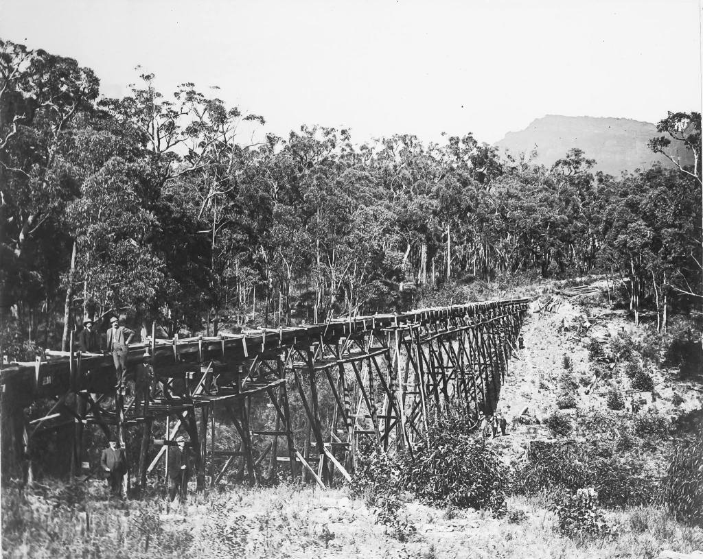
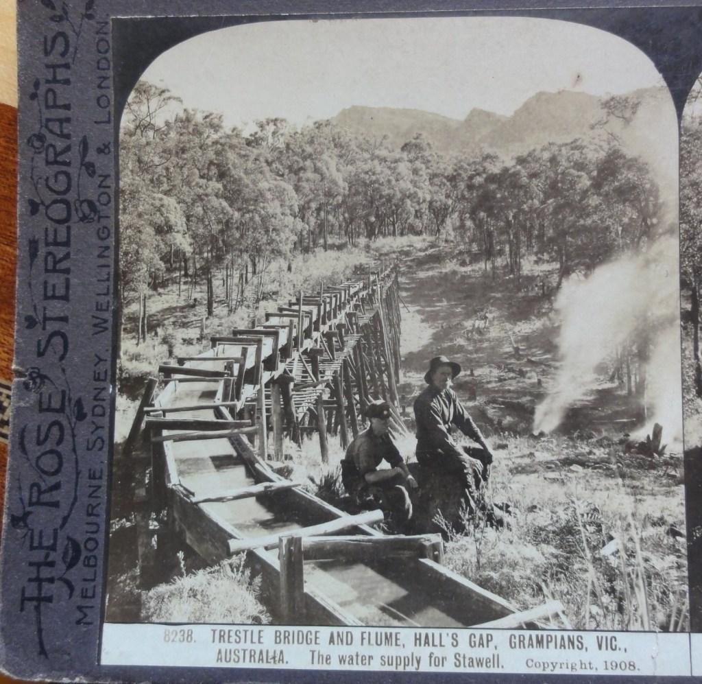
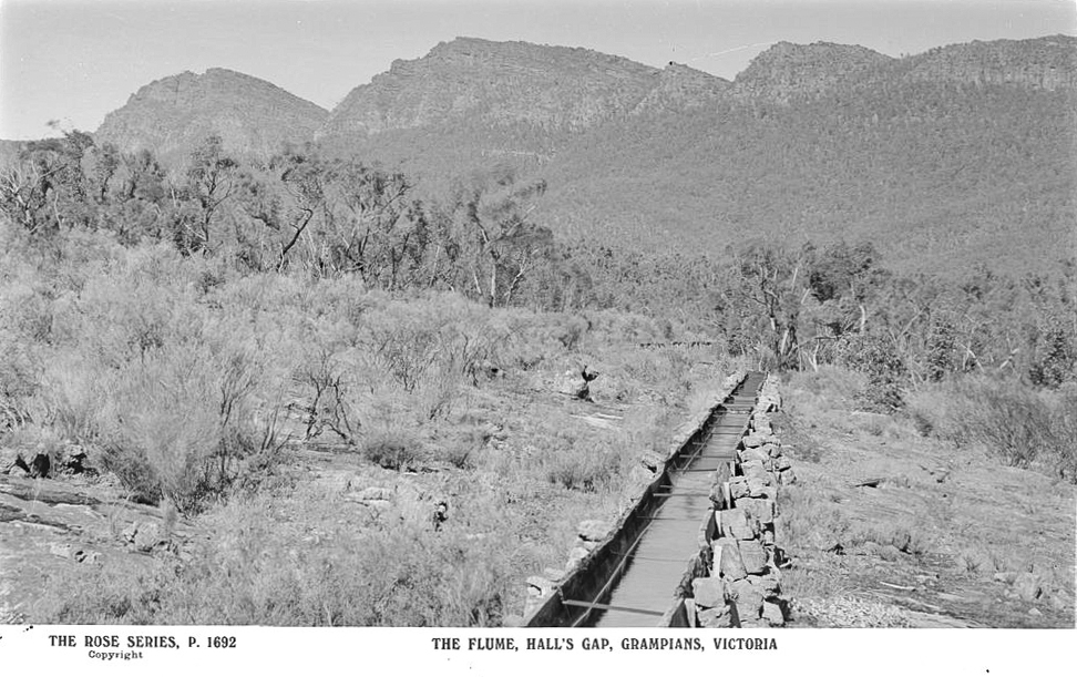
Work began in 1875 on a tunnel over half a mile long, which was linked to Stawell township by nearly 16 miles of pipes and syphons together with about 8 miles of open flume made of metal and wood.
Steam powered rock drills, labourers swinging picks and shovels as well as dynamite, which was used for the first time in Victoria, carved the tunnel through the sandstone rock under the mountains. Dynamite was safer and more effective than gunpowder and the tunnel is still in use.
The project represented a significant engineering achievement at the time and was completed in 1881.
The project bought workers into the area and a small township developed at Borough Huts. The first store was built at nearby Halls Gap in 1876. Holiday homes and Sanderson’s sawmill were also built, along with the workers cottages and a school operated in the 1890s.
Borough Huts was later used as a camp for relief workers during the 1930s depression and is now a large camping area.
Water flows in Fyans Creek were unreliable in summer and the Lake Bellfield storage was completed in 1969.
Associated Kiln Driers Pty. Ltd., or AKD Softwoods, was founded in 1955, with its Head Office based at Colac in western Victoria.
The Otway State forests to the south of Colac had supplied hardwood timber since the earliest days of European settlement with small sawmills cutting timber for housing, construction, railway sleepers, case timbers for food packaging, and for fencing.
But there was little or no value adding, drying, or machining at these small bush sawmills, although a couple of hardware stores and timber yards in Colac made picture frames, doors, windows, architraves as well as mouldings.
The War Service Homes Commission built a mill at Gellibrand in the early 1920s to cut weatherboards, while Hayden Bros established a seasoning kiln and planing mill at Barwon Downs in 1933, which ran until 1944.
When the Second World War ended, the housing boom kicked in, and local Colac sawmillers became concerned at a potential loss of their markets. They were seeing their green sawn timbers leave the area for Geelong or Melbourne only to be kiln dried and dressed before coming back to Colac and being sold at a profit by others.
In 1948, local sawmillers George Bennett and Stan Inglis together with timber merchant Harry Stephens tossed around the notion of value adding kiln dried hardwood timber.
The technology had become available at reasonable cost to kiln-dry wood but none of the local businesses were large enough to make it viable, so the idea of a joint venture, or co-operative, started to take hold.
Nothing much came of this idea until early 1954 when the Forests Commission Victoria (FCV) started making noises about future timber supplies from the Otways.
There were lingering concerns about Melbourne based sawmillers moving in, so the local branch of the Victorian Sawmillers Association (VSA) was stirred into action and began canvasing other local sawmilling companies about the co-operative idea, but with a variable response.
At the same time, the CSIRO Division of Forest Products was engaged to assess the feasibility and begin planning for a new seasoning kiln while the Commission examined how to allocate logs under a co-operative licencing arrangement.
And so it came to pass, that on Melbourne Cup Day, 2 November 1954, George Bennett, Stan Inglis and Tom Prosser formed a new company to carry out kiln seasoning of local hardwoods at Colac.
And that was the start of AKD.
Membership of the new co-operative was open to any registered VSA sawmiller in the Southwest Branch who agreed to contribute sawn timber to the kiln for seasoning. Seven sawmill companies formally entered at a foundation Board meeting held on 5 August 1955, and George Bennett was voted the inaugural Chairman.
The company then purchased a parcel of land at Colac east, an irregularly shaped block near the railway line, within an existing sawmill precinct. The plans and specifications for the new works were devised by the CSIRO’s Division of Forest Products under the guidance of Hal Roberts.
Construction tenders were called which were awarded to Todd & Kerley in association with Kiln Installation and Equipment Pty. Ltd. and work commenced in March 1956.
There was an official opening on 28 February 1957 by the Hon Gordon McArthur, MLC and Minister for Forests.
Together, the shareholders commanded around 16,500 cubic metres of hardwood sawlogs, all of which were coming from FCV allocations in the Otway State forests. The select grades of sawn timber were delivered into the AKD yard at Colac, principally as 6 x 1 inch boards.
Earlier in 1949, the Commonwealth Forestry and Timber Bureau proposed an ambitious national planting program of pine trees to make Australia more self-reliant in timber after the shortages experienced during the second world war.
However, the big leap for Victoria came in 1961, when the Chairman of the Forests Commission, Alf Lawrence, attended the World Forestry Conference in São Paulo Brazil, and upon his return took a bold decision to commit to a massive softwood expansion program which initiated nearly four decades of plantation establishment.
The Commission decision created a new wave of momentum and private investment optimism. The softwood plantation area eventually reached a threshold where manufacturers could confidently establish major processing plants.
Also, from 1961, the Forests Commission began to implement its foreshadowed cuts to hardwood log allocations from the native forests in the Otways.
Commissioner, Ben Benallack, had warned AKD from the very outset that there was no strategic future in hardwoods and that it should move into softwoods.
The writing was on the wall, so in August 1957 a test consignment of 100 m3 of pine from the Forests Commission’s Aire Valley plantation was dispatched for processing to the new Colac plant, but with disappointing results. Pine was re-examined again in 1959 with a better outcome.
The late 1950s period marks AKD’s strategic shift away from native forest hardwoods and was the lever to full dependence on softwoods. But the transition to sawing, drying, processing and selling pine was not without its bumps and hurdles.
The long-term security of raw materials was always a major concern for AKD. Initially, logs were supplied from FCV plantations, some private sources, as well as farm logs.
AKD began acquiring land for its own plantations in 1972 and calculated that it needed to plant about 80 ha per year, every year, well into the future. By 1976 AKD held 1,000 ha and was aiming for 3,700 ha. After some strategic purchases, it now owns a 12,000 ha radiata pine estate.
The company at Colac draws wood from the “Green Triangle” which spans the border area between South Australia and western Victoria. Other major private growers include Forestry-SA, Auspine, Hancock Victorian Plantations (HVP), Timbercorp and ITC.
The green triangle region grows around 160,000 ha of mature softwood plus another 110,000 ha of short-rotation hardwood plantations, which were mostly established from the mid-1990s.
Victoria now has 382,600 hectares of privately owned and managed plantations, making up nearly a quarter of the national total.
In the decades since its formation in 1955, Associated Kiln Driers grew steadily and diversified to employ over 1100 people. The company owns a large plantation estate, as well as six large scale sawmills across Victoria, New South Wales and Queensland processing nearly 1 million m3 of logs. It also has three post and preservation businesses, an export operation in Geelong and its own transport fleet.
A major regional success story by any measure.
Photo: Founding members of AKD.
Norm Haughton (2016). The AKD Softwoods Story: 1954 to 2016. Unpublished.
The Australian Seasoned Timber Company (ASTC) operated in the Mount Disappointment State forest, 37 miles north of Melbourne, between 1880 and 1902.
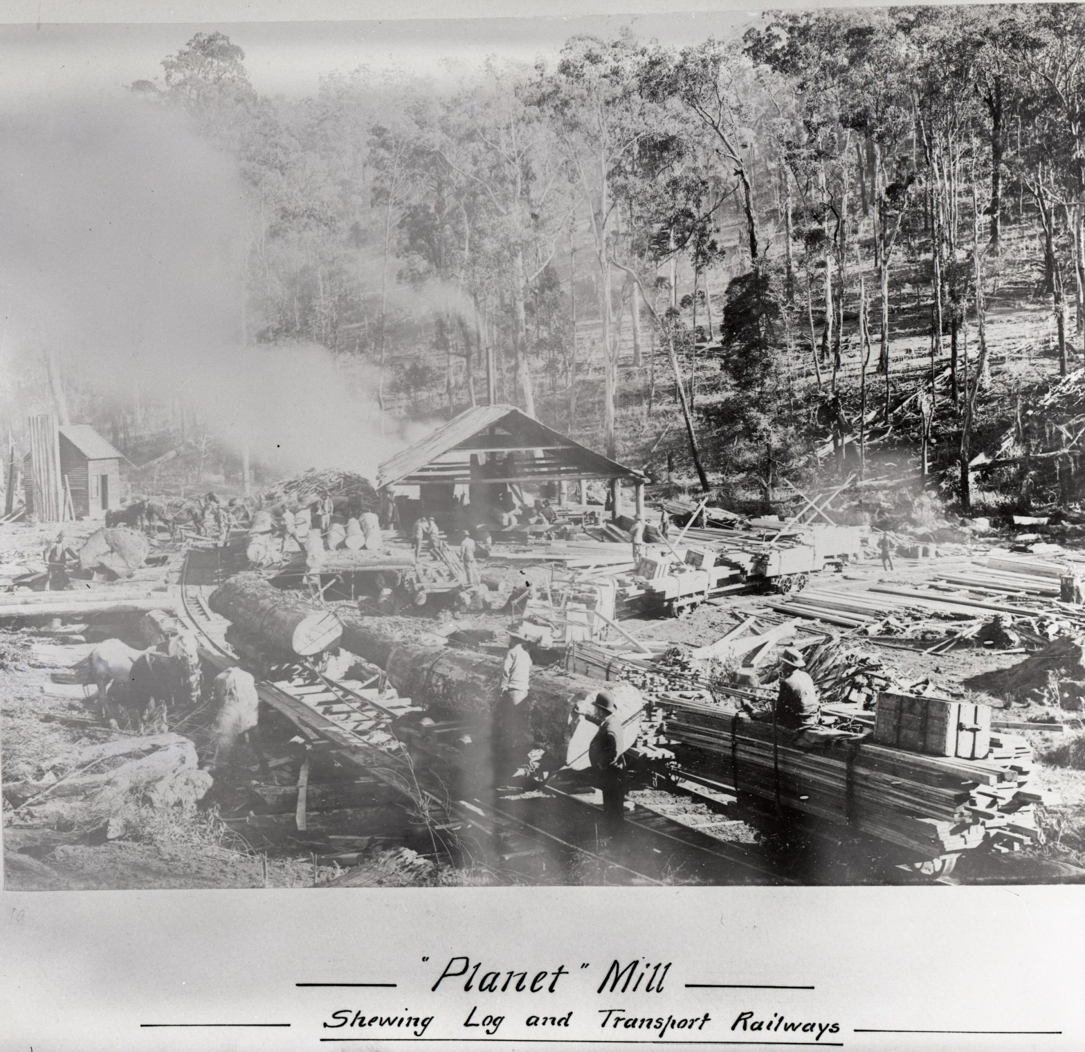
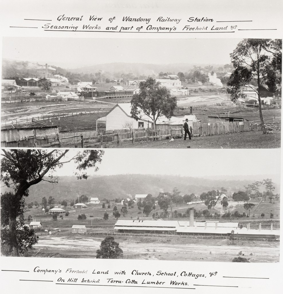
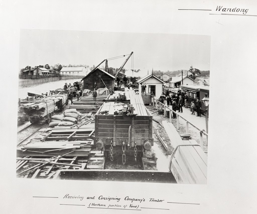
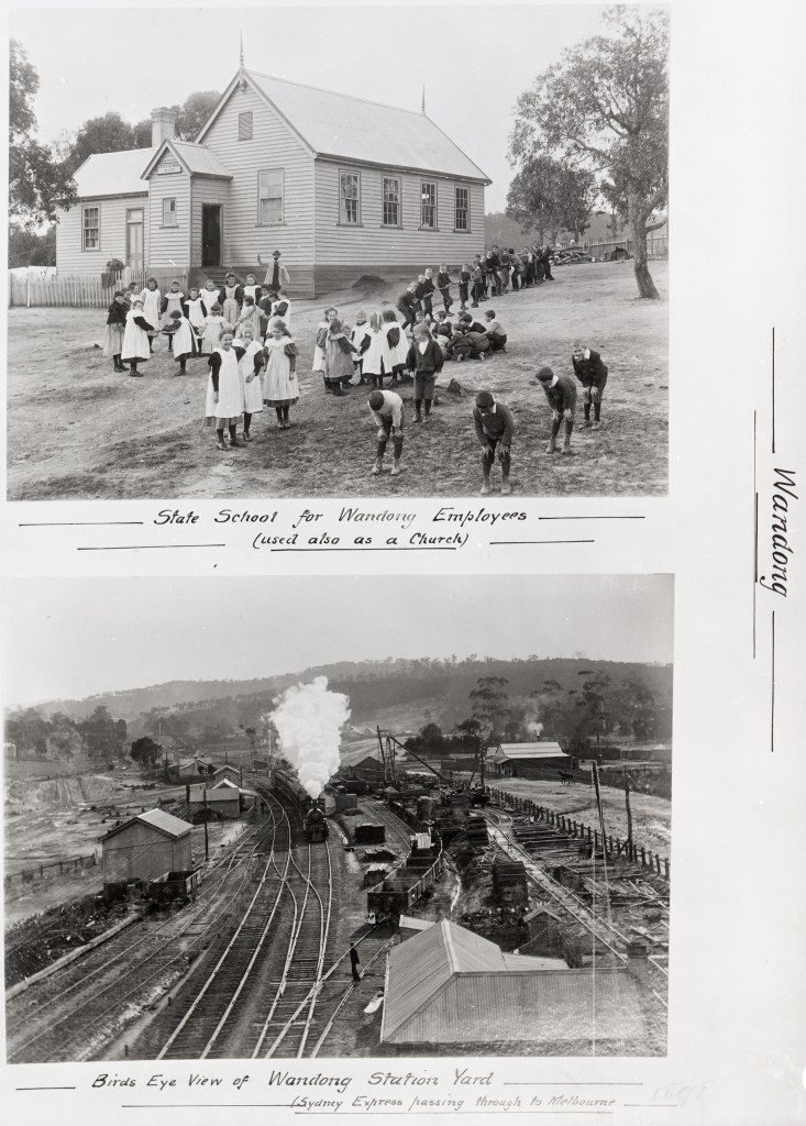
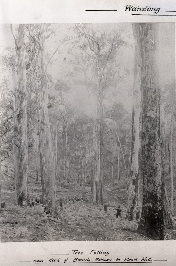
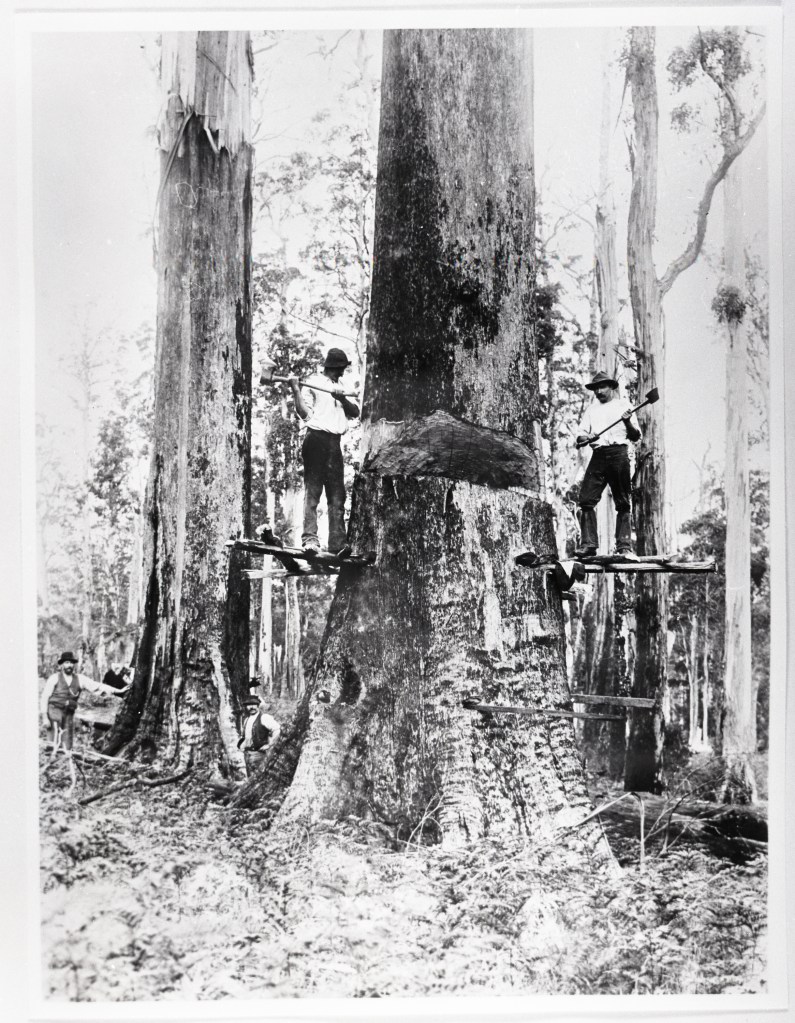
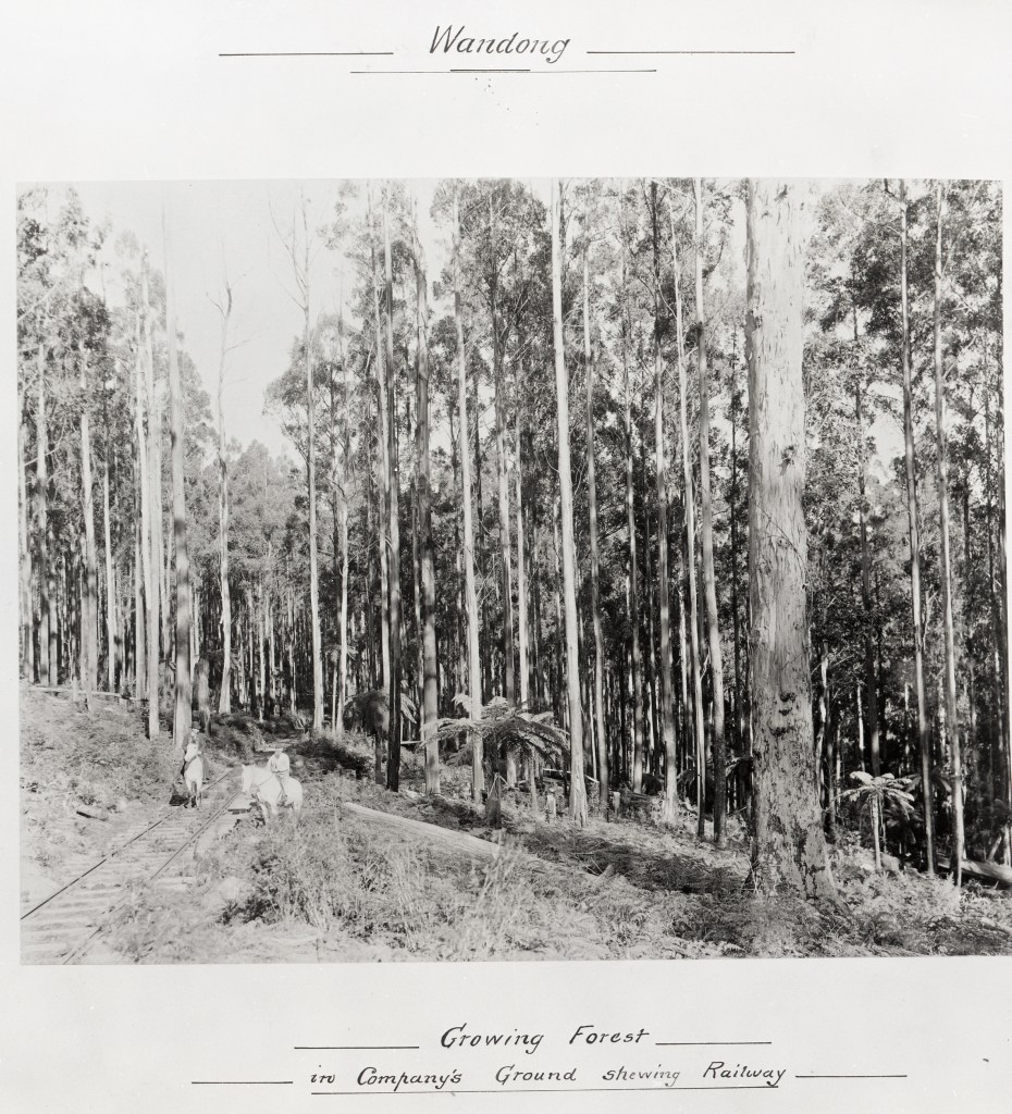
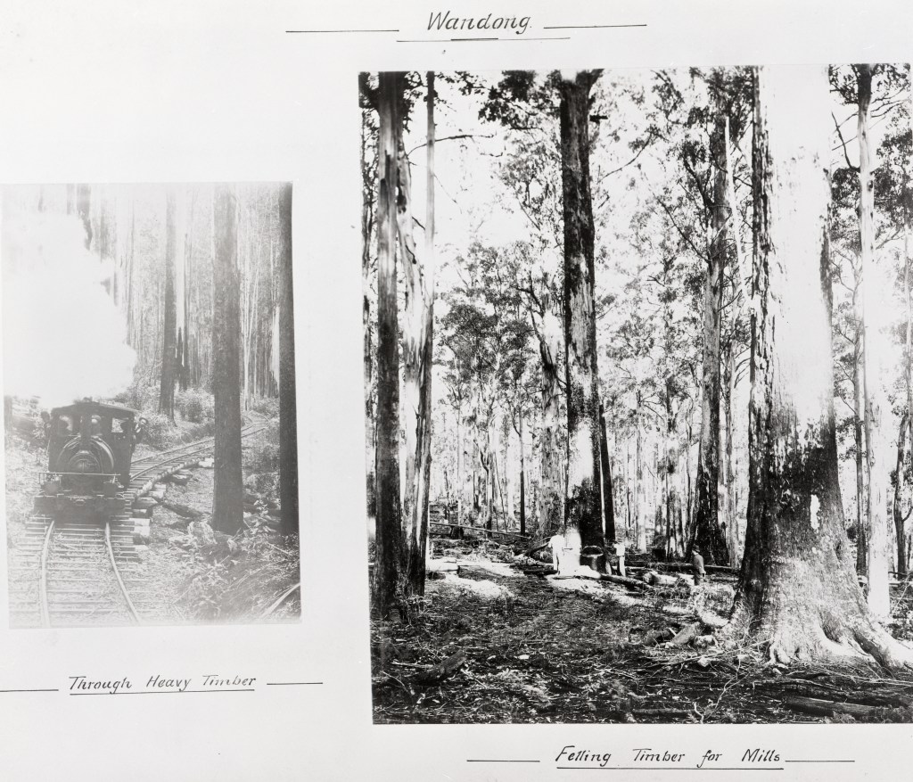
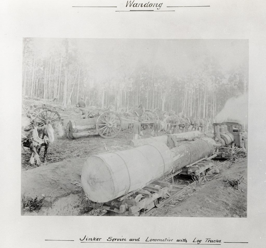
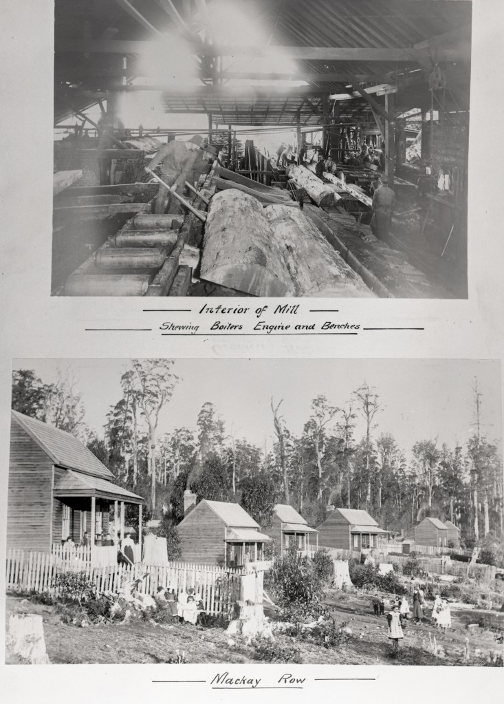
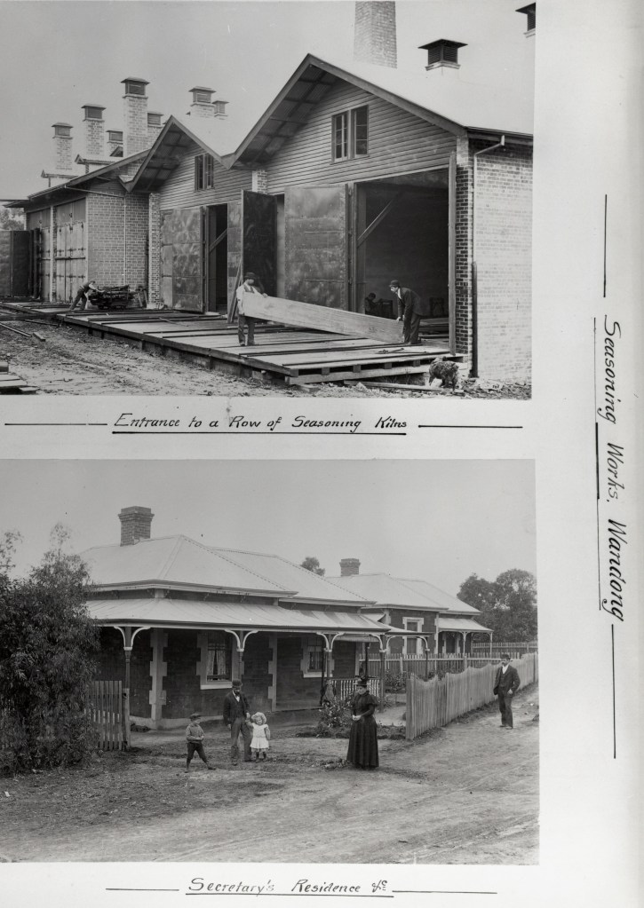
It was said to be the largest sawmilling and timber processing company in the southern hemisphere at the time. It owned several sawmills, along with an extensive network of tramlines supplying timber directly from the bush to a large seasoning and joinery works at Wandong west of the mountain range.
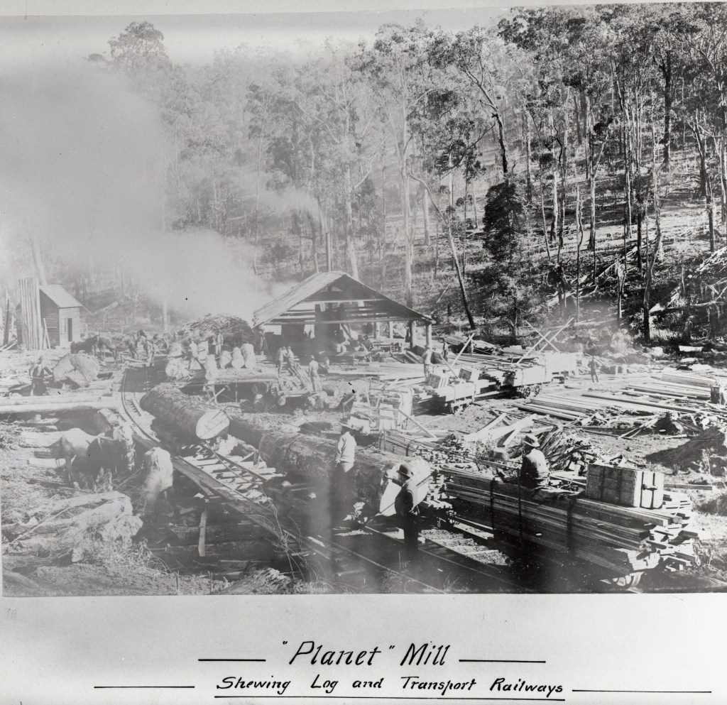
Robert Affleck Robertson, who immigrated from Canada in 1879, started sawmilling in the Ballarat/Bullarook region before moving to the Plenty Ranges in 1883. He soon acquired small sawmills and constructed others in the Mount Disappointment forest including the Derril, the Comet, Planets 1 and 2, and the Bump.
The company later grew and diversified to operate sawmills at Yarrawonga in Northern Victoria and Warburton east of Melbourne.
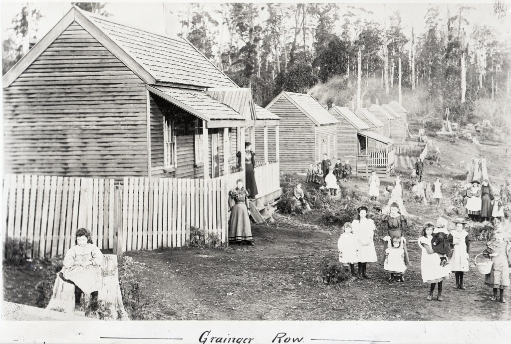
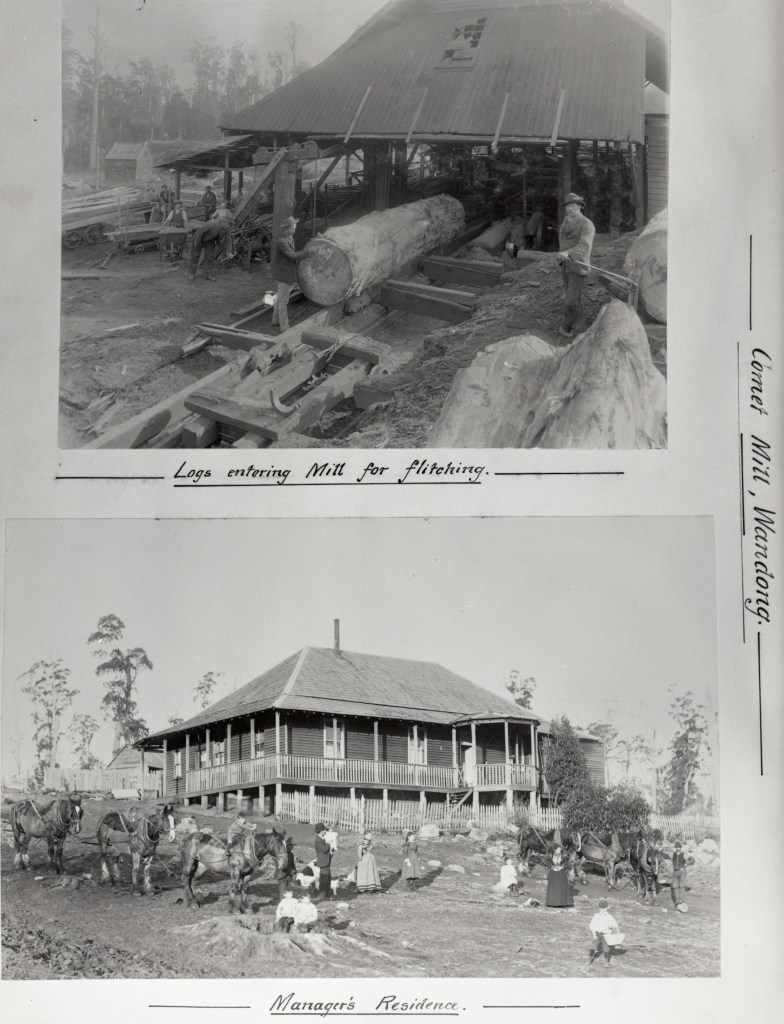
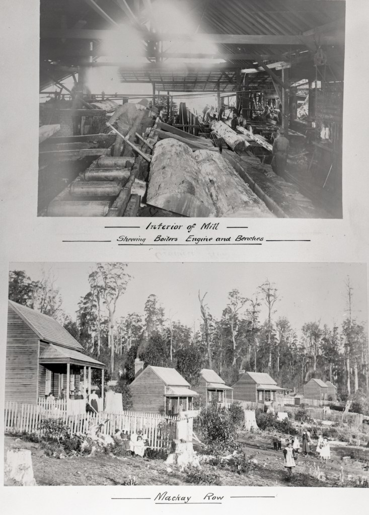
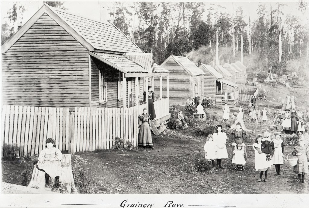
The Comet sawmill was the company showpiece at Mt Disappointment and expanded rapidly during the 1890s processing over 800 logs a month. A thriving community developed with 300 workers and their families. There were rows of cottages, a boarding house, butcher, general store, bakery and about twenty children attended the State School.
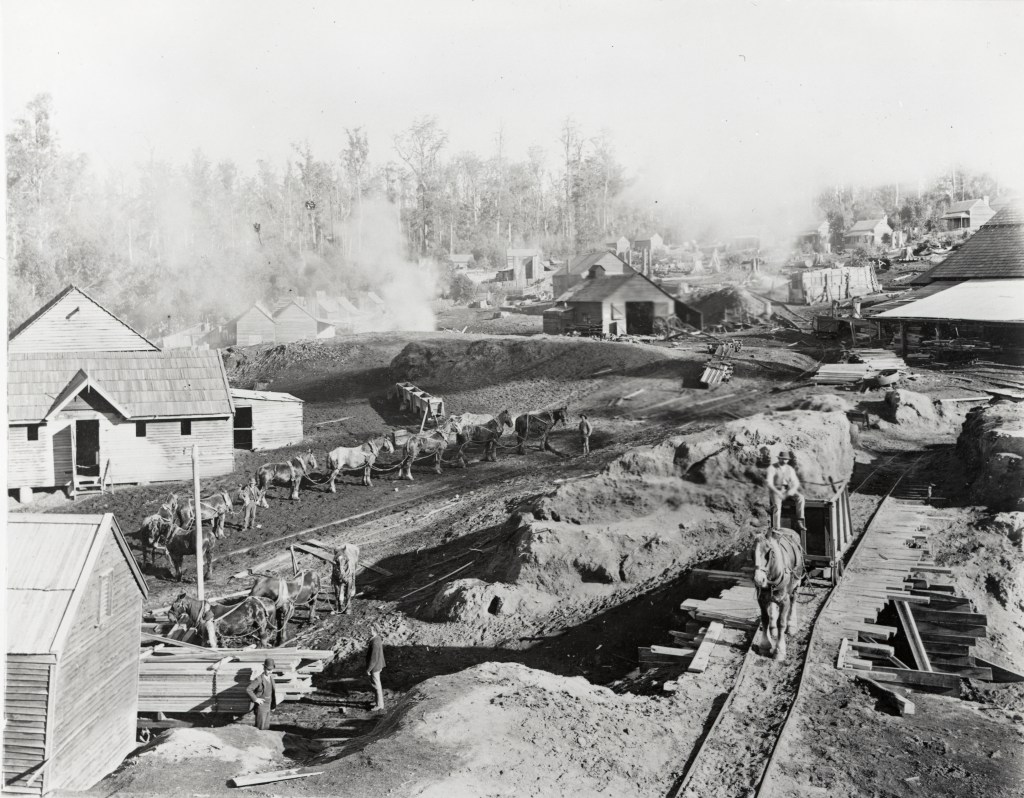
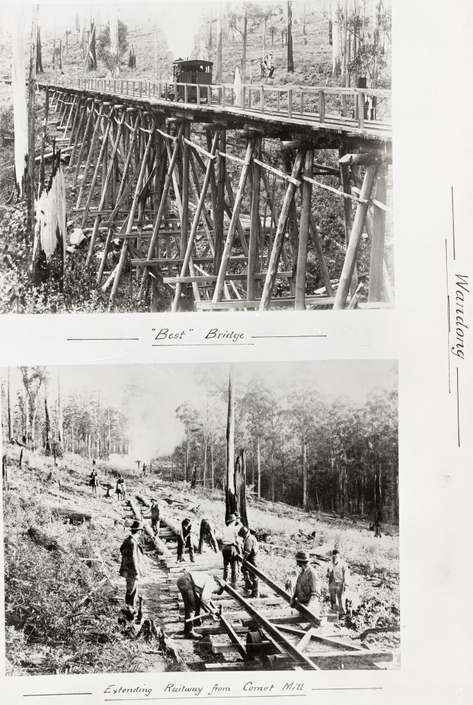
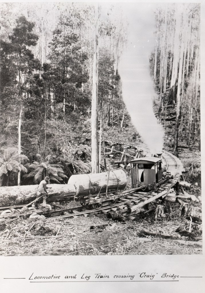
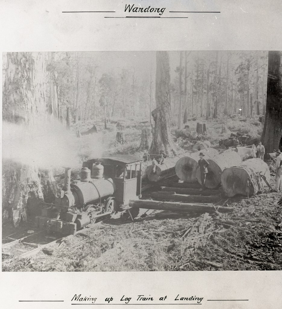
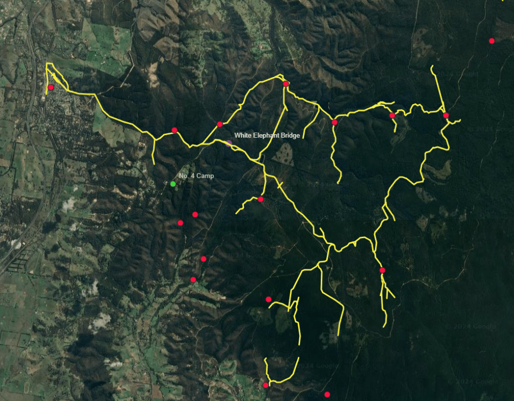
Sawn timber and logs on trolleys were pulled along 11 miles of steel track from the Comet Mill, past Planet 1, Planet 2 and the Bump mills to Wandong.
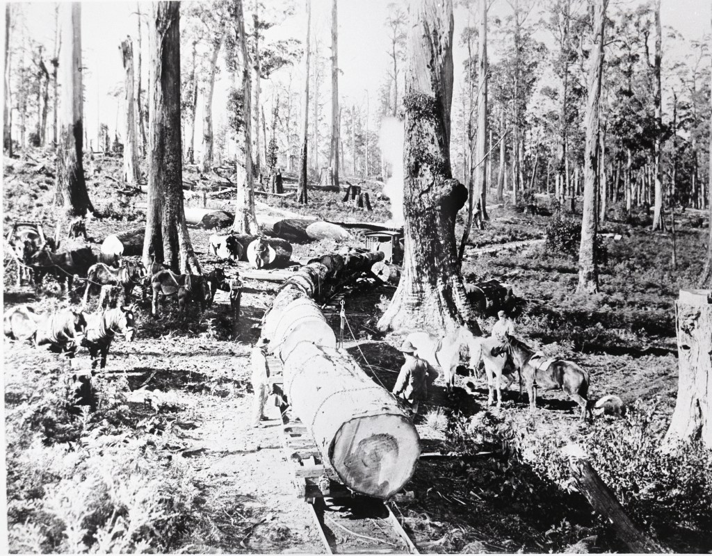
Horse teams pulled timber on the first 7 miles of tramline between Comet Mill and the Bump following gentle grades along Wescott and Sunday Creeks.
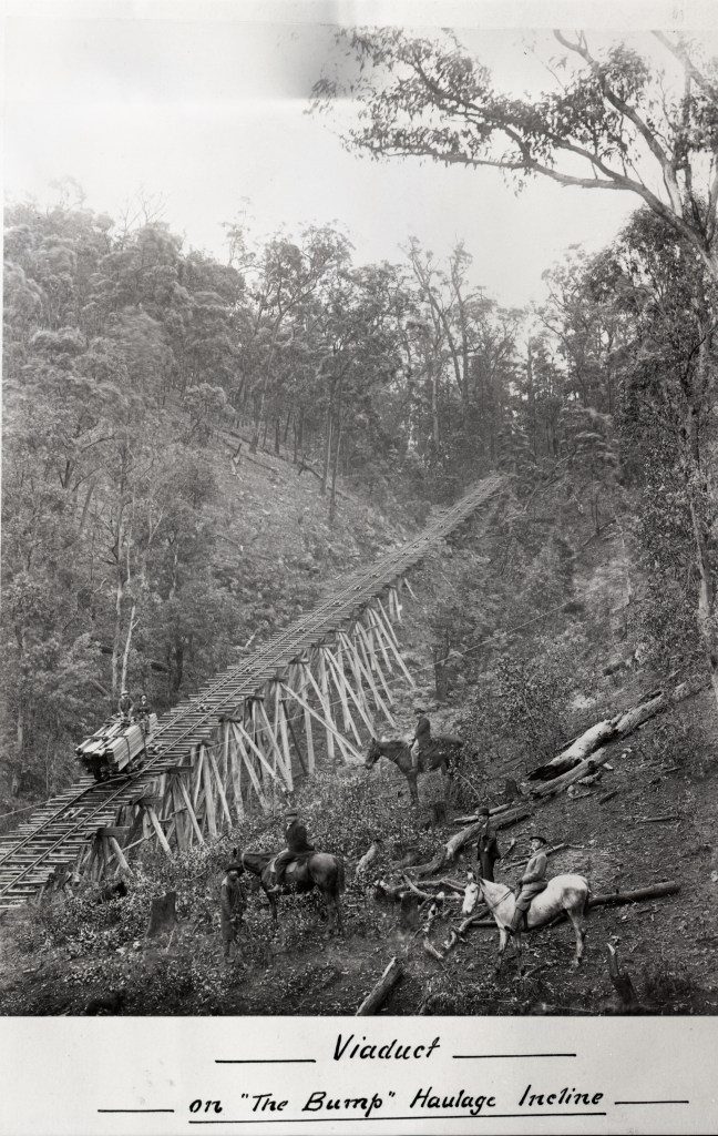
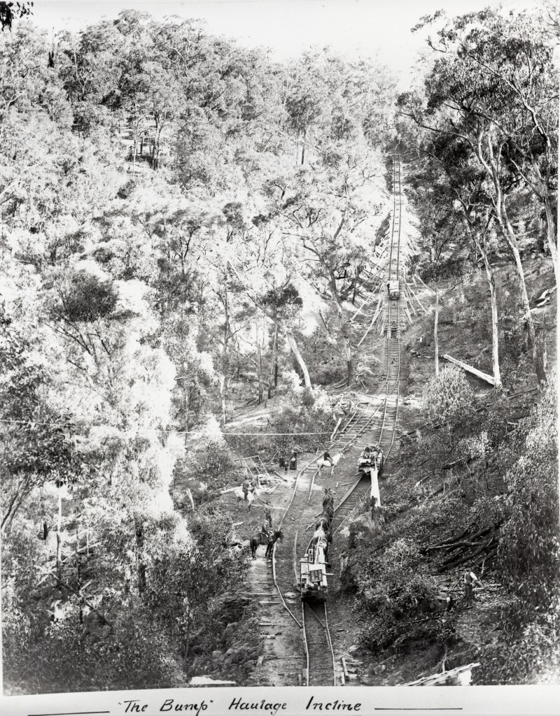
Then there was a notorious section of line called “The Bump Incline” with a steam winch to haul timber over the steep hill. Trollies were then let to roll the last 4 miles into Wandong under gravity with a skilled brakeman sitting on top of the load.
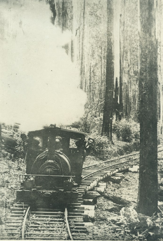
Horses pulled the empty carriages on the return journey from Wandong back to the Bump. A small Baldwin steam locomotive later replaced horses on this section of line.
Maybe to curry favour with the State Government, the company built the Best Bridge over Sunday Creek and named it after the Minister of Lands, Robert Wallace Best.
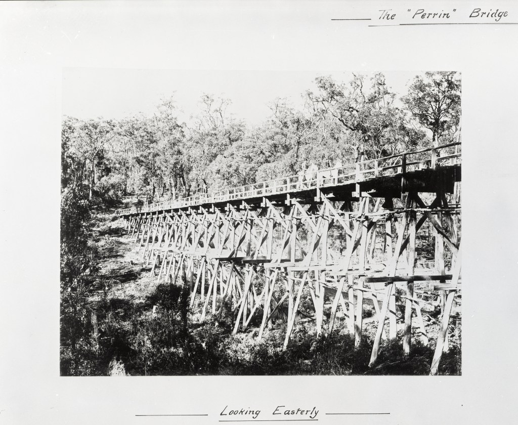
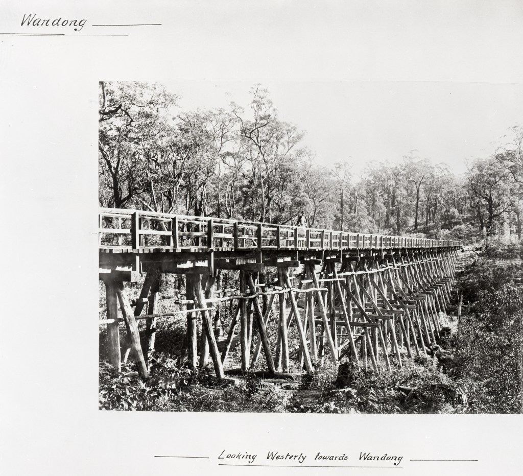
The company began building a new section line to avoid the bump incline which included a magnificent wooden trestle bridge, a quarter of a mile long, 52 feet high and with 10-foot decking, complete with hand railing and other trimmings over a deep gully. It was constructed by Lee Brothers, specialist bridge builders in Victoria of the time. The bridge was named after George Samuel Perrin the Commissioner of the Forest Department. It was also known as the white elephant bridge because it was never used by the company before it folded in 1902.
However, the Perrin Bridge was later used by another sawmiller, Jack Harper. It was damaged by fire in 1916 and repaired but then was completely destroyed by the 1929 bushfires.
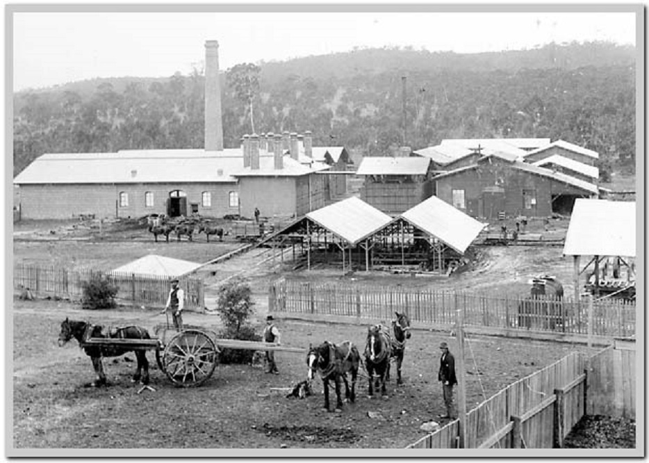
Robert Robertson had always been a keen innovator and astute businessman. Seasoning (drying) of Australian eucalyptus wasn’t well understood in the 1880s. A relatively new process patented by Leon Rieser came to his attention at an exhibition in Melbourne where he displayed ten-day-old seasoned timber and parquetry boards.
Robertson seized the opportunity and within 48 hours had acquired all the Australasian rights for the process as well as recruiting Reiser in a partnership to set up new kilns and joinery works at Wandong.
Messmate (E. obliqua) was the species of choice for seasoning rather than the more abundant mountain ash (E. regnans). It wasn’t until the Forests Commission opened the Newport experimental seasoning works in 1919 that techniques for kiln drying and steam reconditioning of mountain ash were fully developed.
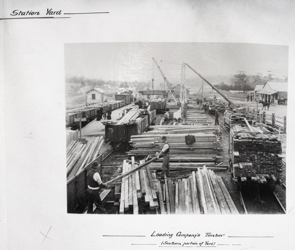
The company owned most of the Wandong township and the railway station grew with several sidings to load and transport seasoned timber to Melbourne.
However, poor management and shareholder dissatisfaction, rather than a lack of timber resources, led to the company and its assets being liquidated in 1902.
As a result, the Comet Mill closed with the machinery dismantled and sent to Western Australia, although some of the foundations of the mill can still be found among the tree ferns. The site of the Planet Mill was flooded under the Sunday Creek Reservoir.
Huge sawdust heaps in the bush are remaining evidence of a thriving sawmilling past. Remnants of the ASTC tramways can still be found in the forest and near Wandong, although many were destroyed by fire in 1982.
The Otway Ranges is characterised by steep terrain, wet weather and thick forest.
An early but unsuccessful attempt was made between 1854 and 1861 to bring Blue Gum (Eucalyptus globulus) railway sleepers to Melbourne in small coastal ships from the Otway Ranges. The voyage was perilous because there were no suitable harbours, and relics of old piers at Wye River and Kennett River still exist.
However, with the completion of railway lines from Colac to Forrest in 1890, and later with an extension to Beech Forest in 1902, sawmilling in the Otway Ranges began to expand.
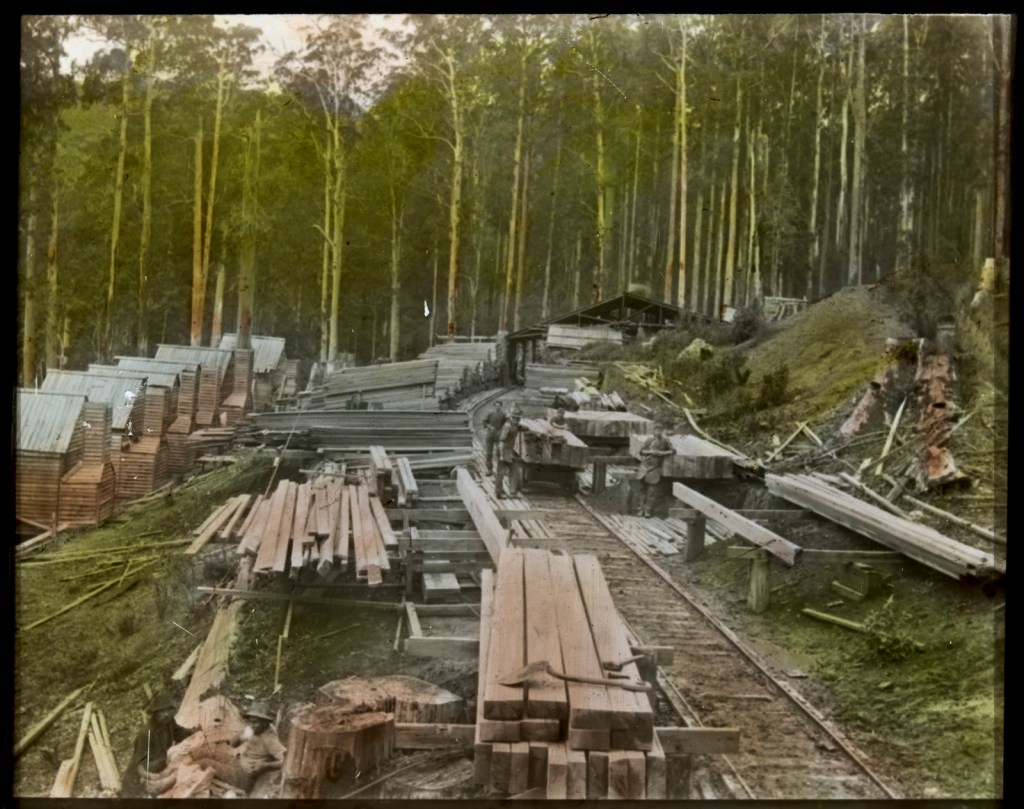
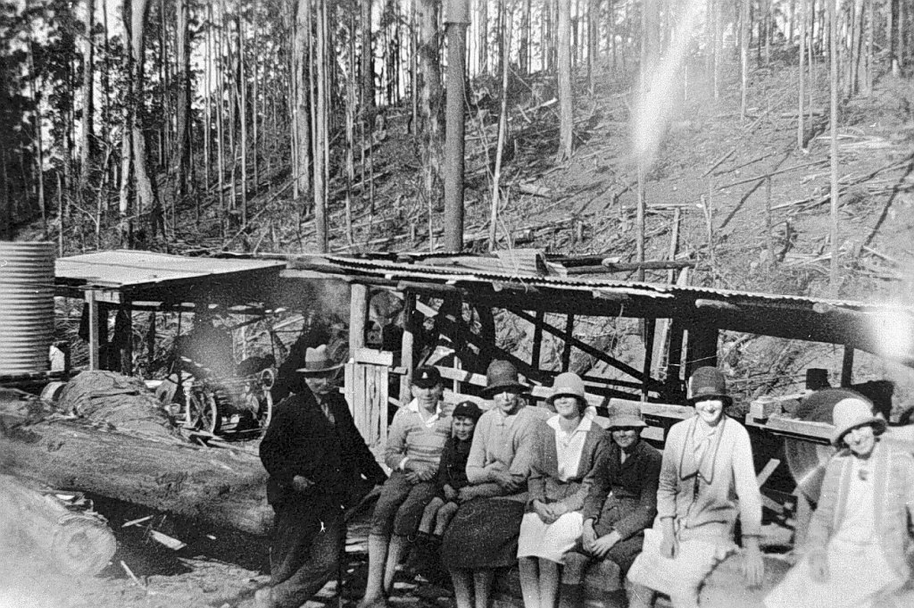
The sawmills were mostly small, isolated settlements established in the forest closer to the timber resources because it was easier and more efficient to cart sawn produce to a railhead rather than heavy logs.
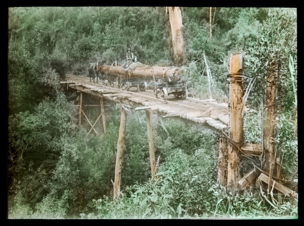
In the end, as many as 400 itinerant sawmills were scattered throughout the bush, linked by over 400 km of timber tramways to roads or rail lines.
William R. Henry was a plumber by trade who had been successful at the Kalgoorlie and Ballarat goldfields before buying into the sawmilling business in the Otways.
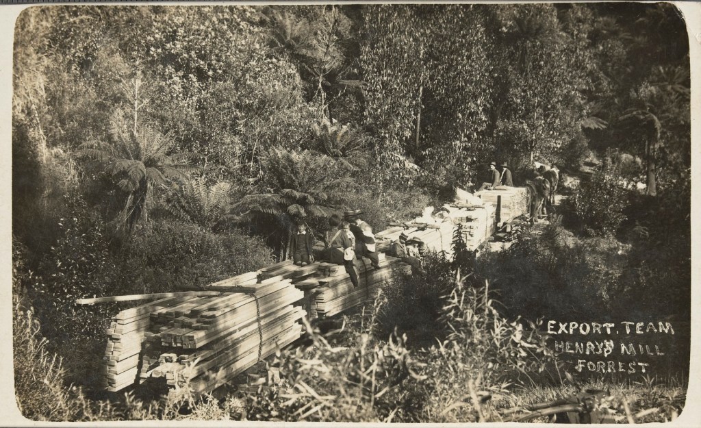
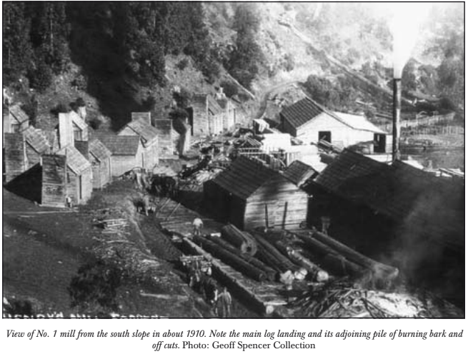
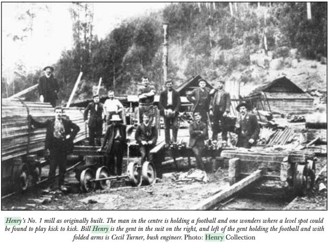
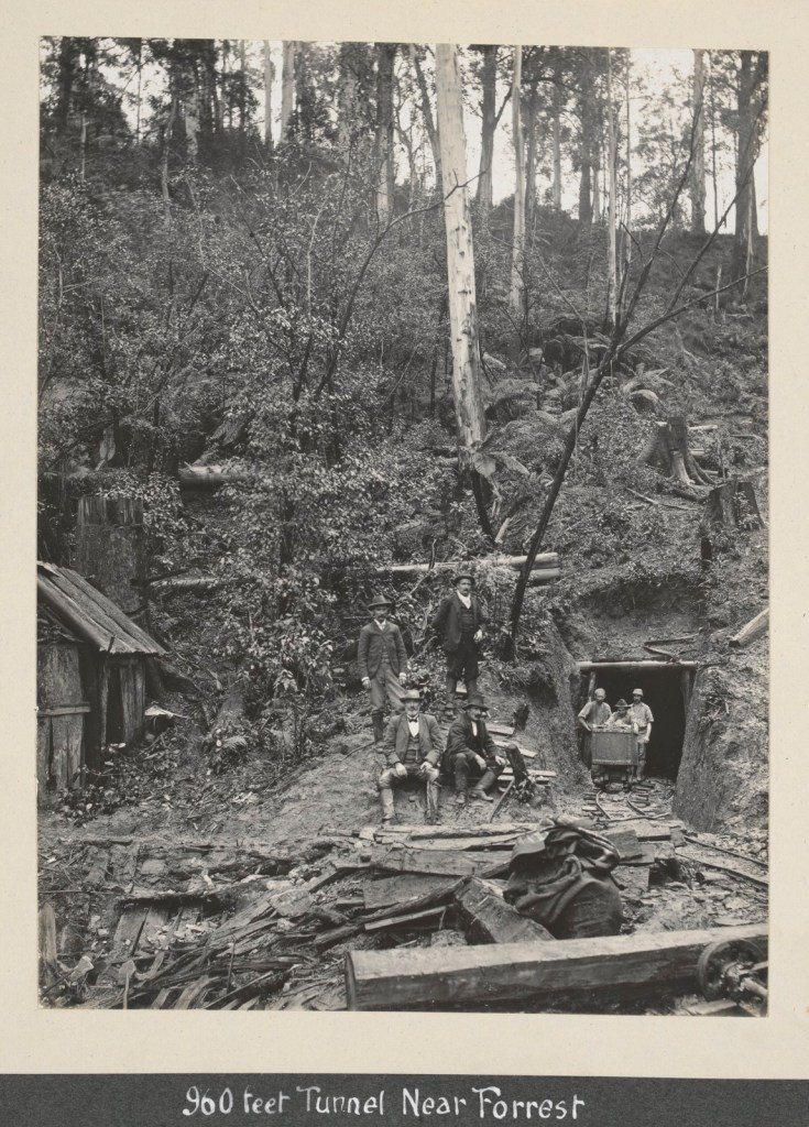
Henry’s No. 1 Mill was established in 1904 deep in the watershed of the West Barwon River. It was one of the largest sawmills in the area and could cut as much as 23 m3 per day. It was connected by a narrow-gauge timber tramline to the railhead at Forrest, ten kilometres to the north. The line included about 57 timber bridges and an impressive 960 foot tunnel at Noonday creek. Several steam engines rode the tracks, the first one in 1911 was known as Tom Thumb.
The Henry Mill had a permanent population of around 100 people and the settlement featured about 30 rough timber huts for single men and modest wooden houses for married men and their families. It also had with a boarding house, stables, school, billiard saloon, baker, store and post office complete with its own franking stamp.
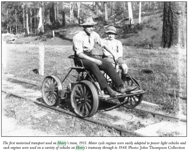
Mail was transported to the mill on a four-wheel trolley powered by 600cc motorcycle engine with a Harley Davidson gear box.
The whistle at the mill was an ex-naval foghorn which was said to be so loud that the entire region could set their clocks. It’s also claimed it could be heard as far away as Bass Strait and became a hazard to shipping.
There were several other Henry sawmills along the line as part of his growing enterprise. But floods, landslips and bushfires all had a major impact on bush sawmills, including those in the Otway Ranges.
From the 1940s, the advent of more powerful bulldozers, crawler tractors, geared haulage trucks and petrol chainsaws dramatically changed logging practices. Diesel and roads were rapidly replacing steam and rails. The newly built and expanded Forests Commission road and track network made it feasible for trucks to haul logs directly from the forest to town-based sawmills within a few hours.
The memory of the loss of 69 forest sawmills and 71 lives in the 1939 bushfires together with Judge Streeton’s Royal Commission recommendations were still fresh. And despite strong and vocal opposition, the Commission refused to allow new sawmills to be rebuilt inside the forest as they had before 1939. But those few that still existed were permitted to remain…. for a while anyway.
Photos: State Library Victoria
Sawdust and Steam. A History of Sawmilling in the East Otway Ranges. 1850-2010. Norman Houghton. 2011
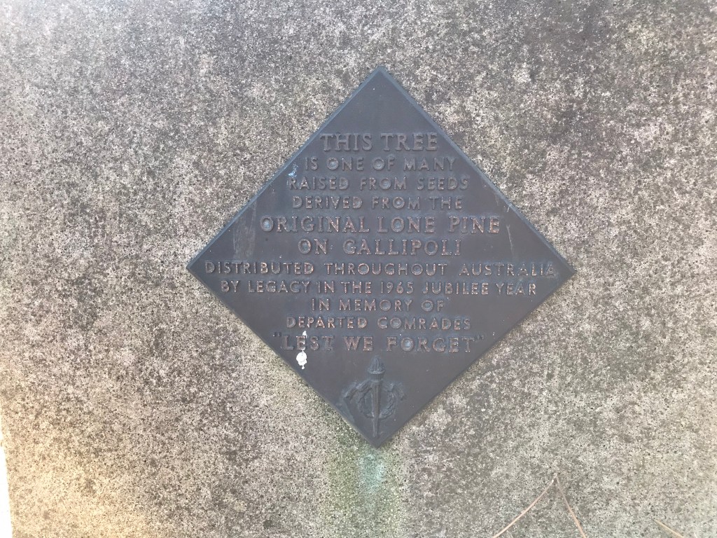
The battle of Lone Pine at Gallipoli is deeply etched in the psyche of Australians, New Zealanders and the Turks. It took place between 6 and 10 August 1915 with tragic losses of over 2,000 ANZACs and a further 7,000 Turkish soldiers.
Over the decades the battle became increasingly symbolic and many memorial parks in towns and cities around Australia were planted with a specimen or grove of “Lone Pines”, usually said to have been propagated from the original tree.
But there is an intriguing and little-known puzzle about the true botanical identity of the original Lone Pine. There are, in fact, three species that can claim some connection to the historic battlefield. You can read more in the Wikipedia story.
The original Lone Pine tree was a Turkish Pine (Pinus brutia) which stood on a prominent ridge and was a reference point for soldiers on both sides until it was destroyed by gunfire.
Turkish Pine is native to the Gallipoli Peninsula and scattered specimens grew across the hills of the battlefield and all the trees, except the famous one, were cut down by the Turks for construction of their defensive trenches.
Sergeant Thomas Keith McDowell collected a cone from this tree and put it in his knapsack, where it remained until he returned to Victoria after the war.
About 10 years later, four seedlings were successfully raised by Emma Gray of Grassmere near Warrnambool using the remaining seeds from the cone that Keith brought back.
The seedlings were planted at Wattle Park in Melbourne (8 May 1933), the Shrine of Remembrance (11 June 1933), the Soldiers Memorial Hall at “The Sisters” near Terang (18 June 1933) and the Warrnambool Botanic Gardens (23 January 1934). Only the pines at Warrnambool and Wattle Park now survive.
In 1964, the President of Warrnambool Branch of Legacy Australia, Tom Griffiths, proposed at its Perth Conference to raise and distribute seedlings of the Lone Pine in time to mark 50 years since the Gallipoli landings.
The project was strongly supported by delegates and some cones of Pinus brutia were collected from trees at “The Sisters” and the Warrnambool Gardens and sent to Ben Benallack at the Forests Commission in Melbourne. But the species is notoriously difficult to grow, and the seeds failed to germinate.
The Melbourne Branch of Legacy collected more cones from the Lone Pine tree near the Shrine of Remembrance and, this time, about 150 seedlings were successfully raised at the Forests Commission’s nursery at Macedon under the direction of Dr Ron Grose, Director of Silviculture.
One of these original seedlings was planted at the Victorian School of Forestry at Creswick in 1965. The tree was later dedicated with a plaque by the RSL in 1975.
Disappointingly, the top was busted in 1976 by some over overly exuberant students on their way home from the Farmers Arms Hotel late one night.
The spindly tree is still alive but has struggled to thrive in the overcrowded arboretum. It can be found near the pathway leading up the hill from the Alexander Peacock Gates to the main school building.
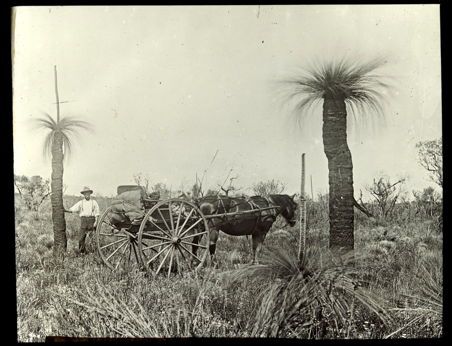
The austral grasstree (Xanthorrhoea australis) is commonly found growing in heathlands on poor sandy soils along the east coastal strip from NSW to SA, as well as Tasmania.
They are highly susceptible to the soil-borne disease Phytophthora cinnamomi.
In 1882, the Victorian Inspector of Forests William Ferguson made a field survey of the Heytesbury Forest in the south-west of the state. It was estimated there were 60,000 acres of grasstree plains thought to be of little commercial or agricultural use.
The Aboriginals had long made use of the grasstree resin and some early settlers were quick to realise its potential.
On the goldfields, hollow stems were used for makeshift waterpipe.
The resin was very versatile and could be used for making industrial alcohol and cheap lacquer for furniture and floors. It was used as a coating on brass instruments and for preserving cans of meat; as stove polish; as a sealing wax, caulking for boats, church incense, sizing paper, perfumery, soap and even making gramophone records.
On treatment with nitric acid, the resin also yields a large quantity of picric acid. There was community outrage when it was learned that in the three years prior to World War I, Germany had imported approximately 1500 tonnes of grass-tree resin suspected of being used to manufacture explosives.
There were a couple of unsuccessful attempts to commercialise the grasstrees at Heytesbury.
But in about 1908, the Victorian Department of Agriculture cleared 1000 acres to establish an experimental farm and as a result some land was made available for selection. The first scheme was deemed a failure, but it was followed by a much larger land clearing program in the 1950s using modern heavy machinery.
Meanwhile, the Forests Department had long opposed applications land clearing and commercial grass tree harvesting in an attempt to protect commercial quantities of timber at Heytesbury.