Rural Water Supplies.

Milk comes from cartons and water comes out of a tap… doesn’t it? I wonder how many people stop to think about where their water comes from?

The MMBW catchments supply Melbourne, but State forests have always been an important source of clean water for rural communities. One of the more innovative and unusual water supply schemes was at Stawell in western Victoria.

The discovery of gold in 1853 saw Stawell’s population rapidly expand which required a reliable water supply.

John D’Alton was the Borough engineer as well as the town valuer, surveyor and designer of several buildings, including the Stawell town hall. He devised a gravity scheme to bring water from Fyans Creek in the Grampians via a tunnel hewn under the Mt William Range.

Work began in 1875 on a tunnel over half a mile long, which was linked to Stawell township by nearly 16 miles of pipes and syphons together with about 8 miles of open flume made of metal and wood.

Steam powered rock drills, labourers swinging picks and shovels as well as dynamite, which was used for the first time in Victoria, carved the tunnel through the sandstone rock under the mountains. Dynamite was safer and more effective than gunpowder and the tunnel is still in use.

The project represented a significant engineering achievement at the time and was completed in 1881.

The project bought workers into the area and a small township developed at Borough Huts. The first store was built at nearby Halls Gap in 1876. Holiday homes and Sanderson’s sawmill were also built, along with the workers cottages and a school operated in the 1890s.

Borough Huts was later used as a camp for relief workers during the 1930s depression and is now a large camping area.

Water flows in Fyans Creek were unreliable in summer and the Lake Bellfield storage was completed in 1969.

https://en.wikipedia.org/wiki/John_D%27Alton_(engineer)

AKD – a regional success story.

Associated Kiln Driers Pty. Ltd., or AKD Softwoods, was founded in 1955, with its Head Office based at Colac in western Victoria.

The Otway State forests to the south of Colac had supplied hardwood timber since the earliest days of European settlement with small sawmills cutting timber for housing, construction, railway sleepers, case timbers for food packaging, and for fencing.

But there was little or no value adding, drying, or machining at these small bush sawmills, although a couple of hardware stores and timber yards in Colac made picture frames, doors, windows, architraves as well as mouldings.

The War Service Homes Commission built a mill at Gellibrand in the early 1920s to cut weatherboards, while Hayden Bros established a seasoning kiln and planing mill at Barwon Downs in 1933, which ran until 1944.

When the Second World War ended, the housing boom kicked in, and local Colac sawmillers became concerned at a potential loss of their markets. They were seeing their green sawn timbers leave the area for Geelong or Melbourne only to be kiln dried and dressed before coming back to Colac and being sold at a profit by others.

In 1948, local sawmillers George Bennett and Stan Inglis together with timber merchant Harry Stephens tossed around the notion of value adding kiln dried hardwood timber.

The technology had become available at reasonable cost to kiln-dry wood but none of the local businesses were large enough to make it viable, so the idea of a joint venture, or co-operative, started to take hold.

Nothing much came of this idea until early 1954 when the Forests Commission Victoria (FCV) started making noises about future timber supplies from the Otways.

There were lingering concerns about Melbourne based sawmillers moving in, so the local branch of the Victorian Sawmillers Association (VSA) was stirred into action and began canvasing other local sawmilling companies about the co-operative idea, but with a variable response.

At the same time, the CSIRO Division of Forest Products was engaged to assess the feasibility and begin planning for a new seasoning kiln while the Commission examined how to allocate logs under a co-operative licencing arrangement.

And so it came to pass, that on Melbourne Cup Day, 2 November 1954, George Bennett, Stan Inglis and Tom Prosser formed a new company to carry out kiln seasoning of local hardwoods at Colac.

And that was the start of AKD.

Membership of the new co-operative was open to any registered VSA sawmiller in the Southwest Branch who agreed to contribute sawn timber to the kiln for seasoning. Seven sawmill companies formally entered at a foundation Board meeting held on 5 August 1955, and George Bennett was voted the inaugural Chairman.

The company then purchased a parcel of land at Colac east, an irregularly shaped block near the railway line, within an existing sawmill precinct. The plans and specifications for the new works were devised by the CSIRO’s Division of Forest Products under the guidance of Hal Roberts.

Construction tenders were called which were awarded to Todd & Kerley in association with Kiln Installation and Equipment Pty. Ltd. and work commenced in March 1956.

There was an official opening on 28 February 1957 by the Hon Gordon McArthur, MLC and Minister for Forests.

Together, the shareholders commanded around 16,500 cubic metres of hardwood sawlogs, all of which were coming from FCV allocations in the Otway State forests. The select grades of sawn timber were delivered into the AKD yard at Colac, principally as 6 x 1 inch boards.

Earlier in 1949, the Commonwealth Forestry and Timber Bureau proposed an ambitious national planting program of pine trees to make Australia more self-reliant in timber after the shortages experienced during the second world war.

However, the big leap for Victoria came in 1961, when the Chairman of the Forests Commission, Alf Lawrence, attended the World Forestry Conference in São Paulo Brazil, and upon his return took a bold decision to commit to a massive softwood expansion program which initiated nearly four decades of plantation establishment.

The Commission decision created a new wave of momentum and private investment optimism. The softwood plantation area eventually reached a threshold where manufacturers could confidently establish major processing plants.

Also, from 1961, the Forests Commission began to implement  its foreshadowed cuts to hardwood log allocations from the native forests in the Otways.

Commissioner, Ben Benallack, had warned AKD from the very outset that there was no strategic future in hardwoods and that it should move into softwoods.

The writing was on the wall, so in August 1957 a test consignment of 100 m3 of pine from the Forests Commission’s Aire Valley plantation was dispatched for processing to the new Colac plant, but with disappointing results. Pine was re-examined again in 1959 with a better outcome.

The late 1950s period marks AKD’s strategic shift away from native forest hardwoods and was the lever to full dependence on softwoods. But the transition to sawing, drying, processing and selling pine was not without its bumps and hurdles.

The long-term security of raw materials was always a major concern for AKD. Initially, logs were supplied from FCV plantations, some private sources, as well as farm logs.

AKD began acquiring land for its own plantations in 1972 and calculated that it needed to plant about 80 ha per year, every year, well into the future. By 1976 AKD held 1,000 ha and was aiming for 3,700 ha. After some strategic purchases, it now owns a 12,000 ha radiata pine estate.

The company at Colac draws wood from the “Green Triangle” which spans the border area between South Australia and western Victoria. Other major private growers include Forestry-SA, Auspine, Hancock Victorian Plantations (HVP), Timbercorp and ITC.

The green triangle region grows around 160,000 ha of mature softwood plus another 110,000 ha of short-rotation hardwood plantations, which were mostly established from the mid-1990s.

Victoria now has 382,600 hectares of privately owned and managed plantations, making up nearly a quarter of the national total.

In the decades since its formation in 1955, Associated Kiln Driers grew steadily and diversified to employ over 1100 people. The company owns a large plantation estate, as well as six large scale sawmills across Victoria, New South Wales and Queensland processing nearly 1 million m3 of logs. It also has three post and preservation businesses, an export operation in Geelong and its own transport fleet.

A major regional success story by any measure.

Photo: Founding members of AKD.

Norm Haughton (2016). The AKD Softwoods Story: 1954 to 2016. Unpublished.

https://drive.google.com/file/d/1XRlXE6U8e57ilO9C9u6GJd9W8ial_FsW/view

Australian Seasoned Timber Company – Mount Disappointment.

The Australian Seasoned Timber Company (ASTC) operated in the Mount Disappointment State forest, 37 miles north of Melbourne, between 1880 and 1902.

It was said to be the largest sawmilling and timber processing company in the southern hemisphere at the time. It owned several sawmills, along with an extensive network of tramlines supplying timber directly from the bush to a large seasoning and joinery works at Wandong west of the mountain range.

Robert Affleck Robertson, who immigrated from Canada in 1879, started sawmilling in the Ballarat/Bullarook region before moving to the Plenty Ranges in 1883. He soon acquired small sawmills and constructed others in the Mount Disappointment forest including the Derril, the Comet, Planets 1 and 2, and the Bump.

The company later grew and diversified to operate sawmills at Yarrawonga in Northern Victoria and Warburton east of Melbourne.

The Comet sawmill was the company showpiece at Mt Disappointment and expanded rapidly during the 1890s processing over 800 logs a month. A thriving community developed with 300 workers and their families. There were rows of cottages, a boarding house, butcher, general store, bakery and about twenty children attended the State School.

Sawn timber and logs on trolleys were pulled along 11 miles of steel track from the Comet Mill, past Planet 1, Planet 2 and the Bump mills to Wandong.

Horse teams pulled timber on the first 7 miles of tramline between Comet Mill and the Bump following gentle grades along Wescott and Sunday Creeks.

Then there was a notorious section of line called “The Bump Incline” with a steam winch to haul timber over the steep hill. Trollies were then let to roll the last 4 miles into Wandong under gravity with a skilled brakeman sitting on top of the load.

Horses pulled the empty carriages on the return journey from Wandong back to the Bump. A small Baldwin steam locomotive later replaced horses on this section of line.

Maybe to curry favour with the State Government, the company built the Best Bridge over Sunday Creek and named it after the Minister of Lands, Robert Wallace Best.

The company began building a new section line to avoid the bump incline which included a magnificent wooden trestle bridge, a quarter of a mile long, 52 feet high and with 10-foot decking, complete with hand railing and other trimmings over a deep gully. It was constructed by Lee Brothers, specialist bridge builders in Victoria of the time. The bridge was named after George Samuel Perrin the Commissioner of the Forest Department. It was also known as the white elephant bridge because it was never used by the company before it folded in 1902.

However, the Perrin Bridge was later used by another sawmiller, Jack Harper. It was damaged by fire in 1916 and repaired but then was completely destroyed by the 1929 bushfires.

Robert Robertson had always been a keen innovator and astute businessman. Seasoning (drying) of Australian eucalyptus wasn’t well understood in the 1880s. A relatively new process patented by Leon Rieser came to his attention at an exhibition in Melbourne where he displayed ten-day-old seasoned timber and parquetry boards.

Robertson seized the opportunity and within 48 hours had acquired all the Australasian rights for the process as well as recruiting Reiser in a partnership to set up new kilns and joinery works at Wandong.

Messmate (E. obliqua) was the species of choice for seasoning rather than the more abundant mountain ash (E. regnans). It wasn’t until the Forests Commission opened the Newport experimental seasoning works in 1919 that techniques for kiln drying and steam reconditioning of mountain ash were fully developed.

The company owned most of the Wandong township and the railway station grew with several sidings to load and transport seasoned timber to Melbourne.

However, poor management and shareholder dissatisfaction, rather than a lack of timber resources, led to the company and its assets being liquidated in 1902.

As a result, the Comet Mill closed with the machinery dismantled and sent to Western Australia, although some of the foundations of the mill can still be found among the tree ferns. The site of the Planet Mill was flooded under the Sunday Creek Reservoir.

Huge sawdust heaps in the bush are remaining evidence of a thriving sawmilling past. Remnants of the ASTC tramways can still be found in the forest and near Wandong, although many were destroyed by fire in 1982.

https://drive.google.com/file/d/1u6ZgpIoP3iv7_QnDFM4zZfrbzV20BA-7/view

Photos: FCRPA Collection

Australian Seasoned Timber Company – Mount Disappointment.
https://www.victoriasforestryheritage.org.au/maps/mtdisappointment/mtd5/index.html

Henry’s sawmills – Otway Ranges.

The Otway Ranges is characterised by steep terrain, wet weather and thick forest.

An early but unsuccessful attempt was made between 1854 and 1861 to bring Blue Gum (Eucalyptus globulus) railway sleepers to Melbourne in small coastal ships from the Otway Ranges. The voyage was perilous because there were no suitable harbours, and relics of old piers at Wye River and Kennett River still exist.

However, with the completion of railway lines from Colac to Forrest in 1890, and later with an extension to Beech Forest in 1902, sawmilling in the Otway Ranges began to expand.

The sawmills were mostly small, isolated settlements established in the forest closer to the timber resources because it was easier and more efficient to cart sawn produce to a railhead rather than heavy logs.

In the end, as many as 400 itinerant sawmills were scattered throughout the bush, linked by over 400 km of timber tramways to roads or rail lines.

William R. Henry was a plumber by trade who had been successful at the Kalgoorlie and Ballarat goldfields before buying into the sawmilling business in the Otways.

Henry’s No. 1 Mill was established in 1904 deep in the watershed of the West Barwon River. It was one of the largest sawmills in the area and could cut as much as 23 m3 per day. It was connected by a narrow-gauge timber tramline to the railhead at Forrest, ten kilometres to the north. The line included about 57 timber bridges and an impressive 960 foot tunnel at Noonday creek. Several steam engines rode the tracks, the first one in 1911 was known as Tom Thumb.

The Henry Mill had a permanent population of around 100 people and the settlement featured about 30 rough timber huts for single men and modest wooden houses for married men and their families. It also had with a boarding house, stables, school, billiard saloon, baker, store and post office complete with its own franking stamp.

Mail was transported to the mill on a four-wheel trolley powered by 600cc motorcycle engine with a Harley Davidson gear box.

The whistle at the mill was an ex-naval foghorn which was said to be so loud that the entire region could set their clocks. It’s also claimed it could be heard as far away as Bass Strait and became a hazard to shipping.

There were several other Henry sawmills along the line as part of his growing enterprise. But floods, landslips and bushfires all had a major impact on bush sawmills, including those in the Otway Ranges.

From the 1940s, the advent of more powerful bulldozers, crawler tractors, geared haulage trucks and petrol chainsaws dramatically changed logging practices. Diesel and roads were rapidly replacing steam and rails. The newly built and expanded Forests Commission road and track network made it feasible for trucks to haul logs directly from the forest to town-based sawmills within a few hours.

The memory of the loss of 69 forest sawmills and 71 lives in the 1939 bushfires together with Judge Streeton’s Royal Commission recommendations were still fresh. And despite strong and vocal opposition, the Commission refused to allow new sawmills to be rebuilt inside the forest as they had before 1939. But those few that still existed were permitted to remain…. for a while anyway.

Photos: State Library Victoria

Sawdust and Steam. A History of Sawmilling in the East Otway Ranges. 1850-2010. Norman Houghton. 2011

https://drive.google.com/file/d/11U0jjvkMhKhgrCJVlvloSN7gCYzHm4TZ/view

https://www.victoriasforestryheritage.org.au/maps/otways/index.html

Lone Pine tree – Victorian School of Forestry (VSF).

The battle of Lone Pine at Gallipoli is deeply etched in the psyche of Australians, New Zealanders and the Turks. It took place between 6 and 10 August 1915 with tragic losses of over 2,000 ANZACs and a further 7,000 Turkish soldiers.

Over the decades the battle became increasingly symbolic and many memorial parks in towns and cities around Australia were planted with a specimen or grove of “Lone Pines”, usually said to have been propagated from the original tree.

But there is an intriguing and little-known puzzle about the true botanical identity of the original Lone Pine. There are, in fact, three species that can claim some connection to the historic battlefield. You can read more in the Wikipedia story.

https://en.wikipedia.org/wiki/Lone_Pine_(tree)

The original Lone Pine tree was a Turkish Pine (Pinus brutia) which stood on a prominent ridge and was a reference point for soldiers on both sides until it was destroyed by gunfire.

Turkish Pine is native to the Gallipoli Peninsula and scattered specimens grew across the hills of the battlefield and all the trees, except the famous one, were cut down by the Turks for construction of their defensive trenches.

Sergeant Thomas Keith McDowell collected a cone from this tree and put it in his knapsack, where it remained until he returned to Victoria after the war.

About 10 years later, four seedlings were successfully raised by Emma Gray of Grassmere near Warrnambool using the remaining seeds from the cone that Keith brought back.

The seedlings were planted at Wattle Park in Melbourne (8 May 1933), the Shrine of Remembrance (11 June 1933), the Soldiers Memorial Hall at “The Sisters” near Terang (18 June 1933) and the Warrnambool Botanic Gardens (23 January 1934). Only the pines at Warrnambool and Wattle Park now survive.

In 1964, the President of Warrnambool Branch of Legacy Australia, Tom Griffiths, proposed at its Perth Conference to raise and distribute seedlings of the Lone Pine in time to mark 50 years since the Gallipoli landings.

The project was strongly supported by delegates and some cones of Pinus brutia were collected from trees at “The Sisters” and the Warrnambool Gardens and sent to Ben Benallack at the Forests Commission in Melbourne. But the species is notoriously difficult to grow, and the seeds failed to germinate.

The Melbourne Branch of Legacy collected more cones from the Lone Pine tree near the Shrine of Remembrance and, this time, about 150 seedlings were successfully raised at the Forests Commission’s nursery at Macedon under the direction of Dr Ron Grose, Director of Silviculture.

One of these original seedlings was planted at the Victorian School of Forestry at Creswick in 1965. The tree was later dedicated with a plaque by the RSL in 1975.

Disappointingly, the top was busted in 1976 by some over overly exuberant students on their way home from the Farmers Arms Hotel late one night.

The spindly tree is still alive but has struggled to thrive in the overcrowded arboretum. It can be found near the pathway leading up the hill from the Alexander Peacock Gates to the main school building.

https://victoriancollections.net.au/items/5da6e1e621ea671ff8250fd8

Grass trees.

The austral grasstree (Xanthorrhoea australis) is commonly found growing in heathlands on poor sandy soils along the east coastal strip from NSW to SA, as well as Tasmania.

They are highly susceptible to the soil-borne disease Phytophthora cinnamomi.

In 1882, the Victorian Inspector of Forests William Ferguson made a field survey of the Heytesbury Forest in the south-west of the state. It was estimated there were 60,000 acres of grasstree plains thought to be of little commercial or agricultural use.

The Aboriginals had long made use of the grasstree resin and some early settlers were quick to realise its potential.

On the goldfields, hollow stems were used for makeshift waterpipe.

The resin was very versatile and could be used for making industrial alcohol and cheap lacquer for furniture and floors. It was used as a coating on brass instruments and for preserving cans of meat; as stove polish; as a sealing wax, caulking for boats, church incense, sizing paper, perfumery, soap and even making gramophone records.

On treatment with nitric acid, the resin also yields a large quantity of picric acid. There was community outrage when it was learned that in the three years prior to World War I, Germany had imported approximately 1500 tonnes of grass-tree resin suspected of being used to manufacture explosives.

There were a couple of unsuccessful attempts to commercialise the grasstrees at Heytesbury.

But in about 1908, the Victorian Department of Agriculture cleared 1000 acres to establish an experimental farm and as a result some land was made available for selection. The first scheme was deemed a failure, but it was followed by a much larger land clearing program in the 1950s using modern heavy machinery.

Meanwhile, the Forests Department had long opposed applications land clearing and commercial grass tree harvesting in an attempt to protect commercial quantities of timber at Heytesbury.

Charles Watson Perpetual Trophy

This cup was awarded at the annual Northeast Division fire school.

Fire schools were an important pre-summer program for all Forests Commission staff and crews.

They were designed as refresher courses for existing staff and training of new staff on how to use pumps and hoses.

FCV Forest Divisions were made up of separate forest inter-district and competitions were held.

The award was displayed prominently in either the winning district or kept in the divisional office.

Charles Watson was appointed as the Divisional Forester at Wangaratta in 1949, before retiring in 1960.

Names of winners.

1954 – F Halloran & B Curren – Upper Ovens

1955 – L J Mitchell & J D Hallen – Ovens ?

1957 – K R O’Kane & R E Warren – Upper Murray

1958 – A P Davis & D G Craig – Delatite

1959 – K N Gibson & R W Handmer – Mansfield

1960 – L Reid & I F McLaughlin – Benalla

1962 – P Breen & G Treloar – Bright

The cup is on display in the Beechworth museum.

Forest Drives.

Just about every Forest District had one… the State forest drive.

Most people enjoy a leisurely drive in the country, or through the bush, which includes a scenic spot for short walk or a picnic.

Staff have always taken pride in their patch of forest and were keen to make the bush available to locals and visitors. And what better way than to develop a forest drive.

Some forest drives were promoted with no more than a photocopied A4 sheet of paper with a map and maybe some signposts along the route. But drivers not only had to contend with bored or carsick kids in the back seat, there were also dusty or muddy gravel roads to negotiate and the ever-present fear of unexpectedly coming face-to-face with a thundering big log truck.

Some larger coloured mapsheets were produced by the Drafting Branch for major tourist destinations like the Grampians, Central Highlands and Toolangi.

In the late 1970s, the Forests Commission responded to the growing interest and developed six major Forest Drives around the state. They were paired with large A1 sized coloured posters which became very popular and were widely sold.

There was a resurgence in the 1980s but many of the Forest Drives seem to have been abandoned over the years.

About 20 years ago, I was filling my car at my local petrol station during Easter and watching the endless stream of caravans and campers heading on their way east to Lakes Entrance and beyond. Meanwhile, I could see the mountains and foothills to my north, and I had a “brain fart” that a hinterland drive might be an idea to showcase our wonderful State Forests.

Some cash was secured from somewhere (I can’t quite remember now), and Suzette Fullerton from Traralgon enthusiastically took up the challenge.

The project was different from many other Forest Drives because it was developed very closely with VicRoads, local municipalities, tourism authorities and small businesses. Consultants with expertise with “tourism products” were wisely engaged.

The final result, the West Gippsland Hinterland Drive, far surpassed anything that I had originally imagined.

The Hinterland Drive is a return route from Melbourne that is best savoured over a couple of days. It combines great scenery, good food, wineries, specialty shops and accommodation. Importantly, it features many “wow factor” sites in the bush including a walk to the Ada Tree, the old trestle bridge at Noojee, the opportunity to stop for a pint of cleansing ale and a selfie with the dinosaur at the historic Nooj Pub is a must, and then a walk to the spectacular Toorongo Falls.

The Drive then follows the bitumen road from Icy Creek to Mt Baw Baw via Tanjil Bren, then back down the gravel South Face Road, with a stroll to Mushroom Rocks, a bite to eat at the eclectic Stockyard in Rawson Village and ending at historic Walhalla, before returning to the Princes Highway. There are a couple of alternative side routes from Warragul and Drouin available.

Suzette later developed the Aberfeldy Four-Wheel-Drive Route for the more adventurous. I felt very proud of her achievements.

The routes are well promoted on tourism websites, but disappointingly there is no acknowledgment of the role the Department played in funding, researching and developing them.

https://www.visitgippsland.com.au/do-and-see/drives/west-gippsland-hinterland-drive

https://www.visitgippsland.com.au/do-and-see/outdoor-activities/four-wheel-driving/aberfeldy-four-wheel-drive

Bacharach Sling psychrometer

Bushfire behaviour is influenced by many factors including temperature, relative humidity (RH), forest type, fuel quantity and fuel dryness, topography and even slope. Wind has a dominant effect on the Rate of Spread (ROS), as well as fire size, shape and direction.

Temperature and relative humidity have major impacts on fuel dryness and therefore upon the availability of fuel for combustion.

The amount of fine fuel available can increase rapidly from nearly zero when fuel moisture content is more than 16% after rain or a heavy morning dew, to many tonnes per hectare as fuel dries out later in the day and the moisture content drops below 9%. This explosive escalation in the amount of available fuel can happen over a few hours on hot and windy days.

A sling psychrometer is a simple device for determining air temperature and relative humidity. It contains two thermometers, one of which is covered with a wick saturated with ambient temperature liquid water. These two thermometers are called dry bulb and wet bulb. When the sling psychrometer is spun rapidly in the air, the evaporation of the water from the wick causes the wet bulb thermometer to read lower than the dry bulb thermometer.

After the psychrometer has been spun long enough for the thermometers to reach equilibrium temperatures, the unit is stopped, and the two thermometers are quickly read.

A psychrometric scale on the side of the instrument is then used to convert the dry bulb temperature TDB and the wet bulb temperature TWB into humidity information. The wet bulb temperature is approximately equal to the adiabatic saturation temperature.

The thermometers fold back into the plastic handle when not in use.

Julia Hale – an extraordinary sawmiller.

The timber industry in Victoria was arguably very lopsided with the Forests Commission, as a large government-owned monopoly, controlling forest licencing, allocation and supply of timber to sawmillers.

In most cases the relationship between sawmillers and the local District Forester were cordial and business like, but it was clearly an uneven one at times.

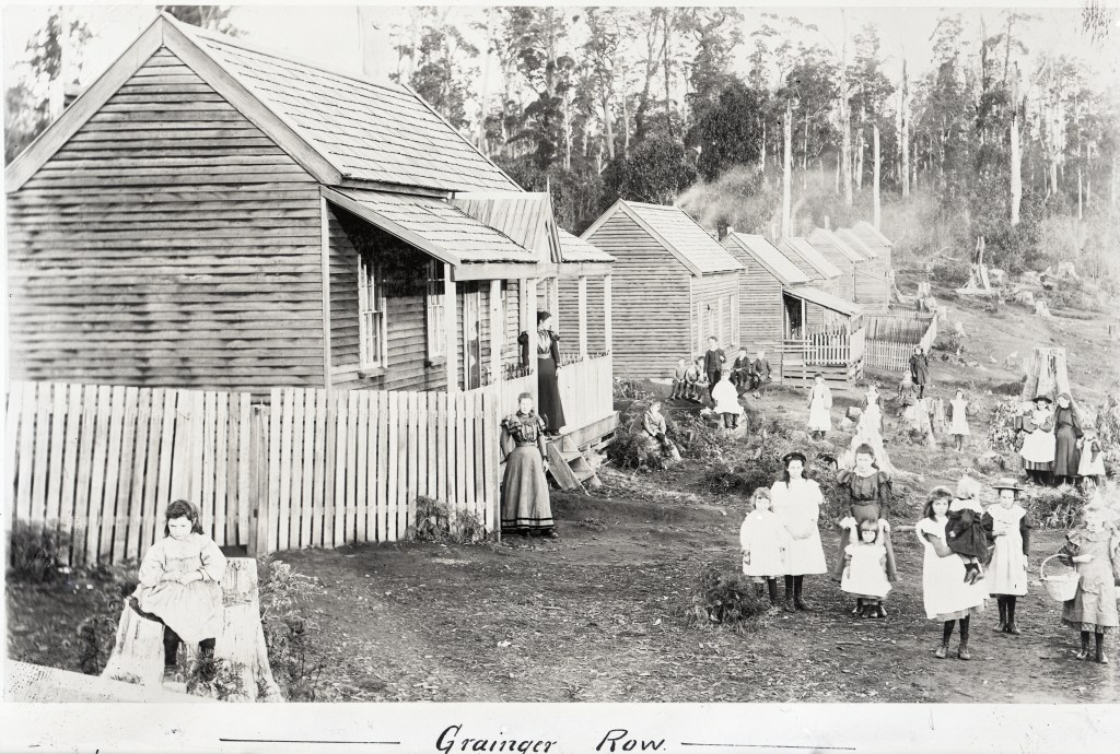
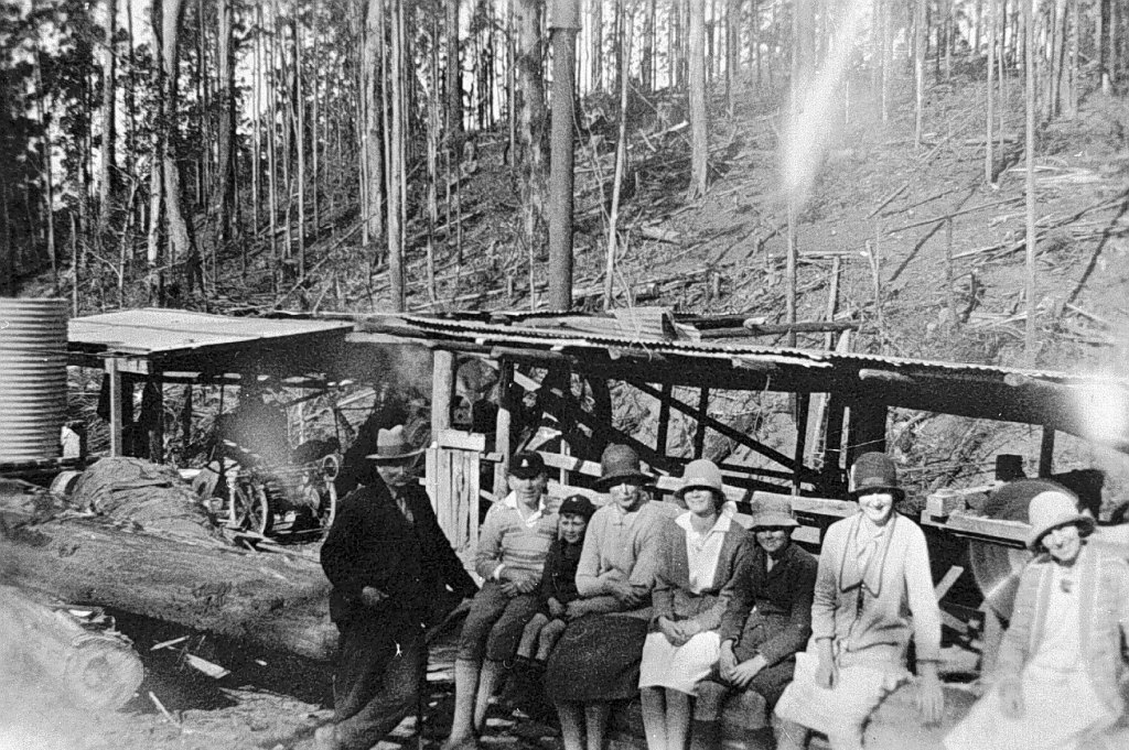
It’s also fair to say that sawmilling in Victoria was primarily a male domain. Women were involved, but they tended to play a lesser role in the business.

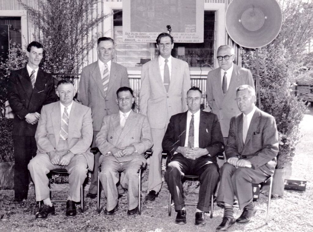
Julia Marion Harvey Hale grew to become a formidable legend in Victorian forestry and sawmilling circles and was not going to be intimidated by mere District Foresters, or even the Commissioners.

Born in 1907 in South Australia, Julia became involved in several sawmilling enterprises in northeast Victoria, the first being with a 25% holding in a small mill on the tablelands south of Whitfield in 1936. Her business partner, Arthur Dye, originally came from Gembrook, but the arrangement was short-lived with the sale of the mill in 1937.

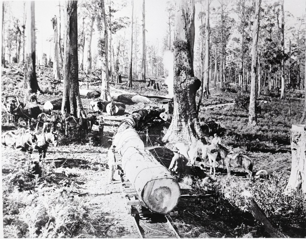
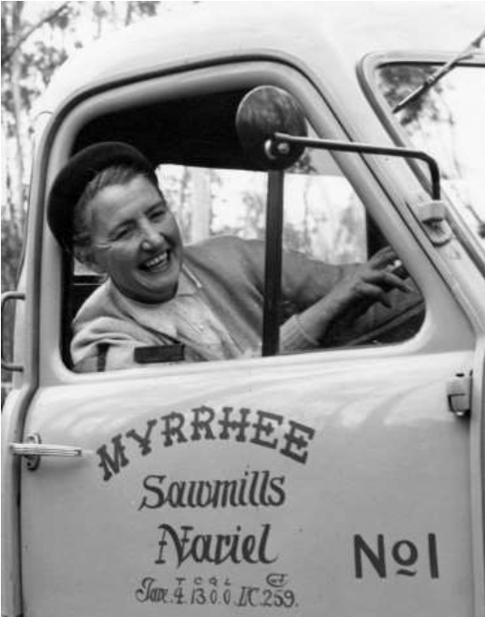
Undeterred, Julia Hale formed another business partnership in 1936 with sawmiller James Moore which proved more successful. Moore had ten years’ experience in the Gembrook district, and they started Myrrhee sawmills on Fifteen Mile Creek, north-west of the earlier Tablelands Sawmil in August 1936 to cut timber off private property.

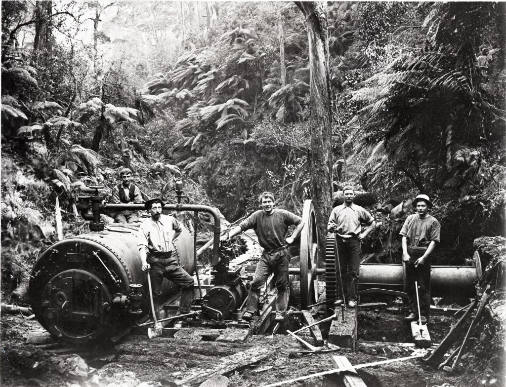
Moore ran the sawmill while Hale the controlling partner oversaw the sales, marketing and financial side of the business. In May 1938, the mill was moved to a new cutting area on State Forest and the company purchased its first crawler tractor, but the forest was steep and rocky making the mill barely profitable.

Meanwhile, Julia became involved with her father and a consortium of others in a murky scheme to buy 6000 acres of forested Crown Land in Tasmania. Normally, the sale would have been refused because of the standing timber, but it was approved in 1938 following the alleged intervention by the Tasmanian Minister for Forests, Robert Cosgrove. This transaction, and several others like it, led to a Royal Commission into forestry administration in 1945. One of the key recommendations was the formation of the Forestry Commission of Tasmania, based upon the Victorian model.

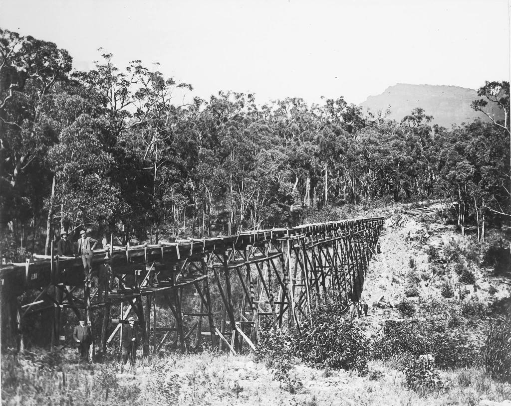
The Black Friday bushfires of 1939 forced an urgent need for timber salvage in the Central Highlands and led to a major shift for the entire Victorian timber industry.

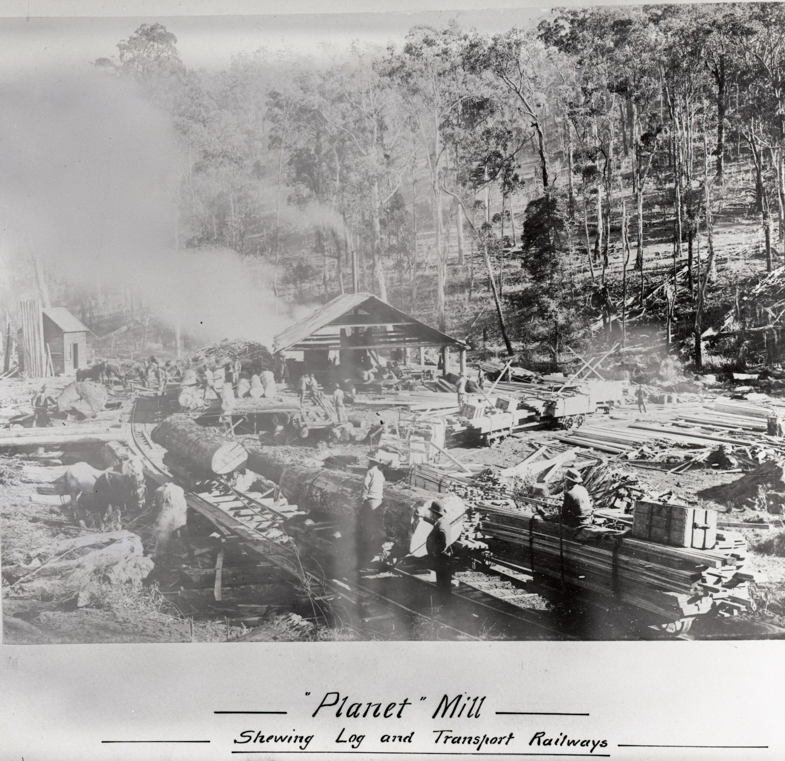
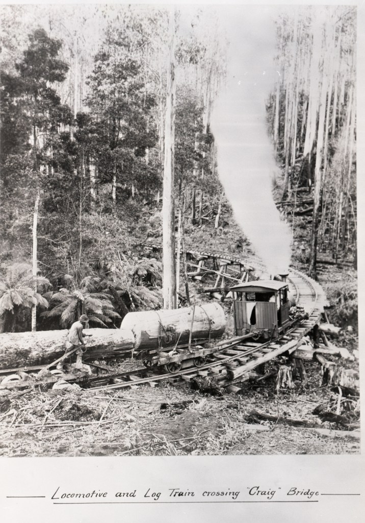
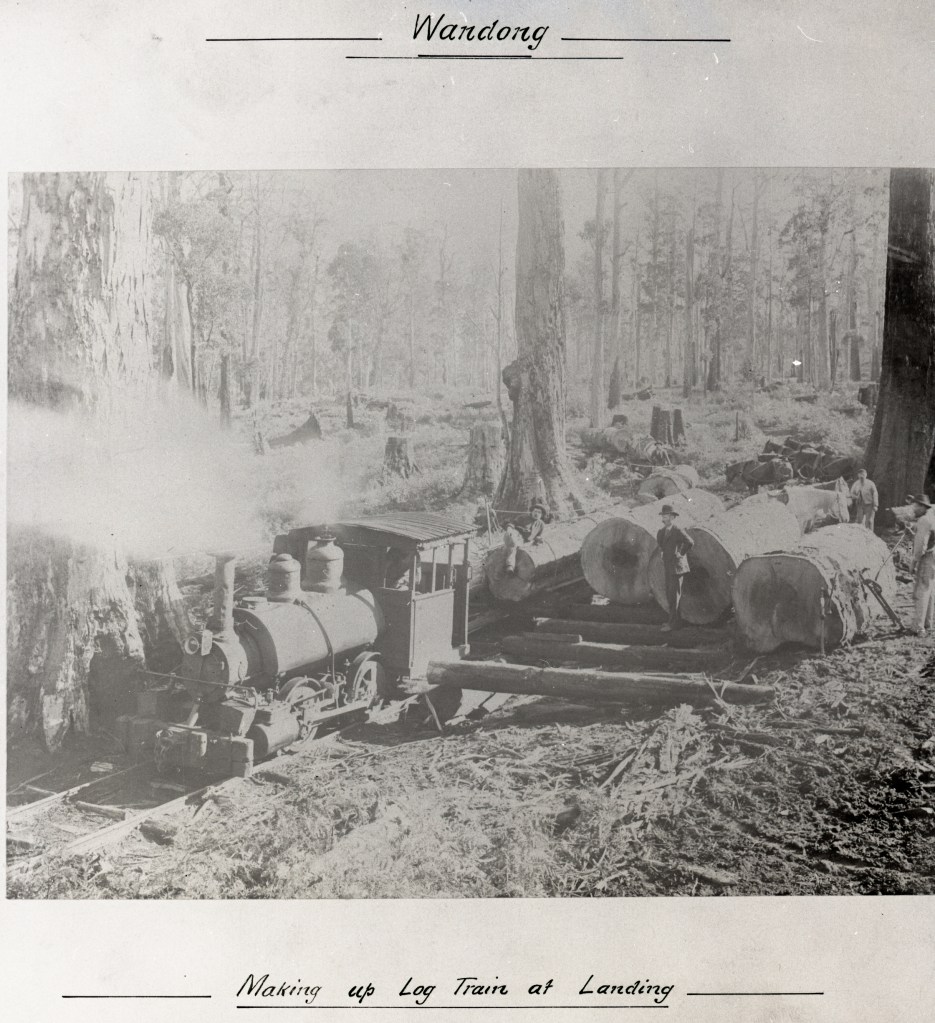
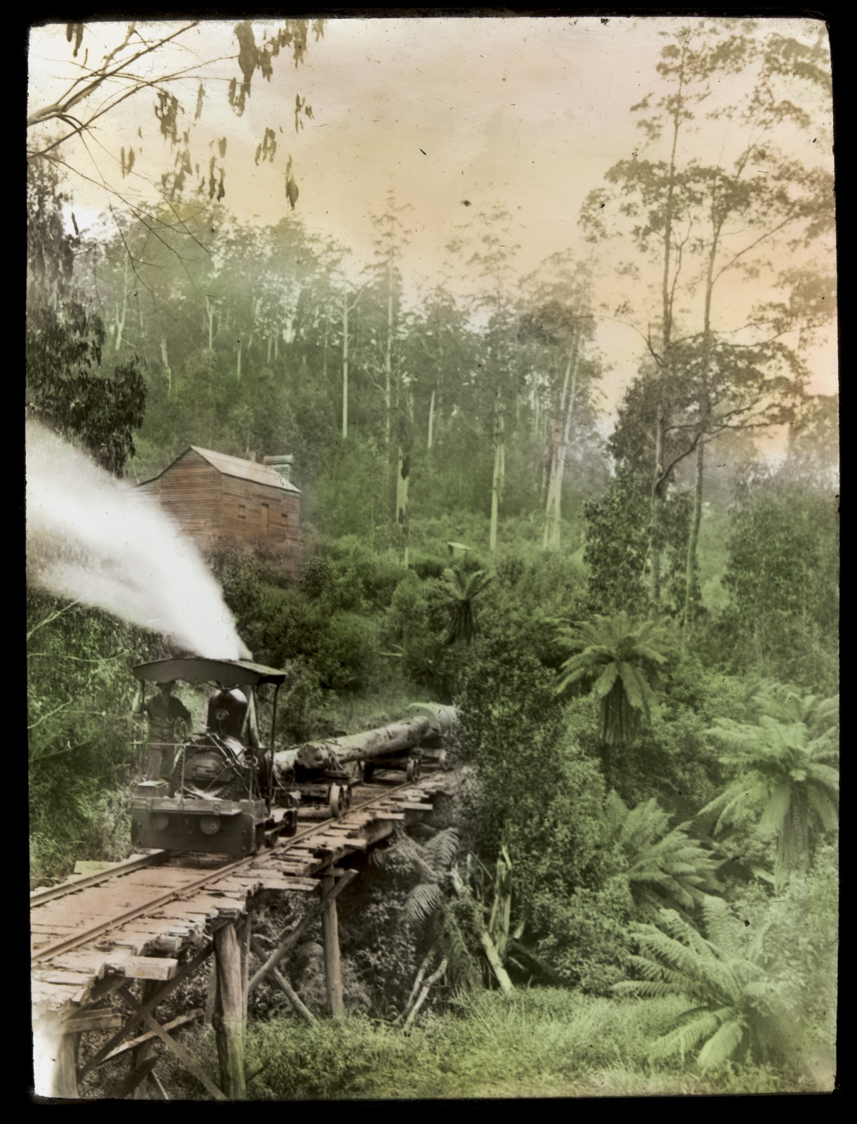
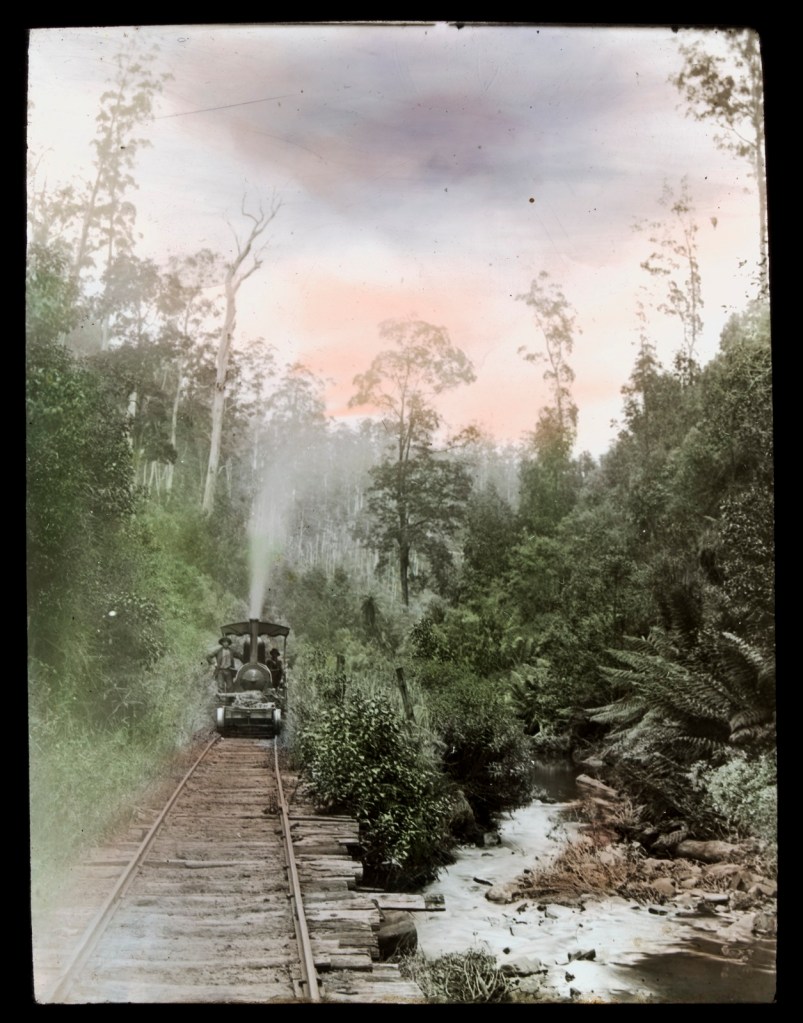
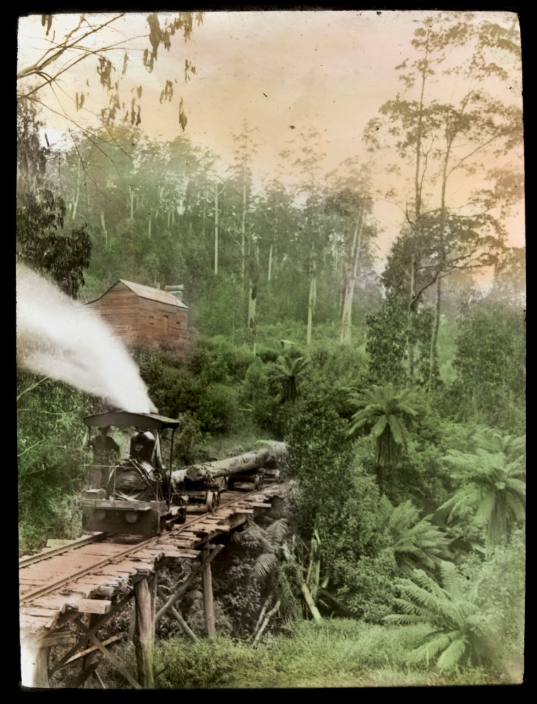
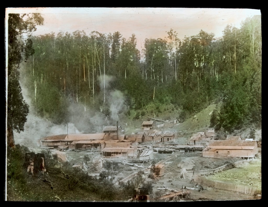
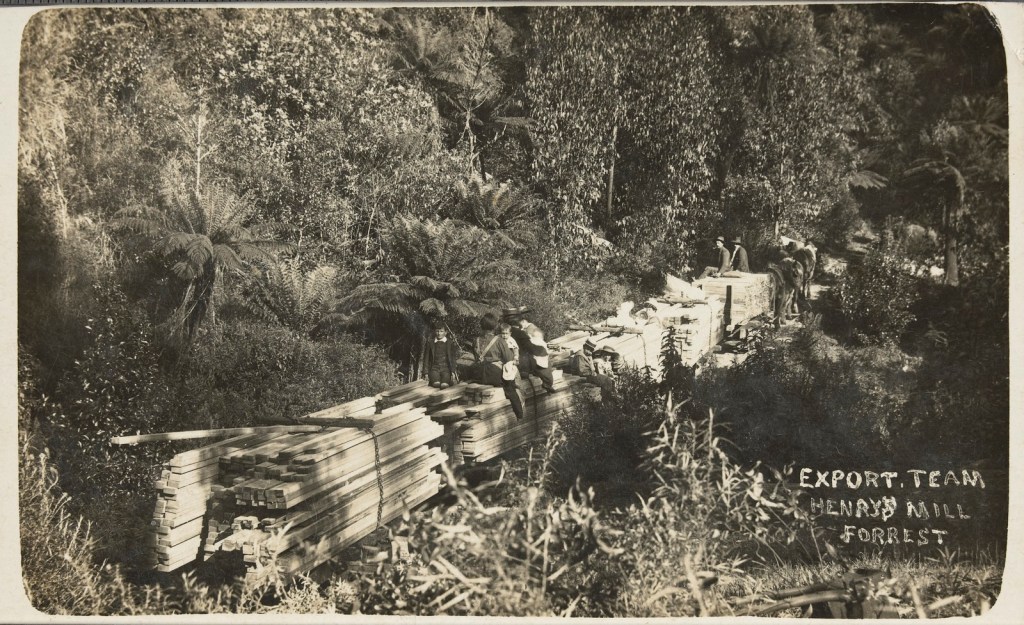
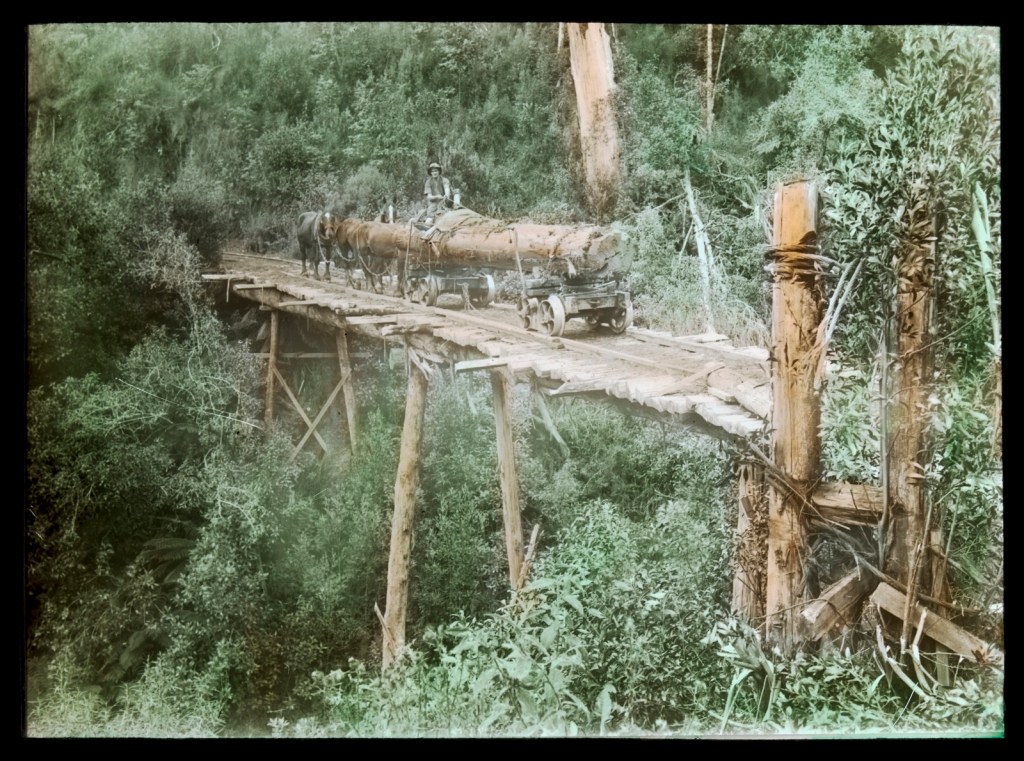
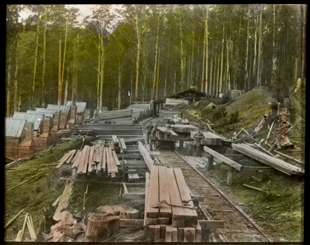
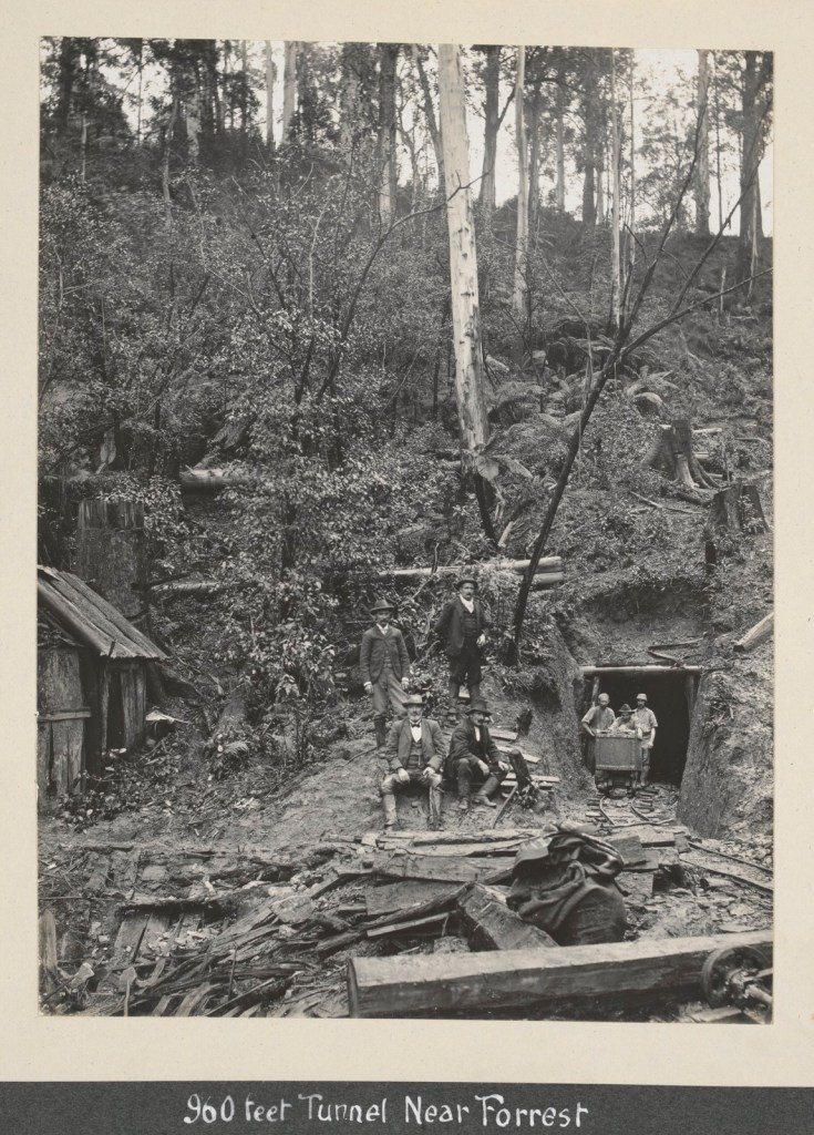
Julia Hale acted quickly, and on 20 February 1939 while the bushfire smoke was still swirling and the Stretton Royal Commission had begun, she lodged an application with the Forests Commission for a 1000-acre allocation at the head of the West Tanjil River north of Noojee. The mill was up and running by January 1940, but constructing access to the mill by either roads or tramways remained a major impediment.

Julia then applied in December 1939 for a second logging area just over the ridge from the first mill in the headwaters of the Thomson River to access fire killed mountain ash, shining gum and woollybutt.

But financial pressures on her ventures were starting to show, so she applied to the Commission for a salvage loan of £1000. But other setbacks, combined with the realignment and slow construction of access roads hurt her bottom line and Julia’s crawler tractor, valued at £2000, was offered as security of this and other loans.

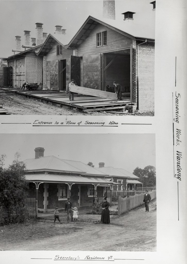
At the time, the mill was supplying sawn timber to the Commission’s seasoning works at Newport, so loan repayments were deducted from the amount paid for the timber.

But Julia’s misfortune didn’t stop there. A major labour shortage caused by the war was made worse by the remoteness of the mill, so a boarding house was built in the hope of attracting enough labour to run her operations. More loans were made, but snow and winter road closures combined with a continuing shortage of labour led to the closure of the No.1 mill in May 1942.

Meanwhile, a new mill was established at Nariel, just south of Corryong, in 1946 to access large stands of high quality old-growth wollybutt near Mount Pinnibar.

The Commission controlled the first section of the road construction and her licence agreement required Julia to extend the logging road at her own cost. But by February 1947, Julia Hale was again in financial difficulties, and she approached the Minister of Forests, Bill Barry, for assistance by getting the Commission pay her to construct the road as a contractor.

In January 1948, W. E. Flanigan applied to the Commission for a logging area in the headwaters of Emu Creek near Milawa.  It became apparent to the Commission that Julia Hale was providing the money and was the major partner in the new enterprise. Flanigan later sold his share to Julia and retired in 1950, but the Emu Valley mill burnt down in June 1951.

It was around this time that Forests Commission officers began to have serious reservations about the viability of Julia Hale’s logging and sawmilling operations in both the Central Highlands and Myree. This led to growing concerns about the security of the loans it had made to Julia.

By 1953, the Commission believed that there was a significant sum of money still owing on her loans due to short deliveries of timber to the Newport seasoning works, but Julia considered the total debt had been repaid. The relationship was far from cordial and a series of savage letters was exchanged. But in 1961, the Commission wrote-off the debt. There seems little doubt that poor record keeping and accounting methods by the Commission had contributed to the discrepancy. However, the fallout from the quarrel caused untold and ongoing friction between Julia Hale and the Forests Commission.

But the mill at Nariel finally made Julia prosperous. The post-war boom was in full swing, and the mill had secured some valuable supply contracts.

Julia Hale was in her early forties and in the prime of her life. She made regular visits to the Nariel mill in her white “Silver Cloud” Rolls Royce from her substantial home and farm property known as “Buckanbe”, at 32 Orion Road in Vermont.

Always expensively and fashionably dressed in English tweed skirts and silk blouses, accompanied with sensible shoes, she carried the air of the English aristocracy and was equally at home in the city or the country. While undoubtedly a tough and forthright businesswoman, Julia also took a strong interest in the welfare of her workers and their families.

In January 1950, the Commission introduced a new royalty equation system which took account of the distance that logs were hauled from the forest to the sawmill, the standard of the forest roads, the quality and size of the logs together with the distance to central markets in Melbourne. It was intended to reduce wastage but also be simple and equitable for all sawmillers across Victoria.

But in 1952, further tension between Julia Hale and the Forests Commission surfaced over who was responsible for measuring logs and determining inputs into the Royalty Equation. The matter was escalated in 1954 to her local MP, a prominent barrister and Corryong grazier, Thomas Walter Mitchell, who was no friend of the Commission, and he raised the matter with the Premier John Caine in State Parliament.

The minor bickering escalated into a major dispute by early 1957 over Julia’s claim for a refund of royalty to the tune of £75,000, which she claimed was overpaid because of an incorrect road classification under the new royalty system. The subsequent refusal by Julia to sign a new log licence agreement led to the suspension of all harvesting and log supply by the District Forester.

By 1962, the dispute went to arbitration with hearings at Corryong. High profile and expensive lawyers were engaged but the result was a disaster for the Commission, with Julia Hale being awarded substantial compensation. An appeal by the Commission was unsuccessful, but the wound continued to fester until Julia Hale’s death from breast cancer on 19 October 1964.

From the very start, Julia Hale seems to have avoided direct dealings with her local district forester, who would have normally been the first point of contact for any sawmiller. She adopted a “take no prisoners approach” and always went straight to the top and thought nothing of lubricating important relationships with a case of Scotch whisky discreetly delivered to a home address.

It became part of Forests Commission folklore that when Julia made personal visits to the Commissioners in Head Office in Melbourne from her lavish estate in Vermont, to pay her royalty and loan debts, she deliberately parked her Rolls Royce in the Chairman’s carpark out the front. It’s also said that Julia regarded some Forests Commission officers as a bit of “sport”, and she had little tolerance for any bureaucrat who got in her way. While some senior male public servants in the Commerce Branch were said to scurry whenever she arrived in the building.

Julia never married, or had children, and in the wind-up of her estate she first provided generously for her family, including her brothers and sisters, but also for her employees.

Somewhat ironically, given her long running and fractured relationship with foresters and the Forests Commission, Julia Hale directed in her will that a $1M bequest to be made to the Forestry Department at the University of Melbourne.

This is an abridged version of a more comprehensive account by Peter Evans which was presented at the ninth conference of the Australian Forest History Society at Mount Gambier in October 2015.

https://www.foresthistory.org.au/2015_conference_papers/06%20Evans%20-%20Julia%20Marion%20Harvey%20Hale%20-%20Victoria’s%20most%20prominent%20woman%20sawmiller.pdf

https://vermonthistory.weebly.com/buckanbe-park.html

World Forestry Day.

Imagine a machine that uses solar energy to remove carbon from the air and turns it into a beautiful, strong and sustainable building material.

Oh wait… that’s what trees are…

Today is World Forestry Day and what better way to celebrate than to acknowledge this magnificent Sugar Gum (Eucalyptus cladocalyx) which grows in front of the historic School of Botany at the University of Melbourne.

Thought to be over 110 years old, the tree is 25 metres tall and has a diameter over 2 metres.

The bean-counting folks at the Uni calculated that this tree uptakes about 282 kilograms of carbon each year, offsetting the amount released by three people breathing.

The tree has been listed by the National Trust of state significance.

https://trusttrees.org.au/tree/VIC/Carlton/University_Of_Melbourne_156_292_Grattan_Street_5

Melb Uni

Mississippi Quarry – Colquhoun forest.

A large granite outcrop at the headwaters of the Mississippi Creek in the Colquhoun State forest, just west of Lakes Entrance, was identified in the early 1890s.

It’s said to be of the same geological formation as the pink granite at Wilsons Promontory, Gabo Island and northern Tasmania.

The beautiful granite will take a high polish and can be used for pillars, casements, sills, steps, or any work that needed a durable and ornamental stone.

In the years following the goldrush, ships entering the Gippsland Lakes from the southern ocean were subject to the vagaries of shifting sands, floods, winds and tides.

Works began in the 1870s to create an artificial entry and navigable access to the inland lakes system. Two rows of wooden piers were installed on each side of the new entrance and stabilised with stone dropped in between the rows of timber.

But over time, the stone sank into the sand or was displaced by currents and had to be replaced. Teredo worms (termites of the sea) ate what was left of the timbers. Something more permanent was needed for the busy port.

In 1890, a surveyor was sent to take depth soundings of the north arm of the lake and survey the line for a new tramway through the bush to the site of the intended quarries.

Despite the early expectations for the granite in the Mississippi Creek, the stone for reinforcing the piers was brought by ship from Refuge Cove at Wilsons Promontory, and later by bullock dray from a quarry at Wy Yung near Bairnsdale, until at least 1900.

The development of the Mississippi Creek Quarry seems to have begun in early 1904 by local contractors, the Coate Brothers.

Cutting the hard rock used the “hammer and tap” method. Two men took turns with sledgehammers to hit a steel drill held by a third man slowly rotating the drill bit so its didn’t get stuck in the rock. Once the drill was about 2 feet deep into the rock another hole would be started nearby. The holes were then packed with explosives and detonated to crack large blocks of granite from the working face of the quarry. If necessary, the blocks would be drilled and blasted again until they were of a workable size and could be trimmed to shape.

Coate Bros built a 3’6″ gauge steel tramway 13 km through State Forest in 1910 to transport the large blocks of granite, which could weigh as much as 5 tons, to the head of the North Arm near Corner Landing. Rock was then loaded by crane and transported by barge a further 6km to the entrance of the Gippsland Lakes where they had the contract to convert the eastern pier from timber to stone and concrete.

At least one load of 60 tons went on the downhill run per day to the barge landing, but occasionally trucks would derail, and the rock tipped into the bush where they still lay.

Later, some stone was used in Melbourne buildings, the most notable being in 1926 with the Masonic Club in Flinders Street. This use extended the life of the quarry when the civil works at the entrance were complete.

Records indicate that the quarry last operated in 1946 for cartage of some more stone to the eastern wharf at Lakes Entrance. The steel tramway was then salvaged, and the quarry abandoned which became slowly overgrown with scrub and blackberries.

In July 2000, the Federal Government was making money available under the Regional Forest Agreement (RFA) process with “structural adjustment” packages to offset the reduction in sawlogs and corresponding loss of jobs. The Feds were looking for “shovel ready” community projects in East Gippsland.

I’m a keen bike rider and a trail from the Mississippi Quarry to Lakes Entrance had been an idea for a while. I was also the Regional Forest Manager for Gippsland at the time but couldn’t secure funding from the Department.

It all came about in a short phone call, very late one Friday afternoon, when a colleague from Melbourne, Richard Wadsworth, rang looking for projects and about $1M fell into my lap. That’s the way funding bids worked sometimes. I followed up with some paperwork and a formal application the following week, but it was as easy as that…

Some of the cash went on the existing rail trail, while Andrew Sharpe and Rob Stewart from Bairnsdale planned and delivered a new project which included a 5km link up a steep hill to the East Gippsland Rail Trail at the junction with Seaton Track.

Most of the old wooden bridges on the tramway had collapsed and needed to be replaced. Remnants of steel rail line and lumps of stone can be found along the track. New signs and a viewing platform at the quarry were built while some old tramway wheels were salvaged for display and a piece of polished granite is included in the design.

It was initially hoped to reinstate the entire tramline from the quarry to the edge of the water and the barge landing site.  But some of the old route was private land, so the Gippsland Lakes Discovery Trail, as it became known, ran 7 km downhill from the quarry site to the Log Crossing picnic area before diverting on Shire roads a further 13 km to Lakes Entrance.

The project was complex and not finished until 2003.

The trail along Mississippi Creek now links to a network of new mountain bike tracks through the bush.

https://en.wikipedia.org/wiki/Gippsland_Lakes_Discovery_Trail

Ship being towed through an artificial entrance to the Gippsland Lakes. c 1891. Source: SLV
1878. Source: SLV
Australasian Sketcher with Pen and Pencil, 17 December 1884 https://trove.nla.gov.au/newspaper/article/60620119
Lakes Entrance, “The Piers” c 1915
Source: SLV

Wind speed.

Bushfire behaviour is influenced by many factors including temperature, relative humidity (RH), forest type, fuel quantity and fuel dryness, topography and even slope. But wind has a dominant effect on the Rate of Spread (ROS), as well as fire size, shape and direction.

Wind speed can be measured using a variety of anemometers.

This simple hand-held Venitimer was made by Elvometer in Sweeden, probably in the 1960s, and was designed for principally for mariners. Some models have a compass in the handle to measure wind direction.

The small inlet hole on the side is faced towards the wind and air pressure lifts small plastic disk inside.  The upper tube is tapered so that as wind speed increases more air escapes and stronger winds are needed to raise the disk.

Wind speed in MPH is read from the side of the clear plastic tube. The waterproof container has instructions on use and conversion scales.

This example is in the Beechworth museum.

https://en.wikipedia.org/wiki/Anemometer

Alan McArthur – bushfire legend.

The Forest Fire Danger Index (FFDI) was originally invented by the legendary pioneer of Australian bushfire science, Alan Grant McArthur, during the 1950s and ‘60s.

After studying forest science at the University of Sydney in 1945, and later the Australian Forestry School in Canberra, Alan McArthur worked first in softwood plantations in the Tumut and Orange districts.

In 1951, he was appointed the first full-time fire control officer of the Snowy Mountains and began a lifelong quest to understand the behaviour and control of forest and grassland fires.

Then in 1953, Alan transferred to the Commonwealth Forestry and Timber Bureau in Canberra as a fire researcher. Five years later he was appointed Principal Research Officer in the newly created Division of Forest Research within the Commonwealth Scientific and Industrial Research Organization (CSIRO).

Alan was a very hands-on forester and fire researcher. To gather data, he deliberately lit over 450 experimental fires between 1956 and 1961 under a range of low to moderate weather conditions in the Kowen Forest and Bulls Head Creek area around Canberra. There were other test fires near Traralgon and the Wombat Forest near Daylesford.

For obvious reasons, he wasn’t able to light test fires under extreme weather conditions, so his subsequent fire danger equations needed to be extrapolated.

Much of his raw field data was collected by students from the Australian Forestry School and later the Australian National University where he lectured. Alan used his fit and hardy crew, armed with time stamped rocks, to mark the progress of the test fires and collect the data as well as map fire progression for his meter, a hugely useful improvement in fire prediction at the time.

Alan made thousands of detailed observations of things like wind speed, RH, temperature, cloud cover, rainfall, fuel moisture content, flame height, fire intensity, spotting distance, rate of spread, fuel quantity. He also made subjective assessments of fire suppression difficulty.

Alan published his landmark paper, “Controlled burning in eucalypt forests” in 1962. Leaflet No. 80, as it was known, proved a turning point for forest and fire managers across Australia.

More importantly, Alan was very practical forester and wanted his work to be useful to people in the field, so after several iterations he came up with the now familiar circular slide rule called the Forest Fire Danger Meter (FFDM).  The Mk 4 version first appeared in operational use in 1967.

There is also a grasslands fire danger meter.

Two Forests Commission staff, Athol Hodgson and Rus Ritchie, built on McArthur’s pioneering work and by applying their own practical experience, developed a modified version in the late 1960s called the Control Burning Meter which was better suited to Victorian forest conditions.

Alan’s research work, in combination with new aerial ignition techniques developed in Western Australia and Victoria, led directly to a rapid escalation of the area of fuel reduction burning, which peaked in Victorian forests 1981 at 477,000 ha.

The FFDI meter uses measurements of dryness, based on rainfall and evaporation together with the Keetch-Bryram Drought Index to calculate a Drought Factor (DF) ranging from 1 to 10.

The Drought Factor is then combined with wind speed, temperature and relative humidity to calculate a FFDI in a range of 0 to 100.

By assessing fuel load (tonnes/ha) and slope, the fire behaviour characteristics such as Rate of Spread (ROS), flame heights and spotting distance can be estimated under a range of fire danger indices.

Most successful firefighting, and indeed fuel reduction burning, occurs when the FFDI is in the “Moderate” range between 5-12. The FFDI rises to “High” between 12-24 and “Very High” between 24 and 50. A day with an index exceeding 50 is considered “Extreme”. (see note below).

Alan used the conditions of the 1939 Black Friday fires as his example to set the upper limits of FFDI at 100.

However, the FFDI went “off the scale” on both Ash Wednesday in 1983 and Black Saturday in 2009. Under these extreme or catastrophic bushfire conditions, the weather rather than fuel load or arrangement, becomes the dominant factor influencing fire behaviour.

But for anyone who has been involved in bushfires they will know that the FFDI has its shortcomings.

  • The original system was only designed for use in forests and grasslands.  But Australia has lots of different types of vegetation such as Mallee heath, woodlands and open savanna, and the FFDI system does not forecast those well.
  • The FFDI meter does not consider all the conditions which have an impact upon fire behaviour such as wind changes and atmospheric stability.
  • The model begins to break down at the extreme end of the scale and small changes to temperature, humidity and wind speed can have a huge influence on the fire danger index.

But no matter what the shortcomings of the FFDI meter, Alan’s scientific legacy is unquestionably huge and has served forest firefighters very well over the decades. New research will refine and develop even better models.

Alan’s seminal book “Bushfires in Australia” was published in 1978 with another forester Robert Henry (Harry) Luke and remains compulsory reading for every bush firefighter. Alan retired from the CSIRO in 1978 and died later that year.

Note: Each State once had their own fire danger ratings, but a new and consistent system was introduced across Australia in 2022.
No Rating (< 12), Moderate – plan and prepare (12-23), High – ready to act (24-49), Extreme – take action now (50-99), Catastrophic – leave early (>= 100).

https://adb.anu.edu.au/biography/mcarthur-alan-grant-10889

There was a noticeable increase in burning across Australian forests after Alan MacArthur’s research work with the CSIRO and his publication of Leaflet No 80 in 1962.
The McArthur Forest Fire Danger Meter (FFDM) first appeared in operational use in 1967 as the Mk 4. Photo: Jack Gillespie.
The FCV Fire Research Branch developed a control burning meter based on Alan McArthur’s models. Version 2 – 1970. Source: Ion Worrell.
Area of prescribed burning in Victoria between 1921–2016. The solid line is the annual area burnt while the dashed line is the 10-year rolling average. The big increase came after leaflet no 80 and the development of aerial ignition techniques using fixed wing aircraft and helicopters. The maximum level of 477,000 was achieved in 1981.Source: Morgan, Tolhurst et al 2019.
https://www.tandfonline.com/doi/full/10.1080/00049158.2020.1739883

Drop chutes.

From the early 1960s, the Forests Commission had pre-season arrangements in place with local aeroclubs and pilots across regional Victoria.

Air observers from FCV districts routinely flew during the summer months in small, fixed-wing aircraft on fire spotting missions and to map fire boundaries.

The information was often needed quickly on the ground or in the control centre and these small chutes were used to drop messages and maps from the reconnaissance aircraft on a low pass above a cleared area like a football field.

About 3-foot long when fully extended, they had a small pouch secured with a press stud for the map or package. The chutes were made from tough canvas with a small, weighted sandbag at one end and a long yellow streamer tail on the other to help direct its fall and locating it on the ground.

Drop chutes were still in common use in the 1980s, but the increased availability of helicopters combined with improved digital data transfer made drop chutes redundant.

This example is in the Beechworth museum.

Update on the Beechworh Museum Collection.

With the money raised from the sale of the FCV lapel pins last year the Forests Commission Retired Personnel Association (FCRPA) engaged Mark Jesser, a professional photographer, from Wodonga.

We recently had a two-day working bee at Beechworth with Leith McKenzie, Andrew Pook, Mark A Webster and myself pulling all the dusty items out of their display cases for the photographer to work his magic.

A total of some 380 museum quality images were taken of about 90 items.

We have created a site with “Victorian Collections” and begun to upload and describe each item so that information is searchable and freely accessible online. But it’s gunna take a while to get this step done.

The future of the museum at Beechworth is still under a cloud but at least this cataloguing project helps to preserve some of Victoria’s rich forest and bushfire heritage.

So, thanks to everyone who purchased the pins.

We hope to eventually get the Altona collection done too.

https://victoriancollections.net.au/organisations/forests-commission-retired-personnel-association-victoria-inc#more-collection

The loss of Longitude and the “Disputed Territory”.

In 1836, the western boundary between colonies of NSW and South Australia, and what was later to become the border of Victoria, was decided as the 141 degree meridian of longitude east of Greenwich.

Three years later in 1839, Charles Tyers transferred from the Royal Navy and was given the task to precisely mark the 141 meridian near the mouth of the Glenelg River at Nelson so that the SA border could be clearly identified on the ground.

But due to inadequate survey equipment he marked the spot too far to the west by two minutes of longitude, or about 2 miles and 4 chains.

For map geeks – one degree of longitude is further subdivided into 60 minutes, and 1 minute of longitude at the equator equals 1 nautical mile which is 1.15 times longer than a regular mile. And a ship sailing at 1 nautical mile per hour is said to be traveling at 1 knot.

Beginning on 28 April 1847, surveyors Henry Wade, and later Edward White, began marking the 279-mile border between Victoria and South Australia with blazed trees, mounds of earth and piles of stone beginning at Tyers survey mark on the coast and heading north. They had a remarkable and arduous journey and finally reached the Murray River on 7 December 1850.

But there were lingering doubts about the accuracy of border and another survey 1868 with better equipment confirmed it to be in the wrong location.

The surveying error is most apparent when pondering the odd kink in the junction of the three states (Vic, SA and NSW) near Mildura.

The South Australian Government wanted the border shifted back to its true position, but Victoria was having none of it.

The error resulted in more than 75 years of a protracted legal arguments between South Australia and Victoria over what was called the “Disputed Territory”.

The matter went to the Australian High Court in 1911 and finally to the Privy Council in London in 1914. South Australia lost the argument and forfeited more than 500 squares miles of land to Victoria.

If you look carefully at the plantation maps near the South Australian border at Rennick you can see evidence of the Disputed Territory and roads which run in a north-south direction along the 141 degree meridian. The Forests Commission began establishing pines on the other side of the disputed line in about 1940.

Main Image: “Surveyors” by colonial artist S T Gill (1865). National Gallery Victoria

https://en.wikipedia.org/wiki/South_Australia%E2%80%93Victoria_border_dispute

Plantation boundaries run north-south between the 141 meridian and the disputed SA border. Source: Google maps

Christian’s Mill – Wombat Forests.

William Christian arrived in Melbourne in 1850 and worked as a pattern maker in a foundry. But like many others he was soon drawn by the lure of the goldfields. After a few unsuccessful years of trying his luck, William ended up in Woodend in 1868 and started a couple of successful sawmills in the Wombat forests at East Trentham.

Timber harvesting for sawlogs had commenced in the Wombat forests in the 1850s to serve the goldfields of Ballarat and Bendigo. At its peak output in 1878 some 138,000 cubic metres of sawn timber was produced from more than up to 190 mills using an extensive network of timber tramlines.

But the rampant scale of wasteful and unsupervised timber harvesting where only the best trees were taken, combined with poor regeneration, resulted in the Wombat forests being officially described in the fourth progress report of the Royal Commission in 1899 as a “ruined forest”.

These photos are of Christian’s Mill near the Campaspe River. It was a portable outdoor setup that could be moved between summer and winter operations so it could cut timber all year. Logs were pulled by horses, mostly downhill, on jinkers, from up to two miles away. Using 20 men the mill could cut about 9 cubic meters per day with the vertical framed saw.

William died in 1899 and the business was taken over by his two sons and it continued to operate until 1918 when it was sold.

Houghton, Norm (2013). Wombat Woodsmen. A sawmilling history of the Wombat forest.

https://www.victoriasforestryheritage.org.au/forest-estate/native-forests/forest-descriptions/553-the-wombat-forest.html