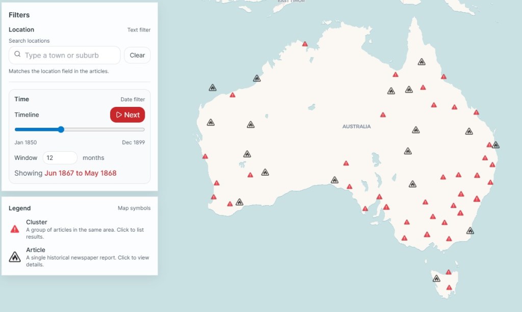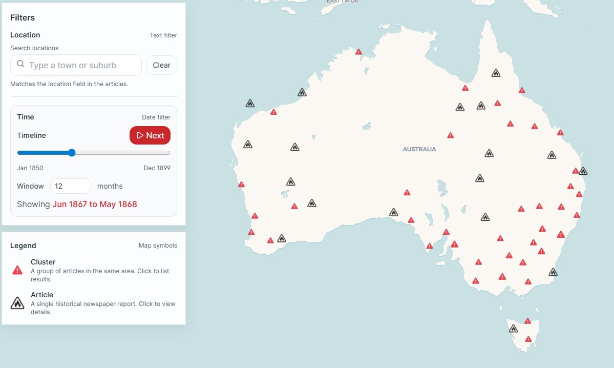
Librarian, Dr Fiannuala Morgan, recently used historical newspaper records held in Trove to reconstruct and map bushfire occurrence from 1850 to 1900.
The major bushfires in colonial Victoria in 1851 and 1898 are well known but there is not much information for the periods in between.
Trove holds millions of digitised pages from old newspapers and magazines, but reporting and sorting is messy.
A key word search of Trove found about 120,000 articles about bushfires between 1850 and 1900.
By applying Named Entity Recognition (NER) to the results, it was often possible to map the location of the bushfire based on its proximity to a place name.
The research highlights how bushfires shaped Victoria’s 19th century, and how they changed over time.
Following the gold rush of the 1850s, the Victorian government opened up large areas of crown land for selection. Much of the land was heavily forested and difficult to access, especially in Gippsland. The freehold land was then cleared and converted into agricultural or pastoral properties mainly with backbreaking toil and fire.
There are still gaps in the historical data and many bushfires went unreported because they were common and not newsworthy. Bushfires on remote State forests were also probably not reported.
This amazing interactive map shows where and how often bushfires occurred across the colonies over fifty years, but details on fire severity or size require consulting the original newspaper stories.
https://lab.slv.vic.gov.au/articles/colonial-bushfires-fiannuala-morgan