Most focus and media commentary about the 1982-83 bushfire season naturally centres on the deadly Ash Wednesday fires of 16 February 1983 when 75 people were killed in Victoria and South Australia.
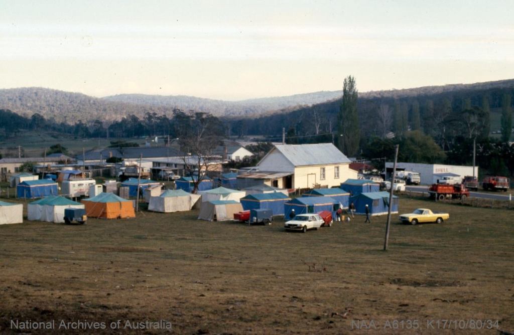
But in the far east of the State, and largely unreported by mainstream media, the Forests Commission Victoria (FCV) and CFA faced two large and adjoining campaign bushfires over a two-month period.
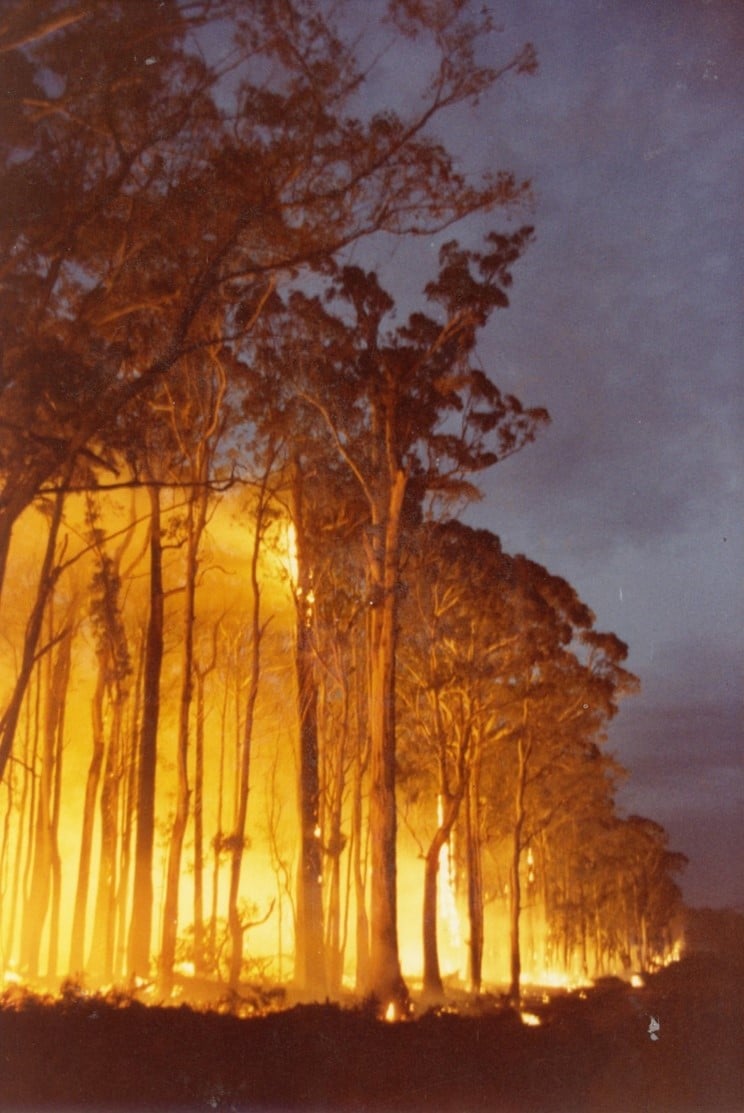
The two bushfires at Cann River were some of the largest in Gippsland since 1965.
Both fires burned under extreme drought and weather conditions, with temperatures exceeding 46 degrees, relative humidity as low as 16 %, and wind speeds exceeding 100 km/hr.
There was significant damage to productive State forest in Victoria. The Bondi plantations in southern NSW and National Parks were extensively burnt.
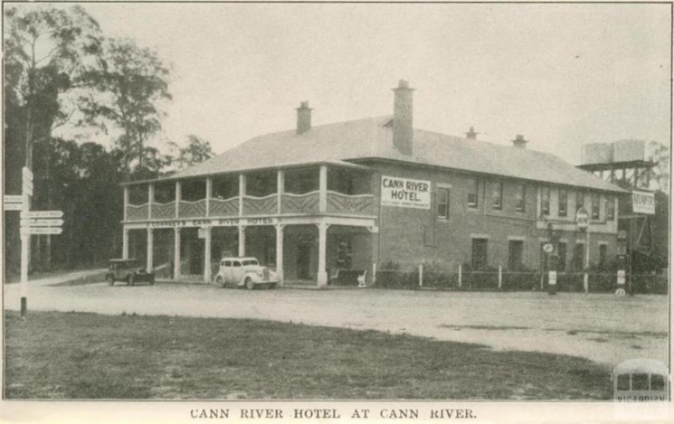
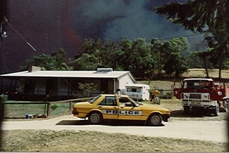
Losses to private property were comparatively small and included SEC power lines, Orbost Shire roads and timber bridges, several unoccupied houses and hundreds of kilometres of fencing. No lives were lost.
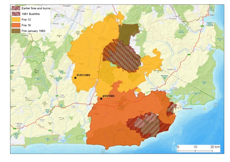
Cann River Fire # 12 – 127,200 ha
On January 31 a bushfire was detected in State forest north west of Noorinbee. The fire was believed to have started five days earlier after a lightning storm.
It burnt north of the Princess Highway and into NSW for the next four weeks or so until 26 February.
This bushfire was impacted by extreme weather on 8 February, the day of the Melbourne dust storm, as well as 16 February, Ash Wednesday.
The fire front split around the earlier 1980 fire at Coopracambra on the NSW border.
Cann River Fire # 16 – 126,100 ha
On 4 March, during extreme fire weather, a breakaway on the southern edge of the earlier fire #12 spread quickly towards Genoa, Tamboon and Mallacoota Inlets. It blocked the Princes Highway and burnt for another 3 weeks until 20 March.
It’s reported that a heroic effort to light a backburn and hold the line at Stoney Peak on 9 March, in the face of 100 km/hr winds, together with a previous fuel reduction burn in 1979-80 probably saved Genoa, Gipsy Point and Mallacoota.
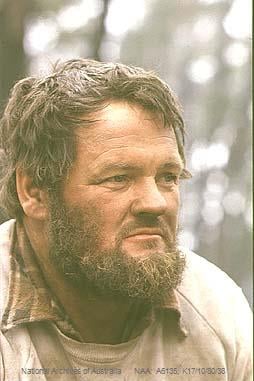
Some observations from Denis Read the District Forester included:
- Blow-up days occurred on regular weekly cycles (mostly Tuesday) while the periods in between were used effectively to build control lines, undertake backburning and consolidate boundaries.
- Direct attack was successful during the night, usually in light fuels, and during the day if retardant was available. Although crown fires at night were also common.
- Backburning was problematic in the very dry conditions and often failed, particularly if it was not possible develop a depth of burnt fuel between the fire edge and the control line.
- Previous fuel reduction burning was effective in slowing the forward rate of spread of fire, even on extreme days.
- Some earlier fuel reduction burning to west of Mallacoota in 1979-80 had a major benefit in saving the town.
- Linking areas which had been recently fuel reduced, together with aggressive first attack and backburning to build containment lines were important and effective control strategies in the very dry conditions.
- FCV tactics at the time were focused on direct attack and not on dropping back and building control lines well away from the fire edge.
- Aerial flights were not possible on several occasions due to thick smoke caused by inversion layers or coastal sea breezes which blew the smoke back over the land.
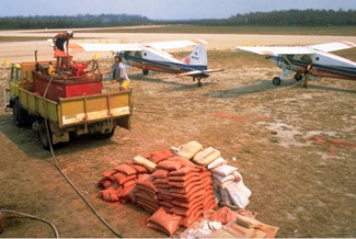
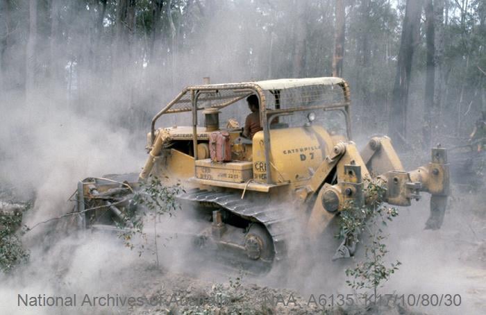
- Fixed wing agricultural firebombing aircraft operating from Mallacoota, Noorinbee and Marlo, with quick turnaround times, dropped nearly 400 loads of retardant. They proved very effective knocking down flames around houses and supporting ground crew to build control lines.
- The MAFFS had some notable success, but the main problems were the lengthy turn-around times from RAAF East Sale together with accuracy and manoeuvrability in the mountains.
- Small reconnaissance helicopters like Bell Jet Rangers were fitted with Forward Looking Infra-Red (FLIR) cameras to identify hot spots, or aerial incendiaries (ping pong ball) machines to assist with backburning.
- A medium helicopter from the NSCA at Sale fitted with a bambi bucket did effective firebombing. Belly Tanks weren’t introduced until about 1984-85.


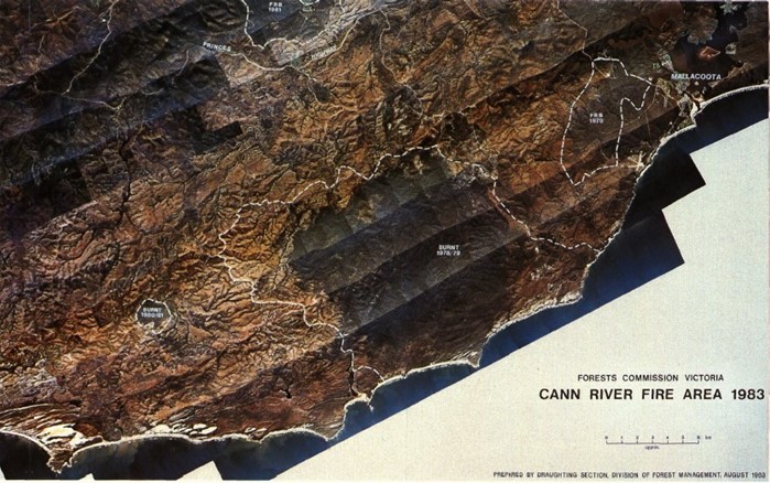

Note the shape the areas which were not burnt.in 1983:
1. 1978- 79 large fire east of Point Hicks (although there is some overlap on the edges).
2. 1980 Coopracambra fire on the NSW border.
3. 1979-80 Fuel Reduction Burn (FRB) west of Mallacoota which helped saved the township
4. The area marked in blue/green on the map on the NSW side was burnt by a deliberately lit fire in January 1983, not in the February fire. It stopped the eastern spread of the fire until the fire front was north of Imlay Road. A FRB done on in autumn 1980 along the length of Coolangubra Forest Way from Imlay Road to the Nalbaugh plantation then helped to contain the eastern flank. Two spot fires to the east of the White Rock River were contained for more than a day by an aerial ignition FRB in April 1981.

https://drive.google.com/file/d/1dPirCWwaYbrfjXUbR4fmTez_p9jMi2TR/view
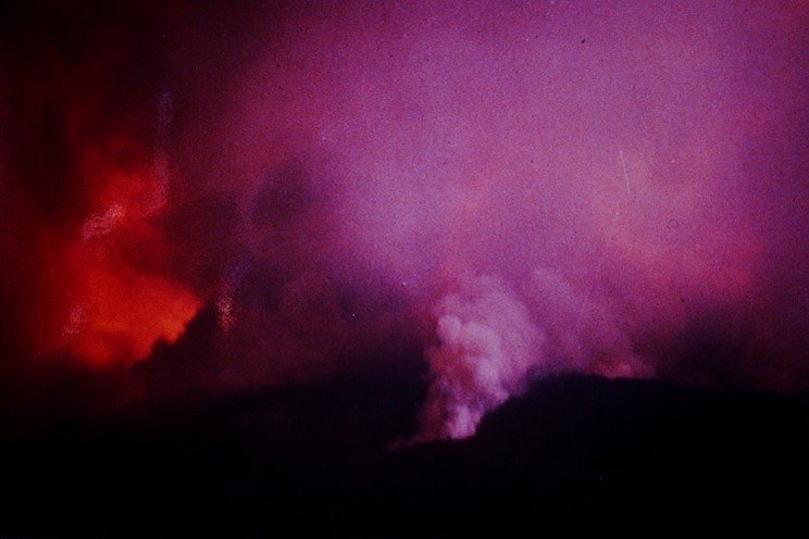
Coopracambra fires – October 1980.
The shape of the first Cann River bushfire #12 was strongly influenced by a major bushfire on the NSW border at Coopracambra earlier in October 1980.
Dry conditions over the 1979-80 summer continued into the autumn and winter of 1980. Gale force winds hit across Victoria in late September.
Large bushfires broke out in East Gippsland during October, marking an early start to the fire season.
These fires also triggered the State Disaster Plan (DISPLAN) which remained in force for nine days.
Rain in late October eased the situation.
More large bushfires occurred again during December and January in the northwest of the State in the Sunset Country and Big Desert.


All of this effort it’s so heartbreaking. Heroism dedication to duty and each other, preserving the bush. Pragmatism at its height , communities considered!
From when I was a kid and realised/taught about the bush around my home til now so much has changed. It’s a bit frightening the nonchalance involved in the upkeep and safety of the bush. ( I’m in my seventies born in glenmaggie)
LikeLiked by 1 person
Thank you.
LikeLike
Peter
Just back from the bush – St Arnaud – look forward to reading this.
As ever, thanks – I was at these fires. (I also was an assistant at CR from 1969-72.)
Good thing about the fires â I discovered a new location for the orange blossom orchid â totally unsuspected.
Rob
>
LikeLiked by 1 person