Having good cartographic skills to use and interpret aerial photographs to make maps was an integral part of most foresters working career.
Aerial photos were used to make maps of forest types, timber resources, to survey logging areas and regeneration, to mark boundaries of public land and new plantations, to identify new roads and tracks, as well as for fire suppression. Infrared film was sometimes used to monitor insect and disease attack.
The images needed to sharp, with high contrast, and in a large format (most were printed in B&W on 9-inch by 9-inch glossy photographic paper) with at least a 60% overlap to enable stereoscopic viewing and with a 20-30% side lap to allow for aircraft drift. Preferably, the photo scale was close to the final map scale avoid to problems when enlarging and to reduce distortion.
It was a big winter job to view hundreds of overlapping photos through a mirror stereoscope and mark features either directly onto the images, or onto transparent overlays, with fine Rotering ink pens or sharpened Chinagraph wax pencils.
Various lens combinations were used on a Zeiss Sketchmaster to adjust for scale and then “rubber sheet” the image to lineup topographic features like streams and roads. The photo information was then laboriously transferred using a light table onto large A0 paper maps or translucent drafting film. The maps were later hand coloured with either Derwent pencils or delicately painted with Pelikan ink wash.
Strict cartographic guidance was provided by the FCV’s 1947 publication – “Handbook of Conventional Signs and Symbols for Use in Forest Mapping and Plan Drawing”. It was slow and exacting work but very rewarding.
Something was needed to supplement the very expensive and infrequent large-area photography programs. From the mid-1960s Victorian foresters began experimenting with small format 70mm and 35mm cameras which proved simple, practical, cheap and flexible.
It was found that any SLR camera could be used provided it had a good quality lens and fast shutter speed (preferably down to 1/1000 second). Motorised cameras with a large film capacity had obvious advantages and were essential when access to the camera was not possible during flight. It is also essential for the shutter to operate at low temperatures and those lubricated with silicones were recommended.
Wide angle lenses were the most practical to ensure overlapping images when flying in light aircraft because they simplified flightline navigation and limited the number of photographs.
Components of a typical FCV Divisional Office system included –
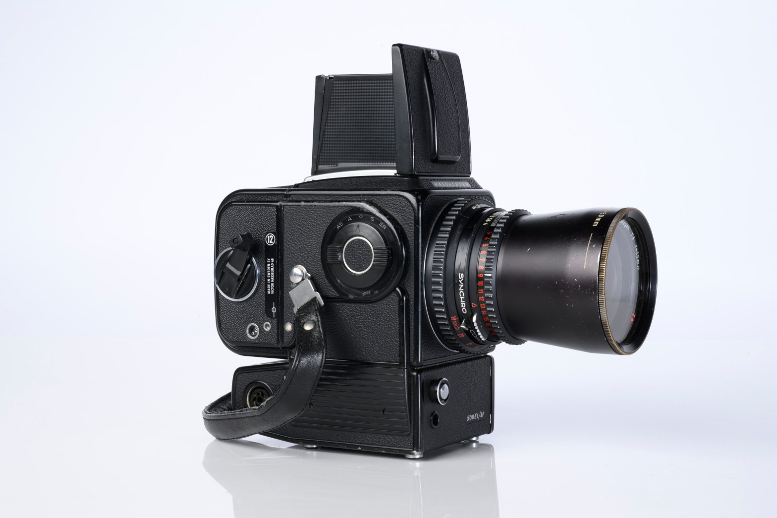
- A Hasselblad or Vinten 70 mm format aerial camera with a focal plane shutter which could be electrically operated.
- Interchangeable lenses to allow for different photo scales and flying heights.
- Several large film magazines, which were loaded in a darkroom, each with a capacity of 100 feet or approximately 500 frames.
- A remote control for the camera in single-shot mode or automatic firing at selected intervals of 2 to 50 seconds. It also needed a frame counter.
- A light aircraft was modified with an internal mounting for the camera to keep it level and steady. Often a hole was cut through the floor for the lens.
- The aircraft also needed an inbuilt 12 Volt DC battery to operate the motorised camera shutter. The front passenger seat was generally removed to improve access to the camera.
- An Aldis drift sight was also fitted. This might be likened to an inverted periscope and is used to determine drift, to facilitate accurate navigation along flight lines and to determine the exposure interval for stereoscopic overlap.
Some smaller 35mm aerial camera setups were also developed by FCV Districts which were inexpensive and required no permanent modification to aircraft.
But the advent of accurate GPS in 2000 and high resolution satellite imagery, combined with sophisticated Geographic Information Systems (GIS) and colour digital plotters, has made the cartographer’s skill of Aerial Photographic Interpretation (API) almost redundant.
Google Maps has consigned beautifully hand-coloured paper maps as curiosities in old Vertiplans or the state archives, while Derwent pencils and mirror stereoscopes have become museum pieces.
Source: Ray Spencer, Victorian Forester & VSFA Newsletter No 30. May 1972.


